Recent additions
View the latest maps added to our website. View our Cairt newsletter for further updates, news and information about our map resources.
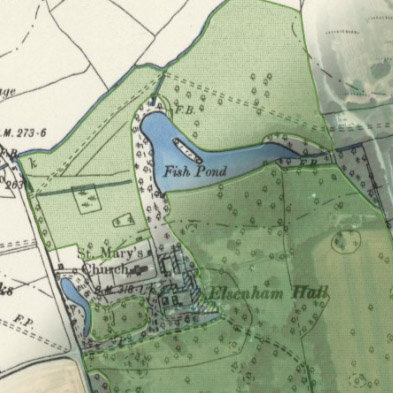
Historic parks in England map viewer, 1890s-1900s
The Library has recently shared our mapping with Zulu Ecosystems, in a project funded by the Forestry Commission, to extract a digital layer showing historic parks from Ordnance Survey six-inch 2nd edition maps. The extraction process used a combination of machine learning, post-processing techniques and manual verification. Historic parks play an important role in landscape history, and accurately mapping these areas supports effective decision making to support woodland creation.
Due to the automated processes used to extract the layer, some revisions are still needed. We are inviting volunteers to easily record corrections they spot in the viewer.
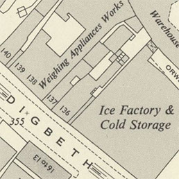
Ordnance Survey National Grid 1:1,250 / 1:2,500 maps of England and Wales, 1940s-1970s
We have put online 137,859 OS National Grid maps of England and Wales at 1:1,250/1:2,500 scales. These are the most detailed maps published by Ordnance Survey of England and Wales after the Second World War. All urban areas with more than about 20,000 inhabitants were mapped at 1:1,250 scale, and all other inhabited areas and cultivated land were mapped at 1:2,500. At 1:1,250 scale, most detached features covering 1 square metre or larger are usually shown. Excellent for viewing divisions between houses, house numbers, public and industrial buildings, railways, pavements, streets and street names, parkland and trees, paths, spot heights, and all administrative urban and rural boundaries. These maps were continually revised, with successive editions for areas undergoing more change on the ground.
- Ordnance Survey National Grid 1:1,250 / 1:2,500 maps, 1940s-1970s
- View the maps with a graphic index
- View the maps as a zoomable overlay (A edition) on satellite imagery
- Further information on these maps
Maps of the Channel Islands by Ordnance Survey and related institutions, 1900s-1970s
We have put online 72 topographic maps of the Channel Islands (including Alderney, Guernsey, Herm, Jersey, Jethou and Sark), by Ordnance Survey, the War Office and the Ministry of Defence. This includes a detailed town plan of St Helier and St Peter Port, as well as 1:2,500 mapping of Alderney and Guernsey. We also have coverage of Guernsey at Six-Inch to the mile (1:10,560), and all the other islands at smaller scales of Three-Inch to the mile (1:21,120) and Two-Inch to the Mile (1:31,680). Through these successive series and editions, significant landscape changes of the 20th century can be viewed. We have georeferenced all the detailed main series, as well as maps which provide an overview of each island.
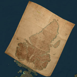
Early estate map of Lewis, surveyed 1807-9
We have put online the earliest detailed estate map of Lewis, from a survey by James Chapman, 1807-9. The only surviving map based on this survey was drawn by Alexander Gibbs (who assisted Chapman) in 1817; for many years this map was on display within the Western Isles Council Offices in Stornoway. Through a successful collaborative project in early 2024 involving Comhairle nan Eilean Siar’s Libraries Service, Heritage Service, the National Library of Wales, and the National Library of Scotland, the map can now be viewed as part of our Stornoway and environs historic maps web resource. Both the original map and georeferenced versions are now available for detailed study by anyone with an interest in the history of Lewis.
- James Chapman / Alexander Gibbs Plan of [the] Island of Lewis (1817)
- View the map as a georeferenced overlay or side by side
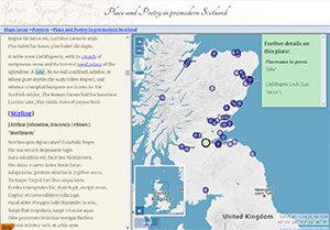
Place and Poetry in Premodern Scotland
This new web resource is dedicated to how places were presented, imagined, and described, in the poetry of premodern Scotland (medieval and early modern periods, c. 1400-1700). It includes seven poems, but it will continue to expand by the time the project completes in the late summer of 2024. The principal purposes have been to act as a research tool for understanding the spatial footprints of selected poems, to provide a shop-window for engaging with the poems, maps and related content, and to provide a 21st century digital combination of poetry, mapping and chorography. It is a collaborative project with the University of Bristol, funded by the British Academy.
Maps of Britain by commercial publishers, 1840s-1970s
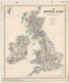
We have put online 906 maps by commercial publishers of Great Britain. Most of these are smaller-scale maps of the whole of Great Britain, England and Wales, as well as Wales. These maps provide an overview of these countries, and include maps of railways and roads, economic maps showing geology and coalfields, educational maps for classroom use, maps showing administrative and ecclesiastical boundaries, planning maps, and maps for tourists. Also included are 88 county maps of regions within England and Wales, as well as 159 town plans, including 119 town plans of London.
Second Land Utilisation Survey, Scotland, 1964-1975
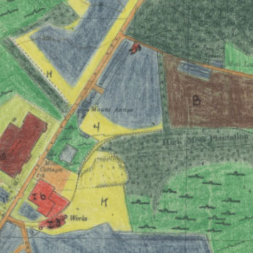
We have put online 860 field survey sheets showing land-use in selected areas in Scotland in the 1960s. The maps form part of the Second Land Utilisation Survey of Great Britain, directed by Professor Alice Coleman of Kings College London. Volunteers, including school children and university students surveyed local areas using Ordnance Survey 1:10,560 National Grid base maps, upon which land use information was hand-coloured and annotated.
- Home page - Second Land Utilisation Survey, Scotland, 1964-1975
- View the maps with a graphic index
- View a georeferenced layer of seamless layer on a satellite image base.
Ordnance Survey One-inch to the mile, England and Wales, "Special" maps
As part of our ongoing scanning of English and Welsh Ordnance Survey maps, we have also added online 110 One-inch to the mile (1:63,360) special sheets of England and Wales. These maps were often attractively coloured to show hills and mountains more clearly for popular tourist areas, or sometimes used different sheetlines for showing selected areas with greater convenience. Others had overprints showing features such as railways or military exercise areas. The maps have been presented online as part of their parent series: the One-Inch Popular edition, the One-Inch 5th edition, and the One-Inch New Popular (with National Grid):
- One-Inch Popular edition: District, Special, Tourist and London Passenger Transport maps
- One-Inch 5th edition Special District maps
- One-Inch New Popular (with National Grid) G.S.G.S. maps
- View all One-Inch maps with a graphic index.
- View a table of specific map additions (ordered by series and sheet number)
Ordnance Survey 1:25,000 and One-inch maps published in 1973
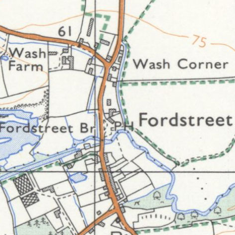
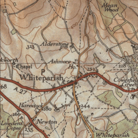
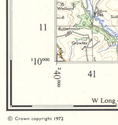
We have put online 385 maps at scales of 1:25,000 and 1:63,360 which were published in 1973, and which have therefore just come out-of-copyright from 1 January 2024. These include 328 maps at 1:25,000 scale, and 57 maps at 1:63,360 scale, covering specific locations in England, Scotland and Wales. Maps at these scales are particularly useful in providing an overview of significant landscape features such as villages and towns, the routes of paths, tracks, roads and railways, as well as patterns of woodland and rural land use.
- OS 1:25,000 - Provisional - Coloured, Provisional - Outline, Second Series / Pathfinder.
View with a graphic index. - OS 1:63,360 - Seventh Series, including Tourist Maps Special Sheets.
View with a graphic index. - View a table of specific map additions (ordered by series and sheet number)
Woodland in Scotland map viewer, 1840s-1880s
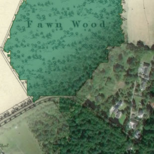
The Library has recently partnered with the nature regeneration platform, Zulu Ecosystems, who have extracted a digital layer showing woodland from the mid-19th century Ordnance Survey maps. The depiction of woodland on these OS Six-Inch to the mile maps (1843-1882) is one of the most comprehensive records of ancient woodland in Scotland. It is hoped that the development and donation of this open access layer will contribute towards the conservation and protection of ancient woodland in Scotland.
Due to the automated processes used to extract the layer, some revisions are still needed. We are inviting volunteers to easily record corrections they spot in the viewer.
Ordnance Survey large-scale maps published in 1973
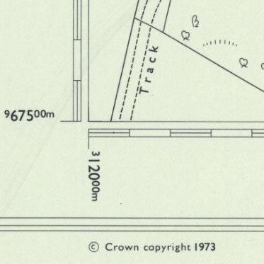
We have put online 1,868 maps at scales of 1:1,250 to 1:10,560 which were published in 1973, and which have therefore just come out-of-copyright from 1 January 2024. These include 1,151 detailed maps at scales of 1:1,250 and 1:2,500 covering areas in Scotland, and 717 less detailed maps at scales of 1:10,000/1:10,560 covering areas in England, Ireland, Scotland and Wales. Our graphic index showing the maps highlights the new maps published in 1973 in orange. These are usually the most detailed, basic scales of Ordnance Survey maps for these areas.
- Home page - Ordnance Survey National Grid maps, 1944-1973
- View the maps with a graphic index
- View a georeferenced layer of 1:1,250, 1:2,500, or 1:10,560 mapping on satellite imagery
- View a table of specific map additions (ordered by scale and sheet number)
Early estate maps of Dumfries-shire, 1760s-1820s
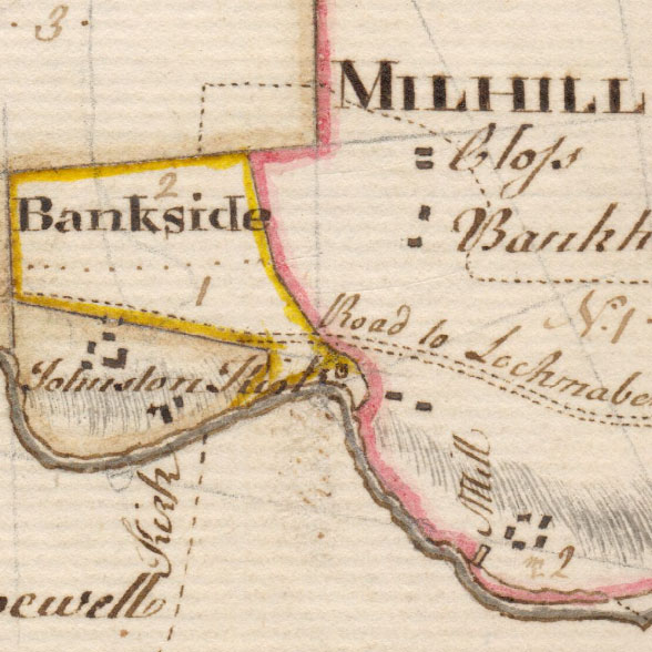
We have added a further 238 estate maps online, excellent for showing detail of the rural landscape. The majority of these relate to the Buccleuch Estates in Dumfries-shire, including James Leslie's Plans of the south side of Barony of Sanquhar (1766), and his Plans of the Barony of Drumlanrig (1772), at this time owned by Charles Douglas, 3rd Duke of Queensberry. There are also a number of early estate maps by James Tait (fl. ca 1739-1797) and Joseph Udny (ca 1770-1828). These are often the earliest detailed maps of these areas, showing the agricultural landscape of farms, fields, mills, commons, and woods, as well as land-ownership. We are very grateful to the Dumfries Archival Mapping Project for scanning these maps.
- Estate Maps of Dumfries-shire, 1730s-1950s (ordered by parish and date)
- View estate maps with a graphic index
- View a table of specific map additions (ordered by parish and date)
War Office, One-inch to the mile, Ireland (Large sheet series), G.S.G.S. 4136 (1940-1942)
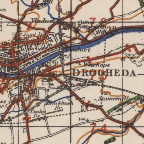
We have added online all our holdings (124 sheets) of the War Office's One-inch to the mile maps of Ireland (G.S.G.S. 4136), published 1940-42. This military map series was rapidly compiled during the Second World War from the latest available Ordnance Survey one-inch and half-inch to the mile mapping. It provides a useful overview of the landscape, with some sheets revised to show the latest road information, whilst others carry an overprint showing bogs, and relief in layer-colours.
- War Office, One-inch, Ireland, G.S.G.S. 4136 home page
- View map sheets using a graphic index.
- View the maps as a seamless layer on a satellite image base
Ordnance Survey of Northern Ireland, Irish Grid Series, 1:10,560 / 1:10,000 (1962-1972)
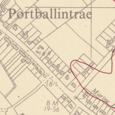
We have added online all our out-of-copyright maps (96 sheets) of the Ordnance Survey of Northern Ireland's Irish Grid Series mapping at 1:10,560 / 1:10,000. This is the largest-scale topographic mapping covering all areas in Northern Ireland from the 1960s to the present day, covering all of Northern Ireland in 285 sheets. This mapping provides a clear, detailed view of the landscape, including roads, buildings, fields, administrative boundaries, water features and vegetation.
- Northern Ireland, Irish Grid Series, 1:10,560 / 1:10,000 home page
- View map sheets using a zoomable map of Northern Ireland
Ordnance Survey, One-inch Ireland, 2nd edition, Administrative edition (1898-1902)
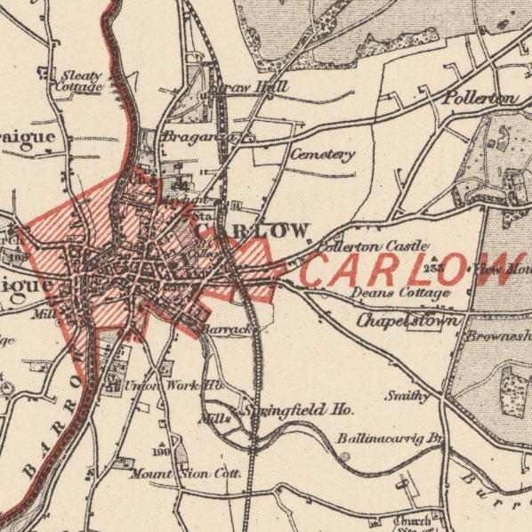
We have added online all our holdings (202 sheets) of a set of administrative maps at one-inch to the mile scale, covering all of Ireland. These show the boundaries of Urban Districts, Rural Districts, County Boroughs, and County Boundaries, as defined by the Local Government (Ireland) Act of 1898. These administrative boundaries are shown in red on top of one-inch to the mile 2nd edition base mapping, laid out on 204 sheets and numbered from north to south.
- OS One-Inch Ireland, 2nd ed., Administrative ed. home page
- View map sheets using a zoomable map of Ireland
Ordnance Survey One-Inch Ireland engraved maps (1850s-1910s)
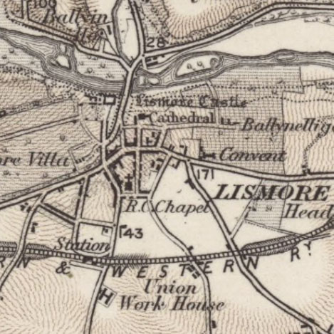
We have added online our main holdings of Ordnance Survey's one-inch to the mile engraved maps of Ireland (1,069 sheets). These were the earliest maps at this scale covering all of Ireland, laid out in 204 sheets from north to south. For most areas, there were three main editions, as well as different styles of maps, sometimes showing relief with contours, or with hachures. The multiple editions of the series are particularly useful in providing an overview of significant landscape changes relating to villages and towns, the development of roads and railways, and changing patterns of woods and estate parkland.
Ordnance Survey modern 1:50,000 and 1:25,000 Leisure Map layers
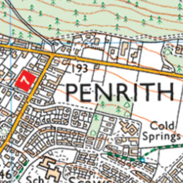
We have added online the Ordnance Survey's present-day 1:50,000 and 1:25,000 scale colour raster layers. These are the digital versions of the OS Landranger and Explorer paper map series. These layers are up-to-date, and taken directly as a Leisure layer from the OS Data Hub. These enduringly popular map series look stunning on screen, and they are particularly useful for visualising the present-day landscape for recreational purposes, including walking and cycling. You can also easily view and compare these layers with the earlier editions of these Ordnance Survey series going back in time.
- View as a background layer in our Georeferenced Maps viewer by choosing the
Background layer - OS Maps Leisure (1:50,000/1:25,000) from the drop-down list in the centre top of the screen. - View these in our Side by side split-screen viewer by choosing:
- Select a category: ESRI / OSM / LiDAR, and then
- Select a map series: OS Maps Leisure (1:50,000/1:25,000)
The 1:50,000 layer is visible at zoom levels 13-15. The 1:25,000 layer is visible at zoom levels 15 and above.
OS Six-Inch Ireland 2nd and later edition maps (1840s-1960s)
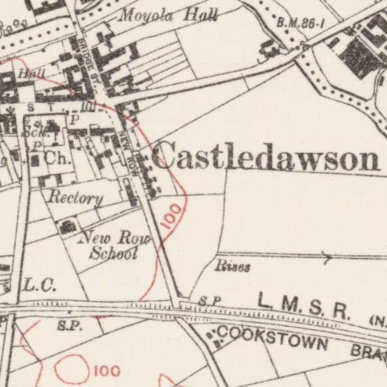
We have added online 2,735 second and later edition maps from the Ordnance Survey of Ireland's Six-Inch to the mile series (1840s-1960s). This series is the most detailed scale of mapping covering all of Ireland and Northern Ireland, showing good landscape detail. These new editions are based on fresh surveys and revisions, and are excellent for researching landscape change over time. Following the first edition, all areas have at least one edition at this scale, and some areas have four editions. These are all our holdings of this series.
OS Six-Inch Ireland 1st edition maps (1820s-1840s)
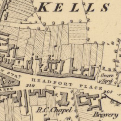
We have added online 1,970 maps forming the Ordnance Survey of Ireland's Six-Inch 1st edition series (surveyed 1829-1842). This is the earliest comprehensive mapping of Ireland, showing good landscape detail. Ordnance Survey began work in Ireland in 1824, working initially on creating an accurate triangulation network. The surveying and publication of map sheets generally proceeded from north to south. Ordnance Survey mapped Ireland at the Six-Inch scale before Scotland, England and Wales, and the maps show emerging practices for this series in terms of features, placenames, heights, and engraving techniques.
OS Six-Inch England and Wales 1st edition (1840s-1880s) georeferenced layer
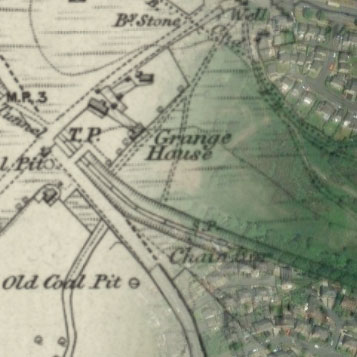
We have added a georeferenced layer made up of 7,564 sheets of the Ordnance Survey Six-Inch England and Wales 1st edition maps (1840s-1880s) covering England and Wales. This is the most detailed scale which covered all areas, allowing most features in the landscape to be shown, and it is of great value for local and family history. As many sheets at county boundaries were mapped just to the county boundary, we have made the layer available as separate county layers. At higher zoom levels, the county layer over the centre of the screen is shown on top, with county boundaries shown as a red line. When you move to another county, that county layer is shown on top.
View the new Six-Inch layer:
- As a seamless zoomable overlay layer (1840s-1880s) on modern satellite imagery and OS maps
- Compare 1st edition (1840s-1880s) with 2nd edition (1888-1913) mapping in our Side by side viewer
- Compare 1st edition (1840s-1880s) mapping with present day satellite imagery in our Side by side viewer
- Further information about the OS Six-inch maps
CPRE Light Pollution / Dark Skies layer (2016)
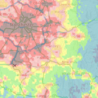
We have added a layer covering Great Britain which shows light pollution and dark skies. Each pixel shows the level of radiance (night lights) shining up into the night sky. These have been categorised into colour bands to distinguish between different light levels. The layer was created by Land Use Consultations for CPRE - the countryside charity in 2016 ( Further information ). Pixel sizes are around 750 x 750 metres, so the layer is best viewed at small to medium scales - when looking at the whole country or wider regions. We are very grateful to Land Use Consultants and CPRE for permission to display this layer on our website.
View Light Pollution / Dark Skies layer in our:
- Side by side viewer - Light Pollution / Dark Skies layer on right
- Georeferenced Maps viewer - Light Pollution / Dark Skies background layer
- XYZ and WMTS links for re-using the layer
OS 1:25,000 maps - Provisional maps (1972) and Second Series (1964-1972)
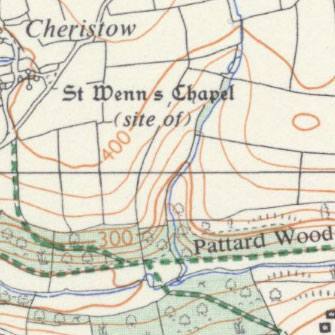
We have added online 75 Ordnance Survey 1:25,000 Provisional maps, published/reprinted in 1972, and which came out of-copyright this year. We have also added 145 Ordnance Survey 1:25,000 Second Series (1964-1972) maps, which are now also out-of-copyright. These maps provide excellent detail of the rural landscape at a medium scale. The Second Series maps show public footpaths and bridleways in England and Wales as a clear bright green dashed line, woodland shown with a green stipple, and buildings shown with a black stipple. We have also taken the opportunity to add records for in-copyright 1:25,000 maps in our Map Finder viewer.
- View all the 1:25,000 maps with a graphic index
- List of Provisional maps, published/reprinted in 1972
- Home page - OS 1:25,000 maps (Second Series)
OS Quarter-inch to the Mile, maps of England and Wales, 1899-1958
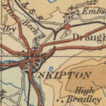
We have put online our main flat-sheet holdings of Ordnance Survey Quarter-Inch to the mile maps of England and Wales, numbering 231 maps across 19 series. The quarter-inch to the mile series provides an overview of significant landscape features, including larger settlements, railways, and roads. It was also particularly valuable for aviation, with various Civil Air and Royal Air Force editions, showing new aerodromes, landing strips and conspicuous features from the air. The earlier series covered all of England and Wales in 25 sheets, whilst later series, with larger sheet extents, covered England and Wales in 12 sheets. There were four main numbered editions, with various military and civilian forms, and with different ways of showing relief using hachures as well as hypsometric tints or layer colours.
- View all the quarter-inch to the mile maps of England and Wales.
- View a graphic index of 1st and 2nd edition mapping (1899-1915)
- View a graphic index of 3rd edition mapping (1919-1942)
- View a graphic index of 4th edition mapping (1934-1966)
- View a seamless layer of Quarter-Inch 1st (Hill shading) edition mapping (1899-1906) on a satellite image base
- View a seamless layer of Quarter-Inch 1st (Outline) edition mapping (1899-1906) on a satellite image base
- View a seamless layer of Quarter-Inch 3rd Civil Air edition mapping (1929-34) on a satellite image base
- View a seamless layer of Quarter-Inch 4th edition mapping (1934-37) on a satellite image base
Ordnance Survey, Indexes to detailed OS maps, England and Wales, 1879-1972
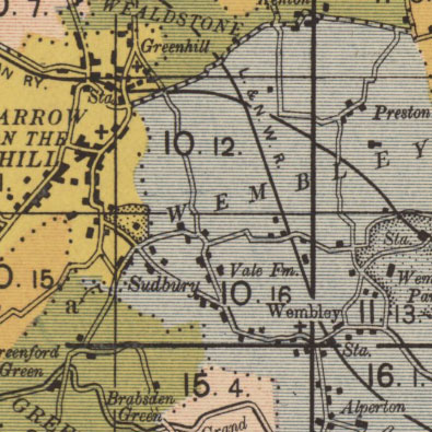
We have added 1,135 Ordnance Survey maps online which show the sheetlines and sheet numbers of detailed OS maps of England and Wales. These sheetlines are predominantly for maps at the Six-Inch and 25 Inch to the mile scales, with some One-Inch to the mile maps also covered. The indexes relate to both County Series maps (primarily before the Second World War) and National Grid maps (primarily after the Second World War). These index maps are also particularly useful for showing civil parish boundaries and their changes over time, as well as various other administrative areas, including Petty Sessional Divisions and Water Catchment Areas.
- View all the maps with a graphic index
- Indexes to the County Series maps, England and Wales, 1887-1897 - 36 sheets
- One-Inch with coloured parishes - Indexes to the Six-Inch and 25 Inch Maps, 1894-1904 - 235 sheets
- Quarter-Inch to the mile, County Diagrams. Showing Civil Parishes with tables of their areas - 1897-1913 - 54 sheets
- Quarter-Inch to the mile, Combined Index maps - 1879-1965 - 408 sheets
- Quarter-Inch to the mile, Couny Series Index maps - 1921-1924 - 175 sheets
- Half-Inch to the mile, County Diagrams. Indexes to County Series, 1932-1946 - 172 sheets
- 1:100,000, Indexes to County Series and National Grid sheets, 1966-1972 - 53 sheets
Ordnance Survey Half-Inch Administrative Area Diagrams, England and Wales, 1899-1972
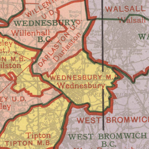
We have added 1,371 Ordnance Survey maps online, showing Administrative Areas at the Half-Inch to the Mile scale (1:126,740). The Administrative Area Diagrams show Administrative Counties, Municipal Boroughs, Urban and Rural Districts, and Civil Parishes for each county in England and Wales. On selected sheets, Parliamentary Constituency boundaries are also included, as well as various Judicial Boundaries. The series was metricated to 1:100,000 during the 1960s. Whilst these boundaries are shown on more detailed Ordnance Survey maps, these Administrative Area Diagrams provide a more comprehensive record of these boundaries over the 20th century.
- Home Page - OS Half-Inch, Administrative Boundaries
- View the maps with a graphic index of England and Wales
Ordnance Survey Half-Inch to the Mile, England and Wales, 1914-1942
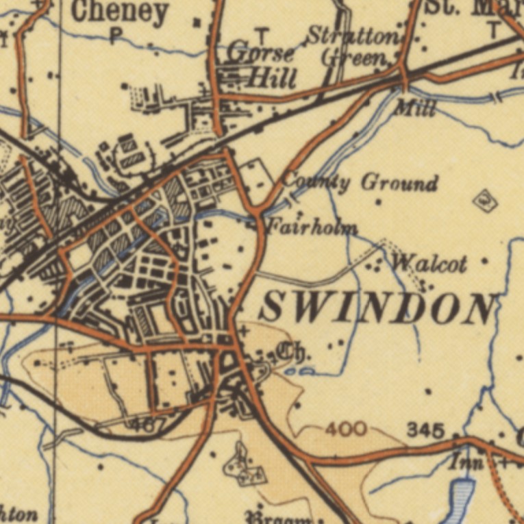
We have added 99 Ordnance Survey maps at Half-Inch to the Mile (1:126,740) covering England and Wales online. These maps provide a simplified overview of the landscape, particularly focusing on roads and railways, with topographic content mainly derived from more detailed surveys in the early 20th century. The additions also include the Ministry of Transport Road Maps, published by the Ordnance Survey in 1923, which were the first to accurately show the initial numbered roads. These are all our flat-sheet holdings of these series; we plan to add our Half-Inch to the Mile folded sheets later this year.
- View the maps with a graphic index
- Layer-coloured, 1908-18 - Home Page
- Ministry of Transport road maps, 1923 - Home Page / Georeferenced layer
- Outline edition, 1930-42 - Home Page / Georeferenced layer
Geological Survey of England and Wales,
One-Inch and Six-Inch to the Mile maps, 1860s-1950s
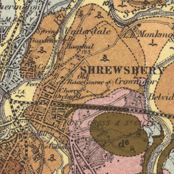
We have added all our out-of-copyright holdings of geological maps of England and Wales online (532 maps). This includes a detailed set of 313 six-inch to the mile maps, focusing on areas with economically valuable geology, as well as 219 less detailed one-inch to the mile maps. All the maps use Ordnance Survey topographic mapping as their base, with geological information added as a coloured overlay. For the one-inch to the mile maps, this overlay is sometimes divided into separate sheets showing 'Solid' geology (ie. bedrock geology - the main mass of rocks forming the Earth) and 'Drift' geology (ie. sediments carried by glacial meltwater).
- View the maps with a graphic index
- Six-inch to the mile geological maps home page
- One-inch to the mile geological maps home page
One-Inch land utilisation and agricultural maps of England and Wales
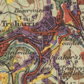
We have put online 133 Land Utilisation Survey maps of England and Wales in the 1930s. This was the first systematic land use survey in Britain, organised by L. Dudley Stamp, and carried out by volunteers, which colour-coded the landscape into six main categories. We have georeferenced these maps allowing them to be compared to modern land use today. We have also put online 84 Agricultural Land Classification maps from the 1960s covering most of England and Wales. These were organised by the Ministry for Agriculture, Fisheries and Food (MAFF), categorising land into five main categories reflecting their quality for agricultural use. They use Ordnance Survey One-inch to the mile Seventh Series maps for their base topography, and a coloured overprint to indicate the respective land quality.
- Land Utilisation Survey, Great Britain, 1931-1938
- Agricultural Land Classification maps, England and Wales, 1960s-
Ordnance Survey maps published in 1972
We have put online 2,094 maps at scales of 1:1,250 to 1:63,360 which were published in 1972, and have therefore just come out-of-copyright from 1 January 2023. These include 1,468 detailed maps at scales of 1:1,250 and 1:2,500 covering areas in Scotland, and 577 less detailed maps at scales of 1:10,000/1:10,560 covering areas in England, Scotland and Wales. Our graphic index showing the maps highlights the new maps published in 1972 in orange. These are usually the most detailed, basic scales of Ordnance Survey maps for these areas. We have also added 49 sheets from the One Inch Seventh Series (1952-72), which have come out of copyright this year too.
- Home page - Ordnance Survey National Grid maps, 1944-1972
- View the maps with a graphic index
- View a georeferenced layer of 1:1,250 / 1:2,500 mapping or 1:10,560 mapping on satellite imagery
- View a table of specific map additions (ordered by scale and sheet number)
Ordnance Survey One-Inch Maps of England and Wales, 1870s-1950s
We have added 2,408 One-Inch to the Mile maps of England and Wales online. These new maps include some of Ordnance Survey's most treasured series including the Popular edition in the 1920s and the 5th edition in the 1930s. One-inch maps are often useful for researching larger landscape features, such as roads, railways, settlements, woodland, or lakes and reservoirs, supplementing the main record of landscape change at the larger basic six-inch and 25-inch to the mile scales. These new maps include our main flat sheet holdings of these maps from the New Series in the 1870s, through to the New Popular and its variants in the 1940s. The new maps also include the military series GSGS 3907, published during the Second World War, and GSGS 4620 from the later 1940s.
- View all the maps with a graphic index
- One-Inch Engraved Maps, England and Wales, 1872-1914 - 2,229 sheets
- One-Inch 3rd Edition (Black Outline Edition), 1906-1917 - 54 sheets
- One-Inch 'Popular' edition, England and Wales, 1919-1926 - 288 sheets
- One-Inch 5th edition, England and Wales, 1931-1937 - 131 sheets
- One-Inch Popular, England and Wales. GSGS 3907 - 1933-43 - 284 sheets
- One-Inch New Popular, England and Wales. GSGS 4620 - 1948-52 - 3 sheets
Ordnance Survey Air Photo Mosaics of England and Wales, 1944-1950
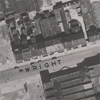
These 6,193 air photo mosaics provide detailed information on the landscape of England and Wales in the 1940s, complementing the Scottish air photo mosaics which we have had online since 2009. They cover 20% of the British landscape at 1:10,560 scale (showing useful information about fields, farms, roads, railways and woodland), and 16 towns/cities in England and Wales at 1:1,250 scale (with excellent detail of urban topography including buildings and industrial premises). These towns and cities had often sustained Second World War bomb damage, which can be clearly seen too. The mosaics were produced as an interim measure by Ordnance Survey as a quick and cheap expedient before proper paper mapping could be surveyed, to assist with post-War planning and reconstruction.
- Ordnance Survey Air Photo Mosaics, 1944-1950
- Georeferenced layer, side by side - 1:10,560 scale (England and Scotland)
- Georeferenced layer, side by side - 1:1,250 scale (16 towns/cities in England and Wales)
- Further information
Ordnance Survey 25 inch Edinburgh gazetteer and viewer
With many thanks to all our volunteers for their transcriptions work, our Ordnance Survey 25 Inch Edinburgh Transcriptions viewer allows you to search all the text on Ordnance Survey 25 inch maps of Edinburgh from 1892-4. There are over 21,950 transcriptions – you’ll find street and other place names, real-world features such as breweries, churches, football grounds, hospitals, pubs and schools, as well as numeric transcriptions for things like acreages and heights. The viewer is of great value for local or family historians searching for streets, buildings or other places in Edinburgh, as well as all those interested in the late 19th century Edinburgh townscape. We have made available the transcriptions dataset for onward re-use, including machine-learning.
- Map Viewer and Search Interface
- Map Viewer Help
- Project Information - datasets, fields, tags, and data download links
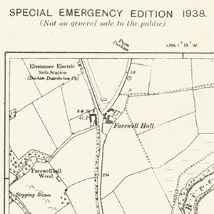
Special Emergency Edition, 1938-39
The Special Emergency Edition, 1938-39 was a rapid revision of the Ordnance Survey's Six-Inch to the mile maps for Air Raid Precaution purposes. Most of the revision was of new buildings and roads, with information obtained variously from One-Inch to the mile revision material, recent 25 inch to the mile revision, and some special surveys. Many sheets therefore show landscape detail which reflects much earlier revision in ca. 1900-25, juxtaposed with some building developments and roads which were very recent in 1939. We have made available all 73 of our sheets in this series, which cover scattered locations in England and Wales.
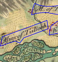
Roy Military Survey of Scotland Gazetteer
With sincere thanks to our volunteers, all 33,523 names on the Roy Military Survey of Scotland (1747-55) can now be searched and browsed. This is of huge value for local and family historians, placename researchers, as well as all those interested in the landscape of 18th century Scotland. You can generate distribution maps of particular name elements, or dynamically view all of the names in a particular area. The transcription workflow also recorded related or nearby names from the Ordnance Survey 1st edition mapping from a century later in order to help searching and provide additional context for the Roy names. The Gazetteer can also be downloaded in accessible formats for onward use and research. We are very grateful to the British Library for collaborating with us on this project.
- Roy Gazetteer information page
- Search all the Roy Names with a map
- Browse all the Roy Names as a list
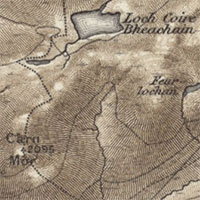
OS Scottish One-Inch 'Hills' editions and additional states (1840s-1900s)
We have added 348 new Ordnance Survey One-Inch to the mile (1:63,360) engraved maps online. This includes two new 'hills' editions at one-inch to the mile scale, with relief shown by hachures (horizontal lines following the direction of the slope). We have also added a number of variant states of these OS one-inch maps, including those with railway additions, minor corrections, different printings, and different colour. We now have a comprehensive set of all our OS one-inch to the mile single-sheet maps of Scotland online.
- View these maps with a graphic index of Scotland.
- 1st edition - 1856-1891 - 539 sheets
- 2nd edition - 1885-1900 - 548 sheets
- 3rd edition - 1903-1912 - 642 sheets
- 4th edition - 1910 - 2 sheets
- Further information on this group of maps.
Ordnance Survey 1:1,056 Town Plans of England (1840s-1850s)
We have added 41 new OS Town Plans of England online at a scale of Five Foot to the Mile (1:1,056 scale). These supplement the OS Ten Foot to the Mile plans (1:500 scale) added in December 2021. These are the most detailed maps that Ordnance Survey ever surveyed of these towns, and are especially useful for showing the urban landscape in maximum detail. Towns with more than 4,000 people were initially surveyed at 1:1,056 scale from the 1840s, and the 1:500 scale was only authorised from 1855, so this set of 1:1,056 town plans usually date from the 1840s-1850s. We have georeferenced all these maps first and will add sheet lines for them all soon so they can be searched in our Map Finder viewers.
- Browse an alphabetical list of all the towns with links to view maps
- View a georeferenced layer of 1:1,056 Town Plans
- OS Town Plans of England and Wales home page
- Further information about the town plans
Additional maps of Great Britain, 19th-20th centuries
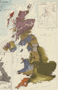
We are also pleased to add online over 200 maps of Great Britain in the 19th and 20th centuries. These maps present an excellent overview of England, Scotland and Wales, and sometimes including Ireland, showing specific subjects such as roads, railways, air travel, population, power generation, rainfall and housing, as well as things like changing administrative divisions. Some of these expand our coverage of the Ordnance Survey's Ten-mile to the Inch (1:625,000) Planning maps series, initiated in the 1940s, and intended to form a survey of national life and resources. Others include military maps showing barracks and military districts, as well as maps to illustrate specific historical time periods, such as Ancient Britain, Britain in the Dark Ages, Roman Britain, and Monastic Britain.
We have divided these maps into the Ordnance Survey "ten mile" Planning maps, other Ordnance Survey small-scale maps, and maps by other publishers:
- Ordnance Survey, "Ten Mile" Planning Maps of the United Kingdom, 1940s-1970s - 183 sheets
- Ordnance Survey, small-scale maps of Great Britain, 19th to 20th centuries - 35 sheets
- General maps of Great Britain and Ireland, 16th to 20th centuries - 41 maps
New LiDAR coverage of Glasgow, Edinburgh and the Sherwood Forest

We are pleased to add new LiDAR coverage of Glasgow, Edinburgh and the Sherwood Forest areas to our website. Light Detection and Ranging (LiDAR) is an airborne mapping technique, which uses a scanning laser to allow highly detailed representations of relief or terrain models to be generated. The new Scottish data is from the latest Phase V of the Scottish Government's LiDAR datasets, flown in 2021, and includes new coverage of Glasgow and Edinburgh with a 50 cm resolution Digital Terrain Model (DTM). Our new Sherwood Forest coverage is the highest resolution LiDAR ever flown of this area at 16 cm resolution, and includes both Digital Terrain Model (DTM) and Digital Surface Model (DSM) coverage. We are very grateful to the Miner 2 Major Veiled Landscape project for making this Sherwood Forest LiDAR available to us.
- View Glasgow, Edinburgh or Sherwood Forest in our Side by side viewer
- Further information on Sherwood Forest LiDAR
- Updated guide - Using LiDAR layers for landscape research
New trench map coordinates search and display
We have added a way to search trench map coordinates in our Map Finder - with Outlines and Georeferenced Maps viewers. You can input various lengths of trench map coordinates (eg. '28.I.8', '36C.S.22.c', '62d.J.19.b.4.3') in the 'Search Places' panel to the upper left, and the map will zoom to these locations. The Trench Map Coordinates for your mouse cursor location are shown dynamically to the lower right. If you click/tap on the 'Show Coordinates' tab in the footer, or hold the ALT button down and click/tap, these Trench Map Coordinates appear in a popup box for copying. During the First World War, trench map coordinates were used extensively for giving precise locations on the Western Front.
- Further details of how to Search using trench map coordinates
- Search and view trench map coordinates in our Georeferenced Maps viewer
- Further information on Trench map sheet numbering and references
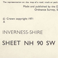
Ordnance Survey maps published in 1971
We have put online 2,332 detailed maps at scales of 1:1,250 to 1:25,000 which were published in 1971, and have therefore just come out-of-copyright from 1 January 2022. These include 1,481 detailed maps at scales of 1:1,250 and 1:2,500 covering areas in Scotland, and 728 less detailed maps at scales of 1:10,000/1:10,560 covering areas in England, Scotland and Wales. Our graphic index showing the maps highlights the new maps published in 1971 in orange. These are usually the most detailed, basic scales of Ordnance Survey maps for these areas. We have also added 125 sheets from the 1:25,000 Provisional edition, which have come out of copyright this year too.
- Home page - Ordnance Survey National Grid maps, 1944-1971
- View the maps with a graphic index
- View a table of specific map additions (ordered by scale and sheet number)
New Guide - Re-using georeferenced maps
Would you like to re-use our georeferenced map layers inside other software? This new set of pages provide easy, step-by-step instructions for how to bring our georeferenced maps into QGIS and ArcGIS, as well as into geojson.io and OpenStreetMap. We also include details of how to find georeferenced layer URLs from our Georeferenced Maps viewer, as well as a brief layers list. Re-use of these layers is intended for personal purposes (further information).
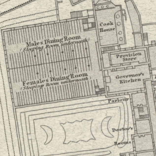
Ordnance Survey 1:500 Town Plans of England and Wales (1840s-1890s)
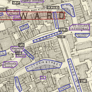
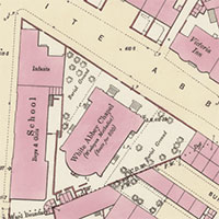
We have added 10,519 sheets online showing Victorian town plans in England and Wales (1840s-1890s). Over 380 towns (all those with more than 4,000 people) were mapped at a scale of 1:500 - the most detailed maps that Ordnance Survey ever surveyed of these towns. These maps are of unrivalled importance for showing all aspects of the urban landscape - industries, public buildings, pubs, churches, infirmaries, poorhouses, schools, houses, trees, and parks. We are georeferencing these maps so they can be easily compared to the present day, or compared to each other over time for towns with two editions (eg. Leeds 1840s/1880s).
We are prioritising town plans at 1:500 scale (around 85% of the total); other scales will be added over the next few months.
- Browse an alphabetical list of all the towns with links to view maps
- View map sheets with a clickable map of England and Wales
- Browse a georeferenced overlay layer
- OS Town Plans of England and Wales home page
Alexander Innes - Jamaica Journal (1823-24)
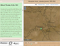
This new map viewer allows you to journey through space, time and text in early 19th century Jamaica. It combines the Journal of Alexander Innes (1823-24) with James Robertson's mapping of Jamaica (1804), showing the locations that Innes visited highlighted in blue. This resource provides an insight into the harsh conditions experienced by enslaved people as seen through a colonial 19th-century viewpoint. Read further information about Alexander Innes, about the journal and map sources, and about the resource. You can also download the data. This resource was created as part of a work placement at the Library undertaken by Matthew Lee, a PhD student working on a collaborative project between the University of Aberdeen and the National Library of Scotland.
- View Alexander Innes - Jamaica Journal
- View this and other Collaborative projects, which combine our maps with other resources.
Scottish water mills website
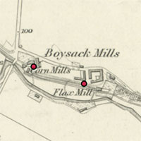
This new web resource shows the locations and details of over 9,000 mills in Scotland in the 19th century. You can query and filter the mill records by name, mill type, date, and related features, as well as compare distributions of mills in a split-screen viewer. There is also supporting information about mills in Scotland, the project workflow to create the mills data, and how to download the mills data. The online resource was created during a six month placement by Iara Calton, an AHRC Collaborative Doctoral Partnership PhD student at the University of Glasgow.
- View the Scottish water mills website.
- View this and other Collaborative projects, which combine our maps with other resources.
OS Six-inch Scotland first edition - railway and other variant states (1840s-1880s)

We have added an additional 1,824 Ordnance Survey Six-inch to the mile, first edition maps of Scotland online (1840s-1880s). These are an earlier set of flat sheets to the initial set we have had online since 2008. In some cases these new sheets are useful for showing the variant states of these maps, including those which show railway additions, updates to towns, county boundary sheet changes, security deletions, administrative boundary changes, as well as related variant information in the map margins. Read further information about these new additions. In other cases, these maps have different annotations, marks or paper tone, which may be preferred as copies.
- View a list of new maps added, including railway and related variant states
- Further information about these new additions
- OS six-inch to the mile, 1st edition home page
New guide - Maps for researching Scottish Woodland History
We have put together a new guide on Maps for researching Scottish Woodland History. Maps provide a wealth of information about woodland history, as well as on woodland archaeology, industry, management, and military use. This guide picks out the most useful maps for viewing and understanding trees and woodland, as well as changes in woodland cover over time. It looks at different definitions and types of woodland and how different map-makers represented woodland. The guide also includes links to downloadable datasets, details of resources that are not online, as well as references for further reading.
- New guide - Maps for researching Scottish Woodland History
OS 25 inch 'blue-and-black' drawings, Scotland, 1890s-1940s
This set of 694 Ordnance Survey 'blue-and-black' drawings show revision for the 25 inch to the mile maps, between the 1890s and the 1940s. This revision process drew new edition information in black ink on a printing of the previous edition in light blue. When this was photographed, the blue would not reproduce, so details not required or no longer present on the ground appear in blue. Military and related sites were added in black, but some of these were subsequently erased from the final printed maps. We have scanned all sheets which include stamps by Ordnance Survey referring to deletions where these were required, as well as all sheets in the counties of Linlithgow and Nairn.
- Home page - OS 25 inch 'blue-and-black' drawings, Scotland, 1890s-1940s
- View the maps with a graphic index
- For sheets with security deletions, view as a:
- seamless zoomable overlay layer on modern satellite images and OS maps
- seamless zoomable layer side-by-side compared to the published editions
New guide - Maps for Researching House and Building History
Are you interested in looking into the history of a house or building? We have put together a new guide on Maps for Researching House and Building History which highlights some of the most relevant maps to use as documentary sources. The maps are arranged roughly chronologically, covering rural and urban areas, with links to the maps and further information about them on our webite. We also include information on recent buildings and map copyright, as well as further relevant resources, both online and in print.
- New guide - Maps for Researching House and Building History
New Scottish LiDAR Digital Terrain Model (DTM) layer
We have reprocessed the Scottish Government's LiDAR Digital Terrain Model (DTM) layer to allow minor landscape features to be seen much more clearly. Light Detection and Ranging (LiDAR) is an airborne mapping technique, which uses a scanning laser to allow highly detailed representations of relief or terrain models to be generated. Many archaeological sites such as hillforts, Roman camps, deserted villages, or cultivation terraces can be seen much more clearly than on satellite imagery or maps. LiDAR can help to bring out the effects of glaciation on local topography, or show the effects of geomorphology on soils. Modern features like quarries, embankments or railway cuttings, as well as historic features like limekilns or canals can be seen more clearly. Although coverage is partial and still expanding, 1 metre or higher resolution LiDAR is available for most of England, Scotland, and Wales.
- New guide - Using LiDAR layers for landscape research
- Compare OS six-inch (1888-1913) maps with the new LiDAR DTM layer in our Side by Side viewer:
Scottish map miscellany, 20th century
This small selection of maps of Scotland, dating between 1907 and 1969, include several interesting maps of Scotland, town plans of Aberdeen, Dundee, Edinburgh, and Glasgow, and various special series maps. The special series maps include some of the very attractive Ordnance Survey One-Inch to the mile Tourist Series, special Administrative District Maps of Glasgow, as well as geological and soil maps. These maps have been incorporated into the relevant existing categories, as indicated in the table below.
- View a table of all these specific map additions (ordered by category)
Scottish military maps, 20th century
These military maps, dating from the 20th century, include very detailed plans of defensive works in and around the Forth and Clyde estuaries, constructed before and during the First World War. These were the largest-scale plans ever surveyed of these sites, and allow the terrain and defences to be scrutinised in minute detail, with whole islands and related coastal sites remodelled for military purposes. There are also plans relating to military training areas, and the construction of new barracks. We have georeferenced a selection of these maps, to allow them to be easily compared with other maps and the present day.
- Home page - Scottish military maps, 20th century, 57 sheets
- Forth military defences (1911-18)
- Clyde military defences (1904-18)
- Military exercise maps (1904-1966)
- Barracks (1926-1939)
New resource - Maps for Scottish Local History
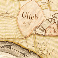
Are you interested in researching local history with our maps website, but not sure where best to start? This new resource highlights some of the most useful maps for local history research, with summary information about their content, and links to further information. Maps can reveal detailed information about local areas over time, including buildings, gardens, industries, railways, roads, woodland and agricultural land. Depending on the place, subject and time period, different maps may be more useful, and these are explained. The resource is part of a growing series, focusing on maps for particular subjects or user communities.
Ordnance Survey Quarter-Inch Administrative Maps, Scotland, 1930s-1960s
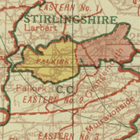
This set of 85 maps includes all our out-of-copyright OS quarter-inch to the mile (1:253,440/1:250,000) maps showing administrative and Parliamentary Constituency boundaries. The maps show these boundaries are a clear, coloured overlay. Local government boundaries, including those for civil parishes, counties, large burghs, small burghs and counties of the city are shown, as well as Parliamentary Constituency boundaries. The maps show changes brought in by the Local Government (Scotland) Act, 1947, the House of Commons (Redistribution of Seats) Acts of 1949 and 1958, as well as some more localised changes. These series complement our existing OS Quarter-Inch to the mile maps and Boundaries viewer.
- Home page - OS Quarter-Inch Administrative Areas, 1938-49 - 16 sheets
- Home page - OS Quarter-Inch Administrative Areas, 1950-52 - 16 sheets - and georeferenced layer
- Home page - OS Quarter-Inch Administrative Areas, 1955-66 - 36 sheets - and georeferenced layer
- Home page - OS Quarter-Inch Administrative Areas, 1966-73 - 17 sheets
- Read further information on the history of counties and parishes, and legislation which changed them.
Ordnance Survey Half-Inch and Quarter-Inch Indexes, Scotland, 1890s-1960s
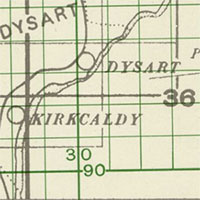
These two series at half-inch and quarter-inch to the mile scales, organised by county, show the sheet boundaries of OS larger-scale maps at Six-Inch and 25 Inch to the mile scales. The half-inch indexes show sheet lines of both the pre-Second World War County Series (in grey) as well as the post-War National Grid sheets (in green); the quarter-inch indexes, show just the County Series (in black). Both series also show an underlying basic topography of railway lines, towns, churches, coastlines and civil parish boundaries. The series complement our existing Ordnance Survey indexes and OS Records viewer.
- View the maps with a graphic index
- Home page - OS Quarter-Inch to the mile, Indexes to County Series, 1890s-1960s - 109 sheets
- Home page - OS Half-Inch to the mile, Indexes to County Series and National Grid, ca. 1966 - 35 sheets
OS One-Inch Seventh Series, Great Britain, 1952-1970

We have put online all of our Ordnance Survey One-Inch Seventh Series maps (896 sheets), covering all of Great Britain, 1952-1970. Our previous coverage of this series just included one edition for each sheet map, but we have now put online all our out-of-copyright editions. This also includes a set of Outline (uncoloured) sheets, as well as the Seventh Series Indexes, showing sheet lines of the 1:2500 County Series related to the National Grid. The Seventh Series provides an excellent overview of the landscape of Great Britain in the 1950s and 1960s, and it was the only standard one-inch to the mile (1:63,360) series to cover the whole of Great Britain.
- View the maps with a graphic index
- Home page - One-Inch Seventh Series - Regular / Coloured maps - 703 sheets
- Home page - One-Inch Seventh Series - Outline / Uncoloured maps - 179 sheets
- Home page - One-Inch Seventh Series - Indexes - 14 sheets
- View a seamless layer of Seventh Series mapping on a satellite image base
- Further information about this series
OS Quarter-inch to the Mile, maps of Scotland, 1901-1960
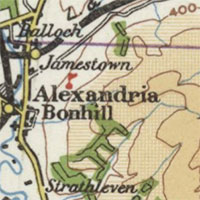
We have put online all of our Ordnance Survey Quarter-Inch to the mile maps of Scotland, numbering 182 maps across 16 series. The quarter-inch to the mile series provides an overview of significant landscape features, including larger settlements, railways, and roads. It was also particularly valuable for aviation, with various Civil Air and Royal Air Force editions, as well as a set captured and reissued for the German Luftwaffe, showing new aerodromes, landing strips and conspicuous features from the air. The earlier series covered all of Scotland in 17 sheets, whilst later series, with larger sheet extents, covered Scotland in 9-10 sheets. There were four main numbered editions, with various military and civilian forms, and with different ways of showing relief using hachures as well as hypsometric tints or layer colours.
- View all the quarter-inch to the mile maps of Scotland.
- View a seamless layer of Quarter-Inch 1st (Hill shading) edition mapping (1900-1906) on a satellite image base
- View a seamless layer of Quarter-Inch 1st (Outline) edition mapping (1900-1906) on a satellite image base
- View a seamless layer of Quarter-Inch 3rd Civil Air edition mapping (1929-30) on a satellite image base
- View a seamless layer of Quarter-Inch 4th edition mapping (1935-37) on a satellite image base
OS Half-inch to the Mile, Scotland, Outline Edition, water in blue, 1942
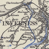
This series at half-inch to the mile scale (1:126,720) was published during the Second World War as an Outline (uncoloured) series, with topography in black, and inland water features printed in blue. The map content largely represents the late 19th century landscape, with only minor later updates to topography and roads. Although printed in 1942, the source content relates to the initial half-inch series drawn in the 1900s, with topographic content derived from the main nationwide revision of maps at the larger-scales from the 1890s.
- Home page - OS Half-inch to the Mile, Scotland, Outline Edition, water in blue, 1942
- View the maps as a seamless layer on a satellite image base
Updated home page, viewers and footer
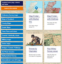
We have updated our home page, viewers and footers in response to user feedback. Our home page is now shorter and simpler, with the main map search options presented more clearly. Our previous Map Finder viewers have been renamed Map Finder, to make their purpose clearer, and the Map Finder - with Marker Pin has been updated with better filtering options. We have also tried to improve help and guidance, with a new Guide to this website page, and clearer orange Help buttons to the lower left in all our viewers. We have also changed the footer to mirror the main Library website, grouping the most useful information pages into clearer lists.
All central page content, URLs and zoomable maps are unchanged.
We realise that for regular users, these updated pages will take some getting used to, but we hope that you will then see them as improvements. We would be happy to receive feedback to maps@nls.uk.
New tools for Drawing / Tracing Features
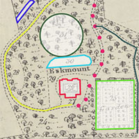
We have added new tools to allow easy drawing / tracing of features on our maps. These have been added to our Georeferenced Maps - Full Screen / Draw viewer (for georeferenced maps), as well as our standard map images viewer (for non-georeferenced maps). You can choose a feature type for drawing, choose a colour, and just click/tap on the map to draw. You can easily modify features once drawn, as well as delete them. The resulting drawn features can be saved locally as an image or JSON file of coordinates (which can be easily edited with a text editor). In the georeferenced maps viewer, you can save a GeoJSON file of drawn features, for easy onward editing in geographic viewers or software. In the map images viewer, you can also print a PDF of the drawn features, and save a JSON file with X,Y image coordinates.
- Go to Georeferenced Maps - Full Screen / Draw viewer (for georeferenced maps - select 'Draw / Trace Features' button top-right)
- Go to map images viewer (for non-georeferenced maps - select 'Draw' button in footer)
- Read how to draw features with georeferenced maps or non-georeferenced maps
Researching climate change with the Map Images website
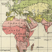
This new resource gathers examples of how the Library’s online map collections can be used to illustrate and understand climate change. Maps provide many insights into historic landscapes and environments, showing different ways of generating power, less polluting lifestyles and means of travel, subjects like fossil fuel extraction and consumption, as well as coastal erosion and sea-level rise. Once georeferenced, so that historic maps can be overlaid on their present-day location, comparison of change over time can be very revealing. This subject guide focusing on maps forms part of a wider Climate Action Plan by the Library.
County maps of Northern England, 1760s-1840s

We have added an additional 22 maps of counties in northern England. These maps generally provide the most detailed coverage of these whole counties, prior to Ordnance Survey mapping from the later 19th century. County maps were often privately funded by subscriptions from county landowners and gentry, and were based on an original survey, using trigonometry, at scales of one-inch to the mile, so they allowed good detail of the landscape to be shown. These particular maps have been scanned to support the 'Away from the water' : the first energy transition, British textiles 1770-1890 research project, based at the University of Glasgow.
- View a table of specific map additions (ordered by county and date)
- View the maps with a graphic index
- Home page - County maps, 1580s-1950s
Extended coverage of Survey of India maps of southern India, 1920 - 1951
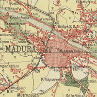
We have added an additional set of 73 topographic maps covering part of southern India, to provide complete coverage of the River Kavery, and everywhere south of the 12th parallel north. The maps were published by the Survey of India, at the scales of one-inch to the mile (1:63,360) and half-inch to the mile (1:126,720). These maps have been scanned and georeferenced to support collaborative academic projects relating to water resources in southern India, led by the University of Lancaster.
- Home page - One-inch / Half-inch to the mile maps of southern India
- View the maps with a graphic index
- View the maps as a seamless layer on a satellite image base
Ordnance Survey National Grid maps published in 1970
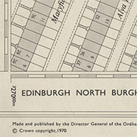
We have put online 2,430 detailed maps at scales of 1:1,250 to 1:10,560 which were published in 1970, and have therefore just come out-of-copyright from 1 January 2021. These include 1,592 detailed maps at scales of 1:1,250 and 1:2,500 covering areas in Scotland, and 513 less detailed maps at scales of 1:10,560 covering areas in England, Scotland and Wales. Our graphic index showing the maps highlights the new maps published in 1970 in orange. These are the most detailed, basic scales of Ordnance Survey maps for these areas.
- Home page - Ordnance Survey National Grid maps, 1944-1970
- View the maps with a graphic index
- View a table of specific map additions (ordered by scale and sheet number)
Ordnance Survey, Scotland, 25 inch to the mile, 1855-1882 (supplementary "Parish edition" sheets)
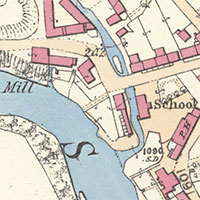
We have added a further 1,657 Ordnance Survey 25 inch Parish edition maps of Scotland online. These new maps are "Parish edition" sheets for areas which we also have a later reprinted "Combined edition" sheet for. Until now, for these areas, only the "Combined edition" sheet has been available online. Although based on the same survey, there are subtle differences of symbols, styles and the depiction of features between these two states of First Edition mapping. The 25 inch to the mile series (1855-1882), is the earliest detailed OS mapping for all the inhabited regions of Scotland. All towns, villages and cultivated rural areas were mapped, comprising over a third of the total land area of Scotland. With this addition, we now have comprehensively put online all of these 25 inch First Edition sheets covering Scotland.
- Home page - Ordnance Survey 25 inch parish edition maps of Scotland
- View the maps with a graphic index
- View a table of specific OS 25 inch map additions (ordered by county and sheet number)
- Read more about the 25 inch series and parish editions
Estate maps of Scotland, 1760s-1950s
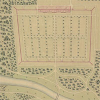
We have added a further 224 estate maps online, excellent for showing detail of the rural landscape. These maps were made to support estate management by particular landed estates, including those of the Lockharts of Lee (1770s-1950s), primarily in Lanarkshire, and those of the Fletchers of Saltoun (1750s-1870s) in East Lothian. We are also grateful to the Dumfries Archival Mapping Project for scanning maps relating to Dalswinton Estate (1768) in Dumfries-shire and Earlstoun Estate (1769-1830) in Kirkcudbrightshire.
- Home page - Estate Maps of Scotland, 1730s-1950s
- View the maps with a graphic index
- View a table of specific map additions (ordered by county, parish and date)
Commercial mapmaker series maps of Scotland, 1870s-1930s
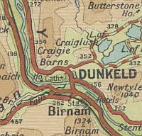
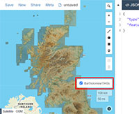
We have added online 214 series maps by Bartholomew, Gall & Inglis and W. & A.K. Johnston to our website. Most of these medium-scale maps, primarily at the half-inch or quarter-inch to the mile scales, are useful for giving a regional overview of the landscape, and showing the latest travel routes by road, rail and steamer. These Edinburgh-based commercial cartographers used Ordnance Survey maps for their primary content, but usually redrew the maps at smaller scales, adding colour and related content to create different, distinctive styles of mapping. These maps are folded and have only recently been possible to scan.
- Bartholomew's Reduced Ordnance Maps of Scotland, 1875-1891
- Bartholomew's Half-inch to the Mile maps of Scotland, 1899-1905
- Bartholomew's Quarter-inch to mile map of Scotland, 1911-1932
- Gall & Inglis' graded road maps of Scotland, 1900s-1930s
- Gall & Inglis' Tourists Map of the Clyde, 1920s-1930s
- Johnston's reduced Ordnance maps of Scotland ... [showing the railways], 1888-1896
- Johnston's "Three miles to inch" map of Scotland, 1885-1912
Stevenson civil engineering plans of Scotland, 19th-20th centuries
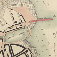
We have put online 1,072 detailed Stevenson civil engineering plans relating to Scotland. The majority of these plans relate to harbour works in coastal towns, but there are significant numbers of maps too relating to bridges, canals, railways, and river engineering. The Stevenson family also served as engineers to the Northern Lighthouse Board, and drafted plans and profiles of lighthouses. The collection also includes a range of related printed mapping, including charts, county maps, and Ordnance Survey plans used for reference purposes, and often annotated. Many of the plans show projected works that were not necessarily carried out in practice. This is around half of our Stevenson collection relating to Scotland; the other plans are undergoing conservation work to allow them to be scanned in future.
- Stevenson civil engineering plans, 1660s-1940s - home page
- Stevenson Maps and Plans of Scotland, 1660-1940 project website:
- Read about the Stevenson maps and plans and the Stevenson family.
- Search all the Stevenson plans (records and images):
- using a graphic index
- using text.
- View and download Stevenson metadata on the Data Foundry
German naval charts of British waters, 1938-1945
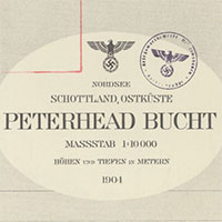
We have added a small set of 21 German naval charts of Scottish and British waters, produced by the Oberkommando der Kriegsmarine in Berlin. Most were published during the Second World War, with a few earlier examples. In all cases these used British Admiralty charts as their primary source material, with no significant changes to hydrographic content. Some place names and descriptive topographic terms, titles, compass roses, abbreviations, legends, revision and publication details, and supporting marginal information were all re-written and printed in German. The charts provide an interesting illustration of capturing and re-using enemy mapping, as well as the importance of hydrographic intelligence in wartime.
- Home page - German naval charts, 1938-1945
- View the charts with a graphic index
Sutherland estate mapping, 1770s-1920s

We have added a further 580 maps online, relating to Sutherland Estates. These include 524 estate maps, 40 county maps, and 22 coastal charts. These maps were made to support all aspects of estate management, including agricultural improvement, the clearance of inland farms and the expansion of sheep runs, the creation of new villages, harbours, mines and industries on the eastern coast, as well as new roads, railways, lighthouses, and fisheries. Later maps show the creation of crofting lands, the expansion of shooting forests, and the sale of land. These maps contain uniquely useful and detailed information about the rural landscape in northern Scotland, many annotated as working documents relating to estate business. We are very grateful to Sutherland Estates for allowing us to put these maps online.
- Home page - Sutherland Estate Maps, 1770s-1920s (in shelfmark order)
- Estate Maps of Scotland, 1730s-1950s - Sutherland (in parish and date order)
- View the estate maps with a graphic index
- View a table of specific map additions (ordered by map type, county, parish and date)
More DAMP estate maps of south-west Scotland, 1770s-1940s
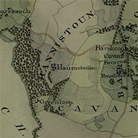
We are very grateful to the Dumfries Archival Mapping Project for scanning this set of 120 estate plans, held in private hands and archives. These include three volumes of estate plans, relating to Caerlaverock in Dumfries-shire (1775-76), Earlstoun in Kirkcudbrightshire and Dumfries-shire (1800-1815), and Dunskey in Wigtownshire (1804). The maps were surveyed primarily to support agricultural improvement and estate management, as well as for the sale of landed estates, and show excellent detail of the rural landscape.
- Home page - Estate Maps of Scotland, 1730s-1950s
- View the maps with a graphic index
- View a table of specific map additions (ordered by parish and date)
One-inch and Half-inch to the mile maps of southern India, 1916 - 1945

We have added a small set of 140 topographic maps covering part of southern India. The maps were published by the Survey of India, at the scales of one-inch to the mile (1:63,360) and half-inch to the mile (1:126,720). Collectively they represent the detail of the colonial landscape of India in the first half of the 20th century. These maps have been scanned and georeferenced to support a collaborative academic project, Digital Innovation in Water Scarcity in Coimbatore, India, led by the University of Lancaster.
- Home page - One-inch / Half-inch to the mile maps of southern India
- View the maps with a graphic index
- View the maps as a seamless layer on a satellite image base
New parish/county information in the Georeferenced Maps viewer

We have added details of the parish and county under the map cursor, when looking at maps of England, Scotland or Wales at zoom level 13 or higher in our Georeferenced Maps viewer. The parish/county information appears to the lower right of the screen (as illustrated). This is based on the parish and county boundaries in the 1950s. For parishes in Scotland, there is also a link to view the specific parish in the centre of the screen, highlighted in our Boundaries Viewer. We have added this to help identify the particular pre-1970s parish when viewing georeferenced maps.
- Go to the Georeferenced Maps viewer, zoomed in on Falkirk, to try this.
Coastal charts of Scotland, 1592-1947

We have added 100 more charts of Scottish coasts and waters, doubling the number of sea charts we have online. These charts focus on nautical information for mariners, but they also play an important part in establishing the coastline and shape of Scotland, as well as providing often unique information on coastal settlements and ports. The initial predominance of Dutch and French charts in the 16th and early 17th centuries, gave way to charts by British and later Scottish surveyors, including John Adair, Thomas Winter, John Ainslie and Murdoch Mackenzie. These charts were drafted to support expanding merchant shipping and fisheries, for ferries and steamer travel, as well as intermittent naval concerns. Many of these charts are folded, fragile or from special collections, that have only recently been possible to scan.
- Home page and browsable map lists - Coasts of Scotland on marine charts, 1580s-1900s
- View these maps with a graphic index
- View a table of specific map additions (ordered chronologically)
Transport plans of Scotland, 18th-20th centuries

We have added 102 specialised early maps, plans and profiles relating to relating to Bridges, Canals and Railways online. These often show proposed new developments, that were not always realised. They include the construction of the Forth & Clyde Canal, actively planned from the 1760s, the Caledonian Canal (1804-1847) and the Union Canal (opened in 1822). Early railway plans often followed similar routes to canals, for transporting goods, but became much more extensive for passengers during the 19th century. We often have vertical profiles or sections of routes, detailed contract plans, station plans, and network routes for passengers. Also included are some early proposed plans for bridges, and tunnels.
- Home page and browsable map lists - Plans and profiles of bridges, 18th-20th centuries
- Home page and browsable map lists - Canal plans of Scotland, 18th-20th centuries
- Home page and browsable map lists - Railway plans of Scotland, 18th-20th centuries
Charles Goad Fire Insurance Plans of Scottish Towns, 1880s-1940s

We have added 230 Goad Fire Insurance Plans of Scottish Towns online. These very detailed maps cover the main industrial areas of seven towns and cities in Scotland, and date from the late 19th century through to the mid-20th century. They are particularly useful for showing the function of each building, and often the names of particular companies or institutions there. Colour-coding allowed fire risk to be graphically portrayed: brick and stone buildings were shown in red, timber buildings in yellow, iron or metal buildings in grey, and skylights in blue. The maps also show building heights and construction materials, wall thickness, internal room arrangement and function, types of roof, proximity to fire hydrants and fire-extinguishing appliances, and the locations of doors, windows and skylights.
- View these maps with a graphic index
- Home page and browsable map lists - Goad Fire Insurance Plans of Scottish Towns
- Read further information about these plans
Military maps of Scotland, 1656-1923
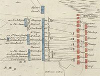
We have added 82 new military maps of Scotland online. These maps include battle plans of Culloden, Falkirk, Glenshiel, and Prestonpans, as well as maps of military roads, including the Kingussie/Ruthven road to Linn of Dee, through Glen Feshie. There are also over 60 maps related to the restoration of Edinburgh Castle in the 1880s, chiefly under the supervision of the architect, Hippolyte Blanc. These maps add to the main existing Board of Ordnance and Wade collection military maps from the 18th century, and are drawn from our other manuscript and early printed map collections.
- View these maps with a graphic index of Scotland
- Home page - Military maps of Scotland
- View a table of specific map additions (ordered by place covered)
Manuscript estate maps of Scotland, 1730s-1920s
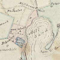
We have added 300 new estate plans of Scotland. These maps were hand-drawn or with manuscript annotations, and are primarily from the earlier era of estate mapping in Scotland in the 18th century. Most relate to particular landed estates, including Cadell of Grange in West Lothian, Gartmore in Stirlingshire, Johnston of Coubister in Orkney, Lynedoch in Perthshire, Minto in Roxburghshire, and Pitfirrane in Fife, with maps deposited as part of larger written collections held in our Manuscripts Department. These maps often show the detail of rural areas, and illustrate a variety of purposes: the division of common land, the planning of new roads, farming and woodland, coal mining, the creation of designed gardens and landscapes, planned villages, architectural reconstruction, and the reclamation of foreshore.
- View these maps with a graphic index of Scotland.
- Home page - estate plans of Scotland, 1730s-1950s
- View a table of specific map additions (ordered by county and parish)
Signet Library maps of Scotland, 1580s-1950s
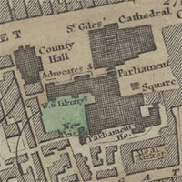
We are very grateful to the WS Society for granting us permission to scan and put online their fine map collection, held on deposit in the National Library of Scotland. The collection includes over 400 flat-sheet maps of Scotland, and dates from the late 16th century through to the mid 20th century. Of these, there are 91 county or district maps, a further 47 plans of towns, (with a focus on Edinburgh), 23 estate plans (including 6 in manuscript), 16 coastal charts, and 9 maps which relate to the whole of Scotland. There are also two Ordnance Survey One-Inch to the mile series of Scotland, the 2nd edition with coloured parishes and a third outline edition (1903-1912). The collection includes several important early editions and unusual maps, as well as some unique manuscript maps, all not found in the main NLS map collections.
- View all of the Signet Library maps.
New estate plans of Scotland, 1730s-1940s

We have added 145 new estate plans of Scotland online. Most of these maps were printed, and are from the later era of estate mapping in Scotland in the 19th century. These are often very detailed maps of rural areas which quantify land and resources. They show the acquisition and sale of land and estates, the feuing of land for building, legal cases settling disputes relating to fishing, mining, and roads, and various other planned rural developments. Many of these maps are folded, fragile or from special collections, that have only recently been possible to scan. We are working on earlier manuscript estate maps of Scotland, which will be added online soon.
- View these maps with a graphic index of Scotland.
- Home page - estate plans of Scotland, 1730s-1940s
New town plans of Scotland, 1580s-1940s

We have added 180 new printed town plans of Scotland dating over the last five centuries to our website. These collectively cover 22 towns, and allow change over time in urban areas to now be seen more clearly. The earliest of these maps are nearly always the most detailed depictions of towns before the Ordnance Survey mapping from the 1840s. Often these maps show new proposals (not always implemented) for buildings, roads, docks, railways or other infrastructure. Many of these maps are folded, fragile or from special collections, that have only recently been possible to scan.
- View these maps with a graphic index of Scotland.
- Home page - town maps of Scotland, 1580s-1940s
- Further information about these maps
New county maps of Scotland, 1620s-1930s
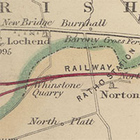
We have added over 300 new printed county maps of Scotland dating over the last four centuries to our website, doubling the number of Scottish maps of counties or regions we now have online. These maps are excellent for providing an overview of the rural landscape, and changes over time can now be viewed more comprehensively. These maps include updates and additions (including new placenames, roads, and railways) to all the standard county maps, as well as new maps for cyclists, motorists and tourists. Many of these maps are folded, fragile or from special collections, that have only recently been possible to scan.
- View these maps with a graphic index of Scotland.
- Home page - County maps of Scotland, 1580s-1940s
- Further information about these maps
New printed maps of Scotland, 1560s-1940s
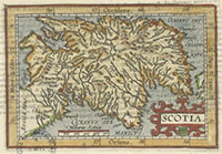
We have added 450 new printed maps of Scotland dating over the last five centuries online, almost doubling the number of maps of the whole of Scotland we now have on our website. Many of these maps are folded, fragile or from special collections, that have only recently been possible to scan. Some of these maps were typically printed within atlases, encyclopaedias, geographical grammars, guide-books, and gazetteers, whilst others were intended as wall maps for educational use or display. These maps display a growing wealth of topographic information on settlements, routes and roads, railways, geology, politics, history and tourist attractions. Collectively they form a vision of Scotland over time, reflecting the ever-changing shape and detail of the country as perceived by locals and outsiders.
- View a set of thumbnail images of these maps with a graphic index of Scotland.
- Home page - Maps of Scotland, 1560-1947
- Further information about these maps
Ordnance Survey, Quarter-inch to the mile, 1st Edition, 1901-1914
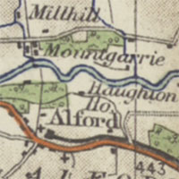
This quarter-inch to the mile series was the earliest complete series by Ordnance Survey at this scale, covering all of Scotland in ten sheets. The maps were attractively coloured with first-class roads in brown, water in blue, and woodland in green, creating a pleasing, clear and legible map. Detail was drawn from larger-scale maps, comprehensively revised in the 1890s. The quarter-inch to the mile series provides an overview of significant landscape features, including larger settlements, railways, and roads, the latter distinguished into three classes.
- View these maps with a graphic index of Scotland.
- Home page - OS Quarter-inch to the mile, 1st Edition
Ordnance Survey, One-inch to the mile, 1st Edition (Coloured), 1856-1891
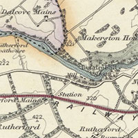
We have scanned a new hand-coloured one-inch series, covering all of Scotland and published on 132 sheets between 1856 and 1891. On these sheets, water was coloured blue, woodland in green, railways in red, and county boundaries with various contrasting colours. The series is particularly useful in showing an overview of significant landscape features such as towns and villages, roads and railways, as well as woodland and land-use. Very often, these new coloured sheets were earliest states which were later re-issued, sometimes with updated information relating to railways, docks, or parish boundaries.
- View these maps with a graphic index of Scotland.
- View the maps as a seamless layer on a satellite image base
- Home page - OS One-inch to the mile, 1st Edition (Coloured)
Ordnance Survey, One-inch to the mile, 3rd Edition (Coloured), 1902-1923
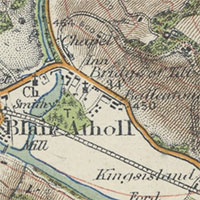
This attractively-coloured series covered most of Scotland in the early 20th century. It was Ordnance Survey's earliest attempt to produce a one-inch to the mile map with coloured topographic detail: water in blue, woodland in green, the first and second class roads in burnt sienna, hachures in brown, and contours in red. The maps were intended for practical recreational purposes, and they were issued in a convenient folded form with covers. The base map content used the Ordnance Survey's one-inch to the mile 3rd edition maps, with topographic detail based on a revision of 1901-1910. We have scanned all our sheets of this series, including the various reprints with updated detail and railway information.
- View the maps with a graphic index of Scotland
- View the maps as a seamless layer on a satellite image base
- Home page - OS One-inch to the mile, 3rd Edition (Coloured), 1902 - 1923
Ordnance Survey Half-Inch to the mile, Scotland, 1908-1918
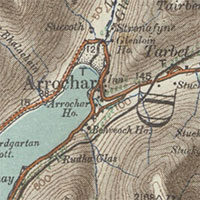
The Ordnance Survey began working on a series of maps at the half-inch to the mile scale (1:126,720) from 1902, with topographic content derived from the main nationwide revision of maps at the larger-scales from the 1890s. The initial driver behind the series was a military one, but it was recognised that the scale had a steadily growing public value particularly for cyclists and motorists. The series was produced in two forms, with relief was shown by layer colours as well as by hachures. We have scanned all our sheets of this series, which were received by the Library in a folded form.
- View the maps with a graphic index of Scotland
- View the Ordnance Survey Half-Inch to the mile, Scotland - 1908-1918 - with hachures
- View the Ordnance Survey Half-Inch to the mile, Scotland - 1908-1918 - with layer colours
Edinburgh Boundaries Viewer
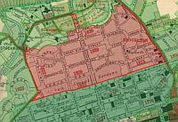
This viewer allows a selection of boundaries traced from maps of Edinburgh to be interactively explored. There are boundaries showing landownership (1804-1817), Police Wards (1822-1848), Sanitary Districts (1864-1880), Municipal Wards (1852-1902), and Registration Districts (1865-1902). We have also traced the extensions of the Royalty Boundary from 1685 to 1885, and Bartholomew's Chronological Map of Edinburgh (1919). These boundaries provide many insights into the administration of Edinburgh over time, particularly its local government, public health, and ownership of land, as well as its patterns of development. You can download any of the boundaries as shapefiles or KML files for onward re-use, and read about the boundaries.
- Go to the Edinburgh Boundaries viewer
Ordnance Survey, 1:25,000 Outline Series of Great Britain, 1945-1965
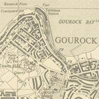
This series was produced as an Outline (ie. uncoloured) edition of the standard, coloured 1:25,000 Provisional series, and it extended over most of Great Britain during the 1940s-1960s. The Outline series was quickly appreciated by planners and local government officials for administrative purposes, and it was also popular with market researchers. The Outline edition allowed new hand-drawn content to be easily annotated onto the base mapping, and it was printed in grey, rather than black, for this reason, so that the presentation of urban areas would not be too heavy. We have scanned all our maps in this series, and put online those that are out-of-copyright.
- Home page - Ordnance Survey, 1:25,000 Outline Series, 1945-1965
- View the maps with a graphic index
The Stevenson Maps and Plans of Scotland, 1660-1940
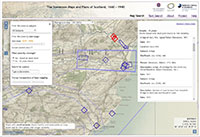
Records for over 2000 plans relating to historical engineering in Scotland from the Stevenson archive can now be searched online using our new map-based viewer. The Stevenson archive contains material from the firm established by Robert Stevenson, celebrated lighthouse engineer and grandfather of Robert Louis Stevenson, in the early-nineteenth century. Stevenson and his descendants worked on projects all over Scotland, ranging from designing harbours and lighthouses to surveying routes for new railways to remodelling the streets of Edinburgh. Records for Stevenson plans of Scottish places can now be viewed, sorted and filtered using a dynamic map interface. The archive can also be searched by keyword, or users can browse a full list of the places, subjects and people featured on the site. The online resource was created during a three month placement by Rachel Dishington, an AHRC Collaborative Doctoral Partnership PhD student at the University of Edinburgh.
- View the Stevenson Maps and Plans of Scotland web resource.
Ordnance Survey, 1:25,000 Administrative Area Series of Great Britain, 1945-1968

The Administrative Area Series at 1:25,000 scale was established after the Second World War as a national cartographic record of administrative boundaries. However, the series always had quite limited uses, primarily for local government purposes, and it never achieved complete coverage, before the decision was taken to discontinue it in the 1950s. The maps consisted of an outline edition of Ordnance Survey 1:25,000 sheets, overprinted in red with administrative information. The boundaries included those for administrative counties and county boroughs, metropolitan and municipal boroughs, urban and rural districts, civil parishes and borough and urban district wards. We have put all our holdings of 1,130 sheets online.
- View the maps with a graphic index
New website - Stornoway / Steòrnabhagh and environs historic maps, 1780s-1960s
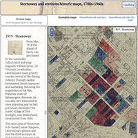
This new website is a collaborative project between Western Isles Libraries and the National Library of Scotland. This has involved the conservation and digitisation of historic maps to allow their wider availability online. Explore a selection of historic maps of Stornoway and environs, dating between 1785-1964, read about them, and view them as georeferenced overlays or side-by-side. The website includes several unique manuscript maps, which provide many insights into the development of Stornoway over the last two centuries, including proposals (some not implemented) for its development.
War Office, Great Britain 1:20,000, GSGS 2748
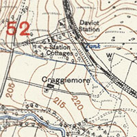
This military series by the War Office had its origins during the First World War on the Western Front, but also continued after 1918, covering selective parts of England, Scotland, and Wales, primarily for artillery training purposes. The maps cover 15 by 10 kilometres on the ground and are attractively coloured, with water in blue, contours at 5 metre intervals in brown, and the grid overlay figures in red. Topographic detail was selectively redrawn from the Ordnance Survey six-inch to the mile maps of the 1920s. Although only around 118 GSGS 2748 sheets were published, our holdings are also incomplete, with 21 sheets covering scattered locations, primarily in Scotland.
- View War Office, Great Britain 1:20,000, GSGS 2748 home page
- View the maps with a graphic index
German Army, Karte von Schottland 1:100,000, 1939-40

This German Army series is essentially a set of Ordnance Survey Half-Inch to the mile maps, captured by the German Army and reprinted in 1939-40, as part of their Second World War intelligence preparations. There was no revision of topographic detail, but the sheets were metricated, enlarged from 1:126,720 to 1:100,000, with updated German titles, marginalia and legends. Our holdings are complete, with 34 sheets covering all of Scotland.
- View German Army, Karte von Schottland 1:100,000, 1939-40 home page
- View the maps with a graphic index of Scotland
Updated Map Finder- with Marker search interface
We have updated our Map Finder- with Marker application, allowing all our online maps to be searched with a marker pin. The application now uses OpenLayers, so it is now consistent with our other web-mapping applications, and has several new enhancements. The bounding boxes of returned maps are shown when you hover over the map thumbnail in the Results panel on the right. The Results panel also has a clearer header, with details of the scales of returned maps and the date filter range. A geolocation option has been added, so you can choose to display your current device location, and a wider range of current and historical base map layers can be selected. Searching is now possible by county/parish as well as by placename, and the map automatically zooms to the selected place, positioning the marker and returning maps covering the place.
- View Map Finder- with Marker application
Ordnance Survey / War Office One-Inch to the Mile Maps of Scotland, 1930s-1940s

In the 1930s and 1940s, the original Ordnance Survey's One-Inch to the Mile Popular edition mapping of 1921-30 was re-issued with selective updates from revisions made primarily in the 1930s. These updates include Air Raid Precaution revisions from 1938-9, included on GSGS 3906, and some selective updating of roads and railways from large-scale revision in the 1930s. Two of these series were officially published by the War Office (Geographical Section, General Staff) and carry their series designation numbers. These series are particularly useful for showing an overprint of the War Office Cassini Grid, often used for referencing places in the Second World War.
- War Office, One-Inch Popular, GSGS 3908, 1933-43
- Ordnance Survey, One-Inch Popular with National Grid (Outline), 1945-7
- War Office, One-Inch Popular, GSGS 4639, 1947-50
Ordnance Survey 1:10,560 scale georeferenced layer of Britain, 1949-1968
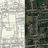
Following completion of the digitisation of our Ordnance Survey National Grid 1:10,560 mapping in January, we have now put together a seamless georeferenced mosaic of mid-20th century Britain based on these maps. In some cases, these maps were basic updates from the pre-War county maps, with only selective revision for major change. However, where sheets exist that were based on large-scale revisions, or from a direct revision of the landscape, we have preferred these, as they give a better reflection of the real world. The maps show farms and settlements, roads and railways, rivers and watercourses, administrative and field boundaries, woodland and land use, as well as contour lines; buildings are generalised in urban areas but many street names are also shown. This is the latest out-of-copyright mapping covering most of mainland Britain. The mosaic seams together 8,657 maps, and will grow in future (especially in Scotland), as more sheets fall out of copyright over time.
- View as a zoomable overlay on satellite imagery
- Compare to 1900s mapping
- Compare with modern satellite imagery
Lovat Highland Estates mapping, 1750s-1960s
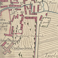
We are deeply grateful to Lovat Highland Estates, based in Beauly, and the North of Scotland Archaeological Society, for scanning and authorising the online display of a uniquely important set of over 400 estate maps. The maps cover extensive areas west of Inverness, as far as Mallaig and Fort Augustus in the west and south, and range in date from the 1750s through to the 1960s. The earliest maps in the collection are by Peter May (1724/33-1795), working for the Commissioners for the Forfeited Annexed Estates, and his nephew George Brown, who trained under May. Later significant map-makers were John Boulton (1830-74) and David Gordon (fl. ca. 1840s-1890s). The maps depict all aspects of Highland estate management, including agricultural improvement, enclosure, drainage and embankments, the planning of settlements such as Beauly, the leasing of farms and grazings, the allocation of land for crofts, and land ownership disputes. The construction of new roads, railways, and bridges, and their development over time is also well-represented. After Ordnance Survey mapped Inverness-shire (1866-76), OS maps were often annotated to show specific features relevant to the estate, whilst fresh maps were also drafted to show new subjects, including the expansion of hunting and shooting runs, and the growth and management of woodland.
- View the maps in the Estate maps page, in parish/date order, under Inverness-shire and Ross and Cromartyshire
- View the maps with a graphic index
- Read further information about the Lovat Estate Map Project
Ordnance Survey One-Inch "Popular" edition, derivative and variant series

Following the publication of the Ordnance Survey "Popular" edition (ca. 1923-30) series, a number of related series were also published. These include the Outline edition of the series, with water in blue and contours in red. Another variant series was the Outline edition with water in blue. In the 1930s too, various water and contour pulls were made of the sheets for educational purposes. These sheets just included the blue and brown lithographic pulls of the standard sheets. Our set of these were originally owned by Alan Ogilvie (1887-1954), first Professor of Geography at Edinburgh University, and they were subsequently donated to the Library in 1981.
- OS One-inch "Popular" outline edition, Scotland, 1921-1930 home page
- OS One-inch "Popular" Scotland, Water and Contour Pulls, ca. 1930s home page
- OS One-inch "Popular" edition, Scotland, Outline Edition. Water in Blue, 1941-42 home page
- View the maps with a graphic index
Geological Survey of Scotland, One-Inch and Six-Inch to the Mile maps, 1850s-1940s

We have recently added all our out-of-copyright holdings of geological maps of Scotland online. This includes a detailed set of six-inch to the mile maps, focusing just on areas with economically valuable geology, as well as less detailed one-inch to the mile maps covering most of Scotland. All the maps use Ordnance Survey topographic mapping as their base. On the earlier editions in the 19th century, the geology is usually hand-coloured, whilst for six-inch second and later edition maps in the 20th century, it is usually printed lithographically in brown. There are also a set of Horizontal and Vertical Sections.
- Six-inch to the mile geological maps home page
- One-inch to the mile geological maps home page
- View the maps with a graphic index
German Army, Karte von Schottland 1:50,000, 1941
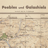
This German Army series is essentially a set of One-Inch Popular edition maps (1921-30), captured by the German Army and reprinted in 1941. There was no revision of topographic detail, but the sheets were metricated, enlarged from 1:63,360 to 1:50,000, with updated German titles, marginalia and legends. Our holdings are incomplete, with 70 of the original 92 sheets. The maps form part of the major intelligence-gathering project by the German Army as part of 'Operation Sealion', Hitler's preparations for a possible invasion of Great Britain.
- German Army, Karte von Schottland 1:50,000, 1941 home page
- View the maps with a graphic index
War Office, Great Britain 1:25,000. GSGS 3906, 1940-43
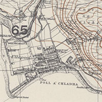
This military map series at 1:25,000 was rapidly completed in the early years of the Second World War. The underlying topographic detail was photographically reduced from the latest available Ordnance Survey six-inch to the mile maps, and then usually overprinted with contour lines, enlarged from the latest Ordnance Survey one-inch to the mile maps. The map series was produced by the War Office, or Geographical Section, General Staff, and carry their series designation, G.S.G.S. 3906. This is all our holdings of this series, consisting of 829 sheets. Coverage of Scotland is complete, with a small number of sheets covering the Isle of Man and south-east England.
- Great Britain 1:25,000. GSGS 3906, 1940-43 home page
- View the maps with a graphic index
Ordnance Survey National Grid 1:10,560 maps for England and Wales, 1950s-1960s
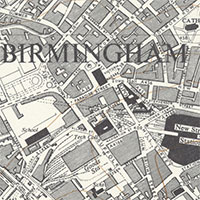
- OS National Grid maps home page
- View the maps with a graphic index
Ordnance Survey National Grid 1:10,560 maps for Scotland, 1950s-1960s
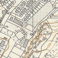
- OS National Grid maps of Scotland home page
- View the maps with a graphic index
Frederick Douglass in Edinburgh and Scotland - map viewers

These map viewers support the Strike For Freedom: Slavery, Civil War and the Frederick Douglass Family in the Walter O Evans Collection treasures display (Thursday 4 October 2018 to Saturday 16 February 2019) in the National Library of Scotland, George IV Bridge. This celebrates the 200 year anniversary of the birth of African American activist and author, Frederick Douglass. Douglass first visited Edinburgh in 1846 and these maps take you to the places where Frederick Douglass lived, held meetings and gave speeches during his antislavery campaign in Edinburgh and Scotland, as well as the sites where other black abolitionists gave speeches in Edinburgh.
- Frederic Douglass in Edinburgh map viewer
- Black Abolitionists in Edinburgh map viewer
- Frederic Douglass in Scotland map viewer
Ordnance Survey 1940s-1960s 1:2,500 maps of Scotland
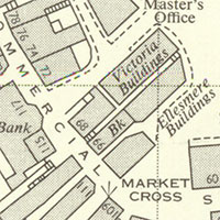
This addition of 5,921 Ordnance Survey 1:2,500 "double-sheets" (ie. covering 1 x 2 kilometre squares), covers large areas of the Central Belt, the Borders and parts of north-east Scotland, dating from 1945-1967. This was the largest scale post-War mapping to cover these rural areas, and it shows excellent detail of man-made structures such as farms, settlements and houses, as well as roads, railways and industrial works. The rural landscape of fields, woodland, lochs, rivers and streams is clearly depicted too. These are the earliest OS maps to comprehensively show house numbers, and they also show parcel numbers (to uniquely reference all land parcels or areas) and their related acreages. The new maps complement the more detailed 1:1,250 scale maps of larger urban areas, scanned last year.
- OS National Grid maps of Scotland home page
- View the maps with a graphic index
- View a seamless layer of National Grid mapping as a georeferenced overlay
Maps of Scotland by commercial map-makers, 1840s-1940s

This small set of 220 maps of Scotland, also includes maps of Scottish towns, counties and regions, and some coastal charts. They were generally published by private companies, including G.W. Bacon & Co., John Bartholomew & Son, J. & W. Emslie, Gall & Inglis, W. & A.K. Johnston and Edward Stanford. There are many attractive and interesting maps of the whole of Scotland, including geological maps, maps for tourists, and road maps for cyclists and motorists. The set also includes the pioneering Botanical Survey of Scotland maps (1900-5) by Robert and William Smith, railway maps by J. & W. Emslie (1898-1941), educational maps for school room use, recreational maps for hunting, maps associated with particular meetings, including the British Association for the Advancement of Science in Aberdeen, and a map of the Royal Botanic Gardens in Edinburgh (1933). A few coastal charts have also been added, including War Office maps proposing coastal harbour defences (1907-9).
Ordnance Survey Books of Reference, 1855-1882
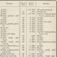
The Ordnance Survey Books of Reference (or Area Books) record acreages of each land parcel on the OS 25 inch to the mile maps, and usually its land use, except in settlements and for counties surveyed after 1879. From 1859, Books of Reference were published for specific parishes, which the Library bound together into 22 volumes, ordered alphabetically by parish. The easiest way of searching for information is by county and parish. The Books of Reference often include index maps of the map sheet layout over the parish, and an index of place names on the maps covering the parish. The volumes were published for counties surveyed after 1859.
- Browse Books of Reference listed by county and parish
- View Books of Reference by volume (with parishes ordered alphabetically)
New gazetteer for searching Ordnance Survey six-inch to the mile, 1888-1913 maps

This new gazetteer allows you to search 2.52 million names on Ordnance Survey six-inch to the mile, 1888-1913 maps of England, Scotland, and Wales, dating from a century ago. The names have been gathered through the GB1900 transcription project, which ran from September 2016 to January 2018, transcribing all text content from these maps. Parish and county names have been added to the transcribed names to make the names easier to tell apart and to provide locational context. The gazetteer provides a very comprehensive list of names for rural areas. Street names are included for many settlements too, although the six-inch maps do not name all streets comprehensively. The gazetteer also includes names of many features that no longer exist, so not found in present-day OpenStreetMap or Google gazetteers.
- The gazetteer is in our Georeferenced Maps viewer, under the Search OS six-inch 1888-1913 names: search box
Bartholomew's Revised Half-Inch Maps of Great Britain, 1940-47
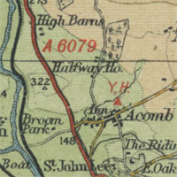
Bartholomew's beautifully layer-coloured half-inch to the mile maps were developed from the 1880s, first covering Scotland as a series in the 1890s, and England and Wales by 1903. This series covering Great Britain in 62 sheets in the 1940s, their first to cover Great Britain at this scale, provides an attractive and useful snapshot of post-War Britain. Bartholomew deliberately selected only certain details from the Ordnance Survey maps, and also added their own. They added categories of roads, including drove roads, steamer routes, and rights of way that were often not shown on Ordnance Survey maps. They also took information from a range of other sources, including local authority surveyors, and from a large and growing body of their customers who they invited to write in with corrections.
- Bartholomew's Revised Half-Inch Maps of Great Britain, 1940-47
- View the maps with a graphic index
- View a seamless layer of Bartholomew Half-Inch mapping, as a georeferenced overlay
- Read more about the Bartholomew half-inch to the mile maps
New Administrative Boundaries Viewer and Information

Our new interactive Boundaries viewer allows counties and parishes from the 1950s, and unitary authorities, districts and boroughs from 2017, to be viewed on a range of different map backgrounds. You can zoom in on any location, click on your point of interest, and the county, parish, or unitary authority that covers the point you have clicked on is shown. These administrative jurisdictions, especially parishes, have many other family and local history records associated with them, and viewing their location and extents is therefore important. The new viewer is accompanied by detailed information on the history of these administrative units, significant legislation that has affected them, and cartographic information sources which show the development of these units over time.
Maps of the World, 16th-20th centuries

This small set of 34 maps of the World has been selected for their historical interest, content, and aesthetic qualities. The maps show the many different ways that the World has been visualised and understood over time, and each reflect aspects of the society and culture when they were created. An emphasis on expanding geographic and topographic knowledge and detail from the 16th to the 18th centuries, was often replaced by a growing interest in the emerging sciences and physical environment in the 19th century. The use of different projections and printing technologies, particularly in the 20th century, allow many other themes, including imperialism, trade, travel, and peace, to be illustrated. Many of these world maps are from larger atlases by C. Ptolemy, H. Moll, W. & A.K. Johnston, A. Fullarton, and J.G. Bartholomew.
New detailed Ordnance Survey maps for Devon, 1860s-1890s
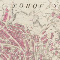
We have been pleased to collaborate with the British Library in a recent project, funded by the Heritage Lottery Fund, to scan, georeference and make available Ordnance Survey mapping for Devon. The project has included first edition OS 25 inch to the mile maps covering the county, and more detailed OS town plans at 1:500 scale for all the towns in Devon with more than 4,000 people: Barnstaple, Bideford, Brixham, Crediton, Dartmouth, Dawlish, Exeter, Exmouth, Ilfracombe, Newton Abbot, Plymouth, Tavistock, Tiverton, Torquay and Totnes. The project forms part of the Know Your Place West of England Project, and has allowed us to fill gaps in our holdings for Devon with British Library maps, so our online presentation is now more complete.
- Georeferenced 25 inch first edition layer, 1873-1888
- OS Town Plans of England and Wales, 1840s-1890s
- Georeferenced Town Plan layer, SW England, 1880s
Completion of OS 25 inch England and Wales, 1841-1952
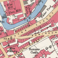
After three years' of scanning, and 89,800 sheets later, we have now completed adding this large series online. These maps are the most detailed topographic mapping covering England and Wales from the 1840s to the 1950s. The maps are very useful for local history, allowing almost every feature in the landscape to be shown. They provide good detail of all buildings, streets, railways, industrial premises, parkland, farms, woodland, and rivers.
- Search for maps using a graphic index
- View a list of all sheets by county
- A georeferenced layer is available for southern England, which we hope to expand in the future
- Further information about the series
Half-Inch to the Mile, Ministry of Transport Road Maps of Scotland (1923)
This set of Ministry of Transport Road Maps, issued by the Ordnance Survey in 1923 at the half-inch to the mile scale (1:126,720), are the first to accurately show the initial numbered roads in Scotland. Class I roads in red show important routes connecting large population centres, whilst less important Class II roads are shown in green. The maps were the result of close liaison between the Ministry of Transport and Ordnance Survey, and are the most important cartographic resource documenting the early days of road numbering in Scotland.
- Further information on this group of maps
- View the maps with a graphic index of Scotland
- View seamless layer of Half-Inch MoT mapping on a Google maps base
Kitchener's Survey of Cyprus, 1882
Kitchener's Survey of Cyprus (1882) represents the first full triangulated survey of the island of Cyprus, and it was the most accurate map of the island when published. The maps are very detailed, marking roads, tracks, and telegraph lines, and locating vineyards, monasteries, ruins, sheepfolds, springs, wells and aqueducts. Towns and villages are identified as being Christian or Muslim, and are given both their Greek and Turkish names. The set consists of a title sheet and 15 map sheets at a scale of one inch to the mile, and are supplemented with a single-sheet index map at a scale of five miles to the inch.
- Further information on this set of maps
- View the individual map sheets using a graphic index covering Cyprus
- View a seamless layer of all the sheets as a mosaic on a Google maps base
Dumfries Archival Mapping Project estate maps, 1750s-1840s
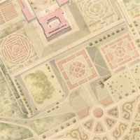
We have recently added a further 300 estate maps of south-west Scotland, scanned by the Dumfries Archival Mapping Project. These include some of the Duke of Buccleuch’s extensive map collections at Drumlanrig, with important holdings too from Dumfries and Kirkcudbright Museums. These estate maps date from the 1750s to the 1840s and show the rural landscape of farms, buildings, fields, woodland, roads, and rivers in great detail. We have georeferenced a selection of these estate maps allowing them to be compared to the present day and other mapping.
The maps are available through a graphic index and on our Estate Maps of Scotland page ordered by county and parish:
- Estate maps of Scotland - Dumfries-shire, Kirkcudbright-shire, Lanarkshire,and Wigtownshire
- Georeferenced estate maps
Scottish Post Office Directory maps, 1794-1944
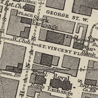
We have just added 400 new street maps of Scottish towns held within Post Office Directories. As well as naming all streets, the Post Office Directory maps show good detail of all the built-up areas, clearly highlighting public buildings, churches and chapels, schools, railways, tramways, docks, harbours, public gardens and parks, and many other urban features. Sometimes too, the Post Office Directory maps show boundaries of parishes, municipal wards, and parliamentary divisions. From the later 19th century, the Post Office Directories were issued every year for several larger towns, and so the Post Office maps can provide a far more regular chronology of urban change compared to Ordnance Survey maps. The Post Office Directory maps allow the locations of people, industrial premises, and addresses that are listed in the Scottish Post Office Directories to be viewed geographically.
- Browse the Post Office Directory maps within our Town Plans / Views listing.
- Browse the Post Office Directory maps using a graphic index.
Claudius Ptolemy World Atlases, 16th century
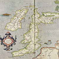
These two atlases, deriving from the work of Claudius Ptolemy in the 2nd century AD, describe geographical principles and locations from the Classical World. Ptolemy's Geography was a synthesis of Greek scientific and geographic thought, and its re-discovery and printing in Western Europe in the 15th century had a catalytic effect on Renaissance cartography. The Geography provides both a description of methods for mapping the known world and an extensive table of known places and their geographical locations based on the Ptolemaic system. The purpose of the text was to provide sufficient information for maps to be constructed by a suitably skilled cartographer. Read further information about Claudius Ptolemy and the Geography.
View copies of Ptolemy's Geography:
Times Survey Atlas of the World, 1920
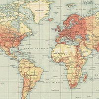
The Times Survey Atlas of the World (1920) was a landmark folio world atlas, defining the world and its countries in detail for the period after the First World War. It included 112 colour maps, all specially compiled for the Atlas over the previous 5 years, and including many thematic maps, as well as political and topographic maps. Earlier editions of the Times Atlas had been published from 1895, but this was the first Times world atlas with maps prepared by the Edinburgh Geographical Institute of John Bartholomew & Son Ltd. The topographic maps all show layer-coloured relief, whilst charts of the oceans are shaded for bathymetry.
- Browse the Times Survey Atlas of the World (1920) by map contents index
- Browse the Times Survey Atlas maps using a graphic index
Estate maps of south-west Scotland
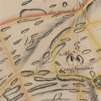
We have recently added a further 150 estate maps of south-west Scotland. These show the rural landscape in great detail - including farms, buildings, fields, woodland, roads, and rivers - dating from the 1750s to the 1840s. All were commissioned by landowners to plan agricultural improvement, including enclosure, drainage, new roads, and consolidation of farms, as well as mining. Our new additions include the Maxwells of Monreith Estate Maps and Plans, 1777-1778, a set of estate maps and accompanying schedules surveyed by John Gillone (1767-1809) in 1777-78, relating to Monreith estate in Wigtownshire. This also includes estate maps scanned by the Dumfries Archival Mapping Project, who we are very pleased to be collaborating with. We have georeferenced a selection of these estate maps allowing them to be compared to the present day and other mapping.
- Estate maps of Scotland - Dumfries-shire, Kirkcudbright-shire, and Wigtownshire
- Georeferenced estate maps
New OS maps for south-west England

We have been pleased to collaborate with the British Library in a recent project, funded by the Heritage Lottery Fund, to scan, georeference and make available more Ordnance Survey mapping for south-west England. The project forms part of the Know Your Place West of England Project, and has included OS 25 inch to the mile maps, and more detailed OS town plans at 1:500 scale for the counties of Gloucestershire, Somerset and Wiltshire. Another benefit of the project is that the British Library have filled gaps in our incomplete holdings of these series, so that our online presentation of these series is now much more complete, including the British Library maps.
- Georeferenced 25 inch first edition layer, 1873-1888
- OS Town Plans of England and Wales, 1840s-1890s
- Georeferenced Town Plan layer, SW England, 1880s
New 3D viewer for georeferenced maps
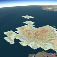
We've just launched a new 3D viewer which allows our georeferenced maps to be explored from a bird’s eye perspective. The 3D viewer is accessible from the 3D tab in the footer of our Georeferenced Maps viewer. You can alter your altitude, tilt and orientation to explore any one of our 600 georeferenced map layers draped over a 3D landscape. It is also possible to fade the transparency and view different base maps. The viewer uses Cesium for 3D geospatial visualisation, which is rendered via WebGL. WebGL is widely supported by modern web browsers - you can check if your browser is supported.
- Georeferenced Maps with our 3D viewer.
Scotland - Land Use Comparison Viewer
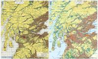
This split-screen map viewer allows you to compare land use in Scotland in the 1930s with land use in 2015. It uses the 1930s Land Utilisation Survey maps for Scotland that we made available online last year, and compares them to the 2015 Historic Land-use Assessment (HLA Map) layer from Historic Environment Scotland. It shows how striking the changes have been in the Scottish landscape during the 20th century, particularly due to widespread afforestation and expanding towns and cities. At the more local level, it is also possible to see new reservoirs, new roads, and significant changes to patterns of arable and pasture land.
This is a collaborative project with Historic Environment Scotland to whom we are very grateful for allowing their 2015 Historic Land-use Assessment (HLA Map) layer to be used in this application.
Blaeu Atlas Maior, 1662-5
The Blaeu Atlas Maior or Cosmographia Blaviana is one of the largest and most splendid of the multi-volume Dutch world atlases. Published in 1662-5, its 594 maps and 3,368 pages of texts collectively presented the state of geographic knowledge of the world in the mid 17th century. Volume VI of the work was devoted to maps of Scotland and Ireland, bringing forward the original mapping of Scotland from the work of Timothy Pont, first published in Blaeu’s Atlas novus of 1654, into their final published form. The Atlas Maior was the most expensive book that could be acquired in the mid-17th century - a lavish and splendid item for display by its powerful and wealthy customers.
- View the Blaeu Atlas Maior and read further information about it.
We are very grateful to David Rumsey for supporting the scanning and wider dissemination of this atlas.
Soil Survey of Scotland mapping (1950s-1980s)
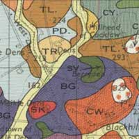
To commemorate the International Year of Soils 2015, we are delighted to have collaborated with the James Hutton Institute to present online a set of detailed soil maps covering cultivated parts of Scotland. These were researched and published by the Macaulay Land Use Research Institute in Aberdeen, forming a set of strikingly attractive coloured maps categorising and portraying soil type, using Ordnance Survey one-inch to the mile base mapping. Read further information about the Soil Survey, including how the surveying was done and how the maps were prepared.
The Soil Survey of Scotland mapping can be viewed using a clickable map of Scotland and as an ordered list. We have also georeferenced them as a layer, so that they can be viewed as a zoomable overlay on a Bing map or satellite layer or in our Side by side viewer.
Historic Maps Subscription API
Our Historic Maps Subscription API service allows you to incorporate five detailed historic georeferenced map layers in your own website. The layers include coverage of Great Britain at scales of six-inch to the mile or 1:10,560, medium-scale mapping at 1:25,000 and 1:63,360, as well as London at 1:1,056 scale. The layers have been optimised for very quick display and distributed under reliable and fast hosting. The Historic Maps Subscription API conforms with international web-mapping standards, and so the layers are simple to incorporate inside your own web mapping applications with demonstration viewers and code. These layers are available by subscription, and complement our Historic Maps API that we intend will remain free.
Land Utilisation Survey, Scotland, 1931-1935
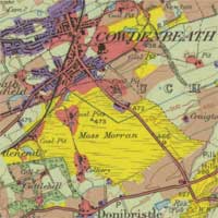
The Land Utilisation Survey was the first systematic and comprehensive depiction of land cover and use in Scotland (1931-1935), under the superintendence of L. Dudley Stamp. The recording of land use was carried out by volunteers, particularly schoolchildren and students, using Ordnance Survey six-inch to the mile field sheets. All land was colour-coded into six main categories and reduced the one-inch to the mile scale for publication. View the maps using a clickable map of Scotland, as a seamless layer on a modern satellite or map base, or as a list of sheets. Read further information about the Land Utilisation Survey.
Ordnance Survey 25 inch England and Wales, 1841-1952
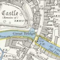
This series is the most detailed topographic mapping covering England and Wales from the 1840s to the 1950s. The maps are very useful for local history, allowing almost every feature in the landscape to be shown. They provide good detail of all buildings, streets, railways, industrial premises, parkland, farms, woodland, and rivers. This layer currently just covers counties in south-east England, but will expand geographically as scanning continues. Search using a graphic index, or view a list of all sheets.
Admiralty Charts of Scotland, 1795-1963
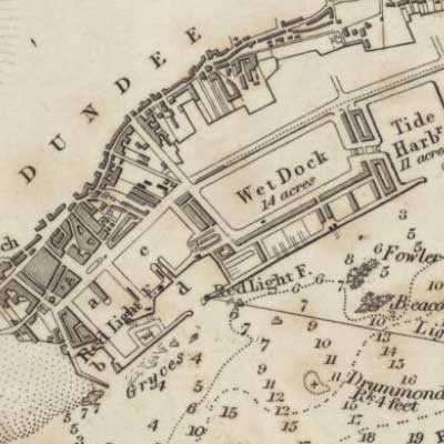
We have added 950 charts covering Scottish coastal waters in the 19th and 20th centuries. These are all our holdings of Admiralty charts of the Scottish coastline and adjacent seas, published over 50 years ago. Admiralty Charts show many coastal features in good detail, and are also useful in predating the work of Ordnance Survey for many northern counties before the 1880s. For many of Scotland’s busier estuaries and ports, there are also regular revisions of charts coming through to the present day - often more revisions than for Ordnance Survey maps, and at different dates. Read further information about the Admiralty charts.
The maps can be viewed using a clickable map and as an ordered list. We have also georeferenced a selection of 200 charts, so that they can be viewed as zoomable overlays on a Bing map or satellite layer or in our Side by side viewer.
Updated map viewers
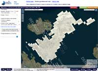
We have updated all our map viewers, offering a number of improvements to viewing and printing. You may now easily rotate all images by holding down your [Alt] and [Shift] keys while dragging the mouse cursor. Obtaining screen prints is also much more straightforward - choosing the 'Print' option (or Ctrl + P in most web browsers) will result in the current map view extending across your default page for printing or saving what you can see on screen. In the map images viewer we also have a new 'Print PDF' option which creates a default A4 landscape PDF file of your current map view. All map images now load faster, and zooming and panning is more responsive, especially on mobile devices. We have also introduced new improvements to viewing results in the Find By Place, Roy and OS records viewers, dynamically linking the main map and results panels on mouse hover to help select the right map. The new viewers are built upon OpenLayers 3 and are compatible with all current release standards-compliant web browsers.
James Robertson's Maps of Jamaica, 1804
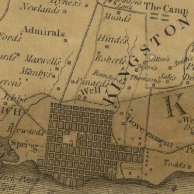
These maps of Jamaica are the most informative maps of the island in the early 19th century. They show its detailed topography, including the geographic distribution and location of sugar plantations and their owners at the sugar industry's peak, shortly before the abolition of slavery.
James Robertson was born on the island of Yell in Shetland, and emigrated to Jamaica where he owned a sugar plantation and worked as a surveyor. In 1796, Robertson petitioned and was appointed by the Assembly to survey Jamaica, producing a three-sheet map of the whole island at a scale of two miles to the inch (1:126,720), and 3 four-sheet maps of each county (Cornwall, Middlesex and Surrey) at a scale of one-inch to the mile (1:63,360). Robertson was paid the monumental sum of £10,450 for his maps and returned to Great Britain, where he later compiled a map of the north-eastern counties of Scotland (1822).
James Robertson's Maps of Jamaica can be viewed using a clickable map, and a georeferenced overlay, or in a side-by-side viewer (allowing comparison to modern Google or Bing layers), or via individual map sheets.
Upgraded Georeferencer application for viewing and georeferencing early maps of Scotland
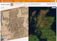
We have just upgraded our collaborative online Georeferencer application with several new features. These include the ability to view the map side-by-side and zoom and pan, comparing the historic map directly with a modern map or satellite layer or to other maps. You can also try out different transformation options for each georeferenced map based the control points entered already. The Georeferencer application is a collaborative online project, where anyone can view selected early maps from our collection, and help georeference them, adding control points to more accurately position them in the real world. The Georeferencer application includes 1,000 early maps of Scotland, including town plans, county maps, coastal charts, and maps of the whole of Scotland. It complements our main Georeferenced Maps application, where you can view the resulting georeferenced maps.
- View the Georeferencer application.
Ordnance Survey, National Grid maps (Central London), 1940s-1960s
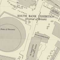
We are pleased to make available the earliest editions of Ordnance Survey National Grid maps at 1:1,250 scale covering central London. This mapping covers an area of about 20 square miles, made up of 4,292 sheets, each covering 500 x 500 metres on the ground. The maps show nearly all permanent features of over 1 square metre in size, showing excellent detail of commercial and residential buildings, railway stations, docks, factories and parks, as well as house names and numbers. This layer will expand geographically over the next year as we continue to scan more OS National Grid post-War mapping.
The maps can be viewed using a clickable map, as a georeferenced overlay or in a side-by-side viewer (allowing comparison to modern Google or Bing layers), and using an ordered list.
Early maps of Scotland and Edinburgh, 1639-1936

We have added a further 120 early maps of Scotland and of Edinburgh. This includes the main set of maps of Scotland from the NLS Marischal Collection, named after George Keith, 10th Earl Marischal of Scotland (1692/3 - 1778). They were collected by supporters of the Jacobite cause from exile in France in the 18th and 19th centuries, and acquired by the Library in 1977. The new additions also include a number of detailed maps of Edinburgh in the 19th century, particularly showing the feuing of land, planning new roads and buildings, and infrastructure developments.
The maps can also be viewed in our Map Finderviewer under Maps of Scotland and Other Town Plans.
Ordnance Survey, National Grid maps (Edinburgh environs), 1940s-1960s
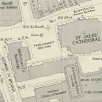
We are pleased to make available the earliest editions of Ordnance Survey National Grid maps covering the Edinburgh environs. Toward the end of the Second World War, Ordnance Survey prioritised the mapping of urban areas on new National Grid sheet lines, and at the detailed 1:1,250 scale for urban areas with a population of over 20,000 people. The maps show nearly all detached features of over 1 square metre in size, as well as house numbers. We have focused on Edinburgh initially as part of our collaborative work with the MESH Edinburgh Atlas project, and we plan to extend coverage geographically in the future.
The maps can be viewed using a clickable map, as a georeferenced overlay (allowing comparison to modern Google or Bing layers), and using an ordered list.
British First World War Trench Maps, 1915-1918
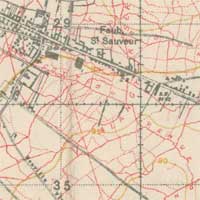
We are pleased to make available all our holdings of trench maps of the Western Front (307 maps). Trench maps are a primary source for studying the battlefields of the Western Front, and the location of enemy positions and defences. They record the names that soldiers gave the trenches, as well as the names of nearby farms, villages, woods, and other landmarks. Accurate locations, and the distances and bearings between them were essential for the artillery, and trench maps also illustrate the innovative survey, compilation, and printing technologies that advanced rapidly during the War. Comparing trench maps to each other over time, and to the present day, allows a detailed and fascinating graphic insight into the changing topography of the Western Front.
The maps can be viewed using a clickable map, as georeferenced overlays and using an ordered list. It is also possible to compare the georeferenced maps side-by-side to each other, and compare them to modern satellite images and maps.
Ordnance Survey Six-inch England and Wales, 1842-1952
This series is the most comprehensive topographic mapping covering all of England and Wales from the 1840s to the 1950s. It was revised for the whole country twice between 1842-1893 and between 1891-1914, and then updated regularly for urban or rapidly changing areas from 1914 to the 1940s. The maps are immensely valuable for local and family history, allowing most features in the landscape to be shown. Search using a graphic index, or view a list of all sheets.
OS One-inch to the mile, Scotland, 2nd edition (Hills), 1885-1903
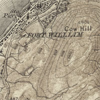
This newly added one-inch 2nd edition (Hills), 1885-1903 series complements our existing Ordnance Survey one-inch 2nd edition, 1885-1900 mapping of Scotland. But in contrast, it shows relief as brown hachures - lines following the direction of the slope, with their thickness indicating steepness. During the 19th century, this was Ordnance Survey's preferred method of indicating the height of the ground, printing the Hills edition maps from two separate copper plates. However, it was very labour intensive, and increasingly Ordnance Survey moved to use contours to represent height the 20th century - as seen in the OS Popular edition mapping. We have also georeferenced this Hills edition so it can be viewed as a seamless layer on top of Google satellite imagery or other modern mapping.
New Side by Side Viewer for Exploring Georeferenced Maps
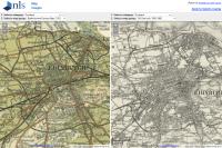
Our new Side by Side Viewer allows an easy way of comparing different layers of historical georeferenced mapping on screen at the same time. We now have over 160 layers of georeferenced mapping in our Georeferenced Maps viewer and it is often useful to compare different scales and dates of this mapping on screen at the same time. You can use the Side by Side Viewer to display your choice of any of these layers in each window, and compare them to each other, as well as to modern Google, Bing or Ordnance Survey maps. The Side by Side Viewer is accessible directly from the Georeferenced Maps viewer.
Ordnance Survey Five feet to the mile - London, 1893-1896
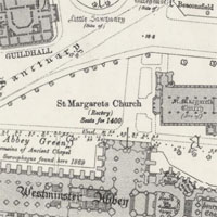
This series is the most detailed mapping of London by Ordnance Survey just over a century ago. The five feet to the mile or 1:1,056 scale covered the capital in 729 sheets, based on a revision and survey of 1891-5. The maps provide excellent detail of the whole urban infrastructure, including residential and industrial premises, schools, asylums, hospitals, parks, canals, docks and railways, and even the interior layout of public buildings, such as cathedrals, churches, and railway stations. We have georeferenced the mapping so it can be viewed as a seamless layer on top of present day maps and satellite images. View a list of all sheets or search using a graphic index.
We are very grateful to David Rumsey for supporting the scanning and georeferencing of this series
Ordnance Survey One-inch Revised New series, England and Wales (1892-1908)
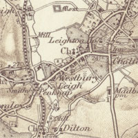
This series covered all of England and Wales in 346 sheets, forming a clear and attractive general overview of the landscape from a century ago, based on a national revision of 1893-8. We have included the Outline edition (with relief shown by contour lines), as well as the Hills edition (with relief shown by brown hachures), borrowing in places from the 3rd edition sheets in the 1900s to provide more complete coverage. We have also georeferenced these two editions (Outline, Hills) so they can be compared to present day and other mapping. View a list of all sheets or search using a graphic index.
We are very grateful to David Rumsey for supporting the scanning and georeferencing of this series
New OS County Map Records for England and Wales (1841-1952)
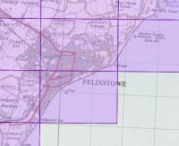
We have added 152,332 records for OS County Maps of England and Wales to our OS sheet records viewer. These are records for the most detailed OS map series covering both rural and urban areas: the OS 25 inch (1:2,500) and OS six-inch to the mile (1:10,560) series. It is now possible to discover through a single interface all the detailed OS paper maps that were published for anywhere in the United Kingdom. This includes all the editions of map sheets at these scales, so you can discover when OS maps were surveyed and published for any particular area.
We are very grateful to EDINA for funding the collection of the OS County map metadata.Bartholomew half-inch to the mile, Great Britain (1897-1909)
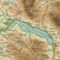
We have added a layer of Bartholomew half-inch to the mile mapping for Great Britain (1897-1909). This includes 29 sheets covering Scotland and 37 sheets covering England and Wales. These sheets have also been mosaicked as a georeferenced overlay. You can also explore these maps through two related applications on our Bartholomew Archive website: the Great Britain time traveller and the Cairngorms layer colour explorer.
Revised Map images website
We have updated our maps website design to improve navigation and usability. The two main search methods, Map Finder and Browse by Category, are now available on all pages, and our georeferenced applications are now fully integrated with all online maps content, using a consistent navigational header. We hope that you find these changes useful, and would be grateful for feedback as we continue to develop the website.
1:25,000 maps of Great Britain, 1937-1961
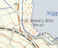
The 1:25,000 series provides an excellent regional overview of the 1940s and 1950s landscape, and illustrates features such as woodland, roads, railways, field boundaries, footpaths, settlements and farms. It is twice as detailed in scale as the one-inch to the mile mapping and is the most-recent OS 1:25,000 series that is out-of-copyright. The series is available as individual sheets and a seamless mosaic.
25 inch 2nd and later edition maps of Scotland, 1892-1949
25 inch 2nd and later edition maps of Scotland form the most detailed topographic mapping for all the inhabited regions of Scotland from the 1890s to the 1940s. The series is made up of 17,466 map sheets, and all were revised from 1892-1907. Sheets covering more populated and rapidly changing areas were selectively revised from 1914 to the 1940s. You can zoom into the detail of the OS 25 inch maps using an interactive index map, and search by county, parish and a gazetteer of place names.
Six-inch 2nd and later edition maps of Scotland, 1892-1960
Six-inch 2nd and later edition maps of Scotland form the most comprehensive, topographic mapping covering all of Scotland from the 1890s. They illustrate a very wide range of natural and man-made features and are excellent for local and family history. The series is made up of 7,486 map sheets. It was revised for the whole country from 1892-1907, and then updated regularly for urban or rapidly changing areas from 1914 to the 1940s. You can zoom into the detail of the OS six-inch maps using an interactive index map, and search by county, parish and a gazetteer of place names.
New georeferenced search application
Our new Map Finder viewer provides a significantly improved method of accessing 18,000 of our online maps. A range of both old and modern mapping layers provides the user with a customisable backdrop to selecting areas of interest, and keyword searching is provided by placename and National Grid Reference, alongside browsable gazetteers of counties and their parishes.
The new search interface integrates our previous five separate search applications into a faster and clearer interface. The application uses the open-source Geoserver and Openlayers software. View our geo search help to see which map series are included and for further guidance on using the application.
We have made available these geo search application options:
New e-payments system
Our new e-payments system lets you purchase printouts and images of any of our online maps. The system is quick and simple, and it has been integrated with the existing Maps of Scotland website. Just browse to the map you want to purchase, and select the ![]() button. Prompts and helpful notes guide you through the payment process using a credit/debit card or PayPal.
button. Prompts and helpful notes guide you through the payment process using a credit/debit card or PayPal.
Registered customers can also track the progress of their orders, view previous orders, and contact / address information is saved for easier repeat orders. Bespoke orders or other queries for copies of items not on our website can still be sent to maps@nls.uk.
Map Georeferencer pilot application
The Map Georeferencer pilot application allows you to georeference any of our Early Maps of Scotland and then view them as an overlay in Google Earth. The georeferencing is quick and fun, and you can also:
- compare our historic maps directly with present day satellite images
- share, use and georeference the maps in more detail
- view the maps alongside other georeferenced historical maps of the same area
- help improve search methods to find them in future
Further information:
Free application provides historical OS maps for mashups
Our new historical map application allows anyone to include historical maps of Great Britain in their own websites. It displays sets of Ordnance Survey mapping relating to Scotland, England and Wales, dating from the 1920s to 1940s.
The free application will also run on many mobile devices, including the iPhone, iPad, or Google Android based phones.
You can use the maps for a range of purposes. They can be:
- Embedded in your own website
- Used for research purposes
- Used as a backdrop for your own markers or geographic data
- Used to create derivative work, such as OpenStreetMap.
Air photo mosaics of Scotland, 1944-1950
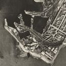
These air photographs provide detailed information on the landscape of post-war Scotland, as well as providing a fascinating portrayal of urban topography and land-use. The aerial photography was flown by the Royal Air Force, primarily in Spitfire and Mosquito fighter aeroplanes, but it was intended for post-war reconstruction and planning. The photographs complement paper mapping, and represent the first widespread use of aerial survey methods by Ordnance Survey.
You can search for OS air photo mosaics using a zoomable map of Scotland and by place-names. They are also available as a Google maps overlay, allowing direct comparison to present-day air photography and mapping.
Ordnance Survey's 25 inch to the mile series (1855-1882)
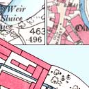
The earliest, detailed mapping for all the inhabited regions of Scotland. The Ordnance Survey 25 inch to the mile maps are immensely valuable for local history. They provide good detail of all buildings, streets, railways, industrial premises, parkland, farms, woodland, and rivers. All towns, villages and cultivated rural areas were mapped, comprising over a third of the total land area of Scotland.
The bold style of the maps and their attractive, informative, hand-colouring allow easy interpretation for a wide range of uses.
Second World War geo-referenced military mapping of Belgium, 1942-1944
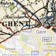
These military maps of Belgium provide reconnaissance information of the whole country at scales between 1:250,000 to 1:50,000. They were compiled and published by the British War Office and used by the Allies during the Second World War.
We have seamed and geo-referenced them so that they can be directly compared with modern Google Map and Satellite views.
Satellite image overlays of Bathymetrical Survey Lochs, 1897-1909
This selection of 33 geo-referenced bathymetrical charts of Scottish lochs allows them to be directly compared with modern Google Maps and Virtual Earth layers. The bathymetrical charts are the most detailed maps showing the depths of these lochs, and they contain useful information too on the surrounding hinterland. We are very grateful to the Scottish Environment Protection Agency for geo-referencing these plans as part of a collaborative project with the Library.
Satellite image overlays of OS town plans, 1847-95

New geo-referenced satellite image overlays allow historic town plans for Scotland to be directly compared with modern Google Maps and Virtual Earth satellite and map layers. These town plans (surveyed 1847-1895) are the earliest and most detailed comprehensive snapshot of urban Scotland ever published by Ordnance Survey. 1,900 sheets covering 62 towns in Scotland have now been mosaicked and geo-referenced. The maps can also be searched using a zoomable map of Scotland, a modern street gazetteer, and by National Grid Reference.
Great Reform Act Plans and Reports, 1832

The Great Reform Act Plans and Reports provide detailed maps and related information for 75 towns in Scotland. The plans depict and name many urban features of importance, including major streets, public buildings, industrial premises, docks, canals, and bridges, as well as surrounding farms and villages. Compiled for the purposes of implementing new parliamentary boundaries, their consistent style and scale (of six-inches to the mile), along with their accompanying burgh reports, make them a valuable snapshot of urban Scotland.
Ordnance Survey six-inch maps of Scotland
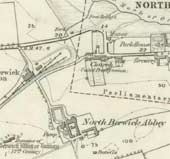
Ordnance Survey six-inch maps of Scotland form the earliest comprehensive topographic mapping of Scotland by Ordnance Survey. They illustrate a very wide range of natural and man-made features for the first time. The six-inch to the mile scale is the most detailed that covered the whole of Scotland, covering the country in 2,123 sheets. You can zoom into the detail of the OS six-inch maps using an interactive index map, and search by county, parish and a gazetteer of place names.
Survey of Sutherland Estate farms
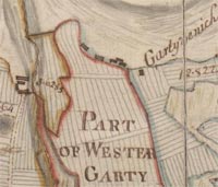
Around 1772, John Kirk produced detailed volumes of manuscript estate plans for the Sutherland Estates. Kirk's survey of farms in Golspie and Loth parishes included some of the estate's richest arable land. It covered the arable coastal strip from Golspie in the south, through Brora and Dunrobin Castle, to what became Helmsdale fishing village in the north.
Military conquest of Scotland by the Romans

William Roy's Military Antiquities of the Romans in North Britain (1793) is a classic work on the military conquest of Scotland by the Romans. It recorded many newly discovered Roman remains for the first time. As a record of early archaeology Roman sites in Scotland, it is almost unbeatable. Its author, William Roy, is better known for his work on the Military Survey of Scotland (see below), and in founding what became the Ordnance Survey. Roy was a keen antiquarian and man of science, and this splendid volume is a lasting monument to these interests.
Roy Military Survey of Scotland, 1747-1755
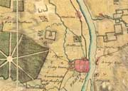
The Roy Military Survey of Scotland, known to its contemporaries as the 'Great Map', is a uniquely important historical cartographic document. It provides a uniform graphic snapshot of the entire Scottish mainland at a time when the landscape was beginning an era of rapid change. For many Highland areas, it is the most detailed and informative map that survives for the entire 18th century. For all areas, it is the only standard topographic map prior to the Ordnance Survey mapping in the 19th century.
Regional Maps of Scotland, 1856-1935
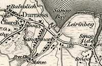
Several hundred detailed maps covering all of Scotland from 1856 to 1936 have been added to our sets of online series mapping, which will particularly benefit anyone doing family or local history research. Among these latest additions are Ordnance Survey and Bartholomew mapping intended for walking, cycling and touring. Together they provide an excellent overview of the Scottish landscape for the period.
The Ordnance Survey one-inch to the mile maps come in three editions, covering:
- 1856-1891
- 1885-1900
- 1903-1912.
We also have Ordnance Survey quarter-inch to the mile maps for 1921-1923. The Bartholomew half-inch to the mile mapping covers 1926-1935.

