December 2021
Viewing Georeferenced Layers in OpenStreetMap
This guide explains how to add georeferenced maps to OpenStreetMap as XYZ tilesets.
View a Brief georeferenced layers list or How to find all georeferenced layer URLs (in our Georeferenced Maps viewer).
Adding XYZ Tilesets in OpenStreetMap
- Go to OpenStreetMap
- To add custom layers you have to be logged into OpenStreetMap. Select login or sign-up. It is free to create an account.
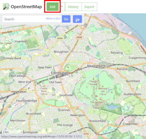
- Zoom to the city, place or town you are interested in and click Edit.
(Hint: For the Edit feature to work you must zoom to a city or town, once your map is added you can zoom out to view it's full extent).
- From the right-hand menu select the Layers icon and under Background choose Custom.

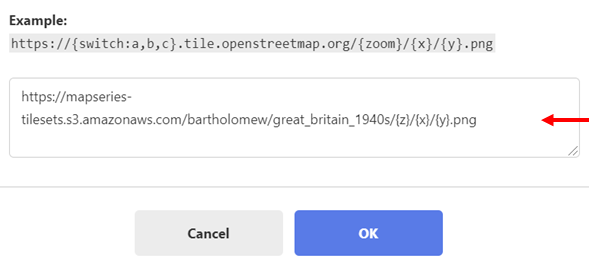
- A new dialog box entitled custom background settings should appear. Enter your map's XYZ URL in the box which states "Enter a URL template" and press OK. To find URLs view our Brief georeferenced layers list or read
How to find all georeferenced layer URLs (in our Georeferenced Maps viewer).

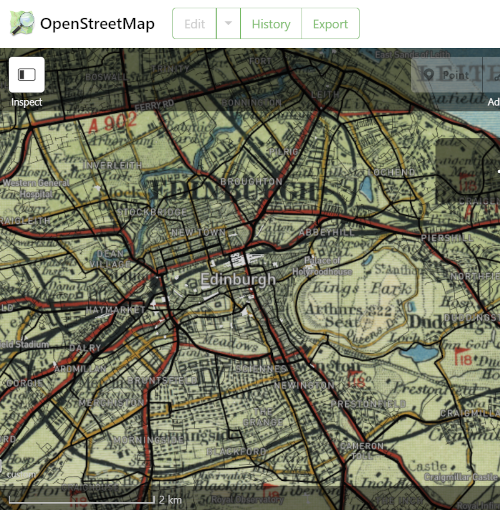
- Your georeferenced map should now be added to your project.

View related Guides:
- Viewing georeferenced layers in QGIS- as XYZ/WMTS tilesets
- Viewing georeferenced layers in ArcGIS- as XYZ/WMTS tilesets
- Viewinggeoreferenced layers in geojson.io- as XYZ tilesets
How to find URLs of georeferenced layers:
- Brief georeferenced layers list with XYZ/WMTS URLs
- How to find all georeferenced layer URLs - in our Georeferenced Maps viewer.
View our Viewing georeferenced maps guides.
We hope you have found some of this information new and useful. If you have further suggestions or comments, please do contact us at maps@nls.uk.
