October 2022
Viewing Georeferenced Layers in geojson.io
This guide explains how to add georeferenced maps to geojson.io as XYZ tilesets.
View a Brief georeferenced layers list or How to find all georeferenced layer URLs (in our Georeferenced Maps viewer).
Adding XYZ Tilesets in geojson.io
- Go to geojson.io
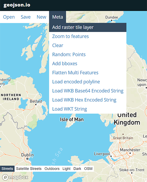
- From the menu select Meta > Add raster tile layer.

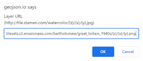
- A new dialog box should appear. Enter your map's XYZ URL and press OK. Currently, geojson.io will only add georeferenced maps with a URL ending in /{z}/{x}/{y}.png or /{z}/{x}/{y}.jpg. - in other words, not those with a {-y} parameter. If you are interested in adding maps with a {-y} parameter please contact us at maps@nls.uk.
To find URLs view our Brief georeferenced layers list or read How to find all georeferenced layer URLs (in our Georeferenced Maps viewer).
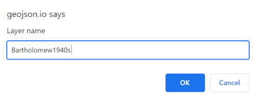
- In the dialog box, add a Layer name and press OK.

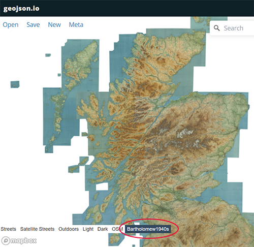
- Your georeferenced map should now be added to your project with its name added to the layers panel at the bottom of the screen (circled in red below). You can toggle its display by choosing other map layers in the layer list panel.

View related Guides:
- Viewing georeferenced layers in QGIS- as XYZ/WMTS tilesets
- Viewing georeferenced layers in ArcGIS- as XYZ/WMTS tilesets
- Viewing georeferenced layers in OpenStreetMap- as XYZ tilesets
How to find URLs of georeferenced layers:
- Brief georeferenced layers list with XYZ/WMTS URLs
- How to find all georeferenced layer URLs - in our Georeferenced Maps viewer.
View our Viewing georeferenced maps guides.
If you have further suggestions or comments on this guide, please contact us at maps@nls.uk.
