Transcription projects
View Transcription project results
Woodland in Scotland map viewer, 1840s-1880s

The Library has recently partnered with the nature regeneration platform, Zulu Ecosystems, who have extracted a digital layer showing woodland from the mid-19th century Ordnance Survey maps. The depiction of woodland on these OS Six-Inch to the mile maps (1843-1882) is one of the most comprehensive records of ancient woodland in Scotland. It is hoped that the development of this open access layer will contribute towards the conservation and protection of ancient woodland in Scotland.
Due to the automated processes used to extract the layer, some revisions are still needed. We are inviting volunteers to easily record corrections they spot in the viewer.
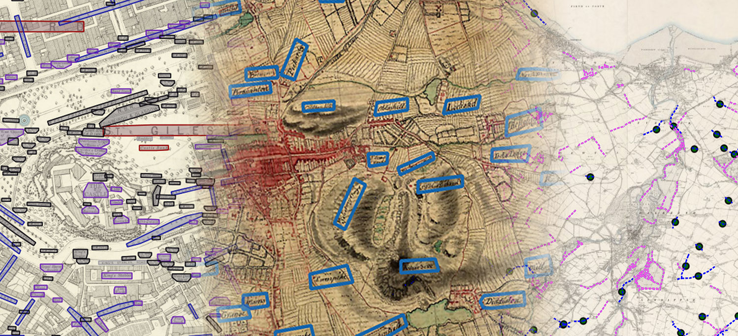
Map Transcription Projects, 2022
From February - May 2022, we initiated a set of new collaborative projects to transcribe features and text from maps. We have gathered all of the placenames from the Roy Military Survey maps of Scotland (1747-55), traced footpaths from Ordnance Survey six-inch to the mile maps of Scotland (ca.1900s), and gathered text from Ordnance Survey 25 inch to the mile mapping of Edinburgh.
Map Transcriptions 2022 - event
Watch our closing event held on Tuesday 8 November 2022 at 17.00 which looked at the impact and value of these projects, and thanked everyone who helped. The event included a welcome from Amina Shah, National Librarian at NLS, and then from 8 speakers who each looked at the value of the transcription projects from different perspectives:
- Roy Military Survey - placename transcriptions
We are very pleased to report that all Roy Names, their accompanying Ordnance Survey names, and comments have been successfully reviewed and edited. We are very grateful to everyone who has helped us with this. Some checking and revision of names is still onging - updates are announced on the Roy Transcriptions Forum
The following ways of accessing the Roy Gazetteer are available:
- Scotways Historic Footpaths Project
Collectively over 120,000 footpaths, spanning over 40,000 miles across Scotland have been traced. The following ways of viewing the Footpaths are available:
- OS 25 inch Edinburgh Placenames Project
Following the successful recording of all 30,043 transcriptions in the first two weeks, further work has taken place to edit and revise the transcriptions to complete them. The regrouped transcriptions allow 21,950 place names and related information on real-world features to be searched and viewed:
- Map Viewer and Search Interface
- Map Viewer Help
- Project Information - datasets, fields, tags, and data download links