Transcription projects, 2022 - Results
Between February - May 2022, we initiated a set of new map transcription projects to transcribe features and text from maps. We are extremely grateful to several hundred volunteers who have very actively helped us. All of these projects are still underway (June 2022), but we are keen to report brief results below from each of the three projects, and provide links to map viewers allowing the results to be seen, searched and browsed:
- Roy Military Survey - placename transcriptions
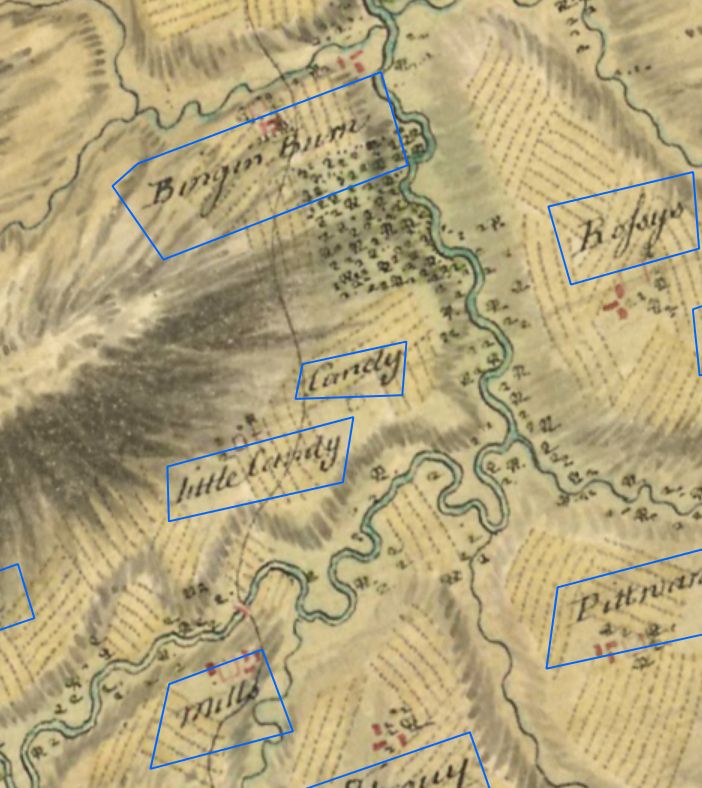
In February we launched our first map transcription project, in collaboration with the British Library, to transcribe all of the names on the Roy Military Survey Map of Scotland (1747-55). Within the first four weeks, all 33,517 names had been transcribed by two separate people. We also asked volunteers to transcribe a nearby / related Ordnance Survey 1st edition name to help with searching and to provide a qualifier for the Roy name. Further phases of work have edited and revised both Roy and Ordnance Survey names. Some checking and revision of names is still onging - updates are announced on the Roy Transcriptions Forum. For the first time, it is now possible to search all the names on this uniquely important 18th century map covering all of mainland Scotland.- The following ways of accessing the Roy Gazetteer are available:
- Scotways Historic Footpaths Project
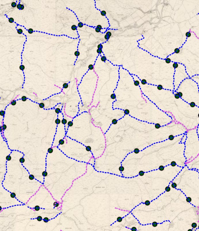
In April we launched our second project, in collaboration with Scotways, to trace all of the footpaths from the Ordnance Survey six-inch to the mile 2nd edition maps of Scotland (1888-1913). 26,000 footpaths (over 11,000 miles) were traced within the first two weeks. Further work extended the core network of paths, and by 2 December 2022, over 120,000 footpaths, spanning over 34,000 miles had been created. Identifying these footpaths and making them available as an open layer, will help facilitate Scotways’ work in researching the backgrounds of footpaths today and safeguarding them as rights of way.The following ways of viewing the Footpaths are available:
- OS 25 inch Edinburgh Transcriptions Project
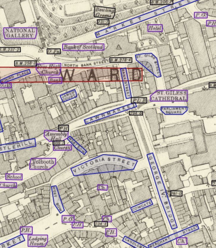
In May we launched our third project, in collaboration with the Machines Reading Maps team at the Alan Turing Institute, to record all the text from the Ordnance Survey 25 inch to the mile maps of Edinburgh (1892-94). All 30,043 transcriptions were recorded in the first two weeks. Further work has been underway since June to edit and revise the transcriptions to complete them. As well as creating a very detailed gazetteer of Edinburgh from a century ago, the transcriptions will also be useful as a training dataset for machine-learning, hopefully encouraging the more widespread automatic ways of harvesting names from OS 25 inch maps. The initial work-in-progress gazetteer includes all 1,212 street names in Edinburgh, as well as all public buildings and abbreviations, allowing many features of the urban landscape to be queried and viewed geographically.- Map Viewer and Search Interface
- Map Viewer Help
- Project Information - datasets, fields, tags, and data download links