About our map images
In our 'Map images' resource you can access and view all the maps we have scanned as high-resolution, colour, zoomable images. The maps mostly date between the 1520s and 1970s and relate primarily to Scotland, England and Wales. We also have maps of areas beyond Great Britain, including maps of Ireland, Belgium, Jamaica, and various World Atlases.
Watch an introductory video about the Map Images website.
Read our Guide to this website.
Map Finder
The easiest way of finding material relating to any particular location is to use the Map Finder - with Marker Pin viewer. Search using a map, or by place name, or by county and parish name. On our related Map Finder - with Outlines viewer, the outlines or extents of all the map images are shown as clear coloured overlays that you can select and view.
Watch a video on the Map Finder viewer.
Browse by category
The easiest way of finding general groups of maps is to browse by category. The maps vary in the amount of detail they show:
- Least detailed maps – early maps of the whole of Scotland
- More detailed – county/regional maps and coastal charts
- Very detailed – town plans.
You can also browse the maps by the names of map-makers, surveyors and engravers.
Sets of county maps
We have several Scottish atlases online with sets of county maps, providing good coverage of regions and rural areas:
- Blaeu Atlas of Scotland, 1654
- Herman Moll's Maps of Scotland, 1745
- John Thomson's Atlas of Scotland, 1832
- Bartholomew Survey Atlas of Scotland, 1912.
Military maps
Another category is of maps made for military purposes, especially those from the 18th century. These include the famous Roy Military Survey of Scotland (1747-1755), and Roy Military Antiquities of Scotland (1793). From the 19th century onwards, maps were often published as a set or series, especially by Ordnance Survey. You can also view 20th century military maps of Scottish sites, or First World War trench maps.
Ordnance Survey maps

Scotland
- One Inch to the Mile - useful for an overview of wide areas
- Six Inch to the Mile - useful for rural detail, showing heights and contour lines, and covering all of Scotland
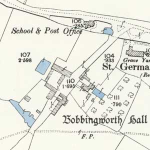
- 25 Inch to the Mile - the most detailed maps for all the inhabited urban and rural regions of Scotland
- 50 and 120 Inch to the Mile - very detailed urban plans covering 62 towns in Scotland
England and Wales
- One Inch to the Mile - useful for an overview of wide areas
- Six Inch to the Mile - useful for rural detail, showing heights and contour lines
- 25 Inch to the Mile - the most detailed maps for all inhabited urban and rural regions
- 50 and 120 Inch to the Mile - very detailed urban plans covering 440 towns in England and Wales
Ireland
- One Inch to the Mile - useful for an overview of wide areas
- Six Inch to the Mile - useful for rural detail, showing heights and contour lines
Ordnance Survey mapping published in the last 50 years is in copyright and cannot be scanned and made available online. You can view which detailed Ordnance Survey maps were published from 1841-1991 through our Ordnance Survey map records viewer.
Seamless and geo-referenced maps
We are geo-referencing a growing proportion of more recent maps. Geo-referencing aligns an historic map image with its real world location information. This lets us present a map series as a seamless layer, and compare the historic maps to other dates of mapping, including modern satellite imagery and maps. Explore our Georeferenced Maps.
Watch a video on the Georeferenced Maps viewer.
More about early maps
We have further information about early maps in our early maps list. Together these information pages also form a brief, descriptive history of mapmaking. Read our Research guides - using maps to explore particular subjects, such as climate change, houses, local history, or woodland.
Projects
We have several collaborative project websites:
- Our Historical Maps API allows you to embed a zoomable georeferenced historic map of Great Britain in your own website
- Our Scotland - Land Use viewer allows you to compare the 1930s landscape to the present day
- Our Bartholomew Archive website presents maps and other information relating to the Bartholomew map-makers and printers
Images and printouts
You can order images, photocopies and printouts of all of these maps. When viewing any map as a zoomable image, select the Order this map button. For further details, including contact information, use the enquires and copies link on all map image pages. The page also has a list of frequently asked questions about our online maps.


