Ordnance Survey Air Photo Mosaics, 1944-1950
Introduction

Central London (1946)
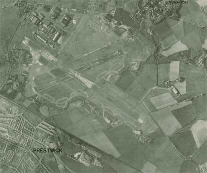
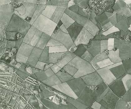
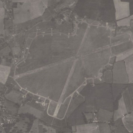
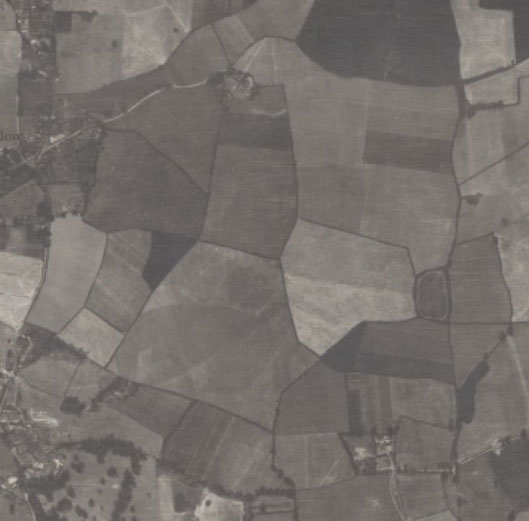
These air photo mosaics provide key information on the landscape of post-war Britain, including good detail of urban topography and land-use. They complement paper mapping, and represent the first widespread use of aerial survey methods by Ordnance Survey.
The sections below describe:
- Background to aerial survey methods
- Aircraft and cameras
- Creating the mosaics
- Geographical coverage, scale and size
- Publication, censorship and security concerns
- Other large air photo collections covering the UK
- Further reading
Background to aerial survey methods
The First World War was an important stimulus to the use of air photography in mapping and survey work, both internationally and for Ordnance Survey. Aerial survey methods were not generally employed by Ordnance Survey in the inter-war period, however, apart from experimental work in the 1920s.
However, during the Second World War, millions of air photos were captured by the Royal Air Force (RAF). Their value for military reconnaissance and topographic surveying was proved beyond all doubt.
With rapid improvements to cameras, equipment and techniques, it was also clear by the end of the war that aerial survey methods would have a great value too in peacetime mapping work. In 1945 the Air Photo Division was established in Ordnance Survey, utilising the surplus aircraft and personnel from the RAF.
The extensive RAF aerial photographic survey of Great Britain (1944-1950), called Operation Revue, was also intended to assist town planning and road building. These photographs are held in the National Collection of Aerial Photography.
It was not until the 1950s, that the Ministry of Transport and Civil Aviation increasingly took over aerial survey work from the RAF. From this time, aerial survey has been an essential part of Ordnance Survey's reconnaissance and data capture methods.
Aircraft and cameras
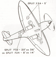
cameras under wings.
Due to post-war budgetary constraints, high-speed wartime aeroplanes such as Spitfires and Mosquitos had to be used, rather than the slower Ansons that were more suited to peacetime aerial survey. The aircraft were specially modified to take two cameras – for stereoscopic capture – beneath each wing. The cameras were tilted in such a way that there was significant lateral cover between the two cameras, a method that came to be known as a "split" installation.
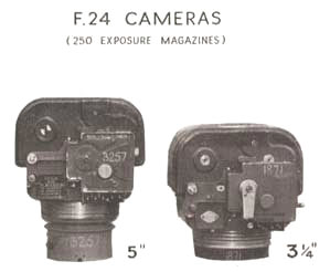
with focal lengths of 5" and 3¼"
During the Second World War, great progress had been made in mounting cameras to reduce problems caused by aircraft vibration. Initially, heaters were set up by the cameras to minimise problems of condensation on the lenses, and to prevent them from freezing up. These methods were increasingly replaced by ducting hot air from the engine into a closed camera compartment. Moving film cameras were also developed to compensate for the forward speed of the aircraft during exposure, thereby allowing more detailed photographs at larger scales.
The F24 and Fairchild K17 cameras were mainly used by the RAF at this time for vertical (i.e. overhead) photography, with a range of lenses from six- to 40-inch focal lengths.
Creating the mosaics
Creating the mosaics was a technically skilled job, involving:
- Rectifying the original photographs to compensate for distortion at the edges of the image
- Carefully cutting overlapping sections of photographs and pasting them together to form a composite mosaic
- Adding lettering for major towns and straight borders to frame the mosaic.
Geographical coverage, scale and size
The mosaics were produced as an interim measure by Ordnance Survey, as a quick and cheap expedient before proper paper mapping could be surveyed. In total, we have 6,393 mosaics published by Ordnance Survey of England, Scotland, and Wales:
- 1,919 mosaics at 1:10,560 (Six-Inch to the mile) scale. (220 in Scotland, and 1,699 in England and Wales)
- 4,474 mosaics at 1:1,250 (50 Inch to the mile) scale. (All covering parts of England and Wales). The following towns have coverage at 1:1,250 scale: Barrow-in-Furness, Bath, Canterbury, Coventry, Dover, Exeter, Gloucester, Great Yarmouth, Kingston-upon-Hull, Liverpool, London, Lowestoft, Portsmouth, Southampton, Swansea, Sunderland.
The focus was generally on the more built up areas which had greatest requirements for reconstruction and development, especially as a result of wartime bomb damage.
Each mosaic followed standard National Grid sheet lines. Each sheet has a mosaic area of approximately 52 x 61 cm (height x width). Each 1:10,560 sheet covers an area on the ground of 25 square kilometres, whilst each 1:1,250 sheet covers an area of 0.25 square kilometres. In total some 18,960 square miles, or 49,100 square kilometres in Britain are covered by the mosaics (just over 20% of the total land area).
Publication, censorship and value
The mosaics were originally intended for official use only for local authorities, public utility services and government departments. These were stamped ‘Circulation Restricted’ and were not available to the general public. Under the 1947 Town and Country Planning Act Local Authorities were obliged to produce plans every three years, but there was no likelihood that Ordnance Survey would have the capacity to survey and publish large-scale maps, so air photo mosaics provided the only possibilities. From 1948, mosaics began to be offered for sale to the public in an effort to recoup costs. Unfortunately, sales were poor and in addition, there were security concerns that the mosaics might fall into the wrong hands.
From 1950, newly doctored mosaics were re-issued for a few key locations, including airfields and military installations. For these sensitive locations, sometimes republished editions carry the edition letter B (to the lower left in the bottom margin) and have had certain installations obscured by false fields or painted clouds. However, some of the mosaics first published in the later 1940s have doctored information too.
Security concerns grew. In March 1951, libraries were warned that the original 'true' mosaics should be withdrawn from public use, and in 1954 the mosaics were withdrawn from sale completely. Changing security regulations would have meant that every mosaic would have needed to be checked, and it was felt that the effort involved would not be justified by the low sales.
Although for the Ordnance Survey, the air photo mosaics were not used to revise large and medium scale mapping, as they were not considered to be sufficiently accurate, the mosaics had a great value for those interested in a contemporary snapshot of the landscape, and they continue to have a great value for those researching landscape history. For Ordnance Survey, the mosaics were a temporary way of providing some landscape coverage before up-to-date regular mapping could be created. Compared with conventional Ordnance Survey maps, the mosaics show more detail because they are less generalised, and they also show a rich variety of land uses, even if they have few place names and no descriptive annotations. Additional information not found on regular maps includes land use, field boundaries on the 1:10,560 mosaics and even traffic flow on the 1:1,250 mosaics. The date of air photography is also given on each mosaic in the lower margin. In spite of the difficulties of "doctored" information, the falsified mosaics in this category can usually be easily identified.
Large collections of air photography covering the United Kingdom
- Aerial Photo Explorer - Historic England
- Britain from the Air - Cambridge University
- Cambridge University Collection of Aerial Photography (CUCAP) - Cambridge University
- National Collection of Air Photography (NCAP) - Historic Environment Scotland
- ScotlandsPlaces - includes air photographs from Historic Environment Scotland
Further reading
- Board, Christopher, 'Air photo mosaics: a short-term solution to topographic map revision in Great Britain 1944-51', Sheetlines 71 (December 2004), pp.24-35. View online.
- Smith, Constance Babington, Evidence in camera. The story of photographic intelligence in World War II, etc.. London : Chatto and Windus, 1958.

