Ordnance Survey / German Army, Fliegerausgabe Grossbritannien 1:250 000 : Schottland, 1939-40
This is a set of Ordnance Survey Quarter-Inch to the mile maps, captured by the Germans and reprinted in 1939-40, as part of their Second World War intelligence preparations. There was no revision of topographic detail, but the sheets were metricated, enlarged from 1:253,440 to 1:250,000, with updated German titles, marginalia and legends. The series was primarily intended for aeronautical purposes. The original maps at quarter inch to the mile (1:253,440) were reduced from larger-scale mapping at the half-inch and one-inch to the mile scales, primarily dating from the third national revision of 1912-1923. These maps are held at: Map.Area.C18(66).
View other quarter-inch to the mile maps of Scotland.
- View the maps with a graphic index of Scotland
| Sheet Number and Name | Date of Publication |
|---|---|
| Sheet 1 - The Border | ca. 1940 |
| Sheet 3 - Forth, Clyde, and Tay | ca. 1940 |
| Sheet 3 - Forth, Clyde, and Tay | ca. 1940 |
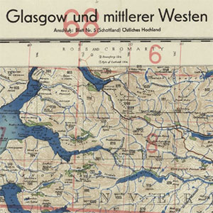
| Sheet 4 - Glasgow und mittlerer Westen | ca. 1940 |
| Sheet 5 - Ostliches Hochland | ca. 1940 |
| Sheet 7 - Nord Schottland | ca. 1940 |