Ordnance Survey - Quarter Inch to the Mile Maps of England, Scotland, and Wales
3rd edition - 1919-1930
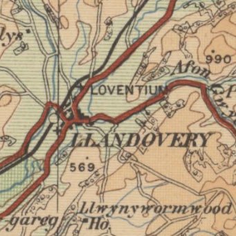
These maps at quarter inch to the mile (1:253,440) were reduced from larger-scale mapping at the half-inch and one-inch to the mile scales, primarily dating from the third national revision of 1912-1923. With some minor variations, each sheet covers 72 x 108 miles, with all of England and Wales in 12 sheets, and all of Scotland in ten sheets. The attractive and distinctive layer colouring is especially good for indicating relief, and there were several later 'aeronautical issues' of the series over the next two decades (see the Civil Air edition (1929-30), and the 3rd Edition / RAF 2nd ed. (War) (1940-1941). This series was also published as an atlas in 1924. For the first time for the Quarter-Inch series, it was constructed on Cassini's Projection with a point of origin at Delamere Forest - as also for the One-Inch Popular edition of Scotland or England and Wales, which began publication at the same time.
View other quarter-inch to the mile maps of Scotland or England and Wales.
- View the maps with a graphic index
- View seamless layer of Quarter-Inch mapping on a satellite image base
View sheets covering England and Wales and Scotland.
England and Wales - standard series
| Sheet | Date of Publication |
|---|---|
| Sheet 1 - The Border | 1921 |
| Sheet 2 - England, North West | 1921 |
| Sheet 3 - England, North East | 1921 |
| Sheet 4 - North Wales | 1920 |
| Sheet 5 - Midlands (N.) | 1920 |
| Sheet 6 - Eastern Counties (N.) | 1920 |
| Sheet 7 - South Wales | 1920 |
| Sheet 8 - Midlands (S.) | 1920 |
| Sheet 9 - Eastern Counties (S.) | 1920 |
| Sheet 10 - England, South West | 1919 |
| Sheet 11 - England, South | 1919 |
| Sheet 12 - England, South East & London | 1920 |
District maps
| Sheet | Date of Publication |
|---|---|
| South Central (District Map) | 1924 |
England and Wales - New Series
| Sheet | Revision details | Date of Printing |
|---|---|---|
| Sheet 2A - North Central | ca. 1926 | |
| Sheet 4A - North Wales & Manchester | Railways inserted to 1927. Minor Corrections: 1923 to 1927 | 1928 |
| Sheet 6A - North Midlands and Lincolnshire | Railways inserted to 1927. Roads revised 1929. Minor Corrections: 1929 | 1930 |
| Sheet 7A - South Wales | Minor Corrections: 1928 | 1929 |
| Sheet 8A - Midlands | Roads revised 1925 to 1928. Minor Corrections: 1929 | 1929 |
| Sheet 9A - East Anglia | Roads revised 1925 to 1928. Minor Corrections: 1929 | 1930 |
Megalithic maps
| Sheet | Date of Publication |
|---|---|
| Sheet 6A - The Trent Basin. Showing the distribution of long barrows, megaliths and habitation sites | 1933 |
Scotland
| Sheet Number and Name | Revision details | Date of Publication |
|---|---|---|
| Sheet 1 - The Border | 1921 | |
| Sheet 1 - The Border | Minor corrections 1923-24 | ca. 1925 |
| Sheet 1 - The Border | Roads rev. (England) to Sep.1929. Railways inserted to 1929 Minor corrections 1930 | ca. 1930 |
| Sheet 1 - The Border | Roads rev. (England) to Sep.1929. Railways inserted to 1929 Minor corrections 1930 | ca. 1930 |
| Sheet 1 - The Border | Roads rev. (England) to Sep.1929. Railways inserted to 1929 Minor corrections 1930. Town plans sheet tipped in cover | ca. 1933 |
| Sheet 2 - Scotland South West | 1922 | |
| Sheet 2 - Scotland. South West | Roads partially rev. to 1924. Minor corrections 1931 | ca. 1932 |
| Sheet 3 - The Forth & Tay | 1923 | |
| Sheet 3 - The Forth & Tay | 1923 | |
| Sheet 3 - The Forth & Tay | 1923 | |
| Sheet 3 - The Forth & Tay | Roads partially rev. 1930. Railways rev. 1930. Minor corrections 1930. Town plans sheet tipped in cover | ca. 1931 |
| Sheet 4 - The Southern Islands | 1923 | |
| Sheet 4 - Glasgow, Oban and the Southern Islands | Minor corrections to 1924-7. H. Rees label pasted on cover | ca. 1927 |
| Sheet 4 - Glasgow, Oban and the Southern Islands | Roads partially rev. 1931. Minor corrections 1931. Gaelic glossary inside cover | ca. 1932 |
| Sheet 4 - Glasgow, Oban and the Southern Islands | Roads partially rev 1931. Minor corrections 1933 | ca. 1933 |
| Parts of sheets 4, 3, 2, 1 - Glasgow and District | Minor corrections 1929 | ca. 1930 |
| Sheet 5 - The Eastern Highlands | 1923 | |
| Sheet 5 - The Eastern Highlands | Roads rev. 1934. Minor corrections 1934. Town plans sheet tipped in cover | ca. 1934 |
| Sheet 6 - The Western Highlands | 1922 | |
| Sheet 7 - Scotland North | 1923 | |
| Sheet 7 - Scotland North | Roads rev. 1927-8. Minor corrections 1931. | ca. 1932 |
| Sheet 7 - Scotland North | Roads rev. 1927-8. Minor corrections 1933 | ca. 1933 |
| Sheet 8 - The Northern Hebrides | 1923 | |
| Sheet 9 - The Orkney Islands | 1923 | |
| Sheet 10 - The Shetland Islands | 1923 | |
| Sheet 10 - The Shetland Islands | Roads rev. 1928-9. Minor corrections 1931. Gaelic glossary inside cover | ca. 1932 |