Times Survey Atlas of the World, 1920
The Times Survey Atlas of the World (1920) was the first Times Survey Atlas with maps prepared by the Edinburgh Geographical Institute of John Bartholomew & Son Ltd. It included 112 colour maps (each measuring 42 x 55 cm., on sheets 46 x 59 cm.) all specially compiled for the Atlas over the previous 5 years. Following an initial General Section of world and thematic mapping, the maps are grouped into five main geographic regions, as listed below.
- Browse Times Survey Atlas using a graphic index
- Browse Times Survey Atlas as a seamless georeferenced layer
We are very grateful to David Rumsey and Geopast for assisting with the georeferencing of these maps.
General Maps | Europe | Asia | Africa | America | Oceania
General Maps
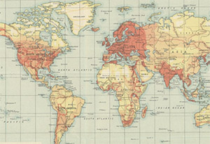
- Mapping of the World
[Maps: Herodotus B.C. 450; Strabo A.D. 18; Mela A.D. 43; Ptolemy A.D. 150; Mountain of Cosmas Indicopleustes; Cosmas Indicopleustes; Wheel Map XI Century; Hereford Map 1280; Ortelius 1570; De Wit c. 1700; The World c. 1800; Cartography of the World 1921] - World – bathy-orographical
[Insets: Longitudinal Section 50° North; Longitudinal Section 35° North; Longitudinal Section 0° (Equator); Longitudinal Section 30° South] - World – climate
[Maps: Temperature - January; Rainfall - January; Pressure and Winds - January; Temperature - July; Rainfall - July; Pressure and Winds - July; Temperature - Annual; Rainfall - Mean Annual; Thermal Regions; Seaonal Rainfall; Storm Tracks and Frequency] - World – vegetation and ocean currents
- World – population, races, religions, languages
- World – commercial development, occupations, means of traffic
- World – political
[Insets: World Powers - Comparative Areas; World Powers - Comparative Population] - North Polar Regions
- South Polar Regions
Europe
- Europe – political
- Europe – orography, vegetation, ethnography, population
- Western Europe – communication
- Eastern Europe - communication
- British Isles – bathy-orographical
[Inset: Orkney and Shetland Islands] - British Isles – vegetation and climate
[Maps: Vegetation; Temperature January; Temperature July; Temperature Actual Annual; Rainfall January; Rainfall July; Rainfall Mean Annual] - British Isles – railways and industries
[Insets: Orkney and Shetland Islands; Distribution of Land Under Cultivation; Distribution of Land Under Pasture] - British Isles – political
[Insets: Orkney and Shetland Islands; Industrial Sketch Map; Density of Population] - England and Wales – S.E. section
[Inset: Channel Islands] - England and Wales – S.W. section
[Inset: Scilly Isles] - England and Wales – N. section
- Scotland – southern section
- Scotland – northern section
[Inset: Orkney and Shetland Islands] - Ireland - northern section
[Inset: Belfast] - Ireland - southern section
[Insets: Killarney; Cork; Dublin] - Environs of London
- Towns of England and Scotland
[Maps: Glasgow; Edinburgh; Hull; Newcastle Upon Tyne; Liverpool; Manchester; Birmingham; Bradford & Leeds; Bristol; Plymouth; Southampton; Portsmouth] - Belgium and Holland
[Insets: Brussels; Antwerp; Rotterdam; Amsterdam] - France – north-western section
[Insets: Paris; Le Harve; Brest] - France – north-eastern section
- France – south-western section
[Inset: Bordeaux] - France – south-eastern section
[Insets: Corsica; Marseille] - France, Belgium and Holland - political
- Spain and Portugal – western section
[Insets: Oporto; Cadiz; Gibraltar; Libson] - Spain and Portugal – eastern section
[Insets: Barcelona; Madrid] - Switzerland
- Northern Italy, Austria &c.
[Inset: Vienna] - Southern Italy
[Insets: Rome; Naples] - Central European States - political
- Germany – southern section
- Germany – western section
[Inset: Berlin] - Germany – eastern section
- Southern Scandinavia and Denmark
- Poland and Czechoslovakia
- Baltic States and East Prussia
- Northern Russia and Finland
- Southern Russia
- Rumania and adjacent states
- Greece and the Aegean
[Insets: Athens; Chanak; Constantinople]
Asia
- Asia - political
[Insets: Jerusalem; Section across Judea and the Dead Sea] - South-Western Asia - political
- Asia Minor, Syria and Mesopotamia
- Palestine
- Persia
- Indian Ocean
- India and Farther India- political
[Insets: Ethnographic Sketch Map; Density of Population] - India – N.W. section
- India – N.E. section
[Inset: Calcutta] - India – S. section
[Inset: Bombay] - Provinces of the Lower Ganges - political
- Farther India
[Insets: Andaman Islands; Hanoi; Singapore] - Malay Archipelago
[Inset: Manila] - China - political
- China
[Inset: Peking] - Eastern China - political
- Japanese Empire – political
- Japan
[Insets: Continuation Hokkaido; Nagasaki; Tokyo] - Siberia
Africa
- Africa – political
[Insets: Prevailing Vegetation; Races; Density of Population; Mean Annual Rainfall] - Northern Africa
- Central and Southern Africa
- South Africa
- Cape Province, Trans Vaal, &c. – W. section
[Inset: Cape Topwn] - Cape Province, Trans Vaal, &c. – E. section
[Insets: Port Elizabeth; Durban] - Central Africa – W. section
- Central Africa – E. section
- West Africa
- North-West Africa
[Inset: Canary Islands] - Egypt and the Nile
[Insets: Continuation Uganda; Alexandria; Aden] - Lower Egypt
[Insets: Continuation Minia to Antaeopolis; Continuation Antaeopolis to Thebes; Cairo; Port Said; Suez]
America
- North America – political
[Inset: Prevailing Vegetation] - North Atlantic Ocean
- Dominion of Canada – political
- North-Eastern Canada
- Western Canada
- Maritime Provinces and Newfoundland
[Inset: Halifax] - Ontario and Quebec
- Manitoba and North-West Ontario
- Alberta and Saskatchewan
- British Columbia
[Inset: Vancouver] - United States – eastern section
[Insets: Niagra Falls; Density of Population] - United States – central section
- United States – western section
[Inset: The Yosemite Valley] - North-Eastern States
- American Cities
[Maps: Chicago; New York; Boston; Quebec; Philladelphia; Montreal; San Francisco; Washington; Otowa; Baltimore; Toronto; New Orleans; St. Louis; Winnipeg] - Mexico and Central America
[Insets: Continuation Yucatan, Campeche, Quintana Roo & British Honduras; Continuation Guatemala, Honduras, Nicaragua, & Costa Rica] - The West Indies
[Insets: Jamaica; Porto Rico; Trinidad; Kingston; Havana; Panama Canal] - South Atlantic Ocean
- South America - political
[Insets: Prevailing Vegetation; Density of Population; Races] - South America – northern section
[Insets: Lima; Bahia] - South America – southern section
[Insets: Rio de Janeiro; Buenos Aires; Montevideo; Valparaiso] - Argentina, Chile &c
[Inset: Continuation Rio de Janeiro]
Oceania
- South Pacific Ocean
- North Pacific Ocean
- Australia - political
[Insets: Prevailing Vegetation; January Rainfall; July Rainfall; Density of Population] - Australia – western section
[Insets: Perth; Albany] - Australia – eastern section
[Inset: Continuation Tasmania] - Victoria and Tasmania
[Insets: Melbourne; Hobart] - New South Wales
[Insets: Sydney; Australian Capital Territory] - Eastern Queensland
[Inset: Brisbane] - South Australia
[Inset: Adelaide] - New Zealand
[Insets: Continuation Stewart Island; Auckland; Wellington; Christchurch; Dunedin] - Islands of Oceania
[Maps: New Hebrides; Hawaiian Islands; Cook Islands; Samoan Islands; Society Islands; Marquesas Islands; New Caledonia and Loyalty Islands; Fiji Islands; Tonga Group]