Maps by John Bartholomew & Son
This includes the various names that Bartholomew traded under - including Bartholomew & Co., J.G. Bartholomew, and John Bartholomew & Son Ltd.
- View Bartholomew Archive website
- 'Times Survey Atlas of the World' 1920. 112 map plates
- Bartholomew's 'Survey Atlas of Scotland' 1912. 23 pages, 68 map plates
Maps of Scotland
- 1882 - Philp's Comic Map of Scotland.
- 1889 - Sportsman's & tourist's guide map of Scotland.
- 1892 - Tourist's map of Scotland ... showing the new county boundaries.
- 1893 - Naturalist's Map of Scotland ...
- 1897 - Sportsman's & tourist's guide map of Scotland.
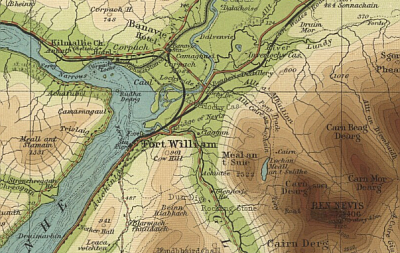
- 1899-1905 - Half-inch to the Mile maps of Scotland.
- 1900 - Tourist's map of Scotland reduced from the Ordnance survey.
- 1920 - Bartholomew's contoured road map of Scotland showing the main roads and railways.
- 1924 - Bartholomew's general map of Scotland.
- 1926-1935 - Half-inch to the Mile maps of Scotland - 29 sheets
- 1946 - Bartholomew's general map of Scotland.
Town Plans of Edinburgh and Environs
- 1826 - Plan of Edinburgh drawn & engraved for the General Post Office Directory.
- 1865 - New plan of Edinburgh and Leith with suburbs
- 1873 - Plan of Edinburgh & Leith with suburbs, from ordnance and actual surveys, constructed for the Post Office
- 1880 - Plan of lands at Craiglockhart, the property of the parochial board of the city parish of Edinburgh.
- 1882 - Plan of Edinburgh and Leith with Suburbs
- 1885 - Pedestrian's map of the Pentland Hills, showing the public paths
- 1888-9 - Plan of Edinburgh and Leith with Suburbs
- 1891 - Bartholomew's Plan of the City of Edinburgh with Leith & Suburbs, reduced from the Ordnance Survey ...
- [1891] - Orographical map of Arthur's Seat: from Bartholomew's reduced Ordnance Survey plan of Edinburgh.
- 1891-2 - Plan of Edinburgh and Leith with Suburbs
- 1893 - Bartholomew's pocket plan of Edinburgh & suburbs
- 1893-4 - Plan of Edinburgh and Leith with Suburbs
- 1895 - Edinburgh street tramways. Routes proposed to be cabled.
- 1901-2 - Plan of Edinburgh and Leith with Suburbs
- 1905-6 - Post office plan of Edinburgh, Leith and Portobello with suburbs
- 1907 - Plan of Edinburgh and Leith with Suburbs
- 1910-11 - Post office plan of Edinburgh, Leith, and Portobello, with suburbs
- 1917-18 - Post office plan of Edinburgh, Leith, and Portobello, with suburbs
- 1918 - BARTHOLOMEW - Post office plan of Edinburgh, Leith, and Portobello [showing] New Parliamentary Divisions - 1918
- 1919 - Chronological map of Edinburgh showing expansion of the City from earliest days to the present
- 1925 - Edinburgh Citizens "No Licence" Council. The Heart of Edinburgh
- 1925 - Post office plan of Edinburgh and Leith
- 1926 - Plan of Edinburgh drawn & engraved for the General Post Office Directory.
- 1932-33 - Post office plan of Edinburgh, Leith, and Portobello, with suburbs
- 1939 - Post office plan of Edinburgh and Leith
- 1939-40 - Post office plan of Edinburgh, Leith, and Portobello, with suburbs
Town Plans of Glasgow and Environs
- 1882 - New plan of Glasgow with Suburbs from Ordnance and Actual surveys
- 1888 - New plan of Glasgow with Suburbs from Ordnance and Actual surveys
- 1918 - New plan of Glasgow with suburbs ... constructed for the Post Office Directory
- 1922 - New plan map of Glasgow, with suburbs, from ordnance and actual surveys. Constructed for the Post office Directory
- 1923 - New plan map of Glasgow, with suburbs, from ordnance and actual surveys. Constructed for the Post office Directory
- 1937 - Plan of the county of the city of Glasgow : constructed for the Post office directory
Town Plans of Peebles and Environs
Maps of England and Wales
- 1902-1906 - Half-inch to the Mile maps of England and Wales
- 1919-1924 - Half-inch to the Mile maps of England and Wales