Claudius Ptolemy and the Geography
Claudius Ptolemy
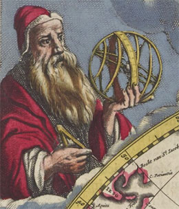
the Blaeu Atlas Maior (1662)
Ptolemy was born in Upper Egypt and lived in Alexandria, ca. A.D. 90-168. He was a polymath who wrote treatises on astronomy, mathematics, physics, optics, harmonics, chronology, and geography. A number of his works contain material relevant to map making. For example: Analemma deals with the theory of the gnomon and orthographic projection; Planisphaerium examines stereographic projection; Tetrabiblos, a treatise on astrology, has references to geography; Mathematical Syntaxis (called Almagest) teaches how to draw a celestial globe; and Geography shows how to draw a map of the inhabited world on a globe or on a plane surface. Ptolemy’s greatest influence on cartography was through translations of Almagest and Geography.
View copies of Ptolemy's Geography:
The Geography
The Geography represents the culmination and synthesis of the scientific tradition in Greek cartography; it consists of eight books, and anywhere from 26 to 64 maps. The Geography has been cited in the literature from as early as the sixth century and was widely used by Muslim scholars and navigators. Whilst the work had no real impact on Western European culture until it was translated from Greek to Latin by Jacopo Angeli in the early 15th century, it had a major impact thereafter. The Geography provides both a description of methods for mapping the known world and an extensive table of known places and their geographical location based on the Ptolemaic system. The purpose of the text was to provide sufficient information for maps to be constructed by a suitably skilled cartographer.
In Book I, Ptolemy gave a definition of what he considers to be geography as opposed to chorography (regional geography). In his view geography was concerned with the extent and measurement of the known world and the methods of representing this information graphically. He continued with a critique of Marinus of Tyre, his predecessor in geography. Marinus used a rectangular cylindrical projection based on the system of meridians and parallels proposed by Diaearchus and Eratosthenes, using Hipparchus’s astronomical calculations to define the dimensions. Ptolemy praised the wealth of information Marinus had gathered, but felt that not all of the information included was from trustworthy sources. Ptolemy provided new values for the dimensions of the Earth, and explained why the rectangular projection used by Marinus was inadequate due to the distortions of land areas near the poles. Ptolemy proposed two new types of projection:
- the first (conic projection) based on a cone tangent to the Earth at the 36° parallel, where the meridians are straight lines that tend to close towards the poles, while the parallels are concentric arcs
- a second (modified conic projection) where the parallels are concentric arcs, but the meridians curve inwards towards the poles.
Books II to VII contain a list of place names and their latitude and longitude locations. Here Ptolemy defined the boundaries, regional subdivisions and inhabitants of all known land areas. This general information was followed by the names of towns situated firstly on the coast, then along major rivers and finally those in the interior or distant from a river. Around 8000 places were named, along with their latitude and longitude data. In Book VIII of Geography Ptolemy described how to construct maps from the data provided in Books II-VII, then he continued to divide the places on the Earth into climatic zones, giving the duration of the longest day at each location, and its distance in hours east or west of Alexandria.
There is no definite evidence that Ptolemy constructed maps or had maps made from his Geography, and not all later editions of the Geography included maps. The earliest existing Greek edition of the Geography that contains maps is from the thirteenth century. Where maps appear in these early editions, it is difficult to determine their provenance. It is assumed that the maps were constructed at the time of publication using the information provided in the text of the Geography. The later Latin editions tended to replicate maps available from the earlier Greek editions with modifications to address known errors in both the text and the maps. Where there were missing maps new maps were constructed using the methods and data described in the Geography.
View copies of Ptolemy's Geography:
Further reading
Crane, Nicholas, Mercator: the man who mapped the planet. (London : Weidenfeld & Nicolson, 2002).
Harley J.B. & Woodward, D. The History of Cartography Volume One, Cartography in Prehistoric, Acient, and Medieval Europe and the Mediterranean. (Chicago : University of Chicago Press, 1987).
Harley J.B. & Woodward, D. The History of Cartography Volume Three, Cartography in the European Renaissance. (Chicago : University of Chicago Press, 2007).
Knight, S. & Pagani, L. Cosmography: Maps from Ptolemy’s Geography (Leicester : Magna, 1990).