Maps for Researching House and Building History
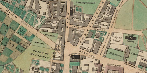
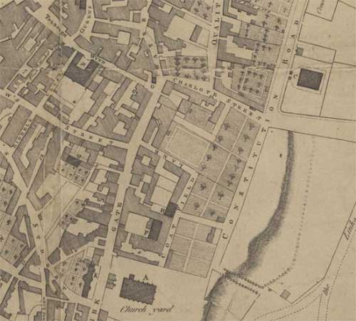
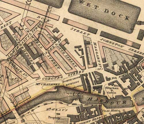
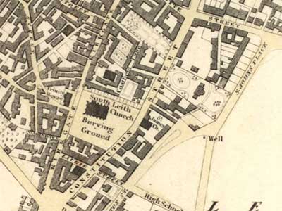
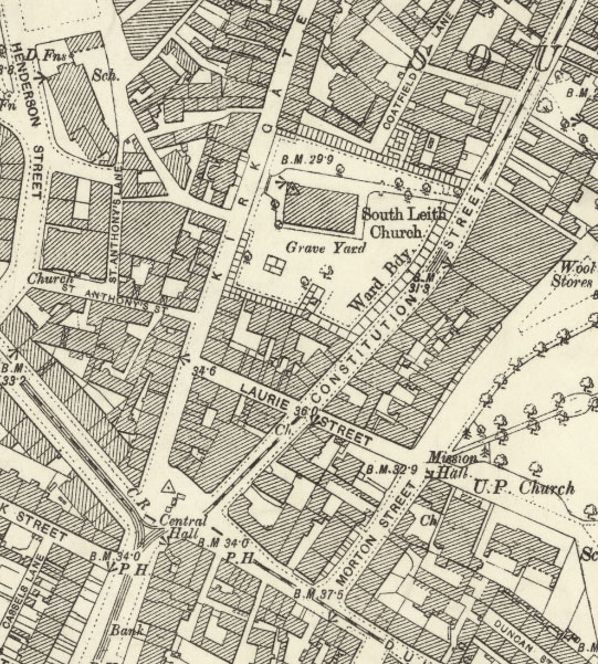
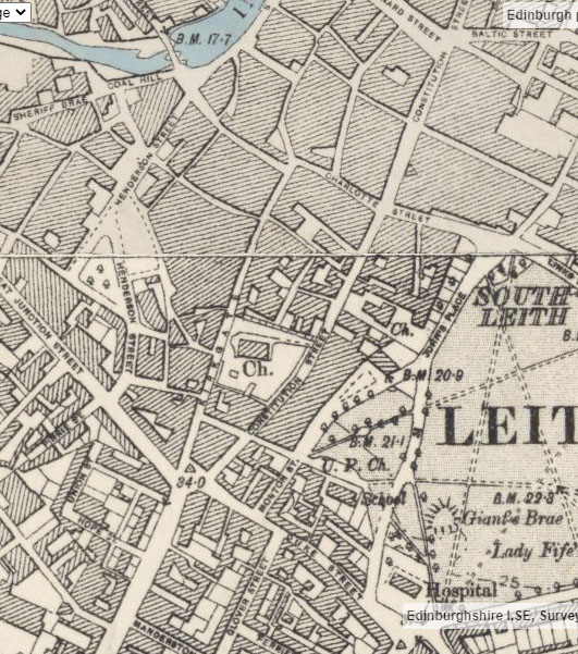
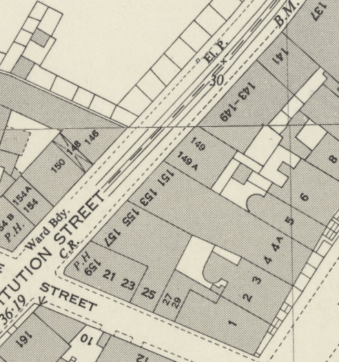
Maps are key documentary sources for researching buildings and houses. This page highlights how the Library's map collections can shed light on a building’s history as well as the area that surrounds it. All the resources on this page are freely available on the National Library of Scotland’s website. Thoughout this page, we will relate back to a case study to illustrate the uses of the various maps and map series. The case study is a tenement building in Leith, on Constitution Street.
Timeline
This page will take you through the most relevant maps for researching building and house history, arranged roughly chronologically:
- Late 16th - Mid 20th Centuries: County and Estate Maps
- 16th - 20th Centuries: Town Plans
-
- 1818-1846: John Wood's Town Plans
- 1832: Great Reform Act
- 1880s-1940s: Goad Fire Insurance Plans
- Late 18th - Mid 20th Centuries: Post Office Directory maps
- 18th - 19th Centuries: Military Maps
- 1840s-1970: Ordnance Survey Maps
-
- 1847-1895: Large Scale Town Plans
- 1840s-1940s: County Series
- 1940s-1970s: National Grid
- Recent Buildings and Map Copyright
- Further resources and reading
To use our map collections, you can search for digitised maps on our website, watch help videos, contact us or ask a question. You can also visit us by making an appointment to visit our Maps Reading Room in Edinburgh.
Quick Search
- To find all maps covering your building, go to the Map Finder - with Marker Pin viewer, and type a modern placename or street name in the 'Search places' box at the top left. You can also just zoom in on your place of interest on the map. Maps covering the place you are looking at are shown in the results on the right.
- To view all georeferenced maps covering your building, go to the Georeferenced Maps viewer, and type a modern placename or street name in the 'Search Gazetter' box at the top left. You can also type an historic name or address in the Search OS six-inch 1888-1913 names box just below. Once you have located your street or building you can then choose different dates and scales of georeferenced map using the lists in the Choose an historic map overlay panel to the lower left.
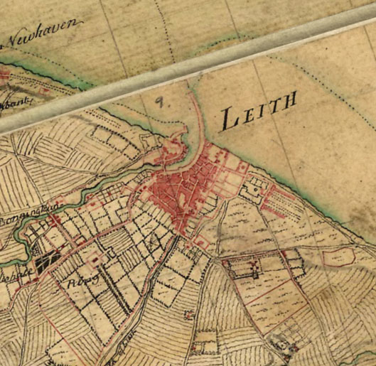
County and Estate Maps
The earliest regional or county maps of Scotland, surveyed by Timothy Pont in the late 16th century, often illustrate larger castles and tower houses, churches, mills, and other significant buildings. Further information on Pont’s depiction of towns. Blaeu’s maps, published in 1654, mostly based on Pont’s work, cover nearly all of Scotland, and are useful for showing and naming significant buildings in the rural landscape.
County maps published in the 18th and 19th centuries often provide good detail of rural buildings, including country mansions, farms, and the general pattern of buildings in settlements. You can sometimes find quite detailed depictions of larger houses and estate houses. In 1832, John Thomson's Atlas of Scotland was published, which included 58 detailed county maps, of every county in Scotland.
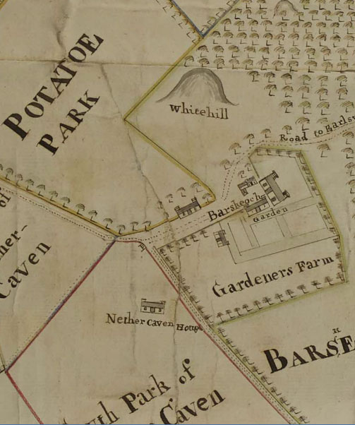
Estate mapping similarly often provides the earliest detailed depictions of rural housing. The functions or occupants of buildings are sometimes named in estate plans, including the gardener’s house, barn, mill, and ‘Pigeon House’ or dovecote/doocot.
Estate maps were associated with landscape improvement, and were often funded by landowners to plan and implement agricultural change. Parts of the Lowlands and Borders have the earliest estate maps in the mid-18th century, whilst some parts of the Highlands or the Nothern and Western Isles have their earliest estate maps in the first half of the 19th century. Reorganisation and consolidation of rural housing was a key part of the agricultural transformation, as was the development of planned villages and crofts. Estate maps often show the earliest houses in these settlements.
Town Plans
Town plans include some of the earliest and some of the most detailed maps in our collections. The size of the maps and the level of detail on town plans made it increasingly possible for these maps to show individual buildings and document their changes over time. Several even include the names of building and property owners, in addition to portraying the layout of streets and gardens. Before the Ordnance Survey mapping of the mid-19th century, these plans were usually the most detailed maps published of towns showing buildings. From the 1840s, Ordnance Survey maps may provide more detail, but other town plans by private individuals or companies were often published more regularly (for example, Post Office Directories) and show different features, so are also useful to consult.
Town plans, as for other maps, are never a simple facsimile of the townscape. Often, mapmakers chose to only include buildings above a certain size, and ignore those that were small or considered "temporary". Many town plans were not based on an original survey, but copied from earlier maps, and their creators may not have included updated building details to reflect what was there on the ground. In other cases, map-makers may have shown anticipated or planned developments, but did not always clearly distinguish these planned developments from buildings already there. It is always useful to consider who made the town plan, their sources of information, their purpose and their intended audiences, as well as other written sources (if available), to assess how far to trust details shown on the plans.
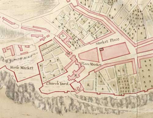
John Wood's Town Plans
John Wood's Town Plans are clear, large-scale plans of over fifty towns in Scotland, most of them surveyed between 1818 and 1826. For several smaller towns, these are the earliest detailed town plans. These are useful if your property is central in one of the towns that was mapped. Wood's Descriptive account of the principal towns in Scotland (1828), accompanied his Town Atlas of Scotland published in the same year, and contains informative descriptions of the 48 Scottish towns included in the Town Atlas.
John Wood (c.1780–1847) was the most significant surveyor of British towns in the early nineteenth century, drawing maps of at least 148 towns in Britain between 1818 and 1846. In a few cases, Wood's plans are based on the work of earlier map makers, who are usually clearly credited in the map title, but more often he undertook his own original survey. In some cases too, Wood's maps also include the names of proprietors of houses - for example, John Wood's Plan of Dalkeith (1822).
Great Reform Act, 1832 - plans and reports
Detailed maps and reports of 75 towns in Scotland were created for the purposes of implementing the Great Reform Act (Scotland), 1832. These are not as detailed as Wood’s plans in terms of individual houses/buildings, but they have valuable accompanying written textual reports on each town. The reports include information such as number of houses in the town, population, and qualitative information about the town.

Goad Fire Insurance Plans
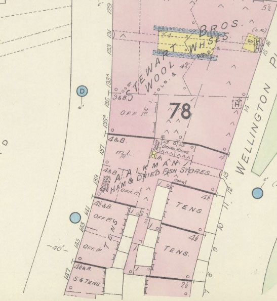
The Charles Goad Fire Insurance Plans of Scottish Towns were surveyed from the 1880s-1940s. They provide detailed information used to assess the fire risk of urban buildings. They are particularly useful for showing the function of each building, and often the names of particular companies or institutions there. They are very detailed, and are most useful for building history of commercial buildings. Unfortunately these plans only cover Edinburgh, Leith, Glasgow, Dundee, Paisley, Greenock, and Campbeltown.
Unlike Ordnance Survey maps, Goad plans are useful for including underground features such as basements and cellars in buildings. They also include the number of windows in rooms, distinguish wooden walls (in yellow) from those built of brick or stone (in red), and at the top of the building show detail such as skylights or glass roofs.
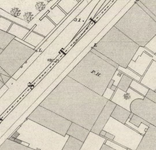
Post Office Directory maps
Post Office Directories and their maps are uniquely useful urban history sources from the late 18th through to the mid 20th centuries. Over time, particularly from the 1830s, Post Office Directories included an alphabetical list of personal names and addresses; a list by ordered street and house number; and a commercial trade listing, often with useful supplementary information and advertisements. Edinburgh and Glasgow's Directories were first published from the late 18th century; those for Aberdeen, Dundee, and Perth from the 1820s-1840s. Directories for many smaller towns were first published in the later 19th century.
Street maps were increasingly regarded as an essential component in the Directories as time went by. These maps were often at a scale of Six-Inches to the Mile (1:10,560), a scale that allowed streets and building blocks to be seen, but not individual buildings. However, as the Directory companies funded the compilation of revised new maps on an annual basis, Post Office Directory maps can show specific road and building updates between years, in contrast to Ordnance Survey maps, which were only revised at intervals of 10 to 30 years or longer.
- View Scottish Post Office directories
- View Post Office Directory maps in our Town Plans listings or map interface.
Military Maps
These are maps and plans that were created for military purposes, such as troop movements, battle layouts, or military infrastructure. More information on military mapping (18th-19th centuries).
The Roy Military Survey (1747-1755) covered all of mainland Scotland, clearly showing built structures such as houses in red. While the numbers of red dots do not accurately show the number of real buildings on the ground, their overall patterns and arrangements often do usefully reflect the mid-18th century landscape. Although William Roy described the map as a 'magnificent military sketch, [rather] than a very accurate map of the country', features of interest to an army commander, including farms, villages and hamlets, are often remarkably accurate.
The Roy Military Survey, and other military mapping, can sometimes be the earliest mapping we have of more rural areas showing buildings.
The earliest detailed maps of several towns in Scotland, including Fort William, Inverness, Perth, Stirling were made for military purposes. Sometimes plans made to assist with the construction of military roads (1720s-1760s) show houses, farms and related buildings along the route of the road.
Ordnance Survey Maps
Timeline of OS mapping:
- 1840s-1880s: The Ordnance Survey first mapped Scotland comprehensively at detailed scales. England and Wales were first mapped at detailed scales from the 1850s to the 1890s.
- 1890-1910: All detailed OS maps all areas of England, Scotland and Wales were revised comprehensively.
- 1920s-early 1940s: Urban areas undergoing more change had regular revisions of detailed mapping, whilst many rural areas were not mapped.
- Ordnance Survey mapped county by county, and the detailed pre-Second World War maps are often referred to as the County Series. From the Second World War onwards, the Ordnance Survey started surveying new maps for all areas, although it would be half a century before all areas were surveyed. These later detailed maps published from the 1940s are often called the National Grid Series.
Ordnance Survey had a specific responsibility to show public buildings distinctively and/or name them. In 1888, "public buildings" were definted as: almshouse, assembly room, asylum, athenaeum, auction mart, aquarium, bank, barrack, bath, bridewell, cathedral, church, chapel, club, college, coastguard station, court of law, custom house, dispensary, dock building, drill hall, exchange, fire station, gymnasium, hall, hospital, infirmary, library, literary and scientific institute, local government board office, market house, monument, municipal building / office, museum, palace, police station, post office, prison, public office, railway station, reading room, school, skating rink, theatre, wash house, water work, workhouse. You can view some of these on our Map of Public Buildings in Great Britain 1900s demonstration viewer.
Find and compare Ordnance Survey maps
- Find all Ordnance Survey maps for a place in our Map Finder - with Marker Pin viewer. Type a modern placename or street name in the 'Search places' box at the top left. You can also just zoom in on your place of interest on the map. Ordnance Survey maps covering the place you are looking at are shown in the results on the right.
- Compare different dates of Ordnance Survey maps in our Side-by-side viewer. Open the Search Panel at the top left and type a modern placename or street name, or zoom in on the map. You can then choose different dates and types of map for display using the drop-down lists above each map.
Ordnance Survey Large Scale Town Plans
Ordnance Survey town plans are at a scale of either 1:500 (10 Feet to the Mile) or 1:1056 (Five Feet to the Mile); they are the most detailed maps ever surveyed by Ordnance Survey. These very detailed urban town plans cover all settlements with more than 4,000 inhabitants. They were surveyed from 1847-1895, and some more populous towns were surveyed more than once during this time.
The large scale town plans show walls and other divisions between all buildings, including tenements. The maps also show the ground floor layout of public buildings, such as cathedrals, churches, schools, poorhouses, prisons, and town halls. Due to the interest in public sanitation that provided the rationale for the maps, buildings of sanitary interest such as privies, taps, cow houses, cess pits, brew and bake houses, cart sheds and stables, as well as beer houses are shown.
Many of the 1:500 town plans were hand coloured, showing different types of building construction. Brick or stone buildings were coloured in red whilst metal or wooden buildings were coloured grey. Other colours and symbols indicated glass, roofed alleyways, interior building features and types of wall.
- View OS Town Plans of Scotland and Further information
- View OS Town Plans of England and Wales and Further information
- Symbols and colours on OS Town Plans
Ordnance Survey County Series maps
OS 25 inch to the mile maps
The Ordnance Survey 25 inch to the mile series (1:2,500 scale) is the most detailed OS mapping for all the inhabited areas of Britain from 1855 to the Second World War. There are two editions of these maps for all areas that were mapped (1850s-1880s and 1890s-1900s). After these editions, urban areas or places undergoing more rapid change were surveyed again. The maps cover all towns, villages and cultivated rural areas, which for Scotland comprises over a third of the total land area.
The 25 inch scale is an excellent scale for exploring buildings as they are shown clearly, with the division between each building clearly demarcated. Divisions are also shown between buildings of a different character (for example, between a residential house and an outbuilding). The maps also provide detail of features like glass roofs and closes. The immediate surroundings, including roads, gardens, trees, railways or industrial premises are also clearly shown.
On the first edition of the 25 inch maps (1850s-1880s), brick or stone buildings were coloured in carmine / red whilst metal or wooden buildings were coloured in grey. Sometimes glass buildings like greenhouses or skylights were coloured in blue.
- Search for all OS 25 inch maps in our Map Finder - with Outlines viewer.
- Further information about OS 25 Inch to the Mile Maps of Scotland.
- Further information about OS 25 Inch to the Mile Maps of England and Wales.
OS Six-inch to the mile maps
The Ordnance Survey Six-inch maps (1{10,560 scale) cover the whole of Britain including rural and uninhabited areas, dating from the 1840s to the Second World War. The OS six-inch maps record practically all man-made and natural features in the landscape, including nearly all buildings. These maps are useful for rural buildings in less inhabited areas, such as farms, hamlets, or cottages. However, in more settled areas, more detailed maps at 25 inch to the mile or the OS Town plans are more useful for buildings.
- Search for all OS Six-inch maps in our Map Finder - with Outlines viewer.
- Further information about OS 6 Inch to the Mile Maps of Scotland, first edition (1843-1882).
- Further information about OS 6 Inch to the Mile Maps of Scotland, second and later editions (1892-1960).
- Further information about OS 6 Inch to the Mile Maps of England and Wales.
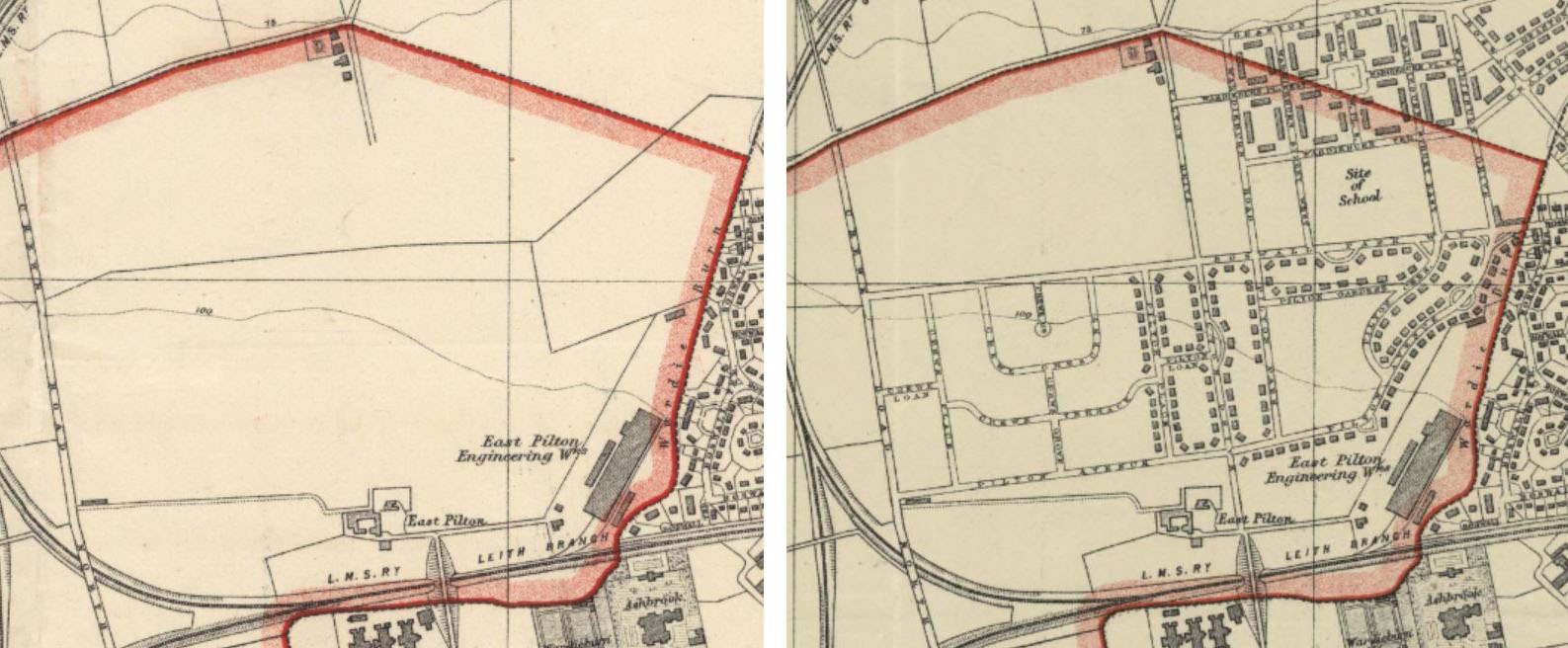
Ordnance Survey National Grid maps - 1:1,250 and 1:2,500
The OS 1:1,250 mapping is the most detailed Ordnance Survey series after the Second World War for urban areas with more than about 20,000 inhabitants, from the 1940s to the present. These maps are the earliest maps to show house numbers comprehensively. Whilst not every building has a number (to avoid overcrowding on the map), enough house numbers are always shown so that a house number for every building can always be inferred. The maps also show excellent detail of related features such as railways, pavements, streets and street names, parkland and trees, paths, spot heights, and all administrative urban boundaries to scale.
The OS 1:2,500 mapping is the most detailed OS series for all inhabited areas and cultivated areas after the Second World War. It is excellent for smaller towns, villages, and rural areas without 1:1,250 coverage.
These OS National Grid maps were placed under continuous revision from their inception in the 1940s. What this means is that new editions of each map were published when there had been sufficient change on the ground to warrant a new edition for that sheet. For many urban areas undergoing more change, there are therefore successive editions of the same sheet over time, which are extremely useful for documenting changes on the ground over the decades.
We have scanned and put online all our out-of-copyright OS National Grid maps at 1:1,250, 1:2,500 and 1:10,560 scales for all of England, Scotland and Wales.
- Search for all OS National Grid maps in our Map Finder - with Outlines viewer.
- OS National Grid maps, 1940s-1970s home page.
- Read further information about National Grid maps.
Ordnance Survey abbreviations – alphabetical list of standard OS abbreviations.
Buildings in the last 50-70 years and map copyright
Due to copyright regulations, we are not permitted to put online most maps published in the last 50-70 years that are in copyright. More information about Copyright.
In-copyright maps can be consulted in our Maps Reading Room. We can also provide copies of in copyright OS maps, with the addition of a royalty fee.
We have detailed annual snapshots of Ordnance Survey’s most detailed mapping for the United Kingdom from 1998 to the present day which can be freely consulted in our Maps Reading Room. Further information on Ordnance Survey digital mapping. In our Maps Reading Room you can also view other recent spatial datasets relating to buildings, including the GeoInformation Group's UK Buildings mapping, as well as maps of listed buildings from Historic Environment Scotland and Historic England. See our Non-Print Legal Deposit of Mapping page for further information.
Our Side-by-Side viewer and Georeferenced Maps viewer have integrated modern ESRI/Bing satellite imagery and ESRI / OpenStreetMap layers for comparing modern buildings to those on historic maps. Our Edinburgh Boundaries viewer shows an interactive, colour-coded map showing the approximate dates of construction of buildings in central Edinburgh up to 1920.
We hope you have found some of this information new and useful. If you have further suggestions or comments, please do contact us at maps@nls.uk.
Further Resources
Digital Gallery - Scottish Places
The Library's Digital Gallery has images from a selection of resources, including books, views, films, photographs, and postcards relating to places in Scotland, and many of these contain information or show images about houses / buildings.
Gazetteers
A Gazetteer is a geographical encyclopaedia. They provide information on towns, villages, geological features, and more. On the Library's digital gallery, we have Scottish gazetteers from 1803 – 1901. These descriptive gazetteers are useful for contextual information on places. They often include lengthy descriptions about towns and cities, with details of their physical and human geography, as well as economic, administrative and statistical data. As such, they form a written complement to detailed maps and atlases, and some of these gazetteers were specifically intended to complement cartographic works.
Post Office Directories
With their alphabetical list of a location's inhabitants and information on their profession and address, the Scottish Post Office directories enable you easily to find out where people lived at a certain time and how they earned their living. All of the Post Office Directory maps are searchable in our Town Plans listings and map interface.
ScotlandsPlaces
ScotlandsPlaces includes useful digitised resources relating to landscape and place from Historic Environment Scotland, the National Library of Scotland, and the National Records of Scotland. The Ordnance Survey Name Books provide information on the form of names chosen for inclusion on OS maps, along with some notes about specific buildings and topography.
ScotLIS - Scotland's Land Information Service
The Registers of Scotland's ScotLIS portal lets you search for current property owners and property prices in Scotland. You can also check to see if a property is on the land register, and purchase property documents.
Valuation Rolls
Valuation rolls are records of property ownership compiled for collecting local taxation. You can find more information, and access records online, at ScotlandsPeople.
Further Reading
General works
- Ian C. Cunningham (ed), The Nation Survey’d: Essays on Late Sixteenth Century Scotland as Depicted by Timothy Pont (East Linton: Tuckwell Press in association with the National Library of Scotland, 2001).
Chapter 8 by Pat Dennison focuses on Pont's depiction of towns. - Christopher Fleet, Margaret Wilkes, and Charles W J Withers, Scotland: Mapping the Nation' (Edinburgh:
Birlinn, in association with the National Library of Scotland, 2011).
Chapter 5 on 'Towns and urban life' and Chapter 6 on 'The Changing Countryside' are most relevant for maps showing buildings. - Christopher Fleet, Margaret Wilkes, and Charles W J Withers, Scotland: Mapping the Islands (Edinburgh:
Birlinn, in association with the National Library of Scotland, 2016).
Chapter 5 on 'Defending', Chapter 6 on 'Exploiting' and Chapter 7 on 'Improving' include maps of settlements in the Western and Northern Isles. - Rosemary Gibson, The Scottish Countryside: Its Changing Face,
1700–2000' (Edinburgh: John Donald in
association with the National Archives of Scotland, 2007).
This beautifully illustrated volume on estate maps in the National Records of Scotland, includes sections on Homes and Gardens, Rural Housing, Planned Villages and Land Settlement. - David Smith, Maps and plans for the local historian and collector: A guide to the types of maps of the British Isles produced before 1914', (London: Batsford, 1988).
Towns
- Brian Robson, 'John Wood 1: The Undervalued Cartographer', and 'John Wood 2: Planning and Paying for his Town Plans', Cartographic Journal 51 (2014), 257–86.
- Roger J.P. Kain and Richard Oliver, British Town Maps: a history (London: British Library, 2015).
See also their related Catalogue of British Town Maps which provides details of 8,000 maps of British towns held in public libraries and archives. - D.G. Moir (ed), The Early Maps of Scotland, Volume 2 (Edinburgh: Royal Scottish Geographical Society, 1983)
Although dated, this includes useful listings of county maps and town plans in Scotland.
Edinburgh
- Christopher Fleet and Daniel MacCannell, Edinburgh: Mapping the City' (Edinburgh: Birlinn, in association with the National Library of Scotland, 2014).
Examines 71 maps, dating from around 1530 to the present day, that illustrate particular themes and places in Edinburgh's history. - William Cowan and Harry R.G. Inglis, ‘The early views and maps of Edinburgh’, Scottish Geographical Magazine 35 (1919), 315–30; and a later revision and expansion by W. Cowan, The Maps of Edinburgh, 1544–1929, 2nd ed., revised by C.B. Boog Watson (Edinburgh: Edinburgh Public Libraries, 1932).
Glasgow
- John Moore, Glasgow: Mapping the City,
(Edinburgh: Birlinn, in association with the National Library of
Scotland, and University of Glasgow Library, 2015).
A selection of over 60 maps, plans and other images of Glasgow, dating from the late 16th century to the present, highlighting significant elements of the city's story. - John Moore, The Maps of Glasgow: A History and Cartobibliography to 1865 (Glasgow: Glasgow University Library, 1996).
Perth
- Jeremy Duncan, ‘The early maps of Perth, 1715 to 1902’, Journal of the Perthshire Society of Natural Science 18 (2010), 10–54.
Views
- E. Pat Dennison et al., Painting the town: Scottish urban history in art, (Edinburgh: Society of Antiquaries of Scotland, 2013).
Over 200 paintings, engravings, sketches, views and maps of 80 towns, together with expert commentary, offer a unique insight into the changing lifestyle and townscapes of Scotland.
Ordnance Survey
- Charles Close Society's Sheetlines Journal and Archive.
- Chris Higley, Old Series to Explorer: A Field Guide to the Ordnance Map' (London: Charles Close Society, 2011).
- Richard Oliver Ordnance Survey Maps: a concise guide for historians (London: Charles Close Society, 2013).
- W.A. Seymour, A history of the Ordnance Survey' (London: Dawson, 1970). Available online.
We hope you have found some of this information new and useful. If you have further suggestions or comments, please do contact us at maps@nls.uk.
View our other Research guides.