|
|
| [1573] facsimile 1830 - R.H. NIMMO - Facsimile of a plan of the siege of the castle of Edinburgh, May 1573 |
| [ca.1582] - Georg BRAUN & Franz HOGENBERG - Edenburgum, Scotiae Metropolis. |
| [ca.1582] - Georg BRAUN & Franz HOGENBERG - Edenburg. (Edenburgum Scotiae Metropolis) - uncoloured |
| [ca. 1582] - Georg BRAUN - Edenburg. (Edenburgum Scotiae Metropolis) - uncoloured |
| [ca.1582, published 1657] - Johannes JANSSONIUS - Edenburgum vulgo Edenburg. |
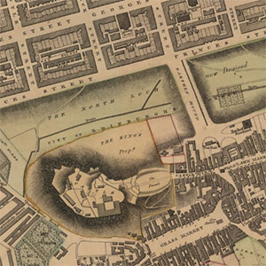
| [ca.1582, published 1817] - Robert KIRKWOOD - Edenburgum Scotiae Metropolis. |
| 1592 - Francesco VALEGIO - Edenburgum Scotiae metropolis. |
| 1592 - Francesco VALEGIO - Edenburgum Scotiae metropolis. |
| 1592 - Francesco VALEGIO - Edenburgum Scotiae metropolis. |
|
|
|
1600
|
|
| 1629 - Daniel MEISNER - Edenburck in Schottl. |
| 1631 - Daniel MEISNER - Edenburck in Schottl. |
| 1631 - Daniel MEISNER - Edenburck in Schottl. |
| 1631 - Daniel MEISNER - Edenburck in Schottl. |
| 1631 - Edenburck in Schottl. |
| [1647] - James GORDON - Viro Amplissimo D. Archibaldo Todo... |
| [1647, published 1729] - James GORDON - Plan de la Ville d'Edenbourg, capitale d'Ecosse / (by James Gordon). |
| [1647, published 1865] - James GORDON - Viro amplissimo D. Archibaldo Todo ... hanc novam Civitatis Regiae ... |
| [1647, published 1865] - James GORDON - Viro amplissimo D. Archibaldo Todo ... hanc novam Civitatis Regiae ... |
| [1647, published 1870] - James GORDON - Bird's eye view of Edinburgh in 1647 |
| 1649 - Edynburgum. |
| [1649] - Benjamin WRIGHT - Alata castra Scotiae : regia urbs et metrolis vulgo Edinburgum |
| 1661 - Rotgerus HERNNANIDES - Edenborrow. Edenburgum. |
| ca. 1680 - James GORDON - Castrum Edinense quod olim Arx Puellarum = The castell of Edinborrowgh from the west porte |
| 1683 - Edimbourg. |
| 1683 - Allain MANESSON-MALLET - Edimbourg. |
| 1684 - Allain MANESSON-MALLET - Edimbourg. |
| 1693 - John SLEZER - The Southside of the Castle of Edinburgh - on Slezer website |
| ca. 1710 - John SLEZER - The Prospect of Edinbrugh from Ye Dean - on Slezer website |
| 1693 - John SLEZER - The North East View of Edinburgh Castle - on Slezer website |
| 1693 - John SLEZER - The North Prospect of the City of Edenburgh - on Slezer website |
| 1693, published 1850 - William MALLOCH - Edinburgh from the Calton Hill in the reign of Queen Anne. From the original print ... |
| 1698 - Johann Jacob HOFMANN - Edenborrow. Edenburgum. |
| [ca.1709-1755] - Board of Ordnance plans - on Military Maps of Scotland website |
|
|
|
1700
|
|
| 1702 - John SLEZER - The north prospect of the city of Edenburgh |
| ca. 1709-94 - BOARD OF ORDNANCE - Edinburgh Castle plans (on Military Maps of Scotland website) |
| ca. 1730? - Profil of the Earth's surface along the course of the great pipe from the Fountainhead at Commistown to the reservoir on the Castle-Hill, Edinburgh. |
| 1742 - William EDGAR - The plan of the city and castle of Edinburgh - (uncoloured first edition) |
| 1759 - Richard COOPER - A plan of the city of Edinburgh with the adjacent grounds |
| 1764 - A plan of the city and castle of Edinburg. |
| 1765 - William EDGAR - Plan of the city and castle of Edinburgh - coloured copy |
| 1765 - William EDGAR - Plan of the city and castle of Edinburgh - uncoloured copy |
| 1765 - William EDGAR - The plan of the city and castle of Edinburgh - uncoloured copy |
| 1765 - William EDGAR - The plan of the city and castle of Edinburgh - uncoloured copy |
| 1765 - William EDGAR - The plan of the city and castle of Edinburgh - uncoloured copy |
| 1765 - William EDGAR - The plan of the city and castle of Edinburgh - uncoloured copy |
| 1765 - William EDGAR - The plan of the city and castle of Edinburgh - uncoloured copy |
| 1768 - James CRAIG - ...this Plan of the new streets and squares, intended for his ancient capital of North-Britain... |
| 1769 - Perspective View of the Castle and City of Edinburgh, with the Towns of Leith, Burnt Island & Kinghorn. |
| 1771 - Plan of the city of Edinburgh. |
| 1773 - Inset on: Andrew & Mostyn ARMSTRONG - Map of the three Lothians. |
| 1773 - Andrew BELL - A plan of the city of Edinburgh, with all the new streets, avenues, buildings, squares, courts &c within & round the city, since 1741 till this present year 1773 |
| 1773 - William FADEN - General plan of the city, castle and suburbs of Edinburgh. |
| 1778 - John AINSLIE - To the right honourable James Stewart Mackenzie, Lord Privy Seal of Scotland ... this map of the environs of Edinburgh ... |
| 1778 - Plan of the city, castle and suburbs of Edinburgh. |
| 1779 - John LESSLIE - A plan of the North Loch and other Grounds belonging to the City of Edinburgh |
| [1780] - John AINSLIE - City of Edinburgh. |
| [1780] - John AINSLIE - City of Edinburgh - later state |
| [1780-85] / 1932 - Thomas MACRAE - Plan no. 3A Edinburgh 1780-1932. [The environs of South Bridge] from plans ... of ... 1780 and ... 1785 upon which are superimposed streets and buildings as in 1932 |
| 1784 - Alexander KINCAID - A plan of the city and suburbs of Edinburgh. |
| 1784 - Alexander KINCAID - A plan of the city and suburbs of Edinburgh from actual surveys |
| 1787 - Daniel LIZARS - Plan of the city of Edinburgh old & new with the late extended improvements, 1787 |
| 1790 - Robert BARKER - [Panorama of Edinburgh from the Calton Hill] |
| 1793 - Thomas BROWN and James WATSON - ...plan of the city including all the latest improvements. |
| 1793 - Thomas BROWN and James WATSON - ...plan of the city including all the latest improvements. |
| 1794-95 - Plan of Edinburgh City and Suburbs |
| 1794-95 - Plan of Leith eng'd for Aitchison's Directory |
| 1795 - A. WILSON - View of Edinburgh from the North West. |
| 1797 - Frederick de WIT - The plan of Edenburgh exactly done from the original of ye famous D. Wit. |
|
|
|
1800
|
|
| 1804 - John AINSLIE - Old and New Town of Edinburgh and Leith with the proposed docks. |
| 1804 - John AINSLIE - Old and New Town of Edinburgh and Leith with the proposed docks. |
| 1804 - John AINSLIE - Old and New Town of Edinburgh and Leith with the proposed docks. |
| 1805 - The Strangers Guide, being a Plan of Edinburgh & Leith... |
| 1807 - POST OFFICE - plan of the city of Edinburgh.... |
| ca. 1807-8 - To the honourable the magistrates of Leith This plan of the City Harbour Wet Dock and other improvements |
| ca. 1808-9 - This Plan of the City of Edinburgh |
| ca. 1808-9 - To the honourable the magistrates of Leith, this plan of the City Harbour Wet Dock and other improvements. |
| 1809 - - Thomas BROWN and James WATSON - A new plan of the city of Edinburgh including all the latest & intended improvements |
| ca. 1809-10 - To the Honorable The Magistrates of Leith, This Plan of the City Harbour Wet Dock and other Improvements |
| 1811 - John LAURIE - A plan of Edinburgh and the country adjacent ... |
| 1812 - Inset on: James KNOX - Map of the shire of Edinburgh. |
| 1813 - John MASON - Plan of the regality of Canongate ... |
| [ca.1814] - James GORDON & Frederik de WIT - The Plan of Edinburgh, exactly done... |
| [1817] - Robert KIRKWOOD - An Ancient Plan of the City of Edinburgh and its Environs... |
| 1817 - Robert KIRKWOOD - This plan of the City of Edinburgh and its environs. |
| 1817 - Robert KIRKWOOD - This plan of the City of Edinburgh and its environs |
| 1817 - Robert KIRKWOOD - This plan of the City of Edinburgh and its environs |
| 1817 - Robert KIRKWOOD - A map of the environs of Edinburgh |
| 1818 - J. ARCHER - A new plan of the City of Edinburgh : including all the latest & intended improvements. |
| 1819 - Robert KIRKWOOD - Plan & elevation of the New Town of Edinburgh. |
| 1819 - Robert KIRKWOOD - Kirkwood's plan & elevation of the new town of Edinburgh. |
| 1819 - Robert KIRKWOOD - Kirkwood's plan & elevation of the new town of Edinburgh. |
| 1820 - William DASSAUVILLE - Plan of Edinburgh and strangers guide |
| 1820 - Charles THOMSON - Plan of the city of Edinburgh including all the latest and intended improvements... |
| 1821 - James KIRKWOOD & Sons - Kirkwood's new plan of the City of Edinburgh. |
| 1821 - James KNOX - Plan of Edinburgh and its environs |
| 1822 - Robert SCOTT - Plan of Edinburgh & Leith. Exhibiting all the present & intended improvements. |
| 1822 - James KNOX - Plan of Edinburgh and its environs |
| 1822 - James KNOX - Plan of Edinburgh and its environs |
| 1823 - James KIRKWOOD & Sons - Kirkwood's new plan of the city of Edinburgh, 1823. |
| 1823 - John WOOD - Plan of the City of Edinburgh, including all the latest and intended improvements. |
| 1824 - W. MURPHY - Plan of the vicinity of Ediburgh. |
| 1824 - James KNOX - Plan of Edinburgh and its environs |
| 1824 - David CRAWFORD - Sketch of the City of Edinburgh and Leith. |
| 1825 - James KNOX - Plan of Edinburgh and its environs |
| 1825 - John LOTHIAN - Lothian's plan of the city of Edinburgh and its vicinity. |
| 1826 - John BARTHOLOMEW - Plan of Edinburgh drawn & engraved for the General Post Office Directory. |
| ca. 1826-28 - William Home LIZARS - Edinburgh drawn & engraved for the General Post Office Directory |
| ca. 1827-28 - William Home LIZARS - Edinburgh drawn & engraved for the General Post Office Directory |
| 1828 - Charles THOMSON - Hamilton's plan of the city of Edinburgh and its vicinity, 1828 |
| 1828 - W.H. HUNTER - Plan of Edinburgh & Leith exhibiting all the present & intended improvements, etc. |
| 1829 - Claud SHAW / George BARTHOLOMEW - Lothian's plan of the city of Edinburgh and its vicinity: adapted to illustrate the antiquities as well as the present state and intended improvements of the city... |
| ca. 1830-31 - William Home LIZARS - Edinburgh drawn & engraved for the General Post Office Directory |
| 1831 - W & A.K. JOHNSTON - Copy on a reduced scale of the plan lodged with the clerk of the Parliaments ... in reference to the Edinburgh Improvement Bill |
| 1831 - John WOOD - Plan of the City of Edinburgh, including all the latest and intended improvements. |
| ca. 1831-32 - C. THOMSON - Edinburgh drawn & engraved for the General Post Office Directory |
| 1832 - Great Reform Act - Edinburgh and Leith |
| 1832 - James GARDNER - Edinburgh & Leith [showing proposed boundaries for the Great Reform Act] |
| ca. 1832-33 - William Home LIZARS - Plan of Edinburgh Drawn & Engraved for the General Post Office Directory. Inlcuding: Plan of Leith. |
| 1833 - W. & A. K. Johnston - The city of Edinburgh. Drawn and engraved for Gray's Annual Directory |
| ca. 1833-34 - William Home LIZARS - Plan of Edinburgh Drawn & Engraved for the General Post Office Directory |
| 1834 - W.B. CLARKE - Edinburgh : Reduced under the superintendence of the Society for the Diffusion of Useful Knowledge |
| 1834 - W.B. CLARKE - Edinburgh : Reduced under the superintendence of the Society for the Diffusion of Useful Knowledge |
| 1834 - JOHNSTON - Pollock's plan of Edinburgh, Leith & suburbs |
| 1834 - W & A.K. JOHNSTON - The city of Edinburgh |
| 1834 - W & A.K. JOHNSTON - Pollock's plan of Edinburgh, Leith & suburbs; engraven, to accompany Pollock's new guide through Edinburgh |
| 1834 - William Home LIZARS - Plan of Edinburgh and Leith |
| 1835 - William Home LIZARS - Plan of Edinburgh and Leith |
| 1836 - William Home LIZARS - Plan of Edinburgh and Leith |
| 1836 - James KAY - Kay's plan of Edinburgh. |
| 1837 - Robert STEVENSON & Son - The City of Edinburgh. |
| 1837 - JOHNSTON - City of Edinburgh |
| [1837] - William MOFFAT - To the Noblemen and Gentlemen of the Highland and Agricultural Society of Scotland, this geometrical and geological landscape... from ... Leith to ... Edinburgh. |
| [1837] - William MOFFAT - To the Noblemen and Gentlemen of the Highland & Agricultural Society of Scotland this Geometrical & Geological Landscape ... is ... / dedicated by... William Moffat ; (Engd. by W.H. Lizars). |
| [1837] - William MOFFAT - To the noblemen and gentlemen of the Highland & Agricultural Society of Scotland this geometrical & geological landscape ... |
| 1837 - William HUNTER - Hunter's plan of the city of Edinburgh and its vicinity including the intended improvements corrected to 1st May 1837. |
| ca. 1837-38 - William Home LIZARS - Plan of Edinburgh and Leith |
| ca. 1838-39 - William Home LIZARS - Plan of Edinburgh and Leith |
| ca. 1839-40 - William Home LIZARS - Plan of Edinburgh and Leith |
| 1840 - JOHNSTON - Plan of Edinburgh, Leith & Suburbs (showing the division of the city into 27 divisions in terms of "Great Post Office Reform, 1840"). |
| ca. 1840-41 - William Home LIZARS - Plan of Edinburgh and Leith |
| ca. 1841-42 - William Home LIZARS - Plan of Edinburgh and Leith |
| ca. 1842 - William Home LIZARS - Plan of Edinburgh and Leith |
| 1843 - William NIXON - Plan of Holyrood Park shewing the proposed new lines of road |
| 1843 - Robert SCOTT - Plans of Edinburgh in the past and present, with its chronology |
| ca. 1843-44 - William Home LIZARS - Plan of Edinburgh and Leith |
| 1844 - Plan von Edinburgh |
| 1845 - W.S. and J.K. MILNE - Milne's pictorial plan of Edinburgh |
| ca. 1845 - James KIRKWOOD & Sons - Plan of the city of Edinburgh with all the recent and intended improvements, lines of railway &c. |
| ca. 1846-47 - William Home LIZARS - Plan of Edinburgh and Leith |
| 1847 - - Edinburgh. A complete view of the city & environs, as seen in a walk round the Calton Hill. |
| ca. 1847-48 - William Home LIZARS - Plan of Edinburgh and Leith |
| ca. 1848-49 - William Home LIZARS - Plan of Edinburgh and Leith |
| 1849-53 - ORDNANCE SURVEY - Large Scale Town Plan - 54 sheets |
| ca. 1849-50 - William Home LIZARS - Plan of Edinburgh and Leith |
| 1850 - Alfred LANCEFIELD - Johnston's plan of the City of Edinburgh. |
| ca. 1850 - W & A.K. JOHNSTON - Plan of Edinburgh, Leith & Suburbs |
| 1851 - Robert KIRKWOOD - Plan of the city of Edinburgh and town of Leith with their environs. Shewing all the recent & intended improvements, lines of railway, &c. |
| 1851 - Alfred LANCEFIELD - Johnston's plan of Edinburgh & Leith. |
| ca. 1850-51 - William Home LIZARS - Plan of Edinburgh and Leith |
| ca. 1851-52 - William Home LIZARS - Plan of Edinburgh and Leith |
| 1850 - Alfred LANCEFIELD - Johnston's plan of the City of Edinburgh. |
| 1852 - William Home LIZARS - Plan of Edinburgh |
| ca. 1852-53 - William Home LIZARS - Plan of Edinburgh and Leith |
| 1854 - J. RAPKIN - Edinburgh |
| ca. 1854-55 - William Home LIZARS - Plan of Edinburgh and Leith |
| ca. 1855-56 - William Home LIZARS - Plan of Edinburgh and Leith |
| 1856 - William & Alexander Keith JOHNSTON - Plan of Edinburgh, Leith & suburbs, showing the division of the city into thirteen wards in terms of the Edinburgh Municipality Extension Act, 1856. |
| ca. 1856-57 - William Home LIZARS - Plan of Edinburgh and Leith |
| ca. 1857-58 - William Home LIZARS - Plan of Edinburgh and Leith |
| ca. 1858-59 - William Home LIZARS - Plan of Edinburgh and Leith |
| ca. 1859-60 - William Home LIZARS - Plan of Edinburgh and Leith |
| 1861 - W. & A.K. JOHNSTON - Post-Office Directory Plan of Edinburgh, Leith & Suburbs |
| 1862 - W. & A.K. JOHNSTON - Post-Office Directory Plan of Edinburgh, Leith & Suburbs |
| 1863 - W. & A.K. JOHNSTON - Post-Office Directory Plan of Edinburgh, Leith & Suburbs |
| 1864 - John BARTHOLOMEW - Plan of Edinburgh & Leith with Suburbs, from Ordnance and Actual Surveys |
| 1865 - HISLOP / BARTHOLOMEW - New plan of Edinburgh and Leith with suburbs |
| 1865 - W. & A.K. JOHNSTON / H.D. LITTLEJOHN - Plan of Edinburgh, Leith & Suburbs [showing Sanitary Districts] |
| 1866 - John BARTHOLOMEW - New Plan of Edinburgh & Leith with Suburbs, from Ordnance and Actual Surveys |
| 1867 - John BARTHOLOMEW - Plan of Edinburgh & Leith with Suburbs, from Ordnance and Actual Surveys |
| 1867 - W. & A.K. JOHNSTON - Plan of Edinburgh, Leith and Suburbs |
| 1868 - John BARTHOLOMEW - Plan of Edinburgh & Leith with Suburbs, from Ordnance and Actual Surveys |
| 1868 - W. & A.K. JOHNSTON - Plan of Edinburgh, Leith and Suburbs |
| 1868 - J. SULMAN - Edinburgh. |
| 1869 - John BARTHOLOMEW - Plan of Edinburgh & Leith with Suburbs, from Ordnance and Actual Surveys |
| 1870 - John BARTHOLOMEW - Plan of Edinburgh & Leith with Suburbs, from Ordnance and Actual Surveys |
| 1871 - John BARTHOLOMEW - Plan of Edinburgh & Leith with Suburbs, from Ordnance and Actual Surveys |
| 1872 - John BARTHOLOMEW - Plan of Edinburgh & Leith with Suburbs, from Ordnance and Actual Surveys |
| 1873 - John BARTHOLOMEW - Plan of Edinburgh & Leith with Suburbs, from Ordnance and Actual Surveys |
| 1873 - John BARTHOLOMEW - Plan of Edinburgh & Leith with suburbs, from ordnance and actual surveys, constructed for the Post Office Directory. |
| 1874 - John BARTHOLOMEW - Plan of Edinburgh & Leith with Suburbs, from Ordnance and Actual Surveys |
| 1875 - John BARTHOLOMEW - Plan of Edinburgh & Leith with Suburbs, from Ordnance and Actual Surveys |
| 1876 - John BARTHOLOMEW - Plan of Edinburgh & Leith with Suburbs, from Ordnance and Actual Surveys |
| 1876 - John BARTHOLOMEW - Plan of Edinburgh & Leith with suburbs, from ordnance and actual surveys, constructed for the Post Office Directory |
| 1876-7 - ORDNANCE SURVEY - Large Scale Town Plan - 66 sheets |
| 1877 - John BARTHOLOMEW - Plan of Edinburgh & Leith with Suburbs, from Ordnance and Actual Surveys |
| 1878 - John BARTHOLOMEW - Plan of Edinburgh & Leith with Suburbs, from Ordnance and Actual Surveys |
| 1879 - John BARTHOLOMEW - Plan of Edinburgh & Leith with Suburbs, from Ordnance and Actual Surveys |
| 1879 - William & Alexander Keith JOHNSTON - Plan of Edinburgh, Leith & Suburbs...[showing the Time Gun] |
| 1879 - Portion of the city of Edinburgh showing the relative positions of W. & A.K. Johnston's New Works, Easter Road and their office, 16 South St. Andrew Street.. |
| 1880 - BARTHOLOMEW - Plan of Edinburgh & Leith with Suburbs, from Ordnance and Actual Surveys |
| 1882 - BARTHOLOMEW - Plan of Edinburgh and Leith with Suburbs |
| ca. 1883-84 - BARTHOLOMEW - Plan of Edinburgh & Leith with Suburbs, from Ordnance and Actual Surveys |
| 1884 - BARTHOLOMEW - Plan of Edinburgh & Leith with Suburbs, from Ordnance and Actual Surveys |
| 1885 - A.H. CAMPBELL - Plan of Edinburgh showing the Ancient and Extended Royalties of the City, and the several extensions of the Police and Municipal Boundaries to 1885 |
| ca. 1885 - BARTHOLOMEW - Plan of Edinburgh & Leith with Suburbs, from Ordnance and Actual Surveys |
| ca. 1885-92 - Hippolyte BLANC - Edinburgh Castle drawings (on Military Maps of Scotland website) |
| 1886-87 - BARTHOLOMEW - Plan of Edinburgh & Leith with Suburbs, from Ordnance and Actual Surveys |
| 1887-88 - BARTHOLOMEW - Plan of Edinburgh & Leith with Suburbs, from Ordnance and Actual Surveys |
| 1888 - William & Alexander Keith JOHNSTON - Johnstons' plan of Edinburgh, Leith, Portobello and environs, constructed from the latest surveys with additions by the local surveyors of these towns. |
| 1888 - W & A.K. JOHNSTON - Johnstons' plan of Edinburgh, Leith, Portobello and environs, constructed from the latest surveys with additions by the local surveyors of these towns |
| 1888-89 - BARTHOLOMEW - Plan of Edinburgh and Leith with Suburbs |
| 1889-90 - BARTHOLOMEW - Plan of Edinburgh & Leith with Suburbs, from Ordnance and Actual Surveys |
| ca. 1889-90 - William Home LIZARS - Plan of Edinburgh Drawn & Engraved for the General Post Office Directory |
| ca. 1890 - W & A.K. JOHNSTON - W. & A.K. Johnston's plan of Edinburgh. |
| 1890-91 - BARTHOLOMEW - Plan of Edinburgh & Leith with Suburbs, from Ordnance and Actual Surveys |
| 1891 - W & A.K. JOHNSTON - Johnstons' plan of Edinburgh, Leith, Portobello and environs, etc. |
| 1891 - BARTHOLOMEW - Bartholomew's Plan of the City of Edinburgh with Leith & Suburbs, reduced from the Ordnance Survey... |
| ca. 1891-92 - Plan of Edinburgh and Leith |
| 1891-92 - BARTHOLOMEW - Plan of Edinburgh and Leith with Suburbs |
| 1892 - BARTHOLOMEW / PHILIP - Map of Edinburgh showing distribution of cases of Pulmonary Tuberculosis received at the Victoria Dispensary for Consumption and Diseases of the Chest... |
| 1892-93 - BARTHOLOMEW - Plan of Edinburgh & Leith with Suburbs, from Ordnance and Actual Surveys |
| 1892-1924 - ORDNANCE SURVEY - 25 inch Map Transcriptions and Gazetteer |
| 1892-1926 - CHARLES GOAD - Fire insurance plans - 25 sheets |
| 1893-94 - ORDNANCE SURVEY - Large Scale Town Plan - 184 sheets |
| 1893-94 - ORDNANCE SURVEY - 25 inch 2nd and later editions |
| 1893-94 - BARTHOLOMEW - Plan of Edinburgh and Leith with Suburbs |
| 1893 - BARTHOLOMEW - Bartholomew's pocket plan of Edinburgh & suburbs |
| ca. 1894-95 - William Home LIZARS - Plan of Edinburgh and Leith. Engraved expressly for the Post Office Directory |
| 1895 - - Bartholomew's pocket plan of Edinburgh & suburbs, reduced from the Ordnance Survey. |
| 1895-96 - BARTHOLOMEW - Plan of Edinburgh & Leith with Suburbs |
| ca. 1896 - BARTHOLOMEW - Plan of Edinburgh & Leith, with Suburbs |
| 1897 - BARTHOLOMEW - Bartholomew's plan of Edinburgh & Leith with suburbs constructed from ordnance and actual surveys |
| 1897 - BARTHOLOMEW - Plan of Edinburgh, Leith with Suburbs, from Ordnance and Actual Surveys |
| 1898 - William SHELFORD - Waverley Station. Amended plan. Lithograph copy of the North British Railway Cos. proposed enlargement and re-arrangement of Waverley Station as amended |
| 1898 - William SHELFORD - Waverley Station. Amended plan. Lithograph copy of the North British Railway Cos. proposed enlargement and re-arrangement of Waverley Station as amended |
| 1898 - W. & A.K. JOHNSTON LIMITED. - Plan of Edinburgh, Leith and Portobello with suburbs. Constructed from ordnance and private surveys. |
| 1898-99 - W. & A.K. JOHNSTON - Post Office Plan of Edinburgh, Leith and Portobello with Suburbs |
| 1899-1900 - W. & A.K. JOHNSTON - Post Office Plan of Edinburgh, Leith with Suburbs |
|
|
|
1900
|
|
| 1900 - Plan of Edinburgh. |
| ca. 1900 - [Edinburgh and Leith, showing tramways and proposed tramway extensions] |
| 1901-2 - BARTHOLOMEW - Plan of Edinburgh and Leith with Suburbs |
| 1904-5 - W. & A.K. JOHNSTON - Post Office Plan of Edinburgh, Leith, and Portobello with Suburbs |
| 1905 - BARTHOLOMEW - Bartholomew's pocket plan of Edinburgh & suburbs, reduced from The Ordnance Survey. |
| 1905-6 - JOHNSTON - Post office plan of Edinburgh, Leith and Portobello with suburbs |
| 1905-6 - ORDNANCE SURVEY - 25 inch 2nd and later editions |
| 1907 - W & A.K. JOHNSTON - Post office plan of Edinburgh, Leith, and Portobello, with suburbs. Constructed from ordnance and private surveys |
| 1907 - BARTHOLOMEW - Plan of Edinburgh and Leith with Suburbs |
| ca. 1907 - Plan of Edinburgh |
| 1910 - W & A.K. JOHNSTON - W. & A.K. Johnston's plan of Central Edinburgh. |
| 1910-11 - W. & A.K. Johnston. - Post office plan of Edinburgh, Leith, and Portobello, with suburbs. . |
| 1910-11 - BARTHOLOMEW - Post office plan of Edinburgh, Leith, and Portobello, with suburbs |
| 1912 - BARTHOLOMEW - Plan of Edinburgh and Leith, from the Survey Atlas of Scotland |
| 1912 - BARTHOLOMEW - Plan of Edinburgh and Leith, from the Survey Atlas of Scotland |
| 1912-13 - ORDNANCE SURVEY - 25 inch 2nd and later editions |
| 1917-18 - BARTHOLOMEW - Post office plan of Edinburgh, Leith, and Portobello, with suburbs |
| 1918 - BARTHOLOMEW - Post office plan of Edinburgh, Leith, and Portobello [showing] New Parliamentary Divisions - 1918 |
| 1918-19 - BARTHOLOMEW - Post Office plan of Edinburgh, Leith, and Portobello, with suburbs |
| 1919 - John G. BARTHOLOMEW - Chronological map of Edinburgh showing expansion of the City from earliest days to the present. |
| 1919 - John G. BARTHOLOMEW - Chronological map of Edinburgh showing expansion of the city from earliest times to the present |
| 1920 - City and royal burgh of Edinburgh, 1920. Map showing the boundary of the city and royal burgh of Edinburgh and the boundaries of the municipal wards.. |
| 1920 - Edinburgh boundaries extension and tramways order 1920: Opposition by the Earl of Morton. Plan showing the present area of the Burgh of Edinburgh with the successive extensions since 1882.. |
| 1920 - Royal Mile, Edinburgh, from the castle to the palace of Holyroodhouse.. |
| 1920 - George A. REID - Pictorial map of Edinburgh and Leith. |
| 1921 - W & A.K. JOHNSTON - W. & A.K. Johnston's map of the city of Edinburgh. |
| 1921 - W & A.K. JOHNSTON - W. & A.K. Johnston's map of the city of Edinburgh. |
| 1921-22 - BARTHOLOMEW - Post Office plan of Edinburgh and Leith |
| 1923-24 - BARTHOLOMEW - Post Office plan of Edinburgh and Leith |
| 1924-25 - BARTHOLOMEW - Post Office plan of Edinburgh and Leith |
| 1925 - John BARTHOLOMEW - Post office plan of Edinburgh and Leith. |
| 1925-26 - BARTHOLOMEW - Post Office plan of Edinburgh and Leith |
| 1926 - John BARTHOLOMEW - Plan of Edinburgh drawn & engraved for the general Post Office directory |
| 1926 - Bartholomew's pocket plan of Edinburgh.. |
| 1926-27 - BARTHOLOMEW - Post Office Plan of Edinburgh and Leith |
| 1927-28 - BARTHOLOMEW - Post Office plan of Edinburgh and Leith |
| 1928-29 - BARTHOLOMEW - Post Office plan of Edinburgh and Leith |
| 1929 - BARTHOLOMEW - Post Office plan of Edinburgh and Leith |
| 1930 - [A photograph of a plan of the centre of Edinburgh.] Traced from a M.S. plan and description ... preserved in the library of Edinburgh University ... May 1930. |
| 1931 - Edinburgh Corporation Transport Department. [A map showing tramway, bus and motor coach routes in and around Edinburgh]. |
| 1931-32 - BARTHOLOMEW - Post Office plan of Edinburgh and Leith |
| 1931-32 - ORDNANCE SURVEY - 25 inch 2nd and later editions |
| 1932 - Thomas McCRAE - Plan no. 3A Edinburgh 1780-1932. [The environs of South Bridge] from plans ... of ... 1780 and ... 1785 upon which are superimposed streets and buildings as in 1932 |
| 1932 - Plan of Edinburgh. ("Geographia" large scale plan).. |
| 1932-33 - BARTHOLOMEW - Post office plan of Edinburgh, Leith, and Portobello, with suburbs |
| 1933 - Royal Botanic Garden Edinburgh.. |
| 1934 - George A. REID - Pictorial map of Edinburgh and Leith. |
| 1934-35 - BARTHOLOMEW - Post Office plan of Edinburgh and Leith, |
| 1935-36 - BARTHOLOMEW - Post Office plan of Edinburgh and Leith |
| 1935 - George A. REID - Pictorial map of Edinburgh and Leith. |
| 1936 - International Union of Geodesy and Geophysics Edinburgh 1936: map of Edinburgh.. |
| 1936-37 - BARTHOLOMEW - Post Office plan of Edinburgh and Leith |
| 1937 - Bartholomew's pocket plan of Edinburgh.. |
| 1937-38 - BARTHOLOMEW - Post Office plan of Edinburgh and Leith |
| 1938 - City of Edinburgh Transport map.. |
| 1938 - George A. REID - Pictorial map of Edinburgh and Leith. |
| 1938-39 - BARTHOLOMEW - Post Office plan of Edinburgh and Leith |
| 1939 - John BARTHOLOMEW - Post office plan of Edinburgh and Leith. |
| 1939-40 - BARTHOLOMEW - Post office plan of Edinburgh, Leith, and Portobello, with suburbs |
| 1940s-1960s - ORDNANCE SURVEY - National Grid maps |
| 1941 - WAR OFFICE - Edinburgh |
| 1941 - GERMAN ARMY - Stadtplan von Edinburgh mit Mil.-Geo.-Eintragungen. |
| 1941 - Bartholomew's pocket plan of Edinburgh.. |
| 1943-1933 - Royal Botanic Garden Edinburgh.. |
| 1944 - John BARTHOLOMEW - Bartholomew's pocket plan of Edinburgh and suburbs.. |
| 1946 - John BARTHOLOMEW - Bartholomew's pocket plan of Edinburgh. |
| 1946 - George A. REID - Pictorial map of Edinburgh and Leith. |
| 1947 - John BARTHOLOMEW - Bartholomew's pocket plan of Edinburgh.. |
| 1947 - The royal mile. |