Town Plans / Views, 1580s-1940s
| Field | Content |
|---|---|
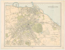
| Title: | Plan of Edinburgh and Leith. |
| Imprint: | Edinburgh : The Edinburgh Geographical Institute, [1912] |
| Pagination: | 1 map ; 392 x 520 mm. |
| Shelfmark: | Map.l.46.42 |
| Zoom Into Map: | Click on the map to view in greater detail. |
| Notes: | Scale ca. 1:18,300 Another copy of Plate 63 in The Survey Atlas of Scotland, 1912. |