Town Plans / Views, 1580s-1940s
Introduction
As well as making maps of all or part of Scotland, map-makers also portrayed Scottish towns. Town councils were often keen to have their towns mapped to enhance their political and economic status.
The earliest surviving Scottish town plans or bird's-eye views - of Edinburgh and St Andrews - date from the 1580s. The former was created for inclusion in the large European town atlas, Civitates orbis terrarum, published from 1572 by Georg Braun and Franz Hogenburg.
In 1647 James Gordon, Parson of Rothiemay, published his famous bird's-eye view of Edinburgh from the south, and he went on (in 1661) to produce a detailed plan of the old and new towns of Aberdeen. However, it was not until the late 18th century that town plans of other Scottish towns began to be created in significant numbers.
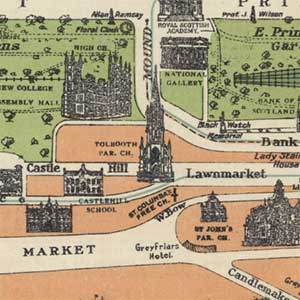
By this time, the bird's-eye view had largely been replaced by the scale map viewing the town from directly overhead. The size of the maps and the level of detail they contained increasingly made it possible for them to document the changes in cities and towns over time. Several even include the names of land and property owners, in addition to portraying the layout of streets and individual buildings. Before the Ordnance Survey mapping of the mid-19th century, these plans were usually the largest-scale maps published.
Apart from some Board of Ordnance military mapping of some Scottish towns between 1715 and 1745 (viewable on our Military Maps of Scotland website), many Scottish towns were not first mapped until the late 18th or early 19th centuries. Some of the maps of this period were by surveyors who also produced smaller-scale maps, such as William Edgar (Edinburgh, 1745) or John Ainslie (Jedburgh, 1770, Edinburgh, 1780, 1804), but many were by local land surveyors working only on detailed urban mapping. In an effort to be as up-to-date as possible, these maps often show buildings under construction, or projected development schemes that never occurred. This is particularly true of the feuing and development plans of parts of Edinburgh in the late 19th century which show the expanding urbanisation of areas such as Newington, Bellevue, Corstorphine, and Warriston.
By far the most significant surveyor of Scottish towns was John Wood, who published 50 plans of Scottish towns between 1818 and 1826. A few of these plans (such as those for Edinburgh, Leith, Glasgow, and Dundee) were based on recent town plans by other surveyors, but many were based on original surveys by Wood himself. As well as being published individually, 48 of these plans were also published in Wood's Town Atlas of Scotland (1828). For many smaller Scottish towns these are the earliest plans that were created, and in addition to showing the town at a very large scale, they often also name land and property owners. Wood was resident in Edinburgh from 1813, but spent long periods surveying English and Welsh towns in the later 1820s and 1830s. He returned to Edinburgh in the 1840s, producing maps of Kirkcudbright, Stranraer and Airdrie before his death in 1847.