Great Reform Act Plans and Reports, 1832
Introduction
In 1831-1832, plans were published of 75 towns in Scotland to implement the Reform Act (Scotland) of 1832. These plans are valuable for a number of reasons:

- For 15 towns, these are the earliest recorded printed plan that exists, the earliest detailed depiction of streets and buildings
- Although John Wood published plans of over 50 towns in Scotland in the 1820s, the 1832 Parliamentary Boundary Commissioners mapped a further 36 towns that had not been mapped by John Wood
- Unlike Wood's plans, the Parliamentary Boundary Commissioners' maps are all with similar style and scale (six inches to the mile), and all showed a generous swathe of the surrounding hinterland to the built-up area
- The plans depict and name many urban features of importance, including major streets, public buildings, industrial premises, docks, canals, and bridges, as well as surrounding farms and villages.
The sections below examine the background to the plans, and their content and value for urban history.
Background: Parliamentary reform and extending the franchise
The First or 'Great' Reform Act of 1832 granted extra seats in the House of Commons to larger towns and cities that had expanded particularly during the Industrial Revolution. It took away seats from those with a very small population – the so-called 'rotten boroughs' in England. The Act also expanded the electorate from 4,239 in Scotland in the 1820s to over 65,000 after 1832. This 16-fold expansion also increased the Scottish burgh representation in Parliament from 15 seats to 22, and established 'parliamentary burghs' (such as Greenock and Paisley). Some older royal burghs, such as Aberdeen, Dundee and Perth, were given a Member of Parliament for the first time, while Glasgow and Edinburgh were each given two MPs.
The passage of the Act was welcomed by those seeking a fairer franchise, and resulted in a celebratory procession of over 15,000 people through the streets of Edinburgh. It represented an important shift of power from aristocratic and landed interests to the growing urban middle-classes and those house owners with property valued over £10.
However, the Act was also criticised for only enfranchising the respectable classes, and with no secret ballot, landowning interests still held an important sway over new voters. Even after 1832, only one in eight adult males were eligible to vote, and the later Reform Acts of 1868 and 1884 went much further in extending the franchise. Many unskilled labourers, all Irish men and all women were not able to vote until 1918.
Report and descriptive information on the burghs
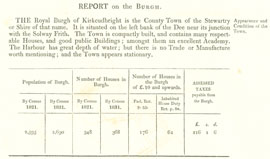
The plans were published in a parliamentary 'Reports upon the Boundaries of the several Cities, Burghs, and Towns in Scotland in respect to the election of members to serve in Parliament'. (House of Commons Paper 1831-1832 (408) XLII.1). We include here a complete electronic facsimile of the boundaries report. For each burgh, the report contains:
- A statement of the current trade, manufactures and general circumstances of the burgh
- A statement of the population and number of residential houses in the burgh and its suburbs, including those with a value of over £10
- The amount of assessed taxes payable by the different burghs
- A detailed description of the proposed new parliamentary boundary, with fixed points indicated on the accompanying plans.
Surveying and engraving the plans
The burghs were visited by two commissioners, Mr William Murray and Captain J W Pringle of the Royal Engineers, and plans drawn up to illustrate the verbal descriptions of the new boundaries. According to their report, 'all the burghs were visted twice, some of them oftener', between November 1831 and February 1832. They were given clear instructions to form unambiguous and precise new boundaries, preferably using permanent urban features, described in their report.
The plans were engraved by a number of London engravers, including Benjamin Davies, Thomas Ellis, James Gardner, J Henshall and Henry Martin.
Content of the plans

detail
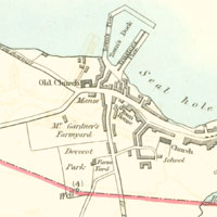
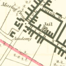
Given their primary purpose, the plans show relatively general detail for the central urban area, with buildings clumped together as shaded blocks. Major streets, public buildings, major industrial units, tolls, canals, bridges and quarries are shown. The only colour on the plans is the proposed boundary in red, and water in blue.
Given their speed of execution, the plans must have been based at best on a quick survey and any available published mapping of the town. In some burghs, new features such as bridges, roads, and buildings, not shown on the John Wood plans of the 1820s, are shown. However, in other burghs, new streets, already built by 1831, are not shown, and the cartography seems rather rushed in places.
Earlier and later municipal boundary mapping
These plans form the most significant body of maps drawn specifically to illustrate urban boundaries in Scotland. Only a few, isolated examples exist of earlier mapping, including Tain in 1750 and the map of the extended royalty of Glasgow circa 1824. The Scottish plans were all executed at the detailed six-inch to the mile scale. This contrasts with the Reform Act plans for England and Wales in 1831-1832, which were drawn at a range of smaller scales.
By the time of the later Reform Acts in 1868 and 1884, state-funded, centralised mapping by Ordnance Survey was largely available for the purposes of illustrating parliamentary boundaries, and so there was no repeat of the 1831-1832 mapping.
For this reason, only a few 'local' burgh boundary maps were produced after 1832:
- Kirkcaldy (1840)
- Inverness (1841)
- Oban (1846)
- Aberdeen (1862)
- Arbroath (1863)
- Dumbarton (1869).

