Maps of Jamaica by James Robertson, 1804
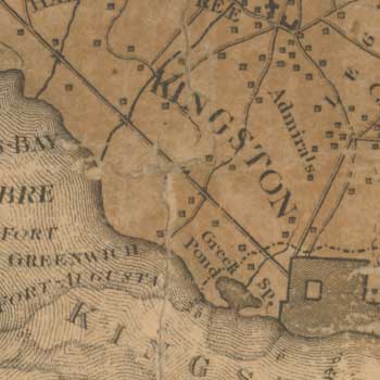
James Robertson, originally from the island of Yell in Shetland, emigrated to Jamaica by 1778. From 1796-1799 he surveyed the most detailed maps of Jamaica at the time, which were engraved and published in London in 1804.
Browse Robertson's maps of Jamaica :- As individual sheets using a zoomable map
- As a zoomable overlay on a modern Google or Bing map
- As a seamless zoomable layer side-by-side with modern Google and OS maps
- As individual maps:
Read a biography of James Robertson (1753-1829)
View Alexander Innes - Jamaica Journal (1823-24)
View Legacies of British Slavery estate records for Jamaica.