Mapmakers
Your search for Tait, James returned 42 records.
Ordered chronologically (undated items first).
| Field | Content | |
|---|---|---|
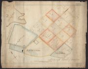
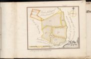
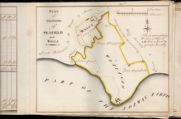
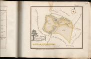
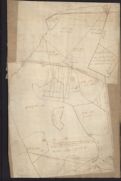
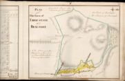
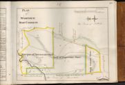
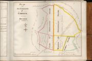
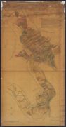
| Name: | Tait, James, fl. ca 1739-1797 | |
| Title: | Plan of Common Good lands at Brownrigg and Fiddler Isle, Dumfries | |
| Imprint: | C18th | |
| Zoom Into Map: | Click on the map to view in greater detail. | |
| Field | Content | |
|---|---|---|
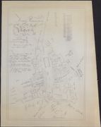
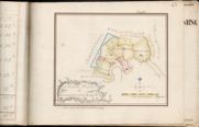
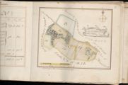
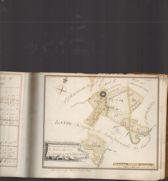
| Name: | Johnston, John T. Tait, James (fl. ca 1739-1797) | |
| Title: | First protraction of the town of Moffat as it stood 1758. (Tracing, 1971) | |
| Imprint: | 1758 (tracing, 1971) | |
| Zoom Into Map: | Click on the map to view in greater detail. | |
| Field | Content | |
|---|---|---|
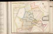
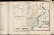
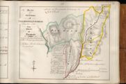
| Name: | Tait, James, fl. ca 1739-1797 (surveyor) Udny, Joseph, fl. ca 1770-1828 (draughtsman) | |
| Title: | Mains, Raw, Halltown and Dornock Wood | |
| Imprint: | 1759 | |
| Zoom Into Map: | Click on the map to view in greater detail. | |
| Field | Content | |
|---|---|---|
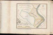
| Name: | Tait, James, fl. ca 1739-1797 (surveyor) Udny, Joseph, fl. ca 1770-1828 (draughtsman) | |
| Title: | Upper and Nether Woodheads | |
| Imprint: | 1759 | |
| Zoom Into Map: | Click on the map to view in greater detail. | |
| Field | Content | |
|---|---|---|
| Name: | Tait, James, fl. ca 1739-1797 (surveyor) Udny, Joseph, fl. ca 1770-1828 (draughtsman) | |
| Title: | Christy-Lands | |
| Imprint: | 1759 | |
| Zoom Into Map: | Click on the map to view in greater detail. | |
| Field | Content | |
|---|---|---|
| Name: | Tait, James, fl. ca 1739-1797 (surveyor) Udny, Joseph, fl. ca 1770-1828 (draughtsman) | |
| Title: | General Plan of Stabletown Barony | |
| Imprint: | 1759 | |
| Zoom Into Map: | Click on the map to view in greater detail. | |
| Field | Content | |
|---|---|---|
| Name: | Tait, James, fl. ca 1739-1797 (surveyor) Udny, Joseph, fl. ca 1770-1828 (draughtsman) | |
| Title: | Wicketthorn, Upper, Mid & Nether Ns, Kirkpatrick Town etc. | |
| Imprint: | 1759 | |
| Zoom Into Map: | Click on the map to view in greater detail. | |
| Field | Content | |
|---|---|---|
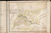
| Name: | Tait, James, fl. ca 1739-1797 (surveyor) Udny, Joseph, fl. ca 1770-1828 (draughtsman) | |
| Title: | Redhall & Calvertsholm | |
| Imprint: | 1759 | |
| Zoom Into Map: | Click on the map to view in greater detail. | |
| Field | Content | |
|---|---|---|
| Name: | Tait, James, fl. ca 1739-1797 (surveyor) Udny, Joseph, fl. ca 1770-1828 (draughtsman) | |
| Title: | Plan of the Farms of Seafield and Walls | |
| Imprint: | 1759 | |
| Zoom Into Map: | Click on the map to view in greater detail. | |
| Field | Content | |
|---|---|---|
| Name: | Tait, James, fl. ca 1739-1797 (surveyor) Udny, Joseph, fl. ca 1770-1828 (draughtsman) | |
| Title: | Croftheads | |
| Imprint: | 1759 | |
| Zoom Into Map: | Click on the map to view in greater detail. | |
| Field | Content | |
|---|---|---|
| Name: | Tait, James, fl. ca 1739-1797 (surveyor) Udny, Joseph, fl. ca 1770-1828 (draughtsman) | |
| Title: | Howes and Milfield | |
| Imprint: | 1759 | |
| Zoom Into Map: | Click on the map to view in greater detail. | |
| Field | Content | |
|---|---|---|
| Name: | Tait, James, fl. ca 1739-1797 (surveyor) Udny, Joseph, fl. ca 1770-1828 (draughtsman) | |
| Title: | Millby, Redgatehead and Hill Land | |
| Imprint: | 1759 | |
| Zoom Into Map: | Click on the map to view in greater detail. | |
| Field | Content | |
|---|---|---|
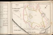
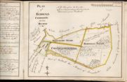
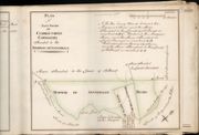
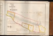
| Name: | Tait, James, fl. ca 1739-1797 (surveyor) Udny, Joseph, fl. ca 1770-1828 (draughtsman) | |
| Title: | Plan of Cummertrees Commonty | |
| Imprint: | 1759 | |
| Zoom Into Map: | Click on the map to view in greater detail. | |
| Field | Content | |
|---|---|---|
| Name: | Tait, James, fl. ca 1739-1797 (surveyor) Udny, Joseph, fl. ca 1770-1828 (draughtsman) | |
| Title: | Boguehead and Hole | |
| Imprint: | 1759 | |
| Zoom Into Map: | Click on the map to view in greater detail. | |
| Field | Content | |
|---|---|---|
| Name: | Tait, James, fl. ca 1739-1797 (surveyor) Udny, Joseph, fl. ca 1770-1828 (draughtsman) | |
| Title: | Graitney Parks, Headless Cross and Graitney Green | |
| Imprint: | 1759 | |
| Zoom Into Map: | Click on the map to view in greater detail. | |
| Field | Content | |
|---|---|---|
| Name: | Tait, James, fl. ca 1739-1797 (surveyor) Udny, Joseph, fl. ca 1770-1828 (draughtsman) | |
| Title: | Hailstone Muir and Elliotstown | |
| Imprint: | 1759 | |
| Zoom Into Map: | Click on the map to view in greater detail. | |
| Field | Content | |
|---|---|---|
| Name: | Tait, James, fl. ca 1739-1797 (surveyor) Udny, Joseph, fl. ca 1770-1828 (draughtsman) | |
| Title: | Flosh-End | |
| Imprint: | 1759 | |
| Zoom Into Map: | Click on the map to view in greater detail. | |
| Field | Content | |
|---|---|---|
| Name: | Tait, James, fl. ca 1739-1797 (surveyor) Udny, Joseph, fl. ca 1770-1828 (draughtsman) | |
| Title: | Loanwath, Scurron &Bellaronn, Alison Banks and Highfoord | |
| Imprint: | 1759 | |
| Zoom Into Map: | Click on the map to view in greater detail. | |
| Field | Content | |
|---|---|---|
| Name: | Tait, James, fl. ca 1739-1797 Much subsequent surveying done in 1770s by Udny | |
| Title: | Plan of the 15 Merkland and Town of Moffat | |
| Imprint: | 1759 and 1770s | |
| Zoom Into Map: | Click on the map to view in greater detail. | |
| Field | Content | |
|---|---|---|
| Name: | Tait, James, fl. ca 1739-1797 (surveyor) Udny, Joseph, fl. ca 1770-1828 (draughtsman) | |
| Title: | Plan of the Farms of Akie-know and That-know | |
| Imprint: | 1759 | |
| Zoom Into Map: | Click on the map to view in greater detail. | |
| Field | Content | |
|---|---|---|
| Name: | Tait, James, fl. ca 1739-1797 (surveyor) Udny, Joseph, fl. ca 1770-1828 (draughtsman) | |
| Title: | Plan of Redhall Commonty on how divided | |
| Imprint: | 1759? | |
| Zoom Into Map: | Click on the map to view in greater detail. | |
| Field | Content | |
|---|---|---|
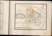
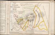
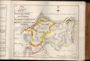
| Name: | Tait, James, fl. ca 1739-1797 (surveyor) Udny, Joseph, fl. ca 1770-1828 (draughtsman) | |
| Title: | Plan of the commonty of Kirkpatrick Flemming as now divided | |
| Imprint: | 1759? | |
| Zoom Into Map: | Click on the map to view in greater detail. | |
| Field | Content | |
|---|---|---|
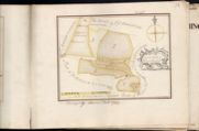
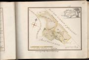
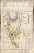
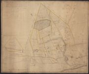
| Name: | Tait, James (fl. ca 1739-1797) | |
| Title: | A plan of the common of Moffat, surveyed by J. Tait 1760. (Tracing, 1971) | |
| Imprint: | 1760 (tracing, 1971) | |
| Zoom Into Map: | Click on the map to view in greater detail. | |
| Field | Content | |
|---|---|---|
| Name: | Tait, James, fl. ca 1739-1797 (surveyor) Udny, Joseph, fl. ca 1770-1828 (draughtsman) | |
| Title: | Kinnel Head | |
| Imprint: | 1761 | |
| Zoom Into Map: | Click on the map to view in greater detail. | |
| Field | Content | |
|---|---|---|
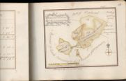
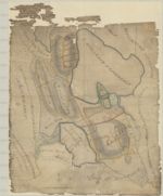
| Name: | Tait, James, fl. ca 1739-1797 | |
| Title: | Draught of His Graces share of Brownmoor Commonty taken from the plan drawn by James Tait, c. 1763 | |
| Imprint: | [c. 1763] | |
| Zoom Into Map: | Click on the map to view in greater detail. | |
| Field | Content | |
|---|---|---|
| Name: | Tait, James (fl. ca 1739-1797) | |
| Title: | Plan of the farm of Bengall in the parish of Dryfesdale | |
| Imprint: | 1764 | |
| Zoom Into Map: | Click on the map to view in greater detail. | |
| Field | Content | |
|---|---|---|
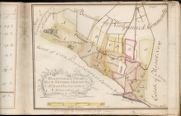
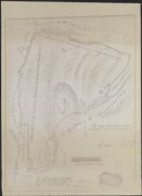
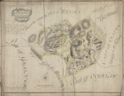
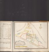
| Name: | Tait, James, ca. 1739 - ca. 1797 | |
| Title: | Plan of the Back Gatas Lying in the Parish of Kirkcudbright - A Collection of Surveys of Scottish Estates of the Earl of Selkirk | |
| Imprint: | 1764 | |
| Zoom Into Map: | Click on the map to view in greater detail. | |
| Field | Content | |
|---|---|---|
| Name: | Tait, James, fl. ca 1739-1797 (surveyor) Udny, Joseph, fl. ca 1770-1828 (draughtsman) | |
| Title: | Plan of Farms between Annan and Evan Water | |
| Imprint: | 1767 | |
| Zoom Into Map: | Click on the map to view in greater detail. | |
| Field | Content | |
|---|---|---|
| Name: | Tait, James, fl. ca 1739-1797 (surveyor) Udny, Joseph, fl. ca 1770-1828 (draughtsman) | |
| Title: | Plan of the farm of Eriocstane and Braefoot | |
| Imprint: | 1767 and 1778 | |
| Zoom Into Map: | Click on the map to view in greater detail. | |
| Field | Content | |
|---|---|---|
| Name: | Tait, James, fl. ca 1739-1797 (surveyor) Udny, Joseph, fl. ca 1770-1828 (draughtsman) | |
| Title: | Share of Graitney Common allocated to the marquis of Annandale | |
| Imprint: | 1770 | |
| Zoom Into Map: | Click on the map to view in greater detail. | |
| Field | Content | |
|---|---|---|
| Name: | Tait, James, fl. ca 1739-1797 (surveyor) Udny, Joseph, fl. ca 1770-1828 (draughtsman) | |
| Title: | Plan of that share of Cummertrees Commonty etc. | |
| Imprint: | 1770 | |
| Zoom Into Map: | Click on the map to view in greater detail. | |
| Field | Content | |
|---|---|---|
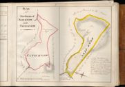
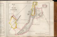
| Name: | Tait, James, fl. ca 1739-1797 (surveyor) ? Udny, Joseph, fl. ca 1770-1828 (draughtsman) | |
| Title: | Plan of Bleise Commonty | |
| Imprint: | 1770s | |
| Zoom Into Map: | Click on the map to view in greater detail. | |
| Field | Content | |
|---|---|---|
| Name: | Tait, James, fl. ca 1739-1797 (surveyor) ? Udny, Joseph, fl. ca 1770-1828 (draughtsman) | |
| Title: | Plan of Wamphray Muir Common | |
| Imprint: | 1770s | |
| Zoom Into Map: | Click on the map to view in greater detail. | |
| Field | Content | |
|---|---|---|
| Name: | Tait, James, fl. ca 1739-1797 (surveyor) ? Udny, Joseph, fl. ca 1770-1828 (draughtsman) | |
| Title: | Plan of the Commonty of Dundorran | |
| Imprint: | 1770s | |
| Zoom Into Map: | Click on the map to view in greater detail. | |
| Field | Content | |
|---|---|---|
| Name: | Tait, James, fl. ca 1739-1797 (surveyor) Udny, Joseph, fl. ca 1770-1828 (draughtsman) | |
| Title: | The Plan of the farm of Kirkhill as posessed comprehending How-Gill-Cleughside, and Staffen-bigging with their shares of the Commonty of Bleise, Middle-rigg, Pleaknow, comprehending also the Mill, Mill-lands and Glebe of Wamphray | |
| Imprint: | 1773 | |
| Zoom Into Map: | Click on the map to view in greater detail. | |
| Field | Content | |
|---|---|---|
| Name: | Tait, James, fl. ca 1739-1797 (surveyor) Udny, Joseph, fl. ca 1770-1828 (draughtsman) | |
| Title: | Plan of the under Commonty of Kirkpatrick Juxta | |
| Imprint: | 1775 | |
| Zoom Into Map: | Click on the map to view in greater detail. | |
| Field | Content | |
|---|---|---|
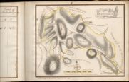
| Name: | Tait, James, fl. ca 1739-1797 (surveyor) ? Udny, Joseph, fl. ca 1770-1828 (draughtsman) | |
| Title: | Plan of the Commonty of Cammock as now divided | |
| Imprint: | 1776 | |
| Zoom Into Map: | Click on the map to view in greater detail. | |
| Field | Content | |
|---|---|---|
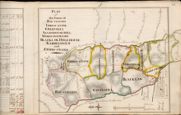
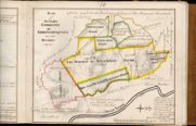
| Name: | Tait, James, fl. ca 1739-1797 (surveyor) Udny, Joseph, fl. ca 1770-1828 (draughtsman) | |
| Title: | Plan of the Farms of Leithanhall, Laverhay together with the estate of Poldean | |
| Imprint: | 1778 | |
| Zoom Into Map: | Click on the map to view in greater detail. | |
| Field | Content | |
|---|---|---|
| Name: | Udny, Joseph (fl. ca 1770-1828) (Tait, James, fl. ca 1739-1797) | |
| Title: | Sketched Plan of the lands of Kirkpatrick Fleming with the share of common allocated to those lands in the division | |
| Imprint: | 1787 | |
| Zoom Into Map: | Click on the map to view in greater detail. | |
| Field | Content | |
|---|---|---|
| Name: | Tait, James (fl. ca 1739-1797) | |
| Title: | Plan [of] Castle Mains of Lochmaben, in Annandale | |
| Imprint: | 1788 | |
| Zoom Into Map: | Click on the map to view in greater detail. | |
| Field | Content | |
|---|---|---|
| Name: | Tait, James, fl. ca 1739-1797 | |
| Title: | No. 1. Plan of Run-rigg Lands of Hightae, Bush, Smallholm and Parkend &c. | |
| Imprint: | 3 December 1789 | |
| Zoom Into Map: | Click on the map to view in greater detail. | |
| Field | Content | |
|---|---|---|
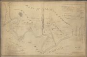
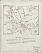
| Name: | Tait, James. | |
| Title: | A Plan of the foot of the river Fleet exhibiting the several fords & roads leading thereto with the adjacent shore & houses / engraved from Mr. Tait's original survey by A. Bell. | |
| Imprint: | Edinburgh, 1934. | |
| Zoom Into Map: | Click on the map to view in greater detail. | |