River and water engineering plans of Scotland, 18th-20th centuries
A small selection of maps and plans relating to river and water engineering projects undertaken by the Stevenson civil engineers, mostly during the 19th century. These cover a wide range of subjects related to the transportation of water, including controlling or diverting floodwater, creating embankments, dredging channels for inland ports to improve navigation, measuring tides and river flow, the creation of reservoirs, water supply networks and sewerage works, disputes involving fisheries and water rights, as well as water to power mills. The plans were produced at a range of scales, from very detailed depictions of specific bends, islands or estuaries to plans covering rivers in their entirety. Many of these were working drawings, annotated to show the specific topics under discussion. Please also see Town Plans / Views and Coastal charts for coastal harbour plans and developments.
Select the map you wish to view:
(ordered chronologically)
Aberdeen - Spill Water Channel for R. Dee - sections
Aberdeen - Spill Water Channel for R. Dee - sections
Aberdeen - Spill Water Channel for R. Dee - sections
Aberdeen - Spill Water Channel for R. Dee - sections
Aberdeen - 1661 - James GORDON - Course of river (copy)
Aberdeen - 1830 - Bag Nets at Don Estuary
Aberdeen - 1909 - Donmouth
River Ae Embankment - 1863 - David and Thomas STEVENSON - Sections of Embankment
River Ae - 1863 - David and Thomas STEVENSON - Junction with the Kirkburn for proposed Flood Bank
Alloa - 1825 - Robert MAXTON - Ferry passage
Almond Water - 1819 - Thomas GRAINGER - Plan of Almond Water from Hallyards Steps to Nether Leny W March
River Avon - 1816 - Robert STEVENSON - Survey from Linlithgow Bridge to Emanuel Abbey
River Awe - 1868 - David and Thomas STEVENSON - Survey from Inverawe to Bridge of Awe
River Awe - 1891 - David and Thomas STEVENSON - Survey plans for use in process Argyll Lochnell Campbell
Annan - 1824 - Robert STEVENSON - Sections of Town and River
Berwick-upon-Tweed - Berwick Fisheries
Berwick-upon-Tweed - Berwick Fisheries
Berwick-upon-Tweed - Tweed fishings
Berwick-upon-Tweed - Tweed fishings
Berwickshire coast - 1884 - David and Thomas STEVENSON - Low water spring tides
Berwick-upon-Tweed - 1885 - David and Thomas STEVENSON - Tweed Commission v. Wood
Berwick-upon-Tweed - 1885 - David and Thomas STEVENSON - Tweed Commission v. Wood
Beauly Firth - 1860 - Sketch of part from Kilmorack to Beauly Firth
Beauly River - 1868 - Sections
Beauly River - 1868 - Sections
Beauly River - 1868 - David and Thomas STEVENSON - Plan showing proposed embankments
Biel Water - Section south of Railway Bridge
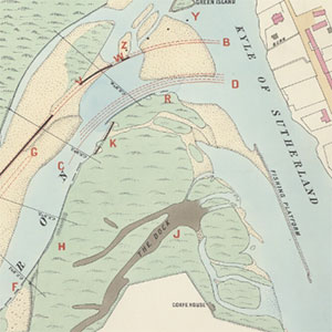
Bonar Bridge - David and Thomas STEVENSON - Junction with Kyle of Sutherland showing South Bark and Bed of Carron
Bonar Bridge - David and Thomas STEVENSON - Junction of river and Kyle of Sutherland
Bonar Bridge - 1875 - Junction of river and Kyle of Sutherland
Broom of Moy - 1883 - Thomas STEVENSON - Moy embankments
Broughty Castle - 1852 - Tay Ferries Trial
Broughty Castle - 1852 - Tay Ferries Trial
Broughty Castle - 1852 - Tay Ferries Trial
Broughty Castle - 1852 - Tay Ferries Trial
Broughty Castle - 1852 - Tay Ferries Trial
Broughty Castle - 1852 - Tay Ferries Trial
Carpow - 1842 - Robert STEVENSON - Shore at Carpow showing line of proposed embankment
Cobbinshaw - 1848 - David STEVENSON and Thomas GRAINGER - Embarkment, sections
Conon Bridge - Sketch plan from Cruive Dyke to Conon Bridge
Conon Fishings Plan - Sections, showing jetty
Conon Fishings - Sections of river
River Conon - 1837-8 - Robert STEVENSON and Alan STEVENSON - Firth and part of River Conon
River Clyde - 1835 and 1880 - Comparative sections of Clyde, opposite Estates of Erskine
River Clyde - 1883 - Channels of deep water near Bishopton
River Clyde - 1883 - Channels of deep water near Bishopton
River Conon - 1882 - MACBEY & GARDEN - Jetty showing march stones
River Conon - 1890 - Jetty showing fishing boundary
Craigo - 1870 - Thomas STEVENSON - Dam and Salmon Pass
Craigo - 1876 - Thomas STEVENSON - Dam & proposed alterations
Cromarty Firth - 1837 - Estuary
Deveron River - 1776 - John MARR - Sketch of Cruive Dam
Duncow - Plan of burn from Glencarrick distillery to Duncow Mills
Dundee - Soundings near Dundee
Dundee - 1869 - Dundee Ferry Harbour and portion of bed of river
Dunfermline - 1854 - David STEVENSON - Plan and sections in case of Cobill v. Dunfermline Water Co.
Dunwan - 1827 - Robert STEVENSON and James LAMB - Plan of reservoir
Dunwan - 1827 - James LAMB - Plan of drainage into dam
Edinburgh - Sections of low line of river
Edinburgh - 1824 - Robert STEVENSON - Plan and section of aqueduct & reservoir
Edinburgh - 1825 - John STEADMAN - Survey shewing the situation of the Black Springs
Elie - 1922 - David Alan and Charles STEVENSON - Sewerage
Ferryden - Mouth of river, showing tide
Findhorn - Estuary
River Findhorn - 1882 - David and Thomas STEVENSON - Plan of river in Hogarth v. Grant case
Glasgow - Sections and levels of Clyde
Glasgow - Level of Clyde during flood, 1831
Glasgow - 1828 - Plan of reservoir near Drygate St. for Cranstonhill Water Co.
Glasgow - 1828 - Plan of reservoir near Drygate St. for Cranstonhill Water Co.
Glasgow - 1828 - Plan of reservoir near Drygate St. for Cranstonhill Water Co.
Glasgow - 1828 - Plan of reservoir near Drygate St. for Cranstonhill Water Co.
Glasgow - 1875-6 - KYLE, DENNISON & FREW - Sections & soundings of Clyde
Glasgow - 1875-6 - KYLE, DENNISON & FREW - Sections & soundings of Clyde
Glasgow - 1875-6 - KYLE, DENNISON & FREW - Sections & soundings of Clyde
Glasgow - 1875-6 - KYLE, DENNISON & FREW - Sections & soundings of Clyde
Glasgow - 1875-6 - KYLE, DENNISON & FREW - Sections & soundings of Clyde
Glasgow - 1885 - Glasgow Water Bill Opposition; graphs illustrating water supply
Glasgow - 1885 - Glasgow Water Bill Opposition; graphs illustrating water supply
Keith - 1898 - David Alan STEVENSON - Course of river, and proposed new cut
Kelso - Sketch of concrete sewers
Kelso - Sketch of concrete sewers
Kelso - Plan of Tweed showing outley of sewers
Kelso - 1858 - John BROMLEY - Sewerage
Kinnaber Mill, North Esk - Plan of river
Kirktonhill - 1818 - George ROBERTSON - Sketch taken from plan of Kirkton Hill
Water of Leith - 1824 - Robert STEVENSON - Position of reservoirs for supply of mills
Mid Calder - Section from New Calder Paper Mill to the Reservoir Dam above West Mill
River Moriston - 1882 - Thomas STEVENSON - Sketch plan & soundings of junction of river and Loch Ness
Nith - 1844 - Navigation Channel
Nith - 1847 - Walter NEWALL - Section from Southerness to Dumfries
Nith - 1861 - David and Thomas STEVENSON - Working drawing of extension of wall to opposite Conheath
Nith - 1862 - David and Thomas STEVENSON - Working drawing of West wall
North Esk Water, Midlothian - 1842 - Thomas GRAINGER - Plan of proposed reservoirs
North Esk Reservoir - 1850 - Thomas STEVENSON - Section of rain Gauge for North Esk Reservoir
Penicuik - 1849 - STEVENSON - Course of proposed pipe from Silver Spring to Penicuik
Perth & Tay - 1818 - Part of River and Perth
Scone Park - 1882 - David and Thomas STEVENSON - Soundings near Scone Park
Seedhill - Plan of River from Seedhill Craigs to hawkhead Mills
Seedhill - Plan of River from Seedhill Craigs to hawkhead Mills
Skelmorlie - Bank and soundings
Stoneywood - 1876 - George Gordon JENKINS - Plan and sections of intake mill-lade at Paper Works
River Tay - 1816 - Robert STEVENSON and John STEEDMAN - Part of Firth-Ferry between Fife and Forfar
River Tay - 1831 - ADAM ANDERSON - Sections to determine the quantity of water discharged
River Tay - 1838 - Friarton to Newburgh
River Tay - 1839 - Robert STEVENSON - Tay near Dorry Island
River Tay, Moncrieff Island - 1848 - David STEVENSON - Section with Sand Island
River Tay - 1863 - David and Thomas STEVENSON - Part of River
River Tay - 1865 - Balmbriech Castle to Dominie Lodge
River Tay - 1866 - Edward CALVER - Entrance with soundings
River Tay - 1871 - James LESLIE - Newburgh to Balnbreich Castle
River Tay - 1879 - David and Thomas STEVENSON - Tay Bridge Navigation Spans
River Teith - 1853 - Bank near Blackdub Farmhouse
River Tweed - 1926 - David Alan and Charles STEVENSON - Queen Elizabeth's Pier
River Tweed - 1926 - David Alan and Charles STEVENSON - Queen Elizabeth's Pier
River Tweed - 1926 - Tweed fishings
Tulliallan - 1868 - Portion of S. Ferry Pier
Tulliallan - 1868 - Parts of embankment (enlarged)