River engineering plans of Scotland, 18th-20th centuries
| Field | Content |
|---|---|
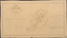
| Title: | Conon, River - Jetty showing fishing boundary |
| Imprint: | 1890 |
| Pagination: | 1 map; 516 x 910 mm. |
| Shelfmark: | MS.5846, No.101 |
| Notes: | This map is from our Stevenson civil engineering plans collection. |
| Zoom Into Map: | Click on the map to view in greater detail. |