Stevenson civil engineering plans, 1660s-1940s
This page presents a listing, in shelfmark order, of the main Stevenson civil engineering plans relating to Scotland held by the National Library of Scotland. As some items are very fragile, held in volumes, or as large rolled maps, only around half of the maps have so far been scanned (November 2020). There are links below to zoomable images for all the maps and related documents that have been scanned.
Stevenson collection and archive
The majority of the firm's maps, plans and technical drawings were organised and donated to the Library in the 1950s by D. Alan Stevenson. Around 2,500 items now form MS.5843-5896 and are arranged broadly geographically. The maps in this part of this archive that relate to Scotland are listed below.In the 1990s, the Library purchased the business archive of the Stevenson firm which included surviving written records. The records comprised letterbooks and correspondence, journals and notebooks, reports and memoranda and a large number of printed pamphlets and reports by the Stevensons and others, in addition to a small number of additional maps, plans and drawings. These records are now Acc 10706. The maps and plans from this accession that relate to Scotland have been listed below.
Read about the Stevenson plans and related Further reading resources on our Stevenson Maps and Plans of Scotland, 1660-1940 website.
Searching for Stevenson plans
Our Stevenson Maps and Plans of Scotland, 1660-1940 website allows all the Stevenson plans to be searched for using a graphic index, as well as by text.
The Stevenson civil engineering plans can also be searched for on these pages:
- Town Plans / Views, 1580s-1940s (including harbour plans)
- Estate Maps of Scotland, 1730s-1950s
- County maps of Scotland, 1580s-1940s
- Coasts of Scotland on marine charts, 1580s-1900s
- Lighthouse plans and profiles, 1800s-1920s
- Canal plans of Scotland, 18th-20th centuries
- Railway plans of Scotland, 18th-20th centuries
- Plans and profiles of bridges, 18th-20th centuries
- River and water engineering plans of Scotland, 18th-20th centuries
- Mapmakers and surveyors
Re-use. The Stevenson items we have put online are out-of-copyright and re-usable under a Creative Commons Attribution (CC-BY) licence. Please contact us if you require further details.
View the Stevenson plans in shelfmark order:
MS.5844-5896
| Shelfmark | Title | Date |
| MS.5844, No.1 | Abbey St Bathans - Bridge | |
| MS.5844, No.2 | Aberdeen - Town | 1661 |
| MS.5844, No.3 | Aberdeen - Town | 1746 |
| MS.5844, No.4 | Aberdeen - Coast between Dee and Don | 1756 |
| MS.5844, No.5 | Aberdeen - Town | 1773 |
| MS.5844, No.6 | Aberdeen - Bridge | 1803-4 |
| MS.5844, No.7 | Aberdeen - Bridge | 1803-4 |
| MS.5844, No.8 | Aberdeen - City and Harbour Works | 1810 |
| MS.5844, No.9 | Aberdeen - Harbour | ca. 1828 |
| MS.5844, No.10 | Aberdeen - Harbour | ca. 1828 |
| MS.5844, No.11 | (Not yet scanned) Aberdeen - Harbour and Basin | 1819 |
| MS.5844, No.12 | (Not yet scanned) Aberdeen - Spill Water Channel for R. Dee - sections | n.d. |
| MS.5844, No.13 | Aberdeen - Spill Water Channel for R. Dee - sections | |
| MS.5844, No.14 | Aberdeen - Spill Water Channel for R. Dee - sections | |
| MS.5844, No.15 | Aberdeen - Spill Water Channel for R. Dee - sections | |
| MS.5844, No.16 | Aberdeen - Spill Water Channel for R. Dee - sections | |
| MS.5844, No.17 | Aberdeen - North Pier Head of Harbour | 1830 |
| MS.5844, No.18 | (Not yet scanned) Aberdeen - North Pier Head of Harbour | 1830 |
| MS.5844, No.19 | (Not yet scanned) Aberdeen - North Pier Head of Harbour | 1830 |
| MS.5844, No.20 | Aberdeen - Harbour | 1843 |
| MS.5844, No.21 | (Not yet scanned) Aberdeen - Harbour Improvements | 1867 |
| MS.5844, No.22 | (Not yet scanned) Aberdeen - Harbour | 1867-8 |
| MS.5844, No.23 | Aberdeen - City (6" OS Aberdeen SH LXXV | |
| MS.5844, No.24 | Aberdeen - City (6" OS Aberdeen SH LXXV | |
| MS.5844, No.25 | Aberdeen - Donmouth | 1909 |
| MS.5844, No.26 | (Not yet scanned) Aberdeen - Harbour with Soundings | n.d. |
| MS.5844, No.27 | (Not yet scanned) Aberdeen - Fisher Town | n.d. |
| MS.5844, No.28 | (Not yet scanned) Aberlady - Aberlady | |
| MS.5844, No.29 | Aberlady - Aberlady | |
| MS.5844, No.30 | River Ae - Sections of Embankment | 1863 |
| MS.5844, No.31 | River Ae - Junction with the Kirkburn for proposed Flood Bank | 1863 |
| MS.5844, No.32 | Loch Aline - Pier | |
| MS.5844, No.33 | (Not yet scanned) Loch Aline - Sections of pier | 1881 |
| MS.5844, No.34 | Loch Aline - Pier at Kirk Point | 1881 |
| MS.5844, No.35 | Loch Aline - Pier at Kirk Point | |
| MS.5844, No.36 | Loch Aline - Pier - detail drawings | 1882 |
| MS.5844, No.37 | Loch Aline - Pier | |
| MS.5844, No.38 | Allanton - Bridge | 1840 |
| MS.5844, No.39 | Allanton - Bridge | 1840 |
| MS.5844, No.40 | Allanton - Bridge | 1840 |
| MS.5844, No.41 | Allanton - Bridge | 1840 |
| MS.5844, No.42 | Allanton - Bridge | 1840 |
| MS.5844, No.42 | Allanton - Bridge | 1840 |
| MS.5844, No.43 | Allanton - Bridge | 1840 |
| MS.5844, No.44 | (Not yet scanned) Allanton - Sections of Bridge | 1840 |
| MS.5844, No.45 | (Not yet scanned) Allanton - Longitudinal section of Bridge | 1840 |
| MS.5844, No.46 | Allanton - Sketch of centre frame of Bridge | 1840 |
| MS.5844, No.47 | Allanton - Sketches and Sections | 1840 |
| MS.5844, No.47 | Allanton - Sketches and Sections | 1840 |
| MS.5844, No.48 | Allanton - Sketches and Sections | 1840 |
| MS.5844, No.49 | Allanton - Sketches and Sections | 1840 |
| MS.5844, No.50 | Allanton - Sketches and Sections | 1840 |
| MS.5844, No.51 | Allanton - Sketches and Sections | 1840 |
| MS.5844, No.52 | Allanton - Sketches and Sections | 1840 |
| MS.5844, No.53 | Allanton - Sketches and Sections | 1840 |
| MS.5844, No.54 | (Not yet scanned) Allanton - Sketches and Sections | 1840 |
| MS.5844, No.55 | Allanton - Sketches and Sections | 1840 |
| MS.5844, No.56 | Allanton - Grounds in vicinity of village with sites of Bridges and connecting roads | 1840 |
| MS.5844, No.57 | Alloa - Proposed Wet Dock | 1798 |
| MS.5844, No.58 | Alloa - Ferry passage | 1825 |
| MS.5844, No.59 | (Not yet scanned) Alloa - Harbour and Ferry | |
| MS.5844, No.60 | Alloa - Harbour and Ferry | |
| MS.5844, No.61 | Alloa - Harbour showing proposed Docks | |
| MS.5844, No.62 | Alloa - Harbour; Coal tipping apparatus | 1859 |
| MS.5844, No.63 | Alloa - Ferry Steamer | |
| MS.5844, No.64 | Alloa - Harbour; extension and improvement of existing Dock and proposed new Dock | 1871 |
| MS.5844, No.65 | Alloa - Harbour; extension and improvement of existing Dock and proposed new Dock | 1871 |
| MS.5844, No.66 | (Not yet scanned) Alloa - Course of river from Hallyards Steps to Nether Leny with proposed water course | 1819 |
| MS.5844, No.67 | Almond Water - Plan of Almond Water from Hallyards Steps to Nether Leny W March | 1819 |
| MS.5844, No.68 | Almond Water - Section from New Calder Paper Mill to the Reservoir Dam above West Mill | |
| MS.5844, No.69 | Craigiehall - Bridge designs at Craigie Hall Mills | 1820 |
| MS.5844, No.70 | (Not yet scanned) Cramond Bridge - Plan & Elevation of Bridge | 1820 |
| MS.5844, No.71 | Cramond Bridge - Elevation of Cramond Bridge | 1820 |
| MS.5844, No.72 | Cramond Bridge - Elevation of Cramond Bridge | 1820 |
| MS.5844, No.73 | Cramond Bridge - Elevation of Cramond Bridge | 1820 |
| MS.5844, No.74 | Cramond Bridge - Elevation of Cramond Bridge | 1820 |
| MS.5844, No.75 | Cramond Bridge - Elevation of Cramond Bridge | 1820 |
| MS.5844, No.76 | Almond Water - Bridge | 1825 |
| MS.5844, No.77 | (Not yet scanned) Almond Water - Boathouse Bridge - Sections of river and Boathouse Bridge | 1832-4 |
| MS.5844, No.78 | Almond Water - Boathouse Bridge - Sections of river and Boathouse Bridge | 1832-4 |
| MS.5844, No.79 | Almond Water - Boathouse Bridge - Sections of river and Boathouse Bridge | 1832-4 |
| MS.5844, No.80 | Almond Water - Boathouse Bridge - Sections of river and Boathouse Bridge | 1832-4 |
| MS.5844, No.81 | Almond Water - Boathouse Bridge - Sections of river and Boathouse Bridge | 1832-4 |
| MS.5844, No.82 | Almond Water - Boathouse Bridge - Sections of river and Boathouse Bridge | 1832-4 |
| MS.5844, No.82 | Almond Water - Boathouse Bridge - Sections of river and Boathouse Bridge | 1832-4 |
| MS.5844, No.83 | (Not yet scanned) Almond Water - Cramond Bridge - Plan of district between Princes St. & Cramond Bridge | n.d. |
| MS.5844, No.84 | (Not yet scanned) Almond Water - Cramond Bridge - Plan of district at Cramond Bridge and inset of Bridge | n.d. |
| MS.5844, No.85 | Almond Water - Bridge and sections of Bridge | |
| MS.5844, No.86 | Almond Water - Bridge and sections of Bridge | |
| MS.5844, No.87 | Almond Water - Bridge and sections of Bridge | |
| MS.5844, No.88 | Altgran - Evanton - Bridge | 1772 |
| MS.5844, No.89 | (Not yet scanned) Annan - Bridge | 1824 |
| MS.5844, No.90 | Annan - Bridge | |
| MS.5844, No.91 | Annan - Bridge | |
| MS.5844, No.92 | Annan - Bridge | |
| MS.5844, No.93 | Annan - Sections of Town and River | 1824 |
| MS.5844, No.94 | (Not yet scanned) Annan - Service Bridge | n.d. |
| MS.5844, No.95 | (Not yet scanned) Anstruther - Harbour Improvements | |
| MS.5844, No.96 | (Not yet scanned) Anstruther - Soundings in harbour | 1848 |
| MS.5844, No.97 | (Not yet scanned) Anstruther - Design for Union Harbour | 1858 |
| MS.5844, No.98 | (Not yet scanned) Anstruther - Design for Union Harbour | 1858 |
| MS.5844, No.99 | (Not yet scanned) Anstruther - Union Harbour; proposed new harbour | 1859 |
| MS.5844, No.100 | (Not yet scanned) Anstruther - Union Harbour General Plan | 1861 |
| MS.5844, No.101 | (Not yet scanned) Anstruther - Union Harbour General Plan | 1861 |
| MS.5844, No.102 | (Not yet scanned) Anstruther - Union Harbour Elevations | |
| MS.5844, No.103 | (Not yet scanned) Anstruther - Union Harbour Opening to present harbour | 1861 |
| MS.5844, No.104 | (Not yet scanned) Anstruther - Union Harbour showing proposed Wet Dock | 1868 |
| MS.5844, No.105 | Anstruther - Union Harbour showing Cross Walls | |
| MS.5844, No.106 | Anstruther - Sections of Harbour | 1870 |
| MS.5844, No.107 | Anstruther - Harbour | 1871 |
| MS.5844, No.108 | Anstruther - Harbour | 1871 |
| MS.5844, No.109 | (Not yet scanned) Anstruther - Union Harbour | |
| MS.5844, No.110 | (Not yet scanned) Anstruther - Harbour | |
| MS.5844, No.111 | Anstruther - Sections of Harbour | 1881 |
| MS.5844, No.112 | (Not yet scanned) Anstruther - Union Harbour - proposed improvements | 1885 |
| MS.5844, No.113 | (Not yet scanned) Anstruther - harbour | 1896 |
| MS.5844, No.114 | (Not yet scanned) Arbroath - Line of Canal to connect Arbroath with Forfar | |
| MS.5844, No.115 | (Not yet scanned) Arbroath - Harbour extension | 1825 |
| MS.5844, No.116 | Arbroath - Harbour Improvements | 1837 |
| MS.5844, No.117 | Arbroath - Harbour | 1883 |
| MS.5844, No.118 | (Not yet scanned) Arbroath - Boom Gates | n.d. |
| MS.5844, No.119 | Ardgour - Timber Pier | 1858 |
| MS.5844, No.120 | (Not yet scanned) Ardnadam - Pier | |
| MS.5844, No.121 | (Not yet scanned) Ardnadam - Pier; plan elevation and details of present pier | 1878 |
| MS.5844, No.122 | (Not yet scanned) Ardnadam - Pier | |
| MS.5844, No.123 | Ardnadam - Pier; arrangement for crane | 1904 |
| MS.5844, No.124 | Ardrossan - Quay | 1844 |
| MS.5844, No.125 | (Not yet scanned) Ardrossan - Additional piers for the harbour | 1884 |
| MS.5844, No.126 | Ardrossan - harbour | |
| MS.5844, No.127 | (Not yet scanned) Ardrossan - Harbour | |
| MS.5844, No.128 | Ardrossan - Harbour | |
| MS.5844, No.129 | (Not yet scanned) Argyll Canal - Plans and sections of proposed canal | 1845 |
| MS.5844, No.130 | (Not yet scanned) Argyll Canal - Plans and sections of proposed canal | 1845 |
| MS.5844, No.131 | (Not yet scanned) Argyll Canal - Sections | 1845 |
| MS.5844, No.132 | Arinagour - Proposed Landing Pier | 1849 |
| MS.5844, No.133 | (Not yet scanned) Arthrie - Lawn and Pond | |
| MS.5844, No.134 | (Not yet scanned) Arthrie - Embankment | |
| MS.5844, No.135 | Auchingray - Embankment | |
| MS.5844, No.136 | Auchmithie - Harbour | 1888 |
| MS.5844, No.137 | (Not yet scanned) Auchmithie - Harbours and sections | 1888 |
| MS.5844, No.138 | Auchmithie - Harbour with proposed breakwaters | 1892 |
| MS.5844, No.139 | Auchmithie - Harbour | 1892 |
| MS.5844, No.140 | (Not yet scanned) Avoch - Harbour with proposed breakwaters | 1905 |
| MS.5844, No.141 | Avoch - Sections of proposed breakwaters | 1905 |
| MS.5844, No.142 | Avon River - Survey from Linlithgow Bridge to Emanuel Abbey | 1816 |
| MS.5844, No.143 | (Not yet scanned) Awe River - Survey from Inverawe to Brander | 1868 |
| MS.5844, No.144 | (Not yet scanned) Awe River - Survey from Inverawe to Bridge of Awe | 1868 |
| MS.5844, No.145 | Awe River - Survey from Inverawe to Bridge of Awe | 1868 |
| MS.5844, No.146 | (Not yet scanned) Awe River - Survey from Inverawe to Bridge of Awe | 1868 |
| MS.5844, No.147 | Awe River - Survey plans for use in process Argyll Lochnell Campbell | 1891 |
| MS.5844, No.148 | Ayr - Harbour with proposed extension of piers and excavation in interior of harbour | 1830 |
| MS.5844, No.149 | (Not yet scanned) Ayr - Notes on harbour extension | 1831 |
| MS.5844, No.150 | A new map of Ayrshire... | 1775 |
| MS.5844, No.151 | A map of Ayrshire | |
| MS.5844, No.152 | A new map of Ayrshire... | |
| MS.5844, No.152 | A new map of Ayrshire... | |
| MS.5845, No.1 | (Not yet scanned) Balintore - Proposed Harbour | 1844 |
| MS.5845, No.2 | Balintore - Proposed Harbour | 1888 |
| MS.5845, No.3 | Balintore - Proposed Harbour | 1889 |
| MS.5845, No.4 | Balintore - Harbour and Foreshore | 1889 |
| MS.5845, No.5 | (Not yet scanned) Balintore - Harbour: General Plan and Sections | 1890 |
| MS.5845, No.6 | (Not yet scanned) Balintore - Sections of Harbour | 1890 |
| MS.5845, No.7 | (Not yet scanned) Balintore - Harbour | Probably 1890 |
| MS.5845, No.8 | Balintore - Harbour: Plan and Sections | 1890 |
| MS.5845, No.9 | Balintore - Harbour: Plan and Sections | 1890 |
| MS.5845, No.10 | Balintore - Proposed alteration to line of West Breakwater | 1890 |
| MS.5845, No.11 | Balintore - Harbour: East Breakwater | |
| MS.5845, No.12 | Balintore - Harbour | 1893 |
| MS.5845, No.13 | (Not yet scanned) Balintore - Two Ton Hand Derrick Crane | 1893 |
| MS.5845, No.14 | (Not yet scanned) Balintore - Harbour: Booms for Harbour Entrance | 1893 |
| MS.5845, No.15 | (Not yet scanned) Balintore - Harbour; sections and soundings | n.d. |
| MS.5845, No.16 | (Not yet scanned) Ballimore - Sectional elevation and details of proposed Pier near Otter Ferry | 1898 |
| MS.5845, No.17 | Ballyvicva - Proposed Pier | 1856 |
| MS.5845, No.18 | Balvag River - Bridge | 1772 |
| MS.5845, No.19 | Banff - Board of Fisheries Refuge Harbour plan | 1858 |
| MS.5845, No.20 | Barlock - Quarry | 1846 |
| MS.5845, No.21 | Beauly River - Sketch of part from Kilmorack to Beauly Firth | 1860 |
| MS.5845, No.22 | Beauly River - Sections | 1868 |
| MS.5845, No.23 | Beauly River - Sections | 1868 |
| MS.5845, No.24 | Beauly River - Plan showing proposed embankments | 1868 |
| MS.5845, No.25 | Beil Water - Section south of Railway Bridge | |
| MS.5845, No.26 | Beltonford Bridge - Bridge: proposed repairs | 1846 |
| MS.5845, No.27 | (Not yet scanned) Balcary Bay - Harbour; soundings | 1846 |
| MS.5845, No.28 | Blackfriar's Bridge - Elevation of proposed Bridge | |
| MS.5845, No.29 | Bladenoch - Old Bridge and site of proposed new one | 1850 |
| MS.5845, No.30 | Bladenoch - Working drawings of proposed New Bridge | 1850 |
| MS.5845, No.31 | Bladenoch - Ground plan of Bridge and secion | 1860 |
| MS.5845, No.32 | Bladenoch - Ground plan of Bridge and secion | 1860 |
| MS.5845, No.33 | Bladenoch - Working Drawings of Bridge | 1866 |
| MS.5845, No.34 | Blairgowrie - Spinning Mill; sections of an opening to be formed in the Croy across the River Ericht | 1852 |
| MS.5845, No.35 | Blairgowrie - Spinning Mill; sections of an opening to be formed in the Croy across the River Ericht | 1852 |
| MS.5845, No.36 | Blairgowrie - Spinning Mill; sections of an opening to be formed in the Croy across the River Ericht | 1852 |
| MS.5845, No.37 | Boddam - Buchanness and intended village | 1824 |
| MS.5845, No.38 | (Not yet scanned) Boddam - harbour | |
| MS.5845, No.39 | (Not yet scanned) Boddam - Harbour | 1849 |
| MS.5845, No.40 | (Not yet scanned) Boddam - Plan of Estate of Boddam and part of Sandford | 1865 |
| MS.5845, No.41 | Boddam - Harbour; proposed works | 1877 |
| MS.5845, No.42 | (Not yet scanned) Boddam - Sketch of harbour | |
| MS.5845, No.43 | Boddam - Sketch of harbour | |
| MS.5845, No.44 | Boddam - Harbour; proposed works | 1877 |
| MS.5845, No.45 | Boddam - Harbour; proposed works | 1877 |
| MS.5845, No.46 | Boddam - Harbour; proposed works | 1877 |
| MS.5845, No.47 | (Not yet scanned) Boddam - Harbour; proposed works | 1878 |
| MS.5845, No.48 | (Not yet scanned) Boddam - Harbour; sections | 1878 |
| MS.5845, No.49 | (Not yet scanned) Bo'ness - harbour | |
| MS.5845, No.50 | Borve - Proposed Breakwater | 1893 |
| MS.5845, No.51 | (Not yet scanned) Bound Skerry - Longitudinal section of Bridge | n.d. |
| MS.5845, No.52 | Broadford - Harbour | 1888 |
| MS.5845, No.53 | (Not yet scanned) Broadford - Harbour; Concrete Work | 1888 |
| MS.5845, No.54 | Broadford - Harbour; sections | 1888 |
| MS.5845, No.55 | (Not yet scanned) Broadford - Harbour; sections | 1888 |
| MS.5845, No.56 | Brodick - Pier | 1898 |
| MS.5845, No.57 | Brodick - Sections of Pier | 1898 |
| MS.5845, No.58 | (Not yet scanned) Brora - Harbour; Breakwater | 1847 |
| MS.5845, No.59 | (Not yet scanned) Brora - Harbour and Improvements | 1855 |
| MS.5845, No.60 | Broomhill - Bridge | |
| MS.5845, No.61 | Broomhill - Ford Bridge - working plans | |
| MS.5845, No.62 | Bruichladdich - Proposed Pier | 1876 |
| MS.5845, No.63 | Buckhaven - Harbour | 1852 |
| MS.5845, No.64 | Buckhaven - Harbour; Extension of Western Pier | 1852 |
| MS.5845, No.65 | Buckhaven - Harbour showing present state of Pierhead | 1863 |
| MS.5845, No.66 | Buckhaven - Harbour; Roadway | 1881 |
| MS.5845, No.67 | (Not yet scanned) Buckie - Proposed Pier | 1852 |
| MS.5845, No.68 | Buckie - Proposed Pier | 1852 |
| MS.5845, No.69 | (Not yet scanned) Buckie - Harbour | 1855 |
| MS.5845, No.70 | (Not yet scanned) Buckie - Harbour; Quay Wall | 1855 |
| MS.5845, No.71 | (Not yet scanned) Buckie - Harbour | 1855 |
| MS.5845, No.72 | Buckie - Harbour; proposed method of protecting landward end of West Pier | 1855 |
| MS.5845, No.73 | Buckie - Harbour; proposed method of protecting south end of West Pier | 1856 |
| MS.5845, No.74 | (Not yet scanned) Buckie - Harbour - East and West Piers | 1856 |
| MS.5845, No.75 | Buckie - Harbour | 1856-7 |
| MS.5845, No.76 | (Not yet scanned) Buckie - Harbour | 1856-7 |
| MS.5845, No.77 | Buckie - Harbour with reductive powers | 1856-7 |
| MS.5845, No.78 | Buckie - Harbour with reductive powers | 1856-7 |
| MS.5845, No.79 | (Not yet scanned) Buckie - Refuge Harbour | 1858 |
| MS.5845, No.80 | Buckie - Harbour; soundings | 1875 |
| MS.5845, No.80 | Buckie - Harbour; soundings | 1875 |
| MS.5845, No.81 | (Not yet scanned) Buckie - Harbour; plans and sections of proposed arbour improvements | 1885 |
| MS.5845, No.82 | (Not yet scanned) Buckie - Harbour; Tidal Waters | n.d. |
| MS.5845, No.83 | (Not yet scanned) Buckie - Harbour | n.d. |
| MS.5845, No.84 | (Not yet scanned) Burghead - Town and Harbour | |
| MS.5845, No.85 | Burnmouth - Harbour showing extension of pier | 1858 |
| MS.5845, No.86 | (Not yet scanned) Burnmouth - Harbour; working plan of proposed extension of pier | 1876 |
| MS.5845, No.87 | (Not yet scanned) Burnmouth - Harbour; enlarged drawings | 1876 |
| MS.5845, No.88 | Burnmouth - Harbour and Pier | 1878 |
| MS.5845, No.89 | Burnmouth - Harbour; proposed breakwater | 1879 |
| MS.5845, No.90 | Burnmouth - harbour plan; proposed extension of pier | 1883 |
| MS.5845, No.91 | (Not yet scanned) Burnmouth - Harbour; plan and sections of work to be carried out | |
| MS.5845, No.92 | Burntisland - Plan of ground acquired for Edinburgh: Northern Railway | 1847 |
| MS.5845, No.93 | Burntisland - Ferry pier | |
| MS.5845, No.94 | (Not yet scanned) Burntisland - Harbour | |
| MS.5845, No.95 | (Not yet scanned) Burntisland - Western Bay & Quarry | n.d. |
| MS.5845, No.96 | Burwick Bay (South Ronaldsay) - Proposed Landing Slip | |
| MS.5845, No.97 | Burray (Orkney) - Landing Slip | |
| MS.5845, No.98 | Bute - Ordnance Survey | |
| MS.5845, No.99 | (Not yet scanned) Bute - Ship Canal; plan of gate Anchor and Collar | ~ |
| MS.5845, No.100 | (Not yet scanned) Bute - Docks | ~ |
| MS.5845, No.101 | (Not yet scanned) Bute - Ship Canal; sections | 1833 |
| MS.5845, No.102 | (Not yet scanned) Bute - Ship Canal; sections | 1833 |
| MS.5845, No.103 | (Not yet scanned) Bute - Ship Canal; sections | 1833 |
| MS.5845, No.104 | Bute - Ship Canal; sections | 1833 |
| MS.5845, No.105 | Bute - Ship Canal; sections | 1833 |
| MS.5845, No.106 | (Not yet scanned) Bute - Ship Canal; sections | 1833 |
| MS.5845, No.107 | (Not yet scanned) Bute - Ship Canal; sections | 1833 |
| MS.5845, No.108 | (Not yet scanned) Bute - Ship Canal; sections | 1833 |
| MS.5845, No.109 | Bute - Ship Canal; sections | 1833 |
| MS.5845, No.110 | (Not yet scanned) Bute - Perspective view of Entrance Lock of Ship Canal | |
| MS.5845, No.111 | Byble - Harbour | 1855 |
| MS.5846, No.1 | (Not yet scanned) Cairnbulg - Sections of proposed harbour | n.d. |
| MS.5846, No.2 | (Not yet scanned) Cairns | |
| MS.5846, No.3 | (Not yet scanned) Cairns | |
| MS.5846, No.4 | (Not yet scanned) Cairns | |
| MS.5846, No.5 | (Not yet scanned) Brough - Section of landing slip and breakwater at Brough | n.d. |
| MS.5846, No.6 | Dunnet Point - Plan of district and harbour at Dunnet Point | |
| MS.5846, No.7 | Campbeltown - Supply of Water and Harbour Improvements | 1845 |
| MS.5846, No.8 | (Not yet scanned) Seedhill - Plan of River from Seedhill Craigs to hawkhead Mills | n.d. |
| MS.5846, No.9 | (Not yet scanned) Seedhill - Plan of River from Seedhill Craigs to hawkhead Mills | n.d. |
| MS.5846, No.10 | Seedhill - Plan of River from Seedhill Craigs to hawkhead Mills | |
| MS.5846, No.11 | Seedhill - Plan of River from Seedhill Craigs to hawkhead Mills | |
| MS.5846, No.12 | (Not yet scanned) Seedhill - Plan of River from Seedhill Craigs to hawkhead Mills | n.d. |
| MS.5846, No.13 | Caledonian Canal - Section of intended canal | 1805 |
| MS.5846, No.14 | Caledonian Canal - Section of Canal | 1821 |
| MS.5846, No.15 | Caledonian Canal - Lock | 1822 |
| MS.5846, No.16 | (Not yet scanned) Dochgarrock Lock - Regulating Lock from outlet of Loch Dochfour to Dochgarroch | 1849 |
| MS.5846, No.17 | (Not yet scanned) Dochgarrock Lock - Regulating Lock from outlet of Loch Dochfour to Dochgarroch | 1850 |
| MS.5846, No.18 | Dochgarrock Lock - Regulating Lock from outlet of Loch Dochfour to Dochgarroch | 1851 |
| MS.5846, No.19 | (Not yet scanned) Dochgarrock Lock - Regulating Lock from outlet of Loch Dochfour to Dochgarroch | |
| MS.5846, No.20 | (Not yet scanned) Dochgarrock Lock - Regulating Lock from outlet of Loch Dochfour to Dochgarroch | 1853 |
| MS.5846, No.21 | (Not yet scanned) Dochgarrock Lock - Regulating Lock from outlet of Loch Dochfour to Dochgarroch | 1854 |
| MS.5846, No.22 | (Not yet scanned) Dochgarrock Lock - Regulating Lock from outlet of Loch Dochfour to Dochgarroch | 1855 |
| MS.5846, No.23 | (Not yet scanned) Dochgarrock Lock - Regulating Lock from outlet of Loch Dochfour to Dochgarroch | 1856 |
| MS.5846, No.24 | Caledonian Canal - Section of canal | |
| MS.5846, No.25 | (Not yet scanned) Caledonian Canal - Section of canal | n.d. |
| MS.5846, No.26 | Caledonian Canal - Segments for gates | |
| MS.5846, No.27 | (Not yet scanned) Caledonian Canal - Sluice Machinery and Bridges | n.d. |
| MS.5846, No.28 | (Not yet scanned) Caledonian Canal - Sluice Machinery and Bridges | n.d. |
| MS.5846, No.29 | (Not yet scanned) Caledonian Canal - Sluice Machinery and Bridges | n.d. |
| MS.5846, No.30 | (Not yet scanned) Caledonian Canal - Sluice Machinery and Bridges | n.d. |
| MS.5846, No.31 | (Not yet scanned) Caledonian Canal - Sluice Machinery and Bridges | n.d. |
| MS.5846, No.32 | (Not yet scanned) Caledonian Canal - Sluice Machinery and Bridges | n.d. |
| MS.5846, No.33 | (Not yet scanned) Lamington Bridge - Section of Lamington Bridge | 1848 |
| MS.5846, No.34 | (Not yet scanned) Carriden - Part of sea coast showing proposed Wall and Footpath along seashore | 1821 |
| MS.5846, No.35 | Bonar Bridge - Junction of river and Kyle of Sutherland | 1875 |
| MS.5846, No.36 | Bonar Bridge - Junction with Kyle of Sutherland showing South Bark and Bed of Carron | |
| MS.5846, No.37 | Bonar Bridge - Junction of river and Kyle of Sutherland | |
| MS.5846, No.38 | (Not yet scanned) Bonar Bridge - Junction of river and Kyle of Sutherland | n.d. |
| MS.5846, No.39 | (Not yet scanned) Cellardyke - Harbour | 1814 |
| MS.5846, No.40 | (Not yet scanned) Cellardyke - Plan and details of fishing boat harbour | 1838 |
| MS.5846, No.41 | Cellardyke - Harbour at Craignoon | 1856 |
| MS.5846, No.42 | Cellardyke - Harbour | 1902 |
| MS.5846, No.43 | Cellardyke - Boat Cradle | |
| MS.5846, No.44 | (Not yet scanned) Cellardyke - Harbour | 1858 |
| MS.5846, No.45 | Clyde | |
| MS.5846, No.46 | (Not yet scanned) Clyde | |
| MS.5846, No.47 | (Not yet scanned) Clyde | |
| MS.5846, No.48 | (Not yet scanned) Clyde | |
| MS.5846, No.49 | Clyde | |
| MS.5846, No.50 | (Not yet scanned) Clyde | |
| MS.5846, No.51 | (Not yet scanned) Clyde | |
| MS.5846, No.52 | Clyde | |
| MS.5846, No.53 | Clyde | |
| MS.5846, No.54 | Clyde | |
| MS.5846, No.55 | Clyde | |
| MS.5846, No.56 | Clyde | |
| MS.5846, No.57 | (Not yet scanned) Clyde | |
| MS.5846, No.58 | (Not yet scanned) Clyde | |
| MS.5846, No.59 | Clyde | |
| MS.5846, No.60 | Clyde | |
| MS.5846, No.61 | (Not yet scanned) Clyde | |
| MS.5846, No.62 | (Not yet scanned) Clyde | |
| MS.5846, No.63 | (Not yet scanned) Clyde | |
| MS.5846, No.64 | Clyde | |
| MS.5846, No.65 | (Not yet scanned) Clyde | |
| MS.5846, No.66 | Clyde | |
| MS.5846, No.67 | (Not yet scanned) Clyde | |
| MS.5846, No.68 | Clyde | |
| MS.5846, No.69 | (Not yet scanned) Clyde | |
| MS.5846, No.70 | Clyde | |
| MS.5846, No.71 | Clyde | |
| MS.5846, No.72 | Clyde | |
| MS.5846, No.73 | (Not yet scanned) Clyde | |
| MS.5846, No.74 | (Not yet scanned) Clyde | |
| MS.5846, No.75 | (Not yet scanned) Cobbinshaw - Reservoir and proposed enlargement | 1840- referred to in 1848 report |
| MS.5846, No.76 | Cobbinshaw - Embarkment | |
| MS.5846, No.77 | (Not yet scanned) Cobbinshaw - Sections of sluice at reservoir | |
| MS.5846, No.78 | (Not yet scanned) Cockenzie - Harbour | |
| MS.5846, No.79 | (Not yet scanned) Cockenzie - Harbour | |
| MS.5846, No.80 | (Not yet scanned) Cockenzie - Harbour | |
| MS.5846, No.81 | (Not yet scanned) Cockenzie - Harbour | |
| MS.5846, No.82 | (Not yet scanned) Cockenzie - Harbour | |
| MS.5846, No.83 | (Not yet scanned) Cockenzie - Village showing improvement of West Pier | 1829 |
| MS.5846, No.84 | Coldingham - Fishery Harbour | 1831 |
| MS.5846, No.85 | (Not yet scanned) Coldingham - Harbour | |
| MS.5846, No.86 | (Not yet scanned) Coldingham - Harbour | |
| MS.5846, No.87 | (Not yet scanned) Coldingham - Harbour | |
| MS.5846, No.88 | (Not yet scanned) Coldingham - Harbour | |
| MS.5846, No.89 | Coldingham - Harbour | |
| MS.5846, No.90 | (Not yet scanned) Coldingham - Shore Harbour | |
| MS.5846, No.91 | Colliston - Plan for mussel bed | 1892 |
| MS.5846, No.92 | Colliston - Harbour | |
| MS.5846, No.93 | (Not yet scanned) Colliston - Harbour | |
| MS.5846, No.94 | (Not yet scanned) Colliston - Harbour | |
| MS.5846, No.95 | (Not yet scanned) Colliston - Harbour | |
| MS.5846, No.96 | (Not yet scanned) Colliston - Harbour | |
| MS.5846, No.97 | Conon | |
| MS.5846, No.98 | (Not yet scanned) Conon | |
| MS.5846, No.99 | (Not yet scanned) Conon | |
| MS.5846, No.100 | Conon | |
| MS.5846, No.101 | Conon | |
| MS.5846, No.102 | Conon | |
| MS.5846, No.103 | Conon | |
| MS.5846, No.104 | Coulport - Pier | 1882 |
| MS.5846, No.105 | (Not yet scanned) Coursington - Bridge | 1875 |
| MS.5846, No.106 | (Not yet scanned) Coursington - Sections of Bridge | 1875 |
| MS.5846, No.107 | (Not yet scanned) Craignish - Pier | 1859 |
| MS.5846, No.109 | Craignure - Plans and sections of Pier | 1853 |
| MS.5846, No.110 | (Not yet scanned) Craignure - Plans and sections of Pier | 1853 |
| MS.5846, No.111 | (Not yet scanned) Craignure - Plans and Sections of Pier | 1853 |
| MS.5846, No.112 | (Not yet scanned) Craignure - Pier - working drawings | 1853 |
| MS.5846, No.113 | Craigo - Salmon Ladder | 1870 |
| MS.5846, No.114 | (Not yet scanned) Craigo - Dam and Salmon Pass | 1870 |
| MS.5846, No.115 | Craigo - Dam and Salmon Pass | 1870 |
| MS.5846, No.116 | (Not yet scanned) Craigo - Dam and Salmon Pass showing proposed alterations at bottom of pass | 1875 |
| MS.5846, No.117 | Craigo - Dam & proposed alterations | 1876 |
| MS.5846, No.118 | (Not yet scanned) Craigo - Dam Dyke repairs | 1881 |
| MS.5846, No.119 | (Not yet scanned) Crail - Harbour and sections showing proposed improvements | 1821 |
| MS.5846, No.120 | (Not yet scanned) Crail - Town; Foreshore damage | 1894 |
| MS.5846, No.121 | (Not yet scanned) Crawford - Plan of River | 1816 |
| MS.5846, No.122 | Loch Crinan - Loch and soundings | 1936 |
| MS.5846, No.123 | (Not yet scanned) Crockhuish - Map of dristrict from Crockhuish to Karra Garrow | 1846 |
| MS.5846, No.124 | (Not yet scanned) Cromarty | |
| MS.5846, No.125 | (Not yet scanned) Cromarty | |
| MS.5846, No.126 | Cromarty | |
| MS.5846, No.127 | (Not yet scanned) Cromarty | |
| MS.5846, No.128 | Cromarty | |
| MS.5846, No.129 | (Not yet scanned) Cromarty | |
| MS.5846, No.130 | (Not yet scanned) Cromarty | |
| MS.5846, No.131 | Crovie - Plan and sections showing proposed alterations | 1848 |
| MS.5846, No.132 | Crovie - Slip; section showing proposed alterations | 1884 |
| MS.5846, No.133 | (Not yet scanned) Crovie - Slip; plan and sections showing proposed alterations | 1884 |
| MS.5846, No.134 | (Not yet scanned) Culkein - Pier | 1899 |
| MS.5846, No.135 | (Not yet scanned) Culkein - Pier | 1899 |
| MS.5846, No.136 | (Not yet scanned) Culkein - Pier | 1902 |
| MS.5846, No.137 | (Not yet scanned) Culkein - Boat Slip | 1902 |
| MS.5846, No.138 | Cullen - Harbour Works | 1887 |
| MS.5846, No.139 | Cullen - Habour | 1888 |
| MS.5846, No.140 | Cullen - Harbour; repair of East Pierhead | 1897 |
| MS.5846, No.141 | Cullen - Harbour | 1898 |
| MS.5846, No.142 | (Not yet scanned) Cullen - Harbour; detail of plans of Douglass | 1912-13 |
| MS.5846, No.143 | Cullen - Harbour | |
| MS.5846, No.144 | (Not yet scanned) Cullen - Harbour; broken Pierhead | n.d. |
| MS.5846, No.145 | (Not yet scanned) Cullen - Coast from Burgh Head to Fraserburgh | |
| MS.5847, No.1 | (Not yet scanned) Dalkeith - Proposed Bridge over N.B. Railway near station | 1874 |
| MS.5847, No.2 | (Not yet scanned) Dalkeith - Proposed Bridge; details of masonry | 1874 |
| MS.5847, No.3 | Dalkeith - Dalkeith cemetry and approach road | 1875 |
| MS.5847, No.4 | (Not yet scanned) Deer - Commutation Road in Buchan district | 1842 |
| MS.5847, No.5 | (Not yet scanned) Denny - Improvements on road from Loanhead to Denny | 1819 |
| MS.5847, No.6 | Denny - Bridge over Carron | 1825 |
| MS.5847, No.7 | Denny - Plan and sections of road bridge | 1825 |
| MS.5847, No.8 | (Not yet scanned) Denny - Surrounding lands and roads | 1826 |
| MS.5847, No.9 | Denny - Bridge and improvements in road | 1827 |
| MS.5847, No.10 | (Not yet scanned) Deyhouse - Sketch of farm | 1816 |
| MS.5847, No.11 | Don | |
| MS.5847, No.12 | (Not yet scanned) Don | |
| MS.5847, No.13 | (Not yet scanned) Don | |
| MS.5847, No.14 | Don | |
| MS.5847, No.15 | (Not yet scanned) Don | |
| MS.5847, No.16 | (Not yet scanned) Don | |
| MS.5847, No.17 | (Not yet scanned) Don | |
| MS.5847, No.18 | (Not yet scanned) Don | |
| MS.5847, No.19 | (Not yet scanned) Don | |
| MS.5847, No.20 | Don | |
| MS.5847, No.21 | (Not yet scanned) Don | |
| MS.5847, No.22 | (Not yet scanned) Dornoch - Design of wooden bridge for Podahurich at Dornoch Meikle Ferry | 1830 |
| MS.5847, No.22a | (Not yet scanned) Dornoch - Survey showing present ferry and others | 1830 |
| MS.5847, No.23 | Dornoch Firth - Map of Firth | 1831 |
| MS.5847, No.24 | (Not yet scanned) Dornoch Firth - Map of Firth | 1831 |
| MS.5847, No.25 | (Not yet scanned) Dornoch Firth - Map of Firth | 1831 |
| MS.5847, No.26 | (Not yet scanned) Dornoch Firth - Chart of Firth and Kyle of Oykell - salmon fisheries | 1842 |
| MS.5847, No.27 | (Not yet scanned) Dornoch Firth - Chart of Firth and Kyle of Oykell - salmon fisheries | 1842 |
| MS.5847, No.28 | (Not yet scanned) Dornoch Firth - Chart of Dornoch Firth | 1842 |
| MS.5847, No.29 | Deveron | |
| MS.5847, No.30 | (Not yet scanned) Deveron | |
| MS.5847, No.31 | (Not yet scanned) Deveron | |
| MS.5847, No.32 | Dumfries - Shaw Bridge - Sketch for Shaw Bridge | 1856 |
| MS.5847, No.33 | (Not yet scanned) Dumfries - Shaw Bridge - Sketch for Shaw Bridge | 1859 |
| MS.5847, No.34 | (Not yet scanned) Dunbar - Survey of part of lands of Lochend and Common belonging to Town of Dunbar with sections of Drain | |
| MS.5847, No.35 | Dunbar - Castle and Bay | |
| MS.5847, No.36 | Dunbar - Castle and Bay | |
| MS.5847, No.37 | (Not yet scanned) Dunbar - Coast | |
| MS.5847, No.38 | (Not yet scanned) Dunbar - Section of Quay Wall | 1843 |
| MS.5847, No.39 | (Not yet scanned) Dunbar - Harbour | |
| MS.5847, No.40 | (Not yet scanned) Dunbar - Harbour | |
| MS.5847, No.41 | Dunbar - Harbour | |
| MS.5847, No.42 | (Not yet scanned) Dunbar - Sections | 1857 |
| MS.5847, No.43 | (Not yet scanned) Dunbar - Drawing of Cofferdam for interior of harbour | 1857 |
| MS.5847, No.44 | (Not yet scanned) Dunbar - Cofferdam at entrance | 1857 |
| MS.5847, No.45 | (Not yet scanned) Dunbar - Harbour | 1857 |
| MS.5847, No.46 | (Not yet scanned) Dunbar - Proposed plan for Victoria Harbour | 1857 |
| MS.5847, No.47 | (Not yet scanned) Dunbar - Proposed plan for Victoria Harbour | 1857 |
| MS.5847, No.48 | Dunbar - Harbour | |
| MS.5847, No.49 | Dunbar - Harbour | |
| MS.5847, No.50 | (Not yet scanned) Dunbar - Harbour sections | 1858 |
| MS.5847, No.51 | (Not yet scanned) Dunbar - Harbour sections | n.d. |
| MS.5847, No.52 | (Not yet scanned) Dunbar - Harbour | 1860 |
| MS.5847, No.53 | Dunbar - Harbour | |
| MS.5847, No.54 | (Not yet scanned) Dunbar - Harbour | 1860 |
| MS.5847, No.55 | (Not yet scanned) Dunbar - Harbour | |
| MS.5847, No.56 | (Not yet scanned) Dunbar - Harbour; cross section of ground at south quay | 1860 |
| MS.5847, No.57 | Dunbar - Harbour | |
| MS.5847, No.58 | (Not yet scanned) Dunbar - Harbour | |
| MS.5847, No.59 | (Not yet scanned) Dunbar - Harbour | 1879 |
| MS.5847, No.60 | (Not yet scanned) Dunbar - Harbour showing proposed repairs | 1880 |
| MS.5847, No.61 | (Not yet scanned) Dunbar - Harbour showing repairs in North Pier | 1880 |
| MS.5847, No.62 | (Not yet scanned) Dunbar - Section of breaches in North Pier | 1880 |
| MS.5847, No.63 | (Not yet scanned) Dunbar - Booms for Old Harbour | 1888 |
| MS.5847, No.64 | (Not yet scanned) Duncow - Plan of burn from Glencarrick distillery to Duncow Mills | 1833 |
| MS.5847, No.65 | Duncow - Plan of burn from Glencarrick distillery to Duncow Mills | |
| MS.5847, No.66 | Dundee - Boat Harbour at Craig Pier for use of Dundee Ferry | 1818 |
| MS.5847, No.67 | (Not yet scanned) Dundee - Copy of magistrates plan of proposed harbour improvements | 1818 |
| MS.5847, No.68 | (Not yet scanned) Dundee - Sketch plan and sections of propsed improvements at Craig Rock and conversion of Pier to Landing Slip. | 1818 |
| MS.5847, No.69 | (Not yet scanned) Dundee - Part of Dundee Harbour | 1830 |
| MS.5847, No.70 | (Not yet scanned) Dundee - Plan and sections of works for water | 1834 |
| MS.5847, No.71 | (Not yet scanned) Dundee - Plan and sections of works for water | 1834 |
| MS.5847, No.72 | (Not yet scanned) Dundee - Plan and sections of works for water | 1834 |
| MS.5847, No.73 | (Not yet scanned) Dundee - Plan and sections of works for water | 1834 |
| MS.5847, No.74 | Dundee - Harbour | |
| MS.5847, No.75 | (Not yet scanned) Dundee - Harbour | |
| MS.5847, No.76 | Dundee - Harbour | |
| MS.5847, No.77 | Dundee - Harbour | |
| MS.5847, No.77 | Dundee - Harbour | |
| MS.5847, No.78 | (Not yet scanned) Dundee - Harbour | |
| MS.5847, No.79 | (Not yet scanned) Dundee - Harbour | |
| MS.5847, No.80 | Dundee - Plan of town with improvements | 1846 |
| MS.5847, No.81 | (Not yet scanned) Dundee - Harbour and improvements | 1859 |
| MS.5847, No.82 | (Not yet scanned) Dundee - Harbour | 1872 |
| MS.5847, No.83 | Dunfermline - Plan and sections in case of Cobill v. Dunfermline Water Co. | 1854 |
| MS.5847, No.84 | (Not yet scanned) Dunfermline - Plan and sections in case of Cobill v. Dunfermline Water Co. | n.d. |
| MS.5847, No.85 | Dunglass - Harbour | 1830 |
| MS.5847, No.86 | (Not yet scanned) Dunglass - Harbour | n.d. |
| MS.5847, No.87 | (Not yet scanned) Dunoon - Plan of extension of Hunter's Quay | 1855 |
| MS.5847, No.88 | (Not yet scanned) Dunoon - Proposed extension of pier | 1867 |
| MS.5847, No.89 | (Not yet scanned) Dunoon - Pier - cross-section of roadway | 1867 |
| MS.5847, No.90 | (Not yet scanned) Dunoon - Pier - details of cattle slip | 1867 |
| MS.5847, No.91 | (Not yet scanned) Dunoon - Pier at Hunter's Quay | 1869 |
| MS.5847, No.92 | (Not yet scanned) Dunoon - Pier at Hunter's Quay | 1869 |
| MS.5847, No.93 | (Not yet scanned) Dunoon - Pier extension | 1881 |
| MS.5847, No.94 | (Not yet scanned) Dunoon - Hunter's Quay Pier extension | 1881 |
| MS.5847, No.95 | (Not yet scanned) Dunoon - Coast | n.d. |
| MS.5847, No.96 | (Not yet scanned) Dunrobin - Dunrobin to West Garty - soundings | 1837 |
| MS.5847, No.97 | (Not yet scanned) Dunrobin - Plan and sections of sea beach | 1847 |
| MS.5847, No.98 | Dunrobin - Drawings of sea-wall break-water | 1847 |
| MS.5847, No.99 | Dunrobin - Drawings of sea-wall break-water | 1847 |
| MS.5847, No.100 | (Not yet scanned) Dunrobin - Cross-section of beach | n.d. |
| MS.5847, No.101 | (Not yet scanned) Dunrobin - Design for Martello Towers | n.d. |
| MS.5847, No.102 | Dunrobin - Design for Martello Towers | |
| MS.5847, No.103 | (Not yet scanned) Dunrobin - Castle; working drawings of sea wall | n.d. |
| MS.5847, No.104 | Dunrobin - Castle; working drawings of sea wall | |
| MS.5847, No.105 | Dunrobin - Castle; working drawings of sea wall | |
| MS.5847, No.106 | (Not yet scanned) Dunrobin - Castle; working drawings of sea wall | n.d. |
| MS.5847, No.107 | Dunrobin - Castle; working drawings of sea wall | |
| MS.5847, No.108 | Dunrobin - Castle; working drawings of sea wall | |
| MS.5847, No.109 | Dunwan - Plan of reservoir | 1827 |
| MS.5847, No.110 | Dunwan - Plan of drainage into dam | 1827 |
| MS.5847, No.111 | Dysart - Elevation and section of addition to harbour | 1795-1819 |
| MS.5847, No.112 | (Not yet scanned) Dysart - Harbour | 1819 |
| MS.5847, No.113 | Dysart - Survey and sections of repairs to Harbour | 1819 |
| MS.5847, No.114 | Dysart - Dock Gates | 1830 |
| MS.5848, No.1 | (Not yet scanned) Bridge of Earn - Bridge | 1819 |
| MS.5848, No.2 | Bridge of Earn - Bridge: plan and section of roadway | 1836 |
| MS.5848, No.3 | (Not yet scanned) East Haven - Survey of harbour of East and West Haven | 1817 |
| MS.5848, No.4 | (Not yet scanned) Eday - Proposed pier | 1855 |
| MS.5848, No.5 | (Not yet scanned) Edinburgh - Sketches of lands | |
| MS.5848, No.6 | Edinburgh - Survey shewing the situation of the Black Springs | 1825 |
| MS.5848, No.6A | (Not yet scanned) Edinburgh - Plans of lands | n.d. |
| MS.5848, No.7 | (Not yet scanned) Edinburgh - Gas Works | |
| MS.5848, No.8 | Edinburgh - Sketch | |
| MS.5848, No.9 | (Not yet scanned) Edinburgh - Section of road | 1815 |
| MS.5848, No.10 | (Not yet scanned) Edinburgh - Sketch showing proposed feuing of lands of Heriot's Hospital | 1819 |
| MS.5848, No.11 | Edinburgh - Plan and section of proposed stair of Greenside Wall | 1845 |
| MS.5848, No.12 | Edinburgh - Plan and section of rocks at Steele and Coulston's Brewery | 1867 |
| MS.5848, No.13 | Edinburgh - Site of School House in Greenside Lane | 1886 |
| MS.5848, No.14 | (Not yet scanned) Edinburgh - Sections | |
| MS.5848, No.15 | (Not yet scanned) Edinburgh - Sketch plan and section of road | |
| MS.5848, No.16 | (Not yet scanned) Edinburgh - Survey of Tan Work of Messrs. Wm. & Oliver Gilmore | 1834 |
| MS.5848, No.17 | (Not yet scanned) Edinburgh - Design for bridge | 1813 |
| MS.5848, No.18 | (Not yet scanned) Edinburgh - Bridge over mill-land at Canonmills meadow | 1815 |
| MS.5848, No.19 | (Not yet scanned) Edinburgh - Sketch | |
| MS.5848, No.20 | (Not yet scanned) Edinburgh - Retaining Wall on Canonmills Road | 1820 |
| MS.5848, No.21 | Edinburgh - Plan of Canonmills Loch | 1836 |
| MS.5848, No.22 | (Not yet scanned) Edinburgh - Plan of loch and adjoining lands | 1839 |
| MS.5848, No.23 | Edinburgh - Elevation of proposed stone bridge | |
| MS.5848, No.24 | (Not yet scanned) Edinburgh - Bridge | |
| MS.5848, No.25 | (Not yet scanned) Edinburgh - Section of new road from Dundas Street | |
| MS.5848, No.26 | (Not yet scanned) Edinburgh - Survey of ground belonging to Robert Mason | 1848 |
| MS.5848, No.27 | Edinburgh - Sections of low line of river | |
| MS.5848, No.28 | (Not yet scanned) Edinburgh - Plan of estate and sea-shore from Portobello to Leith showing proposed railway | |
| MS.5848, No.29 | (Not yet scanned) Edinburgh - Caledonian Distillery and Irrigated Meadows | 1858 |
| MS.5848, No.30 | (Not yet scanned) Edinburgh - Elevation and cross sections of West Side | 1828 |
| MS.5848, No.31 | Edinburgh - Elevation and cross sections of West Side | 1828 |
| MS.5848, No.32 | Edinburgh - Elevation and cross sections of West Side | 1828 |
| MS.5848, No.33 | Edinburgh - Elevation and cross sections of West Side | 1828 |
| MS.5848, No.34 | Edinburgh - Centre for South Arch | |
| MS.5848, No.35 | (Not yet scanned) Edinburgh - Plan of Estates | |
| MS.5848, No.36 | Edinburgh - Survey | 1816 |
| MS.5848, No.37 | Edinburgh - Plan and section of bridge | 1816 |
| MS.5848, No.38 | Edinburgh - Arch over road | 1817 |
| MS.5848, No.39 | Edinburgh - Arch over road | 1817 |
| MS.5848, No.40 | Edinburgh - Sketch plan and section showing proposed improvements at the Quarry Holes | 1817 |
| MS.5848, No.41 | Edinburgh - Survey of Baron Norton's feu | 1838 |
| MS.5848, No.42 | Edinburgh - Survey of Baron Norton's feu | |
| MS.5848, No.43 | Edinburgh - Proposed bridge | |
| MS.5848, No.44 | Edinburgh - Plan of block of buildings between Elm Row | |
| MS.5848, No.45 | (Not yet scanned) Granton - Small Ox Craig: Survey of Morrison's Haven | 1825 |
| MS.5848, No.46 | (Not yet scanned) Granton - Proposed harbour | 1834 |
| MS.5848, No.46A | (Not yet scanned) Granton - Proposed harbour | |
| MS.5848, No.47 | Granton - Proposed harbour | 1834 |
| MS.5848, No.48 | Granton - Plan of road from Granton Pier to Leith and Queensferry Road | 1835 |
| MS.5848, No.49 | Granton - Plan of road from Granton Pier to Leith and Queensferry Road | 1835 |
| MS.5848, No.50 | Granton - Plan of road from Granton Pier to Leith and Queensferry Road | 1835 |
| MS.5848, No.51 | Granton - Plan of road from Granton Pier to Leith and Queensferry Road | 1835 |
| MS.5848, No.52 | (Not yet scanned) Granton - Sketch plan of Ox Craig | 1835 |
| MS.5848, No.53 | Granton - Plan and section of a wharf on the Ox Craig | 1835 |
| MS.5848, No.54 | (Not yet scanned) Granton - Plan and section of a wharf on the Ox Craig | 1835 |
| MS.5848, No.55 | (Not yet scanned) Granton - Plan and section of proposed pier | 1835 |
| MS.5848, No.56 | Granton - Plan and section of road | 1836 |
| MS.5848, No.57 | (Not yet scanned) Granton - Sections of Granton Road | 1837 |
| MS.5848, No.58 | (Not yet scanned) Granton - Plan of district | 1837 |
| MS.5848, No.59 | (Not yet scanned) Edinburgh - Plan of houses nos. 99-103 | 1861 |
| MS.5848, No.60 | (Not yet scanned) Edinburgh - Lands showing City Boundary and Parish of South Leith | 1833 |
| MS.5848, No.61 | Edinburgh - James Grant's feu | |
| MS.5848, No.62 | (Not yet scanned) Edinburgh - New road to Warriston | 1831 |
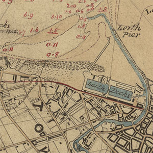
| MS.5848, No.63 | (Not yet scanned) Leith - Old entrance of Leith Harbour | 1709 |
| MS.5848, No.64 | (Not yet scanned) Leith - Track of the Polly of Leven into Harbour | 1814 |
| MS.5848, No.65 | (Not yet scanned) Leith - Proposed town of Leith | 1820 |
| MS.5848, No.66 | (Not yet scanned) Leith - Various properties contiguous to Leith Docks | 1882 |
| MS.5848, No.67 | (Not yet scanned) Leith - Survey of part of river and harbour | 1882-3 |
| MS.5848, No.68 | (Not yet scanned) Leith - Mr Rennie's plan for Leith | 1824 |
| MS.5848, No.68A | (Not yet scanned) Leith - Mr Chalmer's ground between Queensferry Road and Water of Leith | 1824 |
| MS.5848, No.68B | (Not yet scanned) Leith - Leith Mount | 1824 |
| MS.5848, No.69 | Leith - Sketch plan in relation to Leith Harbour | 1828 |
| MS.5848, No.70 | Leith - Plan and chart of harbour and docks | 1831 |
| MS.5848, No.71 | (Not yet scanned) Leith - Plan of proposed Wharf Wall | 1838 |
| MS.5848, No.72 | (Not yet scanned) Leith - Harbour and vicinity | |
| MS.5848, No.73 | (Not yet scanned) Leith - Plan of New Harbour | 1836 |
| MS.5848, No.74 | (Not yet scanned) Leith - Plan and section of part of building yard | 1837 |
| MS.5848, No.75 | Leith - Sections of proposed walls | 1837 |
| MS.5848, No.76 | Leith - Proposed Branch Railway from Edinburgh | |
| MS.5848, No.77 | (Not yet scanned) Leith - Plan of proposed railwayfrom Great Junction Street | 1846 |
| MS.5848, No.78 - 80 | (Not yet scanned) Leith - Plan of Granary | |
| MS.5848, No.81 | Leith - Plans showing proposed range of light of intended light house at Leith pier | 1852 |
| MS.5848, No.82 | Leith - Plan of new docks | 1862 |
| MS.5848, No.83 | (Not yet scanned) Leith - Granary Dock; new dry dock | 1874 |
| MS.5848, No.84 | Leith - Plan of Harbour and Docks | 1905 |
| MS.5848, No.85 | (Not yet scanned) Leith - Mooring Paul and Fender on Pier | n.d. |
| MS.5848, No.86 | (Not yet scanned) Leith - Hollow Quoin Albert Dock | n.d. |
| MS.5848, No.87 | Leith - Pier | |
| MS.5848, No.88 | (Not yet scanned) Leith - Plans of a tower to be erected on Beacon Rock | n.d. |
| MS.5848, No.89 | Leith - Sections of Edinburgh | |
| MS.5848, No.90 | (Not yet scanned) Leith - Harbour and Docks | n.d. |
| MS.5848, No.91 - 93 | (Not yet scanned) Leith - New Dry Dock | n.d. |
| MS.5848, No.94 | (Not yet scanned) Leith - Leith Street to Foot of Leith Walk | n.d. |
| MS.5848, No.95 | Leith - Ground on East side to be laid out for building | |
| MS.5848, No.96 | Edinburgh - Position of reservoirs for supply of mills | 1824 |
| MS.5848, No.97 | (Not yet scanned) Edinburgh - Plan at Greenland Mills | 1827 |
| MS.5848, No.98 - 99 | (Not yet scanned) Edinburgh - Course of River in reference to Clermont Cresc. and Clerks Mill Bleachfield | 1827 |
| MS.5848, No.100 | (Not yet scanned) Edinburgh - Sections at St.Marks Place | 1831 |
| MS.5848, No.101-103 | (Not yet scanned) Edinburgh - Position of weir proposes to be constructed near St. Bernards Well | 1839 |
| MS.5848, No.104 | (Not yet scanned) Edinburgh - Sketch of river & adjacent properties from Colt Bridge to Canon Mills | n.d. |
| MS.5849, No.1 | (Not yet scanned) Edinburgh - Sections through lands of Hillside | 1817 |
| MS.5849, No.2 - 7 | (Not yet scanned) Edinburgh - Sections of drains | 1821 |
| MS.5849, No.8 | Edinburgh - Cross Sections | 1838 |
| MS.5849, No.9 | (Not yet scanned) Edinburgh - Sections through lands of Hillside | n.d. |
| MS.5849, No.10 | Edinburgh - Exhibition Rooms-Royal Academy & Nat Gallery | 1850 |
| MS.5849, No.10 | Edinburgh - Exhibition Rooms-Royal Academy & Nat Gallery | 1850 |
| MS.5849, No.11 - 12 | Edinburgh - Exhibition Rooms-Royal Academy & Nat Gallery | 1850 |
| MS.5849, No.11 - 12 | Edinburgh - Exhibition Rooms-Royal Academy & Nat Gallery | 1850 |
| MS.5849, No.11 - 12 | Edinburgh - Exhibition Rooms-Royal Academy & Nat Gallery | 1850 |
| MS.5849, No.13 | Edinburgh - Exhibition Rooms-Royal Academy & Nat Gallery: plan of foundations | 1850 |
| MS.5849, No.13 | Edinburgh - Exhibition Rooms-Royal Academy & Nat Gallery: plan of foundations | 1850 |
| MS.5849, No.14 | (Not yet scanned) Edinburgh - Nat. Galleries: Iron Work to strengthen masonary above railway tunnel | 1852 |
| MS.5849, No.15 - 17 | (Not yet scanned) Edinburgh - Sections of wall and Iron tie-bars | 1873 |
| MS.5849, No.18 | Edinburgh - Ground acquired for erection of Nat. Gallery | 1892 |
| MS.5849, No.19 | (Not yet scanned) Edinburgh - Ground acquired for erection of Nat. Gallery | 1892 |
| MS.5849, No.20 | (Not yet scanned) Edinburgh - Ground acquired for erection of Nat. Gallery | 1892 |
| MS.5849, No.21 | Edinburgh - Doorways | 1892 |
| MS.5849, No.22 | (Not yet scanned) Edinburgh - Trigonometrical survey of Nat. Gallery ground | 1893 |
| MS.5849, No.23 | (Not yet scanned) Edinburgh - Elevation | 1770 |
| MS.5849, No.24 | Edinburgh - Sketch | 1770 |
| MS.5849, No.25 - 26 | (Not yet scanned) Edinburgh - Sketch | 1820 |
| MS.5849, No.27 | (Not yet scanned) Edinburgh - Transverse section of road-way and parapet | 1820 |
| MS.5849, No.28 | Edinburgh - Plans and sections for widening & improving the North Bridge | 1820 |
| MS.5849, No.29 | Edinburgh - Plans and sections for widening & improving the North Bridge | 1820 |
| MS.5849, No.30 | Edinburgh - Plans and sections for widening & improving the North Bridge | 1820 |
| MS.5849, No.31 | Edinburgh - Sketch showing method of widening | 1835 |
| MS.5849, No.32 - 33 | Edinburgh - Design | 1835 |
| MS.5849, No.32 - 33 | Edinburgh - Design | 1835 |
| MS.5849, No.34 - 39 | (Not yet scanned) Edinburgh - Improvements: sketches and sections | 1845 |
| MS.5849, No.40 | (Not yet scanned) Edinburgh - Plan and elevation | 1872 |
| MS.5849, No.41 | Edinburgh - Design fro widening: east elevations | 1873 |
| MS.5849, No.42 | Edinburgh - Design fro widening: east elevations | 1873 |
| MS.5849, No.43 | Edinburgh - Design for widening: west elevations | 1873 |
| MS.5849, No.44 | Edinburgh - Design for widening: west elevations | 1873 |
| MS.5849, No.45 | (Not yet scanned) Edinburgh - Alteration to be made | |
| MS.5849, No.46 | (Not yet scanned) Edinburgh - Park & Grounds | |
| MS.5849, No.47 | Edinburgh - Survey in reference to tunnel works through the lands of Sir R.K.Dick | 1828 |
| MS.5849, No.48 - 49 | (Not yet scanned) Edinburgh - Retaining Wall for Mr Trotter's property proposed to be erected on Princes Street | 1820 |
| MS.5849, No.50 | Edinburgh - Sketch of East End with proposed alterations | |
| MS.5849, No.51 | Edinburgh - Lands belonging to Capt. McDonald | 1819 |
| MS.5849, No.52 - 53 | (Not yet scanned) Edinburgh - Section relative to Bonnington Mills | 1819 |
| MS.5849, No.54 - 57 | Edinburgh - Section of Tunnel under new road by Jock's Lodge | 1819 |
| MS.5849, No.54 - 57 | Edinburgh - Section of Tunnel under new road by Jock's Lodge | 1819 |
| MS.5849, No.54 - 57 | Edinburgh - Section of Tunnel under new road by Jock's Lodge | 1819 |
| MS.5849, No.54 - 57 | Edinburgh - Section of Tunnel under new road by Jock's Lodge | 1819 |
| MS.5849, No.58 | (Not yet scanned) Edinburgh - Section | |
| MS.5849, No.59 | (Not yet scanned) Edinburgh - Section from Jock's Lodge to Baron Norton's Gate | |
| MS.5849, No.60 | (Not yet scanned) Edinburgh - Sections | |
| MS.5849, No.61 | (Not yet scanned) Edinburgh - Sections | |
| MS.5849, No.62 | (Not yet scanned) Edinburgh - Sections | |
| MS.5849, No.63 | (Not yet scanned) Edinburgh - Sections | |
| MS.5849, No.64 | (Not yet scanned) Edinburgh - Sections | |
| MS.5849, No.65 | Edinburgh - Copy of Parliamentary Plan | |
| MS.5849, No.66 | Edinburgh - East End of Princes Street showing Regent Bridge | |
| MS.5849, No.67 | Edinburgh - Sketches of proposed new buildings | |
| MS.5849, No.68 | Edinburgh - Sketches of proposed new buildings | |
| MS.5849, No.69 | (Not yet scanned) Edinburgh - Section of Windsor Street and Leopold | |
| MS.5849, No.70 | Edinburgh - Specification and plans for excavating ground for houses in Royal Terrace & forming road to Leith Walk | 1821 |
| MS.5849, No.71 | Edinburgh - Specification and plans for excavating ground for houses in Royal Terrace & forming road to Leith Walk | 1821 |
| MS.5849, No.72 | (Not yet scanned) Edinburgh - Specification and plans for excavating ground for houses in Royal Terrace & forming road to Leith Walk | 1821 |
| MS.5849, No.73 | (Not yet scanned) Edinburgh - Cellars and sections of houses | 1821 |
| MS.5849, No.74 | Edinburgh - Cellars and sections of houses | 1821 |
| MS.5849, No.75 | (Not yet scanned) Edinburgh - Cellars and sections of houses | 1821 |
| MS.5849, No.76 | (Not yet scanned) Edinburgh - Cellars and sections of houses | 1821 |
| MS.5849, No.77 | (Not yet scanned) Edinburgh - Cellars and sections of houses | 1821 |
| MS.5849, No.78 | Edinburgh - Cellars and sections of houses | 1821 |
| MS.5849, No.79 | Edinburgh - Perspective view of suspension pier | 1821 |
| MS.5849, No.80 | Edinburgh - Proposes sea wallon north side of lands of Trinity Lodge | 1822 |
| MS.5849, No.80 | Edinburgh - Proposes sea wallon north side of lands of Trinity Lodge | 1822 |
| MS.5849, No.81 | Edinburgh - Proposes sea wallon north side of lands of Trinity Lodge | 1822 |
| MS.5849, No.82 | Edinburgh | |
| MS.5849, No.83 | Edinburgh | |
| MS.5849, No.84 | (Not yet scanned) Edinburgh | |
| MS.5849, No.85 | Edinburgh | |
| MS.5849, No.86 | Edinburgh | |
| MS.5849, No.87 | (Not yet scanned) Edinburgh | |
| MS.5849, No.88 | Edinburgh | |
| MS.5849, No.89 | (Not yet scanned) Edinburgh | |
| MS.5849, No.90 | Edinburgh - Plan of Leith at Union Place showing proposed Direct Atmospheric Railway | |
| MS.5849, No.91 | Edinburgh | |
| MS.5849, No.92 | (Not yet scanned) Edinburgh | |
| MS.5849, No.93 | (Not yet scanned) Edinburgh | |
| MS.5849, No.94 | (Not yet scanned) Edinburgh | |
| MS.5849, No.95 | (Not yet scanned) Edinburgh | |
| MS.5849, No.96 | (Not yet scanned) Edinburgh | |
| MS.5849, No.97 | (Not yet scanned) Edinburgh | |
| MS.5849, No.98 | Edinburgh | |
| MS.5849, No.99 | (Not yet scanned) Edinburgh - Extension and sewerage | |
| MS.5849, No.100 | (Not yet scanned) Edinburgh - Extension and sewerage | |
| MS.5849, No.101 | (Not yet scanned) Edinburgh - Map of shire of Edinburgh | 1812 |
| MS.5849, No.102 | OS One-inch to the mile | |
| MS.5849, No.103 | (Not yet scanned) Edinburgh - Map of shire of Edinburgh | 1847 |
| MS.5849, No.104 | (Not yet scanned) Edinburgh - City of Edinburgh and its environs | 1817 |
| MS.5849, No.105 | (Not yet scanned) Elgin - Harbour and sections | 1835 |
| MS.5849, No.106 | (Not yet scanned) Elie - Pier - plan & sections for proposed wharfs | 1815 (1846) |
| MS.5849, No.107 | (Not yet scanned) Elie - Harbour- sections for proposed wharfs | 1836 |
| MS.5849, No.108 | (Not yet scanned) Elie - Bay and Harbour | 1836 |
| MS.5849, No.109 | Elie - Sewerage | 1922 |
| MS.5849, No.110 | (Not yet scanned) Elie - Sketch of Apple Rock | |
| MS.5849, No.111 | Elie - Harbour- proposed extension of pier | |
| MS.5849, No.112 | Elie - Tunnel for removing silt from Harbour | |
| MS.5849, No.113 | Elie - Tunnel for removing silt from Harbour | |
| MS.5849, No.114 | (Not yet scanned) Ellemford - Bridge | 1878 |
| MS.5849, No.115 | (Not yet scanned) Ellemford - Bridge sections | |
| MS.5849, No.116 | Endrick | |
| MS.5849, No.117 | (Not yet scanned) Ericht - Sections above Blairgowie Bridge | |
| MS.5849, No.118 | (Not yet scanned) Esk | |
| MS.5849, No.119 | Esk | |
| MS.5849, No.120 | (Not yet scanned) Esk | |
| MS.5849, No.121 | Esk | |
| MS.5849, No.122 | (Not yet scanned) Esk | |
| MS.5849, No.123 | Esk | |
| MS.5849, No.124 | (Not yet scanned) Esk | |
| MS.5849, No.125 | (Not yet scanned) Esk | |
| MS.5849, No.126 | (Not yet scanned) Esk | |
| MS.5849, No.127 | Esk | |
| MS.5849, No.128 | Bridge of Dun - Dun Bridge | 1785 |
| MS.5849, No.129 | (Not yet scanned) Esk | |
| MS.5849, No.130 | (Not yet scanned) Esk | |
| MS.5849, No.131 | (Not yet scanned) Esk | |
| MS.5849, No.132 | (Not yet scanned) Esk | |
| MS.5849, No.133 | (Not yet scanned) Esk | |
| MS.5849, No.134 | (Not yet scanned) Esk | |
| MS.5849, No.135 | (Not yet scanned) Esk | |
| MS.5849, No.136 | (Not yet scanned) Esk | |
| MS.5849, No.137 | (Not yet scanned) Esk | |
| MS.5849, No.138 | Esk | |
| MS.5849, No.139 | (Not yet scanned) Esk | |
| MS.5849, No.140 | (Not yet scanned) Esk | |
| MS.5849, No.141 | (Not yet scanned) Esk | |
| MS.5849, No.142 | Esk | |
| MS.5849, No.143 | (Not yet scanned) Eyemouth - Bay and Soundings | 1837 |
| MS.5849, No.144 | (Not yet scanned) Eyemouth - Harbour | |
| MS.5849, No.145 | (Not yet scanned) Eyemouth - Harbour- proposed restoration of pierhead | 1877 |
| MS.5849, No.146 | Eyemouth - Harbour | 1882 |
| MS.5848, No.146 | (Not yet scanned) Eyemouth - Port | |
| MS.5849, No.147 | (Not yet scanned) Eyemouth - Port | 1882 |
| MS.5849, No.148 | (Not yet scanned) Eyemouth - Port | 1843 |
| MS.5850, No.1 | (Not yet scanned) Fife and Kinross - Map of the coastline near Fife | 1818 |
| MS.5850, No.2 | Fife and Kinross - Map of counties | 1827 |
| MS.5850, No.3 | Fife and Kinross - Map of counties | 1827 |
| MS.5850, No.4 | (Not yet scanned) Fife and Kinross - Plan and sections | 1825 |
| MS.5850, No.5 | (Not yet scanned) Findhorn | |
| MS.5850, No.6 | (Not yet scanned) Findhorn | |
| MS.5850, No.7 | Findhorn | |
| MS.5850, No.8 | Findhorn | |
| MS.5850, No.9 | (Not yet scanned) Findhorn | |
| MS.5850, No.10 | (Not yet scanned) Findhorn | |
| MS.5850, No.11 | Findhorn | |
| MS.5850, No.12 | (Not yet scanned) Findochty - Harbour | 1882 |
| MS.5850, No.13 | Findochty - Harbour- enlarged drawings of pierhead and stairs | 1882 |
| MS.5850, No.14 | Findochty - Harbour- proposed additional pier | 1882 |
| MS.5850, No.15 | (Not yet scanned) Fisherrow - Survey of harbour with sections of proposed improvements | |
| MS.5850, No.16 | (Not yet scanned) Fisherrow - Harbours | |
| MS.5850, No.17 | Fisherrow - Harbours | |
| MS.5850, No.18 | (Not yet scanned) Fisherrow - Harbour with proposed new works | 1839 |
| MS.5850, No.19 | (Not yet scanned) Fisherrow - Harbour with proposed new works | 1839 |
| MS.5850, No.20 | Fisherrow - Harbour with proposed new works | 1839 |
| MS.5850, No.21 | (Not yet scanned) Fisherrow - Harbour with proposed new works | 1839 |
| MS.5850, No.22 | (Not yet scanned) Fisherrow - Harbour with proposed new works | 1839 |
| MS.5851, No.22A | Fisherrow - Harbour with proposed new works | 1839 |
| MS.5850, No.23 | (Not yet scanned) Fisherrow - Harbour with proposed new works | 1839 |
| MS.5850, No.24 | Fisherrow - Harbour with proposed new works | 1839 |
| MS.5850, No.25 | (Not yet scanned) Fisherrow - Harbour | |
| MS.5850, No.26 | (Not yet scanned) Fisherrow - Harbour | |
| MS.5850, No.27 | (Not yet scanned) Fisherrow - Harbour | |
| MS.5850, No.28 | (Not yet scanned) Fisherrow - Harbour | |
| MS.5850, No.29 | (Not yet scanned) Fisherrow - Harbour | |
| MS.5850, No.30 | (Not yet scanned) Fisherrow - Harbour and jetty | |
| MS.5850, No.31 | (Not yet scanned) Forfar - Survey and section of canal from Forfar to Arbroath | 1817 |
| MS.5850, No.32 | (Not yet scanned) Forfar - Survey and section of canal from Forfar to Arbroath | |
| MS.5850, No.33 | Forth | |
| MS.5850, No.34 | Forth | |
| MS.5850, No.35 | (Not yet scanned) Forth | |
| MS.5850, No.36 | Forth | |
| MS.5850, No.37 | Forth | |
| MS.5850, No.38 | Forth | |
| MS.5850, No.39 | Forth | |
| MS.5850, No.40 | Forth | |
| MS.5850, No.41 | Forth | |
| MS.5850, No.42 | Forth | |
| MS.5850, No.43 | Forth | |
| MS.5850, No.44 | Forth | |
| MS.5850, No.45 | Forth | |
| MS.5850, No.46 | Forth | |
| MS.5850, No.47 | Forth | |
| MS.5850, No.48 | Forth | |
| MS.5850, No.49 | Forth | |
| MS.5850, No.50 | Forth | |
| MS.5850, No.51 | (Not yet scanned) Forth | |
| MS.5850, No.52 | (Not yet scanned) Forth | |
| MS.5850, No.53 | (Not yet scanned) Forth | |
| MS.5850, No.54 | Forth & Clyde Canal - Sketch of country between Edin | |
| MS.5850, No.55 | (Not yet scanned) Forth & Clyde Canal - Sketch of country between Edin | |
| MS.5850, No.56 | (Not yet scanned) Forth & Clyde Canal - Sketch of country between Edin | |
| MS.5850, No.57 | (Not yet scanned) Forth | |
| MS.5850, No.58 | (Not yet scanned) Fraserburgh - Sketch of coast from Fraserburgh to Peterhead | 1802 |
| MS.5850, No.59 | Fraserburgh - Sketch plan of new southern pier for harbour | 1818 |
| MS.5850, No.60 | (Not yet scanned) Fraserburgh - Harbour | |
| MS.5850, No.61 | Fraserburgh - Harbour | |
| MS.5850, No.62 | (Not yet scanned) Fraserburgh - Above plan | |
| MS.5850, No.63 | (Not yet scanned) Fraserburgh - Sketch of Coast from Fraserburgh to Peterhead with sections at Carnbulg Briggs | |
| MS.5850, No.64 | Fraserburgh - Harbour | |
| MS.5850, No.65 | Fraserburgh - Harbour | |
| MS.5850, No.66 | Fraserburgh - Harbour with proposed improvements | 1838 |
| MS.5850, No.67 | (Not yet scanned) Fraserburgh - Harbour with proposed improvements | 1838 |
| MS.5850, No.68 | (Not yet scanned) Fraserburgh - Harbour | 1838 |
| MS.5850, No.69 | (Not yet scanned) Fraserburgh - Harbour and sections | 1838 |
| MS.5850, No.70 | (Not yet scanned) Fraserburgh - Harbour | 1848 |
| MS.5850, No.71 | (Not yet scanned) Fraserburgh - Harbour | |
| MS.5850, No.72 | (Not yet scanned) Fraserburgh - Harbour | |
| MS.5850, No.73 | (Not yet scanned) Fraserburgh - Harbour | |
| MS.5850, No.74 | (Not yet scanned) Fraserburgh - Harbour; details | 1850 |
| MS.5850, No.75 | (Not yet scanned) Fraserburgh - Harbour; restoration of parts of outer breakwater | 1852-3 |
| MS.5850, No.76 | (Not yet scanned) Fraserburgh - Harbour; restoration of parts of outer breakwater | 1852-3 |
| MS.5850, No.77 | (Not yet scanned) Fraserburgh - Harbour; restoration of parts of outer breakwater | 1852-3 |
| MS.5850, No.78 | Fraserburgh - Harbour; design for cross-section of pier | 1853 |
| MS.5850, No.79 | (Not yet scanned) Fraserburgh - Harbour | |
| MS.5850, No.80 | (Not yet scanned) Fraserburgh - Harbour | |
| MS.5850, No.81 | Fraserburgh - Harbour | |
| MS.5850, No.82 | Fraserburgh - harbour | |
| MS.5850, No.83 | Fraserburgh - Town and bay | |
| MS.5850, No.84 | (Not yet scanned) Freuchie - Railway from Markinch Burn to Freuchie | 1848 |
| MS.5850, No.85 | (Not yet scanned) Fyne | |
| MS.5850, No.86 | Fyne | |
| MS.5850, No.87 | Fyne | |
| MS.5850, No.88 | (Not yet scanned) Fyne | |
| MS.5851, No.1 | Galashiels - Elevation of wire bridge over Gala Water | 1818 |
| MS.5851, No.2 | (Not yet scanned) Galashiels - Plan of railway | n.d. |
| MS.5851, No.3 | (Not yet scanned) Galashiels - Plan of railway | n.d. |
| MS.5851, No.4 | (Not yet scanned) Galashiels - Plan of railway | n.d. |
| MS.5851, No.5 | (Not yet scanned) Galashiels - Plan of railway | n.d. |
| MS.5851, No.6 | (Not yet scanned) Gardenstown - Harbour | 1878 |
| MS.5851, No.7 | (Not yet scanned) Gardenstown - Harbour | 1897 |
| MS.5851, No.8 | (Not yet scanned) Gardenstown - Harbour | 1897 |
| MS.5851, No.9 | Gardenstown - Map of area (OS 1:2500) | |
| MS.5851, No.10 | (Not yet scanned) Glasgow - Plan and section of Clyde opposite Water Works | 1809 |
| MS.5851, No.11 | (Not yet scanned) Glasgow - Copy of part of play of roads in Barony Parish | 1817 |
| MS.5851, No.12 | (Not yet scanned) Glasgow - Plan & elevation of Glasgow Old Bridge with addition to its width | 1820 |
| MS.5851, No.13 | Glasgow - Section of proposed canal from Clyde at Rutherglen to basin above Hamilton | |
| MS.5851, No.14 | (Not yet scanned) Glasgow - Plan of property of Water Works Co. | |
| MS.5851, No.15 | (Not yet scanned) Glasgow - Plan of Cranstonhill Water Co.'s intended reservoir at Drygate Street | 1827 |
| MS.5851, No.16 | Glasgow - Plan of reservoir near Drygate St. for Cranstonhill Water Co. | 1828 |
| MS.5851, No.17 | Glasgow - Plan of reservoir near Drygate St. for Cranstonhill Water Co. | 1828 |
| MS.5851, No.17 | Glasgow - Plan of reservoir near Drygate St. for Cranstonhill Water Co. | 1828 |
| MS.5851, No.18 | (Not yet scanned) Glasgow - Plan of reservoir near Drygate St. for Cranstonhill Water Co. | 1828 |
| MS.5851, No.19 | (Not yet scanned) Glasgow - Plan of reservoir near Drygate St. for Cranstonhill Water Co. | 1828 |
| MS.5851, No.20 | Glasgow - Plan of reservoir near Drygate St. for Cranstonhill Water Co. | 1828 |
| MS.5851, No.21 | (Not yet scanned) Glasgow - Plan & section of reservior near Drygate Street | 1828 |
| MS.5851, No.22 | (Not yet scanned) Glasgow - Design for bridge between Saltmarket St & Hutcheson | 1828 |
| MS.5851, No.23 | (Not yet scanned) Glasgow - Plan & section showing situation of Hutchison Bridge | 1828 |
| MS.5851, No.24 | (Not yet scanned) Glasgow - Design for bridge between Saltmarket & Hutcheson | 1828 |
| MS.5851, No.25 | (Not yet scanned) Glasgow - Relative altitude of various rising grounds in Glasgow | 1828 |
| MS.5851, No.26 | (Not yet scanned) Glasgow - City and environs | 1828 |
| MS.5851, No.27 | (Not yet scanned) Glasgow - Plan of Clyde from Broomielaw to Hutcheson's Bridge | 1829 |
| MS.5851, No.28 | (Not yet scanned) Glasgow - Plan of Clyde from Broomielaw to Hutcheson's Bridge | 1829 |
| MS.5851, No.29 | (Not yet scanned) Glasgow - Sections of Clyde from Broomielaw to Hutcheson's Bridge | 1829 |
| MS.5851, No.30 | (Not yet scanned) Glasgow - Proposed road from Glasgow to Kilmarnock | 1830 |
| MS.5851, No.31 | (Not yet scanned) Glasgow - Proposed extension of Pollock & Govan Railway to Rutherglen | 1830 |
| MS.5851, No.32 | Glasgow - Survey of part of city and section of Clyde with proposed bridge near Broomielaw | 1831 |
| MS.5851, No.33 | Glasgow - Survey of two railway lines Paisley Canal Aqueduct to Rutherglen | 1831 |
| MS.5851, No.34 | Glasgow - Survey and sections of above | 1831 |
| MS.5851, No.35 | Glasgow - Design for wooden bridge over Clyde | 1831 |
| MS.5851, No.36 | (Not yet scanned) Glasgow - Design for wooden bridge over Clyde | 1831 |
| MS.5851, No.37 | Glasgow - Design for wooden bridge over Clyde | 1831 |
| MS.5851, No.38 | (Not yet scanned) Glasgow - Views of the opening of the Glasgow & Garnkirk Railway | 1832 |
| MS.5851, No.39 | Glasgow - Sections of Hutcheson's Bridge | 1832 |
| MS.5851, No.40 | (Not yet scanned) Glasgow - Plan | |
| MS.5851, No.41 | Glasgow - Plan | |
| MS.5851, No.41 | Glasgow - Plan | |
| MS.5851, No.42 | Glasgow - Plan | |
| MS.5851, No.43 | Glasgow - Plan | |
| MS.5851, No.43 | Glasgow - Plan | |
| MS.5851, No.44 | (Not yet scanned) Glasgow - Plan | |
| MS.5851, No.45 | Glasgow - Plan | |
| MS.5851, No.45 | Glasgow - Plan | |
| MS.5851, No.46 | (Not yet scanned) Glasgow - Plan | |
| MS.5851, No.47 | (Not yet scanned) Glasgow - Plan | |
| MS.5851, No.48 | Glasgow - Plan | |
| MS.5851, No.49 | (Not yet scanned) Glasgow - Plan | |
| MS.5851, No.50 | (Not yet scanned) Glasgow - Plan | |
| MS.5851, No.51 | (Not yet scanned) Glasgow - Plan | |
| MS.5851, No.52 | (Not yet scanned) Glasgow - Sections of Glasgow and Falkirk Junction Railway | |
| MS.5851, No.53 | (Not yet scanned) Glasgow - Sections of Stockwell Bridge | 1845 |
| MS.5851, No.54 | (Not yet scanned) Glasgow - Outline of Hutcheson Bridge showing effect on foundations by deepending bed of river | 1846 |
| MS.5851, No.55 | (Not yet scanned) Glasgow - Outline of Hutcheson Bridge showing effect on foundations by deepending bed of river | 1846 |
| MS.5851, No.56 | Glasgow - Sections & soundings of Clyde | 1875-6 |
| MS.5851, No.57 | Glasgow - Sections & soundings of Clyde | 1875-6 |
| MS.5851, No.58 | (Not yet scanned) Glasgow - Sections & soundings of Clyde | 1875-6 |
| MS.5851, No.59 | (Not yet scanned) Glasgow - Sections & soundings of Clyde | 1875-6 |
| MS.5851, No.60 | Glasgow - Sections & soundings of Clyde | 1875-6 |
| MS.5851, No.61 | Glasgow - Sections & soundings of Clyde | 1875-6 |
| MS.5851, No.62 | (Not yet scanned) Glasgow - Sections & soundings of Clyde | 1875-6 |
| MS.5851, No.63 | (Not yet scanned) Glasgow - Sections & soundings of Clyde | 1875-6 |
| MS.5851, No.64 | (Not yet scanned) Glasgow - Sections & soundings of Clyde | 1875-6 |
| MS.5851, No.65 | Glasgow - Sections & soundings of Clyde | 1875-6 |
| MS.5851, No.66 | (Not yet scanned) Glasgow - Sections & soundings of Clyde | 1875-6 |
| MS.5851, No.67 | Glasgow - Glasgow Water Bill Opposition; graphs illustrating water supply | 1885 |
| MS.5851, No.68 | Glasgow - Glasgow Water Bill Opposition; graphs illustrating water supply | 1885 |
| MS.5851, No.69 | (Not yet scanned) Glasgow - Plan of Clyde and proposed dock at Broomielaw Bridge | n.d. |
| MS.5851, No.70 | (Not yet scanned) Glasgow - Sketch & elevations of improvement of Broomielaw Bridge | n.d. |
| MS.5851, No.71 | Glasgow - Wooden bridge at Clyde Iron Works | |
| MS.5851, No.72 | Glasgow - Sections and levels of Clyde | |
| MS.5851, No.73 | Glasgow - Sketch & sections of abutment of Hutcheson's Bridge | |
| MS.5851, No.74 | (Not yet scanned) Glasgow - Section of draught line on Bridge | n.d. |
| MS.5851, No.75 | (Not yet scanned) Glasgow - Section of draught line on Bridge | n.d. |
| MS.5851, No.76 | (Not yet scanned) Glasgow - Section of draught line on Bridge | n.d. |
| MS.5851, No.77 | Glasgow - Level of Clyde during flood | |
| MS.5851, No.78 | (Not yet scanned) Glasgow - Tollhouse of Hutcheson's Bridge | n.d. |
| MS.5851, No.79 | Glasgow - Tollgates | |
| MS.5851, No.80 | Glasgow - Toll lodge for Foot Passengers | |
| MS.5851, No.81 | Glasgow - Bridge & sections in Clyde | |
| MS.5851, No.82 | (Not yet scanned) Glasgow - Comparative levels of railway at Eglinton Street | n.d. |
| MS.5851, No.83 | (Not yet scanned) Golspie - Pier | 1895 |
| MS.5851, No.84 | Gourock - Plan of Gourock Bay | 1844 |
| MS.5851, No.85 | Gourock - Design for docks and other works | 1865 |
| MS.5851, No.86 | Gourock - Modified design of docks at Gourock | 1865 |
| MS.5851, No.87 | Gourock - Modified design of docks at Gourock | 1865 |
| MS.5851, No.88 | Gourock - Proposed docks | 1865 |
| MS.5851, No.89 | (Not yet scanned) Gourock - Harbour | |
| MS.5851, No.90 | Gourock - Proposed Docks & Basin | 1865 |
| MS.5851, No.91 | Gourock - Bay and Soundings | 1877 |
| MS.5851, No.92 | Gourock - Proposed Habour and Railways | 1877 |
| MS.5851, No.93 | (Not yet scanned) Gourock - Proposed harbour & railways | 1877 |
| MS.5851, No.94 | (Not yet scanned) Gourock - Harbour and Railway | 1878 |
| MS.5851, No.95 | (Not yet scanned) Gourock - Bay and Harbour | 1878 |
| MS.5851, No.96 | (Not yet scanned) Gourock - Map of town and coast | |
| MS.5851, No.97 | (Not yet scanned) Gourock - Bay | |
| MS.5851, No.98 | (Not yet scanned) Gourock - Harbour | |
| MS.5851, No.99 | (Not yet scanned) Grandholm - Works belonging to Leys Masson & Co | 1830 |
| MS.5851, No.100 | (Not yet scanned) Grangemouth - Proposed extension of Clyde & Forth Canal with wet dock | 1815 |
| MS.5851, No.101 | (Not yet scanned) Grangemouth - Survey of town with proposed Harbour improvements | 1817 |
| MS.5851, No.102 | Grangemouth - Proposed now timber basin | 1817 |
| MS.5851, No.103 | (Not yet scanned) Grangemouth - Plan and section of new timber basin and Wet Dock | 1818 |
| MS.5851, No.104 | (Not yet scanned) Grangemouth - Sketch of improvements at Grangemouth | 1819 |
| MS.5851, No.105 | Grangemouth - Proposed Wet Dock | 1819 |
| MS.5851, No.106 | Grangemouth - Dock | |
| MS.5851, No.107 | (Not yet scanned) Grangemouth - Harbour | |
| MS.5851, No.108 | (Not yet scanned) Grangemouth - Proposed lock into old timber basin | 1876 |
| MS.5851, No.109 | (Not yet scanned) Grangemouth - Sections of dock | 1876 |
| MS.5851, No.110 | Grangemouth - Section of canal | 1889 |
| MS.5851, No.111 | Grangemouth - Proposed Wet Dock | |
| MS.5851, No.112 | Grangemouth - Supposed cross-section of wall at Old Wet Dock | |
| MS.5851, No.113 | (Not yet scanned) Grangemouth - Plan of dock and town | 1808 & 1817 |
| MS.5851, No.114 | (Not yet scanned) Grangemouth - Town and district | 1886 |
| MS.5851, No.115 | (Not yet scanned) Greenock - Plan & section of 2 dry docks | 1810 |
| MS.5851, No.116 | (Not yet scanned) Greenock - Part of West Burn with ship building yard of J. Scott | 1839 |
| MS.5851, No.117 | (Not yet scanned) Greenock - Harbour showing improvements | 1841 |
| MS.5851, No.118 | (Not yet scanned) Greenock - Section of West Burn | 1852 |
| MS.5851, No.119 | (Not yet scanned) Greenock - Section of harbour | 1859 |
| MS.5851, No.120 | (Not yet scanned) Greenock - Plan of proposed harbour | 1859 |
| MS.5851, No.121 | (Not yet scanned) Greenock - Caledonian Railway - Greenock and Gourock extensions | 1865 |
| MS.5851, No.122 | (Not yet scanned) Greenock - Proposed wall and embankment at Garvel Dock Works | 1879 |
| MS.5851, No.123 | (Not yet scanned) Greenock - Light Post to be erected at Quay for railway | 1887 |
| MS.5851, No.124 | (Not yet scanned) Greenock - Reduced plan of lands drained into reservoirs & aqueduct near Greenock | n.d. |
| MS.5852, No.1 | (Not yet scanned) Haddington - Map of district | |
| MS.5852, No.2 | Harris - Sound showing soundings | 1857 |
| MS.5852, No.3 | (Not yet scanned) Harris - Plan of New Pier at East Loch | |
| MS.5852, No.4 | Helmsdale - Plan of harbour | 1855 |
| MS.5852, No.5 | (Not yet scanned) Helmsdale - Timber stage over Bulwark at Inner Basin | 1868 |
| MS.5852, No.6 | (Not yet scanned) Helmsdale - Proposed Improvements | 1868 |
| MS.5852, No.7 | Hopeman - Plan of harbour | 1870 |
| MS.5852, No.8 | Hopeman - Plan of harbour works | |
| MS.5852, No.9 | (Not yet scanned) Hopetoun - Sections of coast | 1821 |
| MS.5852, No.10 | Hopetoun House - Sections of approach to House | |
| MS.5852, No.11 | Hopetoun House - Plan of park | |
| MS.5852, No.12 | Hoy - Estimate of Landing Slip | |
| MS.5852, No.13 | Hoy - Estimate of Landing Slip | |
| MS.5852, No.14 | (Not yet scanned) Huntly - Diagram of castle; Huntly fishing | 1861 |
| MS.5852, No.15 | (Not yet scanned) Huntly - Diagram of castle; Huntly fishing | 1861 |
| MS.5853, No.1 | (Not yet scanned) Innellan - Pier | 1869 |
| MS.5853, No.2 | (Not yet scanned) Innellan - Pier | 1875 |
| MS.5853, No.3 | (Not yet scanned) Innellan - Sections of Pier | 1899 |
| MS.5853, No.4 | Inverallochy - Proposed Harbour | 1872 |
| MS.5853, No.5 | Invergordon - Jetty | 1855 |
| MS.5853, No.6 | (Not yet scanned) Invergordon - Harbour | 1856 |
| MS.5853, No.7 | Invergordon - Timber Jetty | 1856 |
| MS.5853, No.8 | Invergordon - Timber Jetty | 1886 |
| MS.5853, No.9 | (Not yet scanned) Invergordon - Jetty | |
| MS.5853, No.10 | (Not yet scanned) Inverness - Bridge and sections | 1831 |
| MS.5853, No.11 | Inverness - Sections and improvements of Harbour | 1846 |
| MS.5853, No.12 | (Not yet scanned) Inverness - Harbour & part of river Ness | 1846 |
| MS.5853, No.13 | (Not yet scanned) Inverness - Harbour & proposed improvements | 1851 |
| MS.5853, No.14 | (Not yet scanned) Inverness - Harbour | |
| MS.5853, No.15 | Inverness - Harbour | |
| MS.5853, No.16 | Inverness - Harbour | 1863 |
| MS.5853, No.17 | (Not yet scanned) Inverness - Harbour | |
| MS.5853, No.18 | (Not yet scanned) Inverness - Harbour | 1878 |
| MS.5853, No.19 | Inverness - Harbour and proposed works | 1882 |
| MS.5853, No.20 | (Not yet scanned) Inverness - Plan and section of Old Dock at Shore Street | 1882 |
| MS.5853, No.21 | Inverness - Design for renewal for Shore quay | 1882 |
| MS.5853, No.22 | Irvine - Boyd's Automatic Signalling Appartus | 1904 |
| MS.5853, No.23 | Irvine - Boyd's Automatic Signalling Appartus | 1904 |
| MS.5853, No.24 | Irvine - Boyd's Automatic Signalling Appartus | 1904 |
| MS.5853, No.25 | Irvine - Boyd's Automatic Signalling Appartus | 1904 |
| MS.5853, No.26 | Irvine - Harbour | 1906 |
| MS.5853, No.27 | (Not yet scanned) Irvine - Wharf | |
| MS.5853, No.28 | (Not yet scanned) Irvine - Wharf | |
| MS.5854, No.1 | (Not yet scanned) Keiss - Harbour | 1851 |
| MS.5854, No.2 | Keiss - Harbour | 1851 |
| MS.5854, No.3 | (Not yet scanned) Keiss - Excavation for Harbour | |
| MS.5854, No.4 | Keith - Course of river | |
| MS.5854, No.5 | Kelso - Sewerage | 1858 |
| MS.5854, No.6 | (Not yet scanned) Kelso - Sewerage Disposal | 1885 |
| MS.5854, No.7 | Kelso - Sketch of concrete sewers | |
| MS.5854, No.7 | Kelso - Sketch of concrete sewers | |
| MS.5854, No.8 | Kelso - Plan of Tweed showing outley of sewers | |
| MS.5854, No.9 | (Not yet scanned) Kelvin River - Section of Bed of River from Garscube Bridge to Buchles Ford | 1868 |
| MS.5854, No.10 | (Not yet scanned) Kilmun - Kilmun and Strone Piers | 1893 |
| MS.5854, No.11 | Kincardine - Proposed Harbour | 1811 |
| MS.5854, No.12 | (Not yet scanned) Kincardine - Design of Dock for repair of ships | 1824 |
| MS.5854, No.13 | (Not yet scanned) Kingsmeadows - Wire Bridge | 1820 |
| MS.5854, No.14 | (Not yet scanned) Kingsmeadows - Wire Bridge | 1820 |
| MS.5854, No.15 | Kingston - Longitudinal section for Branch Tramroad | |
| MS.5854, No.16 | (Not yet scanned) Kingston - Plan and sections of proposed diversion | 1848-9 |
| MS.5854, No.17 | (Not yet scanned) Kingston - Plan and sections of proposed diversion | 1848-9 |
| MS.5854, No.18 | (Not yet scanned) Kirkcaldy - Part of area of Harbour | |
| MS.5854, No.19 | (Not yet scanned) Kirkcaldy - Harbour | |
| MS.5854, No.20 | Kirkcaldy - Gangway for sands | 1822 |
| MS.5854, No.21 | (Not yet scanned) Kirkcaldy - Harbour: alternations to east Pier | 1843 & 1844 |
| MS.5854, No.22 | Kirkcaldy - Harbour: alternations to east Pier | 1843 & 1844 |
| MS.5854, No.23 | (Not yet scanned) Kirkcaldy - Harbour: alternations to east Pier | 1843 & 1844 |
| MS.5854, No.24 | (Not yet scanned) Kirkcaldy - Harbour: alternations to east Pier | 1843 & 1844 |
| MS.5854, No.25 | (Not yet scanned) Kirkcaldy - Harbour and proposed improvements | 1848 |
| MS.5854, No.26 | Kirkcaldy - Proposed extension of harbour | 1877 |
| MS.5854, No.27 | (Not yet scanned) Kirkcaldy - Proposed extension of harbour | 1878 |
| MS.5854, No.28 | (Not yet scanned) Kirkcaldy - Proposed extension of harbour | 1878 |
| MS.5854, No.29 | (Not yet scanned) Kirkcaldy - Ravenscraig extension | 1878 |
| MS.5854, No.30 | (Not yet scanned) Kirkcaldy - Proposed Harbour | 1878 |
| MS.5854, No.31 | Kirkcaldy - Harbour | 1878 |
| MS.5854, No.32 | (Not yet scanned) Kirkcaldy - Proposals for New Harbour | |
| MS.5854, No.33 | Kirkcaldy - Harbour and chart of coast from Dysart to the Vows Rock | |
| MS.5854, No.34 | (Not yet scanned) Kirkcudbright - Plan of Town by John Wood | 1843 |
| MS.5854, No.35 | (Not yet scanned) Kirkcudbright - Harbour | |
| MS.5854, No.36 | Kirkcudbright - Harbour | |
| MS.5854, No.37 | Kirkcudbright - Harbour | |
| MS.5854, No.38 | (Not yet scanned) Kirkcudbright - Harbour | |
| MS.5854, No.39 | (Not yet scanned) Kirkcudbright - Harbour | |
| MS.5854, No.40 | Kirkcudbright - Harbour and site of proposed jetty | 1846 |
| MS.5854, No.41 | Kirkcudbright - Harbour and site of proposed jetty | 1846 |
| MS.5854, No.42 | Kirkcudbright - Harbour and site of proposed jetty | 1846 |
| MS.5854, No.43 | Kirkcudbright - Working drawing of steamboat jetty | 1846 |
| MS.5854, No.44 | (Not yet scanned) Kirkcudbright - West Coast from Formby Pt. | 1890 |
| MS.5854, No.45 | (Not yet scanned) Kirkcudbright - Chart of bay with soundings | n.d. |
| MS.5854, No.46 | (Not yet scanned) Kirkcudbright - Timber steamboat jetty | n.d. |
| MS.5854, No.47 | (Not yet scanned) Kirk Kettle Ford - Survey and sections of improved lines of road at Cleugh leading to Ford | 1820 |
| MS.5854, No.48 | (Not yet scanned) Kirkmichael - Map of Parish | 1863 |
| MS.5854, No.49 | (Not yet scanned) Kirktonhill - Course of North Esk | |
| MS.5854, No.50 | Kirkwall - Proposed harbour improvements | 1821 |
| MS.5854, No.51 | (Not yet scanned) Kirkwall - Harbour and soundings | 1855 |
| MS.5854, No.52 | (Not yet scanned) Kirkwall - Harbour | 1855 |
| MS.5854, No.53 | Kirkwall - Harbour | 1855 |
| MS.5854, No.54 | Kirkwall - Harbour | |
| MS.5855, No.1 | (Not yet scanned) Lamington - Part of estate | |
| MS.5855, No.2 | Plan of Part of the County of Lanark | |
| MS.5855, No.3 | (Not yet scanned) Lanark - part of county | 1816 |
| MS.5855, No.4 | Copy of Part of the County of Lanark from actual survey by William Forrest | 1816 |
| MS.5855, No.5 | (Not yet scanned) Lasswade - Survey of village with proposed new road | |
| MS.5855, No.6 | (Not yet scanned) Lasswade - Proposed new road | 1816 |
| MS.5855, No.7 | (Not yet scanned) Lasswade - Proposed new road | 1816 |
| MS.5855, No.8 | (Not yet scanned) Lasswade - Map of area | n.d. |
| MS.5855, No.9 | (Not yet scanned) Latheron - Proposed improvements at Latheronwheel Harbour | 1851 |
| MS.5855, No.10 | (Not yet scanned) Latheron - Proposed improvements at Latheronwheel Harbour | 1851 |
| MS.5855, No.11 | (Not yet scanned) Latheron - Harbour and sections | 1851 |
| MS.5855, No.12 | (Not yet scanned) Lerwick - Harbour | |
| MS.5855, No.13 | (Not yet scanned) Lerwick - Harbour: plan of improvements | |
| MS.5855, No.14 | Lerwick - Fort Charlotte | |
| MS.5855, No.15 | (Not yet scanned) Lerwick - Road from Lerwick to the Gill of Frackafield | n.d. |
| MS.5855, No.16 | (Not yet scanned) Leven - Dock: proposed improvements | 1880 |
| MS.5855, No.17 | Leven - Wet Dock | 1880 |
| MS.5855, No.18 | Leven - Proposed dock improvements | 1880 |
| MS.5855, No.19 | Leven - Harbour sections | 1880 |
| MS.5855, No.20 | Leven - Harbour sections | 1880 |
| MS.5855, No.21 | (Not yet scanned) Lewis - Plan of Port of Ness harbour | 1851 |
| MS.5855, No.22 | Lewis - Ness Harbour- Roller for Slip | 1855 |
| MS.5855, No.23 | (Not yet scanned) Lewis - Ness Harbour- Roller for Slip | 1855 |
| MS.5855, No.24 | Lewis - Ness Harbour | 1855 |
| MS.5855, No.25 | Lewis - Ness Harbour | 1855 |
| MS.5855, No.26 | Lewis - Ness Harbour | 1855 |
| MS.5855, No.27 | (Not yet scanned) Lewis - Port of Ness Harbour | 1883 |
| MS.5855, No.28 | (Not yet scanned) Lewis - Port of Ness Harbour | 1883 |
| MS.5855, No.29 | (Not yet scanned) Lewis - Harbour: sections | 1883 |
| MS.5855, No.30 | (Not yet scanned) Lewis - Harbour: sections | 1883 |
| MS.5855, No.31 | Lewis - Proposed harbours | 1885 |
| MS.5855, No.32 | (Not yet scanned) Lewis - Proposed improvements to Ness Harbour | 1885 |
| MS.5855, No.33 | (Not yet scanned) Lewis - Proposed improvements to Ness Harbour | 1885 |
| MS.5855, No.34 | (Not yet scanned) Lewis - Plan of proposed work to Ness Harbour | |
| MS.5855, No.35 | (Not yet scanned) Lewis - Plan of proposed work to Ness Harbour | 1888 |
| MS.5855, No.36 | Lewis - Ness Harbour | 1888 |
| MS.5855, No.37 | (Not yet scanned) Lewis - Ness Harbour | 1888 |
| MS.5855, No.38 | (Not yet scanned) Lewis - Ness Harbour | 1889 |
| MS.5855, No.39 | (Not yet scanned) Lewis - Ness Harbour: General | 1890 |
| MS.5855, No.40 | (Not yet scanned) Lewis - Ness Harbour: General | 1890 |
| MS.5855, No.41 | (Not yet scanned) Lewis - Ness Harbour: Details | 1890 |
| MS.5855, No.42 | Lewis - Port of Ness Harbour Breakwater | 1891 |
| MS.5855, No.43 | Lewis - Harbour: Breakwater | 1891 |
| MS.5855, No.44 | Lewis - Port of Ness Harbour | |
| MS.5855, No.45 | Linedale - Harbour and sections | |
| MS.5855, No.46 | Linedale - Harbour and sections | |
| MS.5855, No.47 | (Not yet scanned) Linlithgow - Longitudinal cross section of main street | 1822 |
| MS.5855, No.48 | (Not yet scanned) Linlithgow - Sketch survey of Turnpike road from Linlithgow to Falkirk at Castle Bridge | n.d. |
| MS.5855, No.49 | (Not yet scanned) Littleferry - Harbour & proposed improvements | 1855 |
| MS.5855, No.50 | (Not yet scanned) Loanhead - Plan of Mr. Smith's ground | |
| MS.5855, No.51 | (Not yet scanned) Lochalsh - Map of area | |
| MS.5855, No.52 | (Not yet scanned) Lochmaddy - Pier and Harbour | 1877 |
| MS.5855, No.53 | (Not yet scanned) Lochmaddy - Pier and Harbour | 1877 |
| MS.5855, No.54 | Lochmaddy - Pier and Harbour | 1877 |
| MS.5855, No.54 | Lochmaddy - Pier and Harbour | 1877 |
| MS.5855, No.55 | (Not yet scanned) Lochmaddy - Pier and Harbour | 1877 |
| MS.5855, No.56 | (Not yet scanned) Lochmaddy - Plan of pier | 1877 |
| MS.5855, No.57 | (Not yet scanned) Lochmaddy - Pier and sections | 1877 |
| MS.5855, No.58 | (Not yet scanned) Lochmaddy - Working drawings of Pier | 1879 |
| MS.5855, No.59 | (Not yet scanned) Lochmaddy - Working drawings of Pier | 1879 |
| MS.5855, No.60 | (Not yet scanned) Lochranza - Proposed pier | 1886 |
| MS.5855, No.61 | Loch Long - Upper part of Loch Long and Loch Goil | 1908 |
| MS.5855, No.62 | (Not yet scanned) Longhope - Proposed site of pier | 1855 |
| MS.5855, No.63 | (Not yet scanned) Lossiemouth - Harbour and improvements | 1833 |
| MS.5855, No.64 | (Not yet scanned) Lossiemouth - Harbour: plans and sections | 1835 |
| MS.5855, No.65 | (Not yet scanned) Lossiemouth - Plan and sections of Stotfield and Lossiemouth | 1852 |
| MS.5855, No.66 | (Not yet scanned) Lossiemouth - Plan of sea wall and pier-head | 1853 |
| MS.5855, No.67 | Lossiemouth - Plan of lands of Coularthill and Stotfield | 1855 |
| MS.5855, No.68 | Lossiemouth - Plan of lands of Coularthill and Stotfield | 1855 |
| MS.5855, No.69 | Lossiemouth - Plan of lands of Coularthill and Stotfield | 1855 |
| MS.5855, No.70 | (Not yet scanned) Lossiemouth - Harbour with proposed western entrance and improvements | 1855 |
| MS.5855, No.71 | (Not yet scanned) Lossiemouth - Stotfield and Lossiemouth Harbour | 1855 |
| MS.5855, No.72 | (Not yet scanned) Lossiemouth - Harbour | 1855 |
| MS.5855, No.73 | Lossiemouth - Harbour: proposed deepening of entrance | 1889 |
| MS.5855, No.74 | (Not yet scanned) Lossiemouth - Harbour: extents of proposed excavation | 1889 |
| MS.5855, No.75 | (Not yet scanned) Lossiemouth - Harbour: position and journal of bores | |
| MS.5855, No.76 | (Not yet scanned) Lossiemouth - Harbour: position and journal of bores | |
| MS.5855, No.77 | (Not yet scanned) Lossiemouth - Harbour: planand details of Cofferdam | 1890 |
| MS.5855, No.78 | (Not yet scanned) Lossiemouth - Harbour: soundings | 1895 |
| MS.5855, No.79 | (Not yet scanned) Lossiemouth - Plan of south pierhead | 1895 |
| MS.5855, No.80 | (Not yet scanned) Lothian - Map of proposed East Lothian Central Railway | |
| MS.5855, No.81 | Lothian - Map of proposed East Lothian Central Railway | |
| MS.5855, No.82 | (Not yet scanned) Lothian - Map of area | |
| MS.5855, No.83 | Lugton - Plan and section of Bridge and Tunnel for Mill Lead | 1815 |
| MS.5855, No.84 | (Not yet scanned) Lugton - Bridge & proposed improvements | 1815 |
| MS.5855, No.85 | (Not yet scanned) Lugton - Proposed alternations to Bridge and Tunnels | 1815 |
| MS.5855, No.86 | Lugton - Sections of Bridge | 1822 |
| MS.5855, No.87 | (Not yet scanned) Lugton - Sections of Bridge | 1822 |
| MS.5855, No.88 | (Not yet scanned) Lybster - Port and vicinity with soundings | 1839 |
| MS.5855, No.89 | (Not yet scanned) Lybster - Harbour: proposed improvements | 1849 |
| MS.5855, No.90 | (Not yet scanned) Lybster - Harbour: finishing of pierhead | 1852 |
| MS.5855, No.91 | Lybster - Harbour: showing pitching proposed at north end | 1852 |
| MS.5855, No.92 | (Not yet scanned) Lybster - Harbour: sections | 1852 |
| MS.5855, No.93 | Lybster - Pier | |
| MS.5855, No.94 | (Not yet scanned) Lybster - Harbour: sections | 1852 |
| MS.5855, No.95 | Lybster - Harbour: sections | 1854 |
| MS.5855, No.96 | (Not yet scanned) Lybster - Harbour: sections | 1854 |
| MS.5855, No.97 | (Not yet scanned) Lybster - Harbour: proposed improvements | 1869 |
| MS.5855, No.98 | (Not yet scanned) Lybster - Harbour | |
| MS.5855, No.99 | Lybster - Harbour: sketch of weir at upper end of harbour | |
| MS.5855, No.99 | Lybster - Harbour: sketch of weir at upper end of harbour | |
| MS.5856, No.1 | (Not yet scanned) Macduff - Harbour and proposed improvements | 1846 |
| MS.5856, No.2 | (Not yet scanned) Macduff - Harbour survey | 1852 |
| MS.5856, No.3 | (Not yet scanned) Macduff - Harbour | 1852 |
| MS.5856, No.4 | (Not yet scanned) Macduff - Harbour | 1852 |
| MS.5856, No.5 | (Not yet scanned) Macduff - Harbour sections | 1853 |
| MS.5856, No.6 | Macduff - Proposed pier | 1855 |
| MS.5856, No.7 | (Not yet scanned) Macduff - Harbour: proposed improvements | 1857 |
| MS.5856, No.8 | Macduff - Harbour: proposed alterations to West Pier Head | 1859 |
| MS.5856, No.9 | (Not yet scanned) Macduff - Boat Refuge Harbour | 1874 |
| MS.5856, No.10 | (Not yet scanned) Macduff - Plan and sections of work to be executed on harbour | 1874 |
| MS.5856, No.11 | (Not yet scanned) Macduff - Plan and sections of work to be executed on harbour | 1874 |
| MS.5856, No.12 | (Not yet scanned) Macduff - Working drawings of proposed pier and other works | |
| MS.5856, No.13 | Macduff - North Pier showing repairing of breach | 1877 |
| MS.5856, No.14 | (Not yet scanned) Macduff - Enlarged plan of entrance to new harbour | 1877 |
| MS.5856, No.15 | Macduff - General plan of new harbour and section | 1877 |
| MS.5856, No.16 | (Not yet scanned) Macduff - Boat Refuge Harbour | 1883 |
| MS.5856, No.17 | Macduff - Present and proposed harbour lights | 1902 |
| MS.5856, No.18 | (Not yet scanned) Macfarlane Ship Canal - Projected canal by John Macfarlane | 1854 |
| MS.5856, No.19 | (Not yet scanned) Marykirk - Section of road to lead from Marykirk Bridge to Montrose and Marykirk roads | 1812 |
| MS.5856, No.20 | (Not yet scanned) Melville Castle - Plan and elevation of Bridge for the park | 1821 |
| MS.5856, No.21 | (Not yet scanned) Melville Castle - Plan and elevation of Bridge for the park | 1821 |
| MS.5856, No.22 | (Not yet scanned) Melville Castle - Plan and elevation of Bridge for the park | |
| MS.5856, No.23 | (Not yet scanned) Melville Castle - Plan and elevation of Bridge for the park | 1821 |
| MS.5856, No.24 | Melville Castle - Plan and elevation of Bridge for the park | 1821 |
| MS.5856, No.25 | (Not yet scanned) Melville Castle - Plan and elevation of Bridge for the park | 1821 |
| MS.5856, No.26 | (Not yet scanned) Melville Castle - Sketches of proposed bridge | 1821 |
| MS.5856, No.27 | (Not yet scanned) Methil - Harbour and proposed extension of eastern pier | 1815 |
| MS.5856, No.28 | (Not yet scanned) Methil - Dock | 1883 |
| MS.5856, No.29 | Methil - Dock | |
| MS.5856, No.30 | (Not yet scanned) Montrose - Foundations of pier | 1805 |
| MS.5856, No.31 | (Not yet scanned) Montrose - Sketches of a bridge | 1812 |
| MS.5856, No.32 | (Not yet scanned) Montrose - Sketches of a bridge | 1812 |
| MS.5856, No.33 | (Not yet scanned) Montrose - Section of ground for boring and tables of boring | 1815 |
| MS.5856, No.34 | (Not yet scanned) Montrose - Reduced plan and sections of harbour and part of town showing proposed improvements | 1816 |
| MS.5856, No.35 | (Not yet scanned) Montrose - Sketch of proposed improvements of harbour with a Wet Dock | 1816 |
| MS.5856, No.36 | Montrose - Survey and sections of railway from Port of Montrose to Brechin | 1819; 1825 |
| MS.5856, No.37 | Montrose - Railway from Montrose to Brechin | |
| MS.5856, No.38 | (Not yet scanned) Montrose - Piling Engine used for foundation of Towers of New Bridge | |
| MS.5856, No.39 | Montrose - Design for safety chain for Bridge of Montrose | 1831 |
| MS.5856, No.40 | Montrose - Bridge and harbour showing proposed safety chain | 1831 |
| MS.5856, No.41 | Montrose - Suspension bridge and new roadway | 1839 |
| MS.5856, No.42 | Montrose - Suspension bridge and new roadway | 1839 |
| MS.5856, No.43 | Montrose - Suspension bridge and new roadway | 1839 |
| MS.5856, No.44 | Montrose - Suspension bridge and new roadway | 1839 |
| MS.5856, No.45 | (Not yet scanned) Montrose - Plan and sections of bridge or tunnel and embankment for burn on railway from Montrose to Brechin | |
| MS.5856, No.46 | (Not yet scanned) Montrose - Plan of saddles of bridge | |
| MS.5856, No.47 | (Not yet scanned) Montrose - Harbour and Foundations | |
| MS.5856, No.48 | Moriston | |
| MS.5856, No.49 | Portessie - Sketch of East Muck | |
| MS.5856, No.50 | Mull - Sketch showing position of beacon | 1851 |
| MS.5856, No.51 | (Not yet scanned) Murdostown - Park and pleasure grounds | |
| MS.5856, No.52 | (Not yet scanned) Murdostown - Park and pleasure grounds | |
| MS.5856, No.53 | (Not yet scanned) Musselburgh - Wooden bridge over Esk | n.d. |
| MS.5857, No.1 | (Not yet scanned) Nairn - Harbour showing proposed low water pier | 1856 |
| MS.5857, No.2 | Nairn - Harbour - proposed improvements for deep sea fishing boats | 1891 |
| MS.5857, No.3 | (Not yet scanned) Nairn - Harbour - proposed creek for fishing boats | 1892 |
| MS.5857, No.4 | (Not yet scanned) Nairn - Harbour - proposed creek for fishing boats | 1893 |
| MS.5857, No.5 | Nairn - Harbour with proposed excavations | 1898 |
| MS.5857, No.6 | (Not yet scanned) Nairn - Harbour | |
| MS.5857, No.7 | (Not yet scanned) Nairn - Harbour | |
| MS.5857, No.8 | Nairn - Harbour | |
| MS.5857, No.9 | (Not yet scanned) Nairn - Harbour with east pier and sections | 1900 |
| MS.5857, No.10 | Nairn - Harbour showing proposed training wall | |
| MS.5857, No.11 | Nairn - Cross section of breakwater | |
| MS.5857, No.12 | Nairn - Sketches or proposed pier | |
| MS.5857, No.13 | (Not yet scanned) Newhaven - Sections of harbour | 1855 |
| MS.5857, No.14 | Newhaven - Proposed western breakwater | 1861 |
| MS.5857, No.15 | (Not yet scanned) Newhaven - Cross-section of harbour | |
| MS.5857, No.16 | (Not yet scanned) Newport - Survey for harbour and plans for improvement | 1817 |
| MS.5857, No.17 | Newport - Survey for harbour and plans for improvement | 1818 |
| MS.5857, No.18 | Newport - Coast from Newport to Craighead with sections at Biggs | |
| MS.5857, No.19 | (Not yet scanned) Newton-on-Ayr - Plan of part of town | 1840 |
| MS.5857, No.20 | Nigg - Plan of Nigg Bay | 1870 |
| MS.5857, No.21 | Nith - Navigation Channel | 1844 |
| MS.5857, No.22 | Nith - Section from Southerness to Dumfries | 1847 |
| MS.5857, No.23 | (Not yet scanned) Nith - Plan of portion of river to Glencaple | 1850 |
| MS.5857, No.24 | (Not yet scanned) Nith - Section referred to by the Nith Navigation | 1860 |
| MS.5857, No.25 | (Not yet scanned) Nith - Section referred to by the Nith Navigation | 1861 |
| MS.5857, No.26 | (Not yet scanned) Nith - Longitudinal section on the line of the western Training wall | 1861 |
| MS.5857, No.27 | Nith - Working drawing of extension of wall to opposite Conheath | 1861 |
| MS.5857, No.28 | (Not yet scanned) Nith - Working drawing of proposed training wall | 1861 |
| MS.5857, No.29 | Nith - Working drawing of West wall | 1862 |
| MS.5857, No.30 | (Not yet scanned) Nith - Section of proposed extension of river wall near Crook's Pow | 1863 |
| MS.5857, No.31 | (Not yet scanned) Nith - Plan and section of wall near Crook's Pow | 1863 |
| MS.5857, No.32 | (Not yet scanned) Nith - Charts showing different lines of Channel in 1812 | |
| MS.5857, No.33 | (Not yet scanned) North Berwick - North Berwick & Elie Ferry | 1845 |
| MS.5857, No.34 | (Not yet scanned) North Berwick - North Berwick & Elie Ferry | 1845 |
| MS.5857, No.35 | (Not yet scanned) North Berwick - North Berwick & Elie Ferry | 1845 |
| MS.5857, No.36 | (Not yet scanned) North Berwick - Harbour - proposed improvements | 1861 |
| MS.5857, No.37 | (Not yet scanned) North Berwick - Harbour with proposed excavations | 1862 |
| MS.5857, No.38 | (Not yet scanned) North Berwick - Water Works - section of cutting in reservoir | 1869 |
| MS.5857, No.39 | (Not yet scanned) North Berwick - Water Works - plan of ground at reservoirs | 1869 |
| MS.5857, No.40 | North Berwick - Golf course | 1922 |
| MS.5858, No.1 | (Not yet scanned) Oban - Wooden pier; elevations | n.d. |
| MS.5858, No.2 | Oldany - Map of Area | 1875 |
| MS.5858, No.3 | Orkney - Chart for Post Offices Packet Stations | 1834 |
| MS.5858, No.4 | (Not yet scanned) Orkney - Plan of South Isles in reference to proposed improvements on the Post Packet Stations | 1835 |
| MS.5858, No.5 | Oversay - Chart of district | |
| MS.5859, No.1 | Paxton - "Union Bridge" : Patent Wrought Iron Bar Suspension Bridge | 1818 |
| MS.5859, No.2 | Pease Bridge - Bridge | 1818 |
| MS.5859, No.2 | Pease Bridge - Bridge | 1818 |
| MS.5859, No.3 | (Not yet scanned) Peebles - Plan of railway to Lasswade | |
| MS.5859, No.4 | (Not yet scanned) Penicuik - Part of parishes of Penicuik | |
| MS.5859, No.5 | (Not yet scanned) Penicuik - Bankmill Paper Mills | |
| MS.5859, No.6 | Penicuik - Course of proposed pipe from Silver Spring to Penicuik | 1849 |
| MS.5859, No.7 | (Not yet scanned) Pentland Firth - Coast | |
| MS.5859, No.8 | (Not yet scanned) Perth - Part of city | |
| MS.5859, No.9 | Perth - Sketch plan of town | 1818 |
| MS.5859, No.10 | Perth - Bridge | |
| MS.5859, No.11 | Perth - Section | |
| MS.5859, No.12 | (Not yet scanned) Perth - Harbour & part of Tay | 1831 |
| MS.5859, No.13 | Perth - Proposed Wet Dock | 1833 |
| MS.5859, No.14 | Perth - Proposed Wet Dock | 1833 |
| MS.5859, No.15 | (Not yet scanned) Perth - Dock Gates | 1834 |
| MS.5859, No.16 | (Not yet scanned) Perth - Dock Gates | 1834 |
| MS.5859, No.17 | Perth - Plan and section of Tide Harbour | 1834 |
| MS.5859, No.17a | (Not yet scanned) Perth - Plan and section of the Puddle-clam?. Preparatory to the operation of the Tide Harbour at Perth | 1834 |
| MS.5859, No.18 | (Not yet scanned) Perth - Tide-Dock Canal and Basin with scouring conduit from river | 1834 |
| MS.5859, No.19 | (Not yet scanned) Perth - Wet Dock | |
| MS.5859, No.20 | (Not yet scanned) Perth - Wet Dock | |
| MS.5859, No.21 | (Not yet scanned) Perth - Plan | |
| MS.5859, No.22 | Perth - Plan and sections of proposed harbour works | 1835 |
| MS.5859, No.23 | Perth - Harbour - survey of grounds between South Inch and Friarton Quay needed for site of proposed harbour | 1835 |
| MS.5859, No.24 | Perth - Elevation and section of wooden jetties for tide basin | 1836 |
| MS.5859, No.25 | (Not yet scanned) Perth - Elevation and section of wooden jetties for tide basin | 1836 |
| MS.5859, No.26 | (Not yet scanned) Perth - Elevation and section of wooden jetties for tide basin | 1836 |
| MS.5859, No.27 | (Not yet scanned) Perth - Elevation and section of wooden jetties for tide basin | 1836 |
| MS.5859, No.28 | Perth - Plan & section of apparatus for removing sand Banks by Freshes & receding tides | 1836 |
| MS.5859, No.29 | Perth - Part of City and proposed wet Dock | 1845 |
| MS.5859, No.30 | Perth - Harbour and proposed railways | 1846 |
| MS.5859, No.31 | (Not yet scanned) Perth - Harbour and proposed railways | 1846 |
| MS.5859, No.32 | (Not yet scanned) Perth - Harbour and proposed railways | 1846 |
| MS.5859, No.33 | (Not yet scanned) Perth - Harbour and proposed railways | 1846 |
| MS.5859, No.34 | (Not yet scanned) Perth - Harbour and proposed railways | 1846 |
| MS.5859, No.35 | (Not yet scanned) Perth - Harbour and proposed railways | 1846 |
| MS.5859, No.36 | (Not yet scanned) Perth - Waterworks - details of new main | 1849 |
| MS.5859, No.37 | (Not yet scanned) Perth - Eastern march of propoerty of Perth Harbour Commission | 1861 |
| MS.5859, No.38 | (Not yet scanned) Perth - Details of proposed repairs on Dam Dyke at Almond Bank | |
| MS.5859, No.39 | (Not yet scanned) Perth - Details of proposed repairs on Dam Dyke at Almond Bank | |
| MS.5859, No.40 | Perth - Plan of City | |
| MS.5859, No.41 | Perth - Plan of City | |
| MS.5859, No.42 | Perth - Plan of City | |
| MS.5859, No.43 | (Not yet scanned) Perth - City and Environs | 1809 |
| MS.5859, No.44 | (Not yet scanned) Perth - River at Perth | |
| MS.5859, No.45 | (Not yet scanned) Perth - Perth Bridge over Tay | |
| MS.5859, No.46 | (Not yet scanned) Peterhead - Town and harbour | 1805 |
| MS.5859, No.47 | (Not yet scanned) Peterhead - Town and harbour | 1805 |
| MS.5859, No.48 | (Not yet scanned) Peterhead - Town and harbour with proposed works for enlargement of harbour | 1806 |
| MS.5859, No.49 | Peterhead - South harbour and new north harbour | 1821 |
| MS.5859, No.50 | Peterhead - North harbour and proposed new quay | 1824 |
| MS.5859, No.51 | Peterhead - Harbour and improvements | 1826 |
| MS.5859, No.52 | Peterhead - Harbour and improvements | 1826 |
| MS.5859, No.53 | (Not yet scanned) Peterhead - Sketch plan of harbour | 1826 |
| MS.5859, No.54 | Peterhead - Improvement of harbour | 1826 |
| MS.5859, No.55 | (Not yet scanned) Peterhead - Nerth harbour and ground which may be acquired eastward from the graving dock | 1826 |
| MS.5859, No.56 | (Not yet scanned) Peterhead - Reduced plan of north and south harbours | |
| MS.5859, No.57 | Peterhead - Harbour; breaches in sea walls and work proposed for their restoration | 1849 |
| MS.5859, No.58 | Peterhead - Harbour | |
| MS.5859, No.59 | (Not yet scanned) Peterhead - Timber bridge for temporary roadway over Junction Canal | 1849 |
| MS.5859, No.60 | (Not yet scanned) Peterhead - Harbour - swing bridge for Junction Canal | 1849 |
| MS.5859, No.61 | Peterhead - Harbour - swing bridge for Junction Canal | 1849 |
| MS.5859, No.62 | (Not yet scanned) Peterhead - Harbour; soundings and sea wall | 1851 |
| MS.5859, No.63 | Peterhead - Harbour; soundings and sea wall | 1851 |
| MS.5859, No.64 | Peterhead - Harbour of refuge | 1883 |
| MS.5859, No.65 | (Not yet scanned) Peterhead - Harbour | |
| MS.5859, No.66 | Peterhead - North andsouth harbours and improvements | |
| MS.5859, No.67 | (Not yet scanned) Peterhead - Swing Bridge | n.d. |
| MS.5859, No.68 | (Not yet scanned) Pittenweem - Town | |
| MS.5859, No.69 | (Not yet scanned) Pittenweem - Town | |
| MS.5859, No.70 | Pittenweem - Harbour | 1902 |
| MS.5859, No.71 | (Not yet scanned) Pittenweem - Harbour | 1902 |
| MS.5859, No.72 | Pittenweem - Harbour | |
| MS.5859, No.73 | Pittenweem - Harbour | |
| MS.5859, No.74 | Pittenweem - Harbour | |
| MS.5859, No.75 | (Not yet scanned) Pittenweem - Harbour | |
| MS.5859, No.76 | (Not yet scanned) Pittenweem - Harbour | |
| MS.5859, No.77 | (Not yet scanned) Pittenweem - Harbour | |
| MS.5859, No.78 | (Not yet scanned) Pittenweem - Scheme for extension of harbour | 1913 |
| MS.5859, No.79 | (Not yet scanned) Pittenweem - Scheme for extension of harbour | 1913 |
| MS.5859, No.80 | (Not yet scanned) Pittenweem - Scheme for extension of harbour | 1913 |
| MS.5859, No.81 | (Not yet scanned) Pittenweem - Harbour | |
| MS.5859, No.82 | Pittenweem - Harbour | |
| MS.5859, No.83 | Pittenweem - Harbour | |
| MS.5859, No.84 | Pittenweem - Harbour | |
| MS.5859, No.85 | Pittenweem - Harbour | |
| MS.5859, No.86 | Pittenweem - Harbour | |
| MS.5859, No.87 | Pittenweem - Harbour | |
| MS.5859, No.88 | Pittenweem - Harbour | |
| MS.5859, No.89 | (Not yet scanned) Pittenweem - Harbour | |
| MS.5859, No.90 | Pittenweem - Harbour | |
| MS.5859, No.91 | (Not yet scanned) Pittenweem - Harbour | |
| MS.5859, No.92 | Pittenweem - Harbour | |
| MS.5859, No.93 | Pittenweem - Harbour | |
| MS.5859, No.94 | Pittenweem - Harbour | |
| MS.5859, No.95 | Pittenweem - Harbour | |
| MS.5859, No.96 | Pittenweem - Harbour | |
| MS.5859, No.97 | (Not yet scanned) Pittenweem - Harbour | |
| MS.5859, No.98 | Pomona - Howton Harbour and soundings | |
| MS.5859, No.99 | Pomona - Landing slips at Holm and Waddel | |
| MS.5859, No.100 | (Not yet scanned) Pomona - Landing slip at Scapa Bay | |
| MS.5859, No.101 | Port-a-Stoth - Harbour and quay wall | 1854 |
| MS.5859, No.102 | Port Charlotte - Proposed pier and soundings | 1876 |
| MS.5859, No.103 | Port Charlotte - Proposed pier and soundings | 1876 |
| MS.5859, No.104 | Port Charlotte - Proposed pier and soundings | 1876 |
| MS.5859, No.105 | Port Ellen - General plan of pier | 1876 |
| MS.5859, No.106 | (Not yet scanned) Port Ellen - Plan | |
| MS.5859, No.107 | (Not yet scanned) Portessie - Proposed boat harbour | 1867 |
| MS.5859, No.108 | (Not yet scanned) Portessie - Harbour | |
| MS.5859, No.109 | Portgordon - Plan and sections for improvements and extension of harbour | 1853 |
| MS.5859, No.110 | (Not yet scanned) Portgordon - Survey for refuge harbour | 1858 |
| MS.5859, No.111 | (Not yet scanned) Portgordon - Plan of Harbour | 1872 |
| MS.5859, No.112 | Portgordon - Plan of Harbour | 1874 |
| MS.5859, No.113 | (Not yet scanned) Portgordon - Harbour | |
| MS.5859, No.114 | (Not yet scanned) Portgordon - Harbour | 1891 |
| MS.5859, No.115 | Portknockie - Harbour | |
| MS.5859, No.116 | (Not yet scanned) Portknockie - Harbour | 1883 |
| MS.5859, No.117 | Portknockie - Harbour | |
| MS.5859, No.118 | (Not yet scanned) Portmahomack - Pier | 1853 |
| MS.5859, No.119 | (Not yet scanned) Portmahomack - Harbour | |
| MS.5859, No.120 | (Not yet scanned) Portmahomack - Harbour | |
| MS.5859, No.121 | (Not yet scanned) Portmahomack - Harbour | |
| MS.5859, No.122 | (Not yet scanned) Portobello - Village | |
| MS.5859, No.123 | Portobello - Town plan | 1824 |
| MS.5859, No.124 | (Not yet scanned) Portobello - Town plan | 1856 |
| MS.5859, No.125 | Portobello - Beacon to be erected at end of bath intake | 1902 |
| MS.5859, No.126 | (Not yet scanned) Portobello - Sections of sends | |
| MS.5859, No.127 | (Not yet scanned) Portree - Survey of Harbour | 1854 |
| MS.5859, No.128 | (Not yet scanned) Portree - Working drawings of steamboat Wharf and roadway for harbour | |
| MS.5859, No.129 | (Not yet scanned) Portree - Harbour | |
| MS.5859, No.130 | (Not yet scanned) Port Seton - Harbour Works | 1877 |
| MS.5859, No.131 | (Not yet scanned) Port Seton - Harbour Sections- enlarged drawings | 1878 |
| MS.5859, No.132 | (Not yet scanned) Port Seton - Harbour | 1878 |
| MS.5859, No.133 | Port Seton - Harbour showing west breakwter and area of rocks to be dressed | 1880 |
| MS.5859, No.134 | (Not yet scanned) Port Seton - West breakwater | |
| MS.5859, No.135 | (Not yet scanned) Port Seton - Harbour | |
| MS.5859, No.136 | (Not yet scanned) Port Seton - Harbour | |
| MS.5859, No.137 | (Not yet scanned) Port Seton - Harbour | |
| MS.5859, No.138 | (Not yet scanned) Port Seton - Harbour | |
| MS.5859, No.139 | (Not yet scanned) Port Seton - Harbour | |
| MS.5859, No.140 | Port Seton - Harbour and proposed breakwaters | 1895 |
| MS.5859, No.141 | Port Seton - Harbour improvements | 1902 |
| MS.5859, No.142 | Port Seton - Proposed extension to harbour | 1911 |
| MS.5859, No.143 | Port Seton - Proposed breakwaters | 1911 |
| MS.5859, No.144 | Port Seton - Section of outer harbour | 1911 |
| MS.5859, No.145 | Port Seton - Section and excavations | 1913 |
| MS.5859, No.146 | (Not yet scanned) Portsoy - Proposed works at East Harbour | 1869 |
| MS.5859, No.147 | (Not yet scanned) Port William - Harbour and improvements | 1839 |
| MS.5859, No.148 | (Not yet scanned) Port William - Harbour and proposed improvements | 1853 |
| MS.5859, No.149 | Pow of Errol - Sections showing proposed improvements on Harbour Mill Lead and Dam | 1818 |
| MS.5860, No.1 | (Not yet scanned) Queensferry - Improvements at piers and landing places | 1810 |
| MS.5860, No.2 | Queensferry - Queensferry Passage | 1847 |
| MS.5860, No.2 | Queensferry - Queensferry Passage | 1847 |
| MS.5860, No.2 | Queensferry - Queensferry Passage | 1847 |
| MS.5861, No.1 | (Not yet scanned) Ramornie - Part of Estate intersected by Edin. & North Railway | 1847 |
| MS.5861, No.2 | (Not yet scanned) Rockfield - Pier | 1851 |
| MS.5861, No.3 | Rosehearty - Proposed improvements on harbour | 1875 |
| MS.5861, No.4 | Rosehearty - Proposed improvements on harbour | 1881 |
| MS.5861, No.5 | Rosehearty - Harbour- detail drawings | 1881 |
| MS.5861, No.6 | (Not yet scanned) Rosehearty - Details of lighthouse on North Pier | 1882 |
| MS.5861, No.7 | (Not yet scanned) Roseneath - Plan of Estate | 1869 |
| MS.5861, No.8 | (Not yet scanned) Roseneath - Bay showing harbour works | 1874 |
| MS.5861, No.9 | (Not yet scanned) Roseneath - Bay | |
| MS.5861, No.10 | (Not yet scanned) Rothesay - Kirk Dam Embankment | 1861-2 |
| MS.5861, No.11 | Rothesay - Proposed widening and extension of pier | 1898 |
| MS.5861, No.12 | Rothesay - Harbour | |
| MS.5861, No.13 | Rothesay - Harbour | |
| MS.5861, No.14 | Rothesay - Harbour | |
| MS.5861, No.15 | (Not yet scanned) Rothesay - Harbour | |
| MS.5862, No.1 | (Not yet scanned) St. Andrews - Sections of piers for new harbour | 1815 |
| MS.5862, No.2 | (Not yet scanned) St. Andrews - Sections of piers for new harbour | 1816 |
| MS.5862, No.3 | (Not yet scanned) St. Andrews - Sections of piers for new harbour | 1817 |
| MS.5862, No.4 | St. Andrews - Harbour | 1883 |
| MS.5862, No.5 | (Not yet scanned) St. Andrews - Plan & sections of harbour | |
| MS.5862, No.6 | (Not yet scanned) St. Andrews - Plan & sections of harbour | |
| MS.5862, No.7 | (Not yet scanned) St. Andrews - Plan & sections of harbour | |
| MS.5862, No.8 | (Not yet scanned) St. Boswells - Turnpike road | 1849 |
| MS.5862, No.9 | St. Kilda - Sketch of church and missionary house | 1826 |
| MS.5862, No.10 | St. Kilda - Plan of island | |
| MS.5862, No.11 | (Not yet scanned) St. Monans - Sketch of premises in dispute | 1841 |
| MS.5862, No.12 | (Not yet scanned) St. Monans - Harbour and soundings | 1851 |
| MS.5862, No.13 | (Not yet scanned) St. Monans - Map of Area | 1853 |
| MS.5862, No.14 | (Not yet scanned) St. Monans - Harbour & proposed extension | 1860 |
| MS.5862, No.15 | St. Monans - Harbour sections | 1861 |
| MS.5862, No.16 | St. Monans - Harbour | |
| MS.5862, No.17 | St. Monans - Harbour | 1877 |
| MS.5862, No.18 | St. Monans - Harbour | 1878 |
| MS.5862, No.19 | (Not yet scanned) St. Monans - Harbour - proposed new works | 1878 |
| MS.5862, No.20 | (Not yet scanned) St. Monans - Harbour - proposed new works | 1878 |
| MS.5862, No.21 | (Not yet scanned) St. Monans - Harbour - proposed new works | 1878 |
| MS.5862, No.22 | (Not yet scanned) St. Monans - Harbour - proposed new works | 1878 |
| MS.5862, No.23 | St. Monans - Harbour | 1884 |
| MS.5862, No.24 | St. Monans - Harbour | 1884 |
| MS.5862, No.25 | St. Monans - Harbour | 1884 |
| MS.5862, No.26 | St. Monans - Harbour-proposed improvements | 1884 |
| MS.5862, No.27 | St. Monans - Harbour-proposed improvements | 1884 |
| MS.5862, No.28 | (Not yet scanned) St. Monans - Map of area & soundings | 1893 |
| MS.5862, No.29 | St. Monans - Harbour with proposed wet harbour | 1901 |
| MS.5862, No.30 | (Not yet scanned) St. Monans - Harbour with proposed wet harbour | 1901 |
| MS.5862, No.31 | (Not yet scanned) St. Monans - Harbour- improvements and sections | 1903 |
| MS.5862, No.32 | (Not yet scanned) St. Monans - Harbour- improvements and sections | 1903 |
| MS.5862, No.33 | (Not yet scanned) St. Monans - Harbour- improvements and sections | 1903 |
| MS.5862, No.34 | (Not yet scanned) St. Monans - Harbour- improvements and sections | |
| MS.5862, No.35 | St. Monans - Harbour section | 1905 |
| MS.5862, No.36 | St. Monans - Proposed extension of harbour breakwater | 1906 |
| MS.5862, No.37 | (Not yet scanned) St. Monans - Proposed West Harbour | 1911 |
| MS.5862, No.38 | St. Monans - Proposed Extension of harbour | 1912 |
| MS.5862, No.39 | St. Monans - Harbour- proposed improvements | 1929 |
| MS.5862, No.40 | St. Monans - Harbour- proposed improvements | 1929 |
| MS.5862, No.41 | St. Monans - Harbour- plan & sections | |
| MS.5862, No.42 | St. Monans - Harbour- enlarged sections | |
| MS.5862, No.43 | (Not yet scanned) St. Monans - Proposed new slip | |
| MS.5862, No.44 | St. Monans - Harbour- sections | |
| MS.5862, No.45 | St. Monans - East Pier | |
| MS.5862, No.46 | St. Monans - Sections of Outer Breakwater | |
| MS.5862, No.47 | St. Monans - Proposed alteration at Outer Breakwater | |
| MS.5862, No.48 | St. Monans - Proposed alteration at Outer Breakwater | |
| MS.5862, No.49 | St. Monans - Proposed alteration at Outer Breakwater | |
| MS.5862, No.50 | St. Monans - Proposed alteration at Outer Breakwater | |
| MS.5862, No.51 | (Not yet scanned) Salen - Pier- working drawings | 1862 |
| MS.5862, No.52 | Sandend - Proposed Harbour | 1892 |
| MS.5862, No.53 | (Not yet scanned) Sandhaven - Feuing plan of Town | 1873 |
| MS.5862, No.54 | Sandhaven - Harbour Plan | 1881 |
| MS.5862, No.55 | (Not yet scanned) Sandhaven - Harbour & cross-section of wall | |
| MS.5862, No.56 | (Not yet scanned) Sandsair - Drawings of Sandsair Slip | |
| MS.5862, No.57 | (Not yet scanned) Sandsair - Sandlodge Pier-soundings | |
| MS.5862, No.58 | Scalisaig - Harbour | |
| MS.5862, No.58 | Scalisaig - Harbour | |
| MS.5862, No.59 | (Not yet scanned) Eastern coast from Stonehaven to Troup Head | |
| MS.5862, No.60 | Scrabster - Plan and sections of low water pier | 1846 & 1848 |
| MS.5862, No.61 | (Not yet scanned) Scrabster - Plan and sections of low water pier | 1846 & 1848 |
| MS.5862, No.62 | (Not yet scanned) Scrabster - Plan and sections of low water pier | 1846 & 1848 |
| MS.5862, No.63 | (Not yet scanned) Scrabster - Plan and sections of low water pier | 1846 & 1848 |
| MS.5862, No.64 | (Not yet scanned) Scrabster - Plan and sections of low water pier | 1846 & 1848 |
| MS.5862, No.65 | (Not yet scanned) Scrabster - Thurso Bay & Scrabster road with low water pier | 1847 |
| MS.5862, No.66 | (Not yet scanned) Scrabster - Thurso Bay & Scrabster road with low water pier | 1847 |
| MS.5862, No.67 | (Not yet scanned) Scrabster - Thurso Bay & Scrabster road with low water pier | 1847 |
| MS.5862, No.68 | (Not yet scanned) Scrabster - Extension of harbour and low water pier | 1849 |
| MS.5862, No.69 | Scrabster - Elevation of pier | 1860 |
| MS.5862, No.70 | (Not yet scanned) Scrabster - Plan of Harbour | 1860 |
| MS.5862, No.71 | (Not yet scanned) Scrabster - Proposed breakwater | |
| MS.5862, No.72 | (Not yet scanned) Scrabster - Proposed breakwater | |
| MS.5862, No.73 | Scrabster - Proposed breakwater | |
| MS.5862, No.74 | Scrabster - Proposed breakwater | |
| MS.5862, No.75 | (Not yet scanned) Scrabster - Proposed breakwater | |
| MS.5862, No.76 | (Not yet scanned) Scrabster - Proposed breakwater | |
| MS.5862, No.77 | Scrabster - Proposed breakwater | |
| MS.5862, No.77 | Scrabster - Proposed breakwater | |
| MS.5862, No.78 | Scrabster - Proposed breakwater | |
| MS.5862, No.79 | Scrabster - Proposed breakwater | |
| MS.5862, No.80 | Scrabster - Proposed breakwater | |
| MS.5862, No.81 | (Not yet scanned) Scrabster - Proposed breakwater | |
| MS.5862, No.82 | Scrabster - Plan & sections of breakwater & extension of pier | 1861 |
| MS.5862, No.83 | (Not yet scanned) Scrabster - Harbour and soundings | |
| MS.5862, No.84 | (Not yet scanned) Scrabster - Design for pier head | |
| MS.5862, No.85 | (Not yet scanned) Scrabster - Soundings in Thurso and Scrabster Harbour | n.d. |
| MS.5862, No.86 | Shawbridge - Elevation & sections | 1860 |
| MS.5862, No.87 | Skateraw - Harbour & sections | 1853 |
| MS.5862, No.87 | Skateraw - Harbour & sections | 1853 |
| MS.5862, No.88 | Skateraw - Details of grayne | 1859 |
| MS.5862, No.89 | Skateraw - Details of grayne | 1859 |
| MS.5862, No.90 | (Not yet scanned) Skateraw - Proposed excavations of harbour | n.d. |
| MS.5862, No.91 | (Not yet scanned) Skerryvore - Sounding sheet for lighthouse | 1865 |
| MS.5862, No.92 | (Not yet scanned) Skelmorlie - Survey of Bank | |
| MS.5862, No.93 | Skelmorlie - Bank and soundings | |
| MS.5862, No.94 | Skipness - Pier and sections | 1857 |
| MS.5862, No.95 | Skipness - Pier and sections | 1857 |
| MS.5862, No.96 | Slateford - Position of proposed bridge | 1833 |
| MS.5862, No.97 | (Not yet scanned) Slateford - Position of proposed bridge | 1833 |
| MS.5862, No.98 | (Not yet scanned) Hawick - Part of river at Hawick | 1854 |
| MS.5862, No.99 | (Not yet scanned) Hawick - Part of river at Hawick | 1854 |
| MS.5862, No.100 | (Not yet scanned) Hawick - Part of river at Hawick | 1854 |
| MS.5862, No.101 | (Not yet scanned) Boat O'Brig Bridge - Elevation of intended bridge at Boat of Bog | n.d. |
| MS.5862, No.102 | (Not yet scanned) Edinburgh - Plan of road and sections | 1836 |
| MS.5862, No.103 | (Not yet scanned) Loch Spynie - Part of Loch with canal | 1832 |
| MS.5862, No.104 | (Not yet scanned) Loch Spynie - Part of Loch with canal | 1832 |
| MS.5862, No.105 | (Not yet scanned) Loch Spynie - Plans and drainage | 1832 |
| MS.5862, No.106 | Loch Spynie - Canal & proposed deepening of River Lossie | 1888 |
| MS.5862, No.107 | Loch Spynie - Canal- outfall from sluice to sea | 1888 |
| MS.5862, No.108 | (Not yet scanned) Stirling - Part of town | 1826 |
| MS.5862, No.109 | Stirling - Proposed alternations on road from Stirling to Crieff | 1826 |
| MS.5862, No.110 | (Not yet scanned) Stirling - Proposed alternations on road from Stirling to Crieff | 1826 |
| MS.5862, No.111 | (Not yet scanned) Stirling - Copy of design for bridge | 1829 |
| MS.5862, No.112 | Stirling - Centering of Bridge | 1832 |
| MS.5862, No.113 | (Not yet scanned) Stirling - Stirling Quay | 1899 |
| MS.5862, No.114 | Stirling - Sections of Stirling and Crieff road | |
| MS.5862, No.115 | (Not yet scanned) Stonehaven - Survey of harbour with proposed improvements | 1824 |
| MS.5862, No.116 | (Not yet scanned) Stonehaven - Survey of harbour with proposed improvements | 1824 |
| MS.5862, No.117 | (Not yet scanned) Stonehaven - Harbour and improvements | 1824 |
| MS.5862, No.118 | (Not yet scanned) Stonehaven - Proposed southern pier | 1825 |
| MS.5862, No.119 | Stonehaven - Proposed southern pier | 1825 |
| MS.5862, No.120 | (Not yet scanned) Stonehaven - Long. Section of proposed pier | 1825 |
| MS.5862, No.121 | (Not yet scanned) Stonehaven - Proposed southern pire | 1825 |
| MS.5862, No.122 | Stonehaven - Survey of Bay showing sites of proposed breakwater | 1884 |
| MS.5862, No.123 | (Not yet scanned) Stonehaven - Amended plan and sections of proposed new works | 1899 |
| MS.5862, No.124 | Stonehaven - Amended plan and sections of proposed new works | 1899 |
| MS.5862, No.125 | Stonehaven - Map of Bay | |
| MS.5862, No.126 | Stoneywood - Plan and sections of intake mill-lade at Paper Works | 1876 |
| MS.5862, No.127 | Stornoway - Proposed new pier & section | 1846 |
| MS.5862, No.128 | Stornoway - Proposed new pier & section | 1846 |
| MS.5862, No.129 | (Not yet scanned) Stornoway - Proposed new pier & section | 1846 |
| MS.5862, No.130 | (Not yet scanned) Stornoway - Harbour- proposed improvements | 1856 |
| MS.5862, No.131 | Stornoway - Timber wharf and stone quay | 1864 |
| MS.5862, No.132 | (Not yet scanned) Stornoway - Harbour and section | 1867 |
| MS.5862, No.133 | Stornoway - Harbour & proposed works | 1880 |
| MS.5862, No.134 | (Not yet scanned) Stromness - Plan & sections of slip for drawing up ships for repair | |
| MS.5862, No.135 | Sutherland - Plan and sections of harbour and connecting road to be formed at Leck Robie | 1847 |
| MS.5862, No.136 | Sutherland - Plan and sections of harbour and connecting road to be formed at Leck Robie | 1847 |
| MS.5862, No.137 | (Not yet scanned) Sutherland - Plan and sections of harbour and connecting road to be formed at Leck Robie | 1847 |
| MS.5862, No.138 | Sutherland - Plan and sections of harbour and connecting road to be formed at Leck Robie | 1847 |
| MS.5862, No.139 | Sutherland - Plan and sections of harbour and connecting road to be formed at Leck Robie | 1847 |
| MS.5862, No.140 | Sutherland - Plan and sections of harbour and connecting road to be formed at Leck Robie | 1847 |
| MS.5862, No.141 | Sutherland - Plan and sections of harbour and connecting road to be formed at Leck Robie | 1847 |
| MS.5863, No.1 | Tankerness - Pier for fisherman | 1834 |
| MS.5863, No.2 | (Not yet scanned) Tarbet - Plan & section of proposed pier | 1872 |
| MS.5863, No.3 | (Not yet scanned) Tarbet - Pier and cattle slips | |
| MS.5863, No.4 | (Not yet scanned) Tarbet - Pier and cattle slips | |
| MS.5863, No.5 | (Not yet scanned) Tarbet - Pier and cattle slips | |
| MS.5863, No.6 | (Not yet scanned) Tay | |
| MS.5863, No.7 | Tay | |
| MS.5863, No.8 | Tay | |
| MS.5863, No.9 | (Not yet scanned) Tay | |
| MS.5863, No.10 | (Not yet scanned) Tay | |
| MS.5863, No.11 | (Not yet scanned) Tay | |
| MS.5863, No.12 | Tay | |
| MS.5863, No.12 | Tay | |
| MS.5863, No.13 | Tay | |
| MS.5863, No.14 | Tay | |
| MS.5863, No.15 | (Not yet scanned) Tay | |
| MS.5863, No.16 | Tay | |
| MS.5863, No.16A | Tay | |
| MS.5863, No.17 | Tay | |
| MS.5863, No.18 | (Not yet scanned) Tay | |
| MS.5863, No.19 | Tay | |
| MS.5863, No.20 | (Not yet scanned) Tay | |
| MS.5863, No.21 | (Not yet scanned) Tay | |
| MS.5863, No.22 | Tay | |
| MS.5863, No.23 | (Not yet scanned) Tay | |
| MS.5863, No.24 | (Not yet scanned) Tay | |
| MS.5863, No.25 | (Not yet scanned) Tay | |
| MS.5863, No.26 | (Not yet scanned) Tay | |
| MS.5863, No.27 | (Not yet scanned) Tay | |
| MS.5863, No.28 | (Not yet scanned) Tay | |
| MS.5863, No.29 | (Not yet scanned) Tay | |
| MS.5863, No.30 | (Not yet scanned) Tay | |
| MS.5863, No.31 | (Not yet scanned) Tay | |
| MS.5863, No.32 | (Not yet scanned) Tay | |
| MS.5863, No.33 | (Not yet scanned) Tay | |
| MS.5863, No.34 | (Not yet scanned) Tay | |
| MS.5863, No.35 | (Not yet scanned) Tay | |
| MS.5863, No.36 | (Not yet scanned) Tay | |
| MS.5863, No.37 | (Not yet scanned) Tay | |
| MS.5863, No.38 | Tay | |
| MS.5863, No.39 | (Not yet scanned) Tay | |
| MS.5863, No.40 | Tay | |
| MS.5863, No.41 | (Not yet scanned) Tay | |
| MS.5863, No.42 | (Not yet scanned) Tay | |
| MS.5863, No.43 | Tay | |
| MS.5863, No.44 | (Not yet scanned) Tay | |
| MS.5863, No.45 | (Not yet scanned) Tay | |
| MS.5863, No.46 | (Not yet scanned) Tay | |
| MS.5863, No.47 | (Not yet scanned) Tay | |
| MS.5863, No.48 | (Not yet scanned) Tay | |
| MS.5863, No.49 | (Not yet scanned) Tay | |
| MS.5863, No.50 | (Not yet scanned) Tay | |
| MS.5863, No.51 | Tay | |
| MS.5863, No.52 | (Not yet scanned) Tay | |
| MS.5863, No.53 | (Not yet scanned) Tay | |
| MS.5863, No.54 | (Not yet scanned) Tay | |
| MS.5863, No.55 | Tay | |
| MS.5863, No.56 | (Not yet scanned) Tay | |
| MS.5863, No.57 | Tay | |
| MS.5863, No.58 | Tay | |
| MS.5863, No.59 | Tay | |
| MS.5863, No.60 | Tay | |
| MS.5863, No.61 | Tay | |
| MS.5863, No.62 | Tay | |
| MS.5863, No.63 | (Not yet scanned) Tay | |
| MS.5863, No.64 | (Not yet scanned) Tay | |
| MS.5863, No.65 | Tay | |
| MS.5863, No.66 | (Not yet scanned) Tay | |
| MS.5863, No.67 | (Not yet scanned) Tay | |
| MS.5863, No.68 | Tay | |
| MS.5863, No.69 | (Not yet scanned) Tay | |
| MS.5863, No.70 | Tay | |
| MS.5863, No.71 | (Not yet scanned) Tay | |
| MS.5863, No.72 | Tay | |
| MS.5863, No.73 | (Not yet scanned) Tay | |
| MS.5863, No.74 | (Not yet scanned) Tay | |
| MS.5863, No.75 | Tay | |
| MS.5863, No.76 | (Not yet scanned) Tay | |
| MS.5863, No.77 | Tay | |
| MS.5863, No.78 | (Not yet scanned) Tay | |
| MS.5863, No.79 | Tay | |
| MS.5863, No.80 | (Not yet scanned) Tay | |
| MS.5863, No.81 | (Not yet scanned) Tay Bridge - Sections of Tay Bridge | |
| MS.5863, No.82 | (Not yet scanned) Tay Bridge - Sections of Tay Bridge | |
| MS.5863, No.83 | (Not yet scanned) Tay Bridge - Sections of Tay Bridge | |
| MS.5863, No.84 | (Not yet scanned) Tay Bridge - Sections of Tay Bridge | |
| MS.5863, No.85 | (Not yet scanned) Tay Bridge - Sections of Tay Bridge | |
| MS.5863, No.86 | (Not yet scanned) Tay Bridge - Sections of Tay Bridge | |
| MS.5863, No.87 | (Not yet scanned) Tay Bridge - Sections of Tay Bridge | |
| MS.5863, No.88 | (Not yet scanned) Tay | |
| MS.5863, No.89 | (Not yet scanned) Tay | |
| MS.5863, No.90 | Tay | |
| MS.5863, No.91 | Teith | |
| MS.5863, No.92 | (Not yet scanned) Teith | |
| MS.5863, No.93 | Teith | |
| MS.5863, No.94 | (Not yet scanned) Teith | |
| MS.5863, No.95 | (Not yet scanned) Tobermory - Pier and soundings | 1861 |
| MS.5863, No.96 | Tobermory - Mishnish Pier | 1861 |
| MS.5863, No.97 | Tobermory - Mishnish Pier | 1861 |
| MS.5863, No.98 | Tobermory - Harbour: low water pier | 1861 |
| MS.5863, No.99 | Tobermory - Harbour: low water pier | 1861 |
| MS.5863, No.100 | Tobermory - Harbour: low water pier | 1861 |
| MS.5863, No.101 | Tobermory - Harbour: low water pier | 1861 |
| MS.5863, No.102 | (Not yet scanned) Tongland - Quay | |
| MS.5863, No.103 | Troon - Harbour | 1865 |
| MS.5863, No.104 | Troon - Harbour | |
| MS.5863, No.105 | Tulliallan - Portion of S. Ferry Pier | 1868 |
| MS.5863, No.106 | Tulliallan - Parts of embankment (enlarged) | 1868 |
| MS.5863, No.107 | Tweed | |
| MS.5863, No.108 | (Not yet scanned) Tweed | |
| MS.5863, No.109 | Tweed | |
| MS.5863, No.110 | Tweed | |
| MS.5863, No.110 | Tweed | |
| MS.5863, No.111 | Tweed | |
| MS.5863, No.112 | Tweed | |
| MS.5863, No.113 | Tweed | |
| MS.5863, No.114 | Tweed | |
| MS.5863, No.115 | Tweed | |
| MS.5863, No.116 | Tweed | |
| MS.5863, No.117 | Tweed | |
| MS.5863, No.118 | (Not yet scanned) Tweed | |
| MS.5863, No.119 | Tweed | |
| MS.5863, No.120 | (Not yet scanned) Tweed | |
| MS.5863, No.121 | Ullapool - Sketch plan of harbour | 1854 |
| MS.5863, No.122 | Union Canal - Breach in north bank | 1846 |
| MS.5863, No.123 | (Not yet scanned) Union Canal - Section of Lock Gates | 1846 |
| MS.5863, No.124 | (Not yet scanned) Avon AqueductUnion Canal - Breach at Avon Aquaduct | 1846 |
| MS.5863, No.125 | (Not yet scanned) Union Canal - East End at Fountainbridge | n.d. |
| MS.5863, No.126 | Union Canal - Draw Bridge | |
| MS.5863, No.126 | Union Canal - Draw Bridge | |
| MS.5863, No.127 | Union Canal - Draw Bridge | |
| MS.5863, No.128 | (Not yet scanned) Union Canal - Draw Bridge | |
| MS.5863, No.129 | Union Canal - Draw Bridge | |
| MS.5863, No.130 | Union Canal - Draw Bridge | |
| MS.5864, No.1 | West Barns - Survey of Mills | 1814 |
| MS.5864, No.2 | West Barns - Survey and sections of mills | 1815 |
| MS.5864, No.3 | West Barns - Plan and sections of bridge for enlargement of waterway | 1846 |
| MS.5864, No.4 | West Barns - Plan of distillery and Park | 1838 |
| MS.5864, No.5 | (Not yet scanned) West Barns - Sketch of Biel water | 1846 |
| MS.5864, No.6 | West Barns - Section of Turnpike road and bridge | 1846 |
| MS.5864, No.7 | Whalsey - Boulders on bound Skerry | |
| MS.5864, No.8 | Whiteadder - East Front of Preston Bridge | |
| MS.5864, No.8A | Whiteadder - Bridge at Blue Stone Ford | |
| MS.5864, No.9 | (Not yet scanned) Whiteadder - Footbridge at Abbey St. Bathans | |
| MS.5864, No.10 | (Not yet scanned) Whitehills - Harbour & proposed improvements | 1890 |
| MS.5864, No.11 | (Not yet scanned) Woodside - Wooden bridge over River Kelvin | |
| MS.5864, No.12 | Shetland - Chart referred to in report on Post Office Packet Station | 1834 |
| MS.5886, No.1 | (Not yet scanned) Shetland - Charts showing position of northern lighthouses | 1858 |
| MS.5886, No.2 | (Not yet scanned) Barra Head - Machine case and revolving frame | 1880 |
| MS.5886, No.3 | (Not yet scanned) Barra Head - Details of sash frame | |
| MS.5886, No.4 | Barra Head - Details of sash frame | |
| MS.5886, No.5 | Barra Head - Details of straight prisms and their settings | 1880 |
| MS.5886, No.6 | Barra Head - Sections of dome | |
| MS.5886, No.7 | Barra Head - Sections of dome | |
| MS.5886, No.8 | Buddonness - Proposed new towers | |
| MS.5886, No.9 | (Not yet scanned) Buddonness - Working drawings of High Tower | |
| MS.5886, No.10 | Buddonness - Working drawings of Low Tower | |
| MS.5886, No.11 | Buddonness - Proposed new Tower | |
| MS.5886, No.12 | (Not yet scanned) Corran Point - Frames for coloured glass | 1859 |
| MS.5886, No.13 | (Not yet scanned) Corran Point - Appartus; horizontal section and plan on level of focus | 1859 |
| MS.5886, No.14 | Stour Head - Details of apparatus | 1908 |
| MS.5886, No.15 | Stour Head - Details of apparatus | 1908 |
| MS.5886, No.16 | Stour Head - Details of apparatus | 1908 |
| MS.5886, No.17 | Turnberry Head - 3rd Order Lantern; dome and ventilator | 1870 |
| MS.5886, No.18 | Turnberry Head - Inron Parapet and Iron Floor | 1870 |
| MS.5886, No.19 | (Not yet scanned) Turnberry Head - 9 feet tower with Iron parapet | 1870 |
| MS.5886, No.20 | Turnberry Head - 9 feet tower with Iron parapet | 1870 |
| MS.5886, No.21 | (Not yet scanned) Turnberry Head - Iron Parapet | 1870 |
| MS.5886, No.22 | (Not yet scanned) Turnberry Head - Appartus Frame | 1870 |
| MS.5886, No.23 | (Not yet scanned) Proposals for uniform system of buoyage | |
| MS.5888, No.1 | Keith's Patent Mineral Oil Gas Apparatus | |
| MS.5888, No.2 | (Not yet scanned) Designs of salmon ladders | n.d. |
| MS.5888, No.3 | Designs of salmon ladders | |
| MS.5888, No.4 | (Not yet scanned) Reservoir Embankments | n.d. |
| MS.5888, No.5 | Harbour Walls | |
| MS.5888, No.6 | (Not yet scanned) Harbour Walls | n.d. |
| MS.5888, No.7 | (Not yet scanned) Harbour Walls | n.d. |
| MS.5888, No.8 | Boyd's Automatic Signalling Appartus | |
| MS.5888, No.9 | Boyd's Automatic Signalling Appartus | |
| MS.5888, No.10 | Ten ton coal wagon | 1876 |
| MS.5888, No.11 | (Not yet scanned) Steam Engine | |
| MS.5888, No.12 | (Not yet scanned) Steam Engine | |
| MS.5888, No.13 | (Not yet scanned) Slipway | 1819 |
| MS.5888, No.14 | (Not yet scanned) Slipway | 1819 |
| MS.5888, No.15 | Rigging plans of tug steamer | |
| MS.5888, No.16 | (Not yet scanned) Rigging plans of tug steamer | |
| MS.5888, No.17 | Rigging plans of tug steamer | |
| MS.5888, No.18 | Split Lug Rig; proposed new rig for fishing boats | |
| MS.5888, No.19 | Sketch of proposed twin screw steamer | 1916 |
| MS.5888, No.20 | Sketch of proposed twin screw steamer | 1916 |
| MS.5889 | Firth of Tay from Entrance to Broughty Castle, including the coast from St. Andrews to East Haven | |
| MS.5891 | Firth of Forth, St. Davids to Stirling | 1856 |
| MS.5891 | Firth of Forth, St. Davids to Stirling | 1856 |
| MS.5891 | Firth of Forth, St. Davids to Stirling | 1856 |
| MS.5892 | Strathmore Railway | |
| MS.5893 | Brechin to Kirriemuir Railway | |
| MS.5894 | Coupar to Forfar Railway | |
| MS.5895 | Arbroath to Forfar Railway | |
| MS.5896, No.1 | (Not yet scanned) Edinburgh - Retaining Wall | |
| MS.5896, No.2 | (Not yet scanned) Stromness - Stromness (endorsed): entitled 'Plan & sections of Mr Morton's Graving Dock' 1816 | 1816 |
| MS.5896, No.3 | (Not yet scanned) The National Ship Canal. Plan & Sections (printed) c. 1904 D & C Stevenson | |
| MS.5896, No.4 | Edinburgh - Edinburgh. ?North Bridge. Signed: 'Thos. Brown | |
| MS.5896, No.5 | (Not yet scanned) Proposed design for lantern apparatus | |
| MS.5896, No.6 | Edinburgh - Sketch of Station Approach from St Andrew Square' [Proposed design of Caledonian Station Entrance - from Ruthland Street] Architects: Frank W. Simon and Henry F. Kerr | |
| MS.5896, No.7 | (Not yet scanned) Portknockie - Portknockie? Craigandargity Harbour. ?1880-90. | 1880-90 |
| MS.5896, No.8 | (Not yet scanned) Repair work to unidentified building. Signed Rowand Anderson. 5/9/1892 | 1892 |
| MS.5896, No.9 | Plan & elevation of a gin moving upon french | |
| MS.5896, No.10 | A Rib of the centering for the Middle Arch [of an unidentified bridge]. Engraved: R. Baldwin. Published: London | |
| MS.5896, No.11 | Edinburgh - Calton Jail c. 1800 | 1800 |
| MS.5896, No.12 | Cross section of Sea Bed - North Sea & English Channel. Watermark: 1834 | 1834 |
| MS.5896, No.13 | Repair of river bank or seawall. Signed: D & T Stevenson. June 7 1882 | 1882 |
| MS.5896, No.14 | Design by Sir Samuel Brown. 1820-40? | 1820-40? |
| MS.5896, No.15b | Plans of Suspension Bridges [unidentified] c. 1820 | c. 1820 |
| MS.5896, No.15c | Plans of Suspension Bridges [unidentified] c. 1820 | c. 1820 |
| MS.5896, No.15a | Plans of Suspension Bridges [unidentified] c. 1820 | c. 1820 |
| MS.5896, No.15d | (Not yet scanned) Plans of Suspension Bridges [unidentified] c. 1820 | |
| MS.5896, No.16 | Plan of Suspension Bridge [unidenfitied]. Signed: John Smith. 1820 | 1820 |
| MS.5896, No.17 | Elevation & serctions of T. Pope's Flying Pendent Lever Bridge [unidentified] G.C.Scott. Fecit. N.d | |
| MS.5896, No.18 | Roadway of proposed Cast Iron Bridge [unidentified]. 1820 | 1820 |
| MS.5896, No.19 | Sketches of Bridges [unidentified] | |
| MS.5896, No.20 | Elevations of Bridges [unidentified]. Watermark. 1838 | 1838 |
| MS.5896, No.20 | Elevations of Bridges [unidentified]. Watermark. 1838 | 1838 |
| MS.5896, No.21 | Plan of Cast Iron Bridge [unidentified] 1820 | 1820 |
| MS.5896, No.22 | Sketch Elevation of Timber Bridge [unidentified] Watermark: 1848 | 1848 |
| MS.5896, No.23 | (Not yet scanned) East Lothian Central Railway - collection of 21 sheets of plans and elevations c. 1850 | c. 1850 |
| MS.5896, No.24 | Harbour works c. 1810 | c. 1810 |
| MS.5896, No.25 | Sketches of Bridges. N.d. | |
| MS.5896, No.26 | Skethes of Bridges. N.d. |
Acc. 10706
| Acc.10706, No.274 | Caledonian Canal - Printed plan | |
| Acc.10706, No.275 | Edinburgh and Glasgow Canal - Reduced Survey and Section of a line canal between Edinburgh and Glasgow ... by Robert Stevenson | |
| Acc.10706, No.276 | Edinburgh and Glasgow Canal - Reduced Survey and Section of a line of canal between Edinburgh and Glasgow ... by Robert Stevenson | |
| Acc.10706, No.277 | (Not yet scanned) Edinburgh and Glasgow Canal - Sections of the Edinburgh and Glasgow Canal on paper watermarked 1809(?) | 1809 |
| Acc.10706, No.278 | (Not yet scanned) Edinburgh and Glasgow Canal - Section | |
| Acc.10706, No.281 | (Not yet scanned) National Ship Canal of Scotland - Plans and sections | |
| Acc.10706, No.282 | (Not yet scanned) National Ship Canal of Scotland - Map of low level route by Loch Lomond | |
| Acc.10706, No.282a. | (Not yet scanned) National Ship Canal of Scotland - Plan of the National Ship Canal of Scotland | |
| Acc.10706, No.284 | The Tay and Loch Earn Canal - Plan of proposed canal | |
| Acc.10706, No.286 | St Bernard's Well - Section of mill leads at St Bernard's Well and Canonmills and formulae for the calculation of water velocity in ink and pencil on paper watermarked 1852. | 1852 |
| Acc.10706, No.287 | (Not yet scanned) Edinburgh - Sketch plan of Broughton Road and the neighbouring streets showing the direction of the drains. (referred to in a report by Robert Stevenson) | |
| Acc.10706, No.288 | (Not yet scanned) Edinburgh - Sections showing drains and tunnel in the Grass Market | |
| Acc.10706, No.289 | (Not yet scanned) Edinburgh - Sketch of part of the Grounds of North Loch showing the proposed improvements | |
| Acc.10706, No.290 | Alloa - Plan and sections showing proposed dock | |
| Acc.10706, No.292 | (Not yet scanned) Cullen - Plan and sections showing proposed repair of East Pier Head. D & C Stevenson | |
| Acc.10706, No.293 | Granton - MSS Chart of the Firth of Forth from Queensferry to Inchkeith | |
| Acc.10706, No.294 | (Not yet scanned) Granton - Chart of the Firth of Forth from Queensferry to Inchkeith | |
| Acc.10706, No.295 | (Not yet scanned) Leith - Sketch plan of the Harbour & Town of Leith ... referred to in a report by Robert Stevenson | |
| Acc.10706, No.296 | (Not yet scanned) Portpatrick - Plan for enlarging and improving the harbour and for extending the lighthouse | |
| Acc.10706, No.297 | Minch - Sketch of The Minch relative to the conveyance of the Stornoway Mail referred to in a report by Robert Stevenson | |
| Acc.10706, No.298 | Minch - Sketch of The Minch... tracing | |
| Acc.10706, No.299 | Harbours - Miscellaneous - Plans and Dimensions of harbours | |
| Acc.10706, No.300 | Aberdeen - Plans | |
| Acc.10706, No.304 | Clough - Plan of Clough Lighthouse showing the entrance to the light | |
| Acc.10706, No.305 | (Not yet scanned) Toward Point - Plans of Lantern and Lightroom | |
| Acc.10706, No.306 | Cordouan - Drawing of supplementary lenses and their mirrors showing their place in reference to great Lenses | |
| Acc.10706, No.309 | Corsewall - Section of Corsewall Lighthouse (on paper watermarked | |
| Acc.10706, No.310 | Corsewall - Elevation of Corsewall Lighthouse (on paper watermarked | |
| Acc.10706, No.311 | Covesea - Northern Light. Frame for the Pyramidal Lenses and Mirrors | |
| Acc.10706, No.312 | Island of Devaar - Plan and elevation of the lighthouse on the Island of Devaar | |
| Acc.10706, No.313 | (Not yet scanned) Inchkeith - Plan of the Island of Inch Keith showing the site of the Lighthouse. Surveyed 1813. | |
| Acc.10706, No.314 | (Not yet scanned) Inchkeith - Section of the Inch Keith Lighthouse. | |
| Acc.10706, No.315 | (Not yet scanned) Inchkeith - Elevation of the Inch Keith Lighthouse. | |
| Acc.10706, No.321 | (Not yet scanned) Kirkwall - Design of a lighthouse for Kirkwall Bay and ... [...] n.d. (sheet damaged) | n.d. |
| Acc.10706, No.322 | (Not yet scanned) Kilwarlin - Plan of South Rock Light (on paper watermarked | |
| Acc.10706, No.323 | (Not yet scanned) Kilwarlin - Plan and section of South Rock Lighthouse (on paper watermarked | |
| Acc.10706, No.325 | Lismore - Elevation of Lismore Lighthouse | |
| Acc.10706, No.326 | Little Ross - Elevation of Little Ross Lighthouse | |
| Acc.10706, No.327 | Little Ross - Sections of Little Ross Island Lighthouse | |
| Acc.10706, No.329 | Isle of May - Section of the Island of May Lighthouse | |
| Acc.10706, No.331 | North Ronaldsay - Elevation and section of the 1st Order of Revolving Holophotal | |
| Acc.10706, No.332 | Peterhead - Plan | |
| Acc.10706, No.333 | Port Glasgow - Elevation and plan of the Harbour Light | |
| Acc.10706, No.334 | Port Nicholson - Sections of the Harbour Light on Soames Island | |
| Acc.10706, No.335 | Rhinns of Islay - South elevation of the Rhinns of Islay lighthouse | |
| Acc.10706, No.339 | Ship of Sanna - Sections showing access to Lighthouse at Ship of Sanna. Alan Stevenson | |
| Acc.10706, No.340 | Skerryvore - Elevation of a Bronze Lighthouse proposed to be erected on the Skerryvore Rock by Samuel Brown | |
| Acc.10706, No.340 | Skerryvore - Elevation of a Bronze Lighthouse proposed to be erected on the Skerryvore Rock by Samuel Brown | |
| Acc.10706, No.341 | Skerryvore - Sections of Bronze Lighthouse (fig 2) signed Sam Brown | |
| Acc.10706, No.341 | Skerryvore - Sections of Bronze Lighthouse (fig 2) signed Sam Brown | |
| Acc.10706, No.342 | South Ferry - Plans and sections of South Ferry Lower Lighthouse. Thomas Stevenson | |
| Acc.10706, No.343 | South Ferry - Elevation of South Ferry Lower Lighthouse. no.1. Thomas Stevenson | |
| Acc.10706, No.346 | Lighthouses - Miscellaneous - Three designs for lightkeepers' cottage | |
| Acc.10706, No.347 | Lighthouses - Miscellaneous - Two designs for lightkeeper's cottages. (Paper watermarked 1823) | 1823 |
| Acc.10706, No.348 | Leith - Design for a store-house built at Leith for the Hon the Commissioners of Northern Lighthouses | |
| Acc.10706, No.349 | Lighthouses - Miscellaneous - Drawing of Mitchell's Screw Pile Lighthouse. (On paper watermarked 1840) | 1840 |
| Acc.10706, No.350 | (Not yet scanned) Lighthouses - Miscellaneous - Drawing of the iron-work and framing of a revolving light of the First Order - mirrors are fixed | |
| Acc.10706, No.351 | (Not yet scanned) Lighthouses - Miscellaneous - Appareil lenticulaire du 1er Ordre � few fixe Paris 1830. | 1830 |
| Acc.10706, No.352 | Lighthouses - Miscellaneous - Light of the Third Order | |
| Acc.10706, No.353 | Lighthouses - Miscellaneous - Mirrors - First order | |
| Acc.10706, No.354 | (Not yet scanned) Lighthouses - Miscellaneous - Fixed Light of Second Order | |
| Acc.10706, No.355 | (Not yet scanned) Lighthouses - Miscellaneous - Fixed Light of Third Order | |
| Acc.10706, No.356 | Edinburgh - Elevation of Lord Melville's Monument showing the scaffolding employed in it's erection. R Stevenson | |
| Acc.10706, No.357 | Edinburgh - Sketch showing the situation of Lord Melville's Monument with respect to George Street and the Excise Office | |
| Acc.10706, No.358 | Edinburgh - Section of the foundation-pit and underground work of the Melville Monument | |
| Acc.10706, No.359 | Edinburgh - Section of base of the Melville Monument | |
| Acc.10706, No.360 | Edinburgh - Section of base of the Melville Monument | |
| Acc.10706, No.361 | Edinburgh - Drawing of the top of the Melville column. | |
| Acc.10706, No.362 | Edinburgh - Elevation of base of Melville's Monument | |
| Acc.10706, No.363 | Edinburgh - Section of column and foundations of Melville's Monument. (torn in two unequal parts) | |
| Acc.10706, No.364 | (Not yet scanned) Edinburgh - Sections and plans for the base of the Melville Monument endorsed no.30 (deleted) | |
| Acc.10706, No.365 | Machinery - Drawing of Hand Dredge in use on the Foss Dyke Navigation | |
| Acc.10706, No.366 | Machinery - Drawing of Dixon's Paradoxical Engine | |
| Acc.10706, No.367 | Dundee - Section of a Steam Dredging Machine in use at Dundee | |
| Acc.10706, No.368 | Machinery - Sections and front elevation of Marine Dynamometers - full size - for sinking flush in masonry | |
| Acc.10706, No.369 | Machinery - Drawings of a Balance Crane | |
| Acc.10706, No.372 | Machinery - Railway and tram | |
| Acc.10706, No.374 | Machinery - Longitudinal section of 6 Horse Portable Steam engine. Printed. | |
| Acc.10706, No.375 | Cockenzie - Waggon and Tilting apparatus used at Cockenzie. | |
| Acc.10706, No.376 | Machinery - Plan of part of railway showing the mode of drawing waggons up an inclined plane. 1818. | 1818 |
| Acc.10706, No.377 | Machinery - Coal pit machines. | |
| Acc.10706, No.378 | Machinery - Coal pit machines. | |
| Acc.10706, No.379 | (Not yet scanned) Edinburgh - Map of the City of Edinburgh drawn and engraved for Gray's Annual Directory by A K Johnston | |
| Acc.10706, No.380 | Edinburgh - Sketch map of the City of Edinburgh and Leith with the Estate of Prestonfield and lands adjacent | |
| Acc.10706, No.381 | Edinburgh - Sketch map of the streets adjacent to the top of Leith Walk showing projected new streets | |
| Acc.10706, No.382 | Edinburgh - Section of Rothemay's plan of Edinburgh | |
| Acc.10706, No.383 | Edinburgh - Plan and section of the retaining arches for the grounds behind Mr Lorimer's house in Ainslie Place | |
| Acc.10706, No.384 | Edinburgh - Sections of the Bank upon the northern side of Moray & Ainslie Place | |
| Acc.10706, No.385 | (Not yet scanned) Edinburgh - Plan of the Bank behind Moray Place and Ainslie Place ... From a survey by George Buchanan | |
| Acc.10706, No.386 | (Not yet scanned) Edinburgh - Plan of the Bank behind Moray Place and Ainslie Place ...From a survey by George Buchanan | |
| Acc.10706, No.387 | Edinburgh - Cross sections of the bank behind Moray Place from Water of Leith to Building. 1837. George Buchanan. | 1837 |
| Acc.10706, No.388 | Edinburgh - Cross sections of the bank behind Moray Place from Water of Leith to Building. 1837. George Buchanan. | 1837 |
| Acc.10706, No.389 | (Not yet scanned) Edinburgh - Cross sections of the bank behind Moray Place from Water of Leith to Building. 1837. George Buchanan. | 1837 |
| Acc.10706, No.390 | (Not yet scanned) Edinburgh - Cross sections of the bank behind Moray Place from Water of Leith to Building. 1837. George Buchanan. | 1837 |
| Acc.10706, No.391 | Edinburgh - Ground plan of the City of Edinburgh's Property on the North Side of the Town. 1816. | 1816 |
| Acc.10706, No.392 | Edinburgh - Mr Stevenson's office sketch of part of the City of Edinburgh and extended Royalty | |
| Acc.10706, No.393 | Edinburgh - Plan showing part of the Parliament Square | |
| Acc.10706, No.394 | Edinburgh - Sketch of a plan and section of ground for a new Justiciary Courthouse and prison | |
| Acc.10706, No.395 | Edinburgh - Plan of Bridewell Prison (Calton) on paper watermarked 1812(?) | 1812 |
| Acc.10706, No.396 | Lancaster - Plan of Castle | |
| Acc.10706, No.397 | (Not yet scanned) Edinburgh - Plan of Bridewell Prison | |
| Acc.10706, No.398 | (Not yet scanned) Caledonian Railway - Plans of branches to Canonbie | |
| Acc.10706, No.399 | (Not yet scanned) Caledonian Railway - Plans of Edinburgh Station | |
| Acc.10706, No.400 | (Not yet scanned) Carnwath and West Linton Railway - Plans and section of the proposed railway: Carnwath in Lanarkshire to Leadburn. James Leslie | |
| Acc.10706, No.401 | Carnwath and West Linton Railway - Sections from the River Clyde toward the south showing railway lines etc. Report by Robert Stevenson | |
| Acc.10706, No.402 | (Not yet scanned) Clydesdale Junction Railway - Plans and sections of proposed railway. Joseph Locke | |
| Acc.10706, No.403 | (Not yet scanned) Dundee and Perth Railway - Plans and sections (North-side). John Miller | |
| Acc.10706, No.404 | (Not yet scanned) Dundee and Perth Railway - Plans | |
| Acc.10706, No.405 | Dundee and Perth Railway - Section showing railway line connected with the Earl of Elgin's Coalworks...taken by F H Fryer | |
| Acc.10706, No.406 | (Not yet scanned) East Lothian Railway - Plan from Cairnie to Haddington and Dunbar. Robert Stevenson | |
| Acc.10706, No.407 | (Not yet scanned) East Lothian Railway - Smaller MS copy of 406. | |
| Acc.10706, No.408 | (Not yet scanned) East Lothian Railway - Lithograph of 407. | |
| Acc.10706, No.409 | (Not yet scanned) East Lothian Railway - Lithograph of no.407 | |
| Acc.10706, No.410 | (Not yet scanned) East Lothian Railway - Lithograph of no.407. | |
| Acc.10706, No.411 | (Not yet scanned) East Lothian Central and Tyne Valley Railway - Plans and sections from Dalkeith by Ormiston | |
| Acc.10706, No.412 | (Not yet scanned) East Lothian Central and Tyne Valley Railway - Plans and sections from Dalkeith by Ormiston | |
| Acc.10706, No.413 | (Not yet scanned) East Lothian Central and Tyne Valley Railway - Plans and sections from Dalkeith by Ormiston | |
| Acc.10706, No.414 | East Lothian Central Railway - Plans and sections of the proposed East Lothian Central Railway from East Linton by Haddington to Pencaitland and Ormiston | |
| Acc.10706, No.415 | Edinburgh Railway - Sections of the ground surveyed for the several lines of the Edinburgh Railway | |
| Acc.10706, No.416 | (Not yet scanned) Edinburgh Railway - Sections of the ground surveyed for the several lines of the Edinburgh Railway | |
| Acc.10706, No.417 | Edinburgh and Dalkeith Railway - Plans and sections of the proposed extension of the Leith branch of the Edinburgh and Dalkeith Railway from Seafield to Leith | |
| Acc.10706, No.418 | (Not yet scanned) Edinburgh Railway - - Plan of the Edinburgh and Dundee Railway from a survey by Robert Stevenson & Son | |
| Acc.10706, No.419 | (Not yet scanned) Edinburgh and Dundee Railway - Plan of the Edinburgh and Dundee Railway | |
| Acc.10706, No.420 | (Not yet scanned) Edinburgh and Dundee Railway - Reduced plan and section of the proposed railway between Edinburgh and Glasgow and branches; surveyed under the direction of James Jardine | |
| Acc.10706, No.421 | (Not yet scanned) Edinburgh and Glasgow Railway - Plans and sections of the branch to South Queensferry | |
| Acc.10706, No.422 | (Not yet scanned) Edinburgh and Glasgow Railway - Survey of a proposed line of railway between Edinburgh and Glasgow. Robert Stevenson | |
| Acc.10706, No.423 | Edinburgh and Glasgow Railway - Reduced copy of no.422. | |
| Acc.10706, No.424 | Edinburgh | |
| Acc.10706, No.425 | (Not yet scanned) Edinburgh to Mid and East Lothian coalfields Railway - Plan and section of proposed railway line from Edinburgh to the coalfields of Mid and East Lothian. Robert Stevenson | |
| Acc.10706, No.426 | Edinburgh to Mid and East Lothian coalfields Railway - Another version of 425 dated 1819. | 1819 |
| Acc.10706, No.427 | Edinburgh to Mid and East Lothian coalfields Railway - Reduced engraved plan showing proposed railway line from Edinburgh to the coalfields of Mid and East Lothian | |
| Acc.10706, No.428 | (Not yet scanned) Edinburgh and Northern Railway - Plans and sections from Burntisland Pier to Dunfermline. Thomas Grainger | |
| Acc.10706, No.429 | (Not yet scanned) Edinburgh and Northern Railway - Plans and sections from Burntisland via Kinghorn | |
| Acc.10706, No.430 | (Not yet scanned) Edinburgh and Northern Railway - Plans and sections from North Queensferry | |
| Acc.10706, No.431 | (Not yet scanned) Edinburgh and Northern Railway - Plans and sections from the Newport extension of the Edinburgh and Northern Railway near Seggiehall to St Andrews. Thomas Grainger | |
| Acc.10706, No.432 | (Not yet scanned) Edinburgh to Peebles Railway - Plans and sections of proposed railway from Edinburgh to Peebles and of branches to Lasswade and Roslin | |
| Acc.10706, No.433 | (Not yet scanned) Edinburgh and Perth Railway - Edinburgh and Perth Railway with branches and connections. John Miller | |
| Acc.10706, No.434 | (Not yet scanned) Edinburgh | |
| Acc.10706, No.435 | (Not yet scanned) Plan and section of a proposed railway from the Garnkirk and Glasgow Railway to the Edinburgh and Glasgow Union Canal | |
| Acc.10706, No.436 | Glasgow and Garnkirk Railway - Plan and section of a proposed railway from the Garnkirk and Glasgow Railway to the Edinburgh and Glasgow Union Canal | |
| Acc.10706, No.437 | (Not yet scanned) Glasgow Harbour Grand Junction Railway Terminus - Plan and sections. William Gale | |
| Acc.10706, No.438 | (Not yet scanned) Plan of proposed railway from the Coalfield of Mid-Lothian to the Rivers Tweed and Leeder. Robert Stevenson | |
| Acc.10706, No.439 | Plan of proposed railway from the Coalfields of Mid-Lothian to the Rivers Tweed and Leeder | |
| Acc.10706, No.440 | Reduced plan of above. Lithography | |
| Acc.10706, No.441 | Montrose to Brechin Railway - Reduced surveys and sections of several railway lines from Montrose to Brechin. Robert Stevenson | |
| Acc.10706, No.442 | Montrose to Brechin Railway - As above dated 1825 (colour added). | 1825 |
| Acc.10706, No.443 | Montrose to Brechin Railway - As above dated 1819 (colour added). | 1819 |
| Acc.10706, No.444 | Montrose to Brechin Railway - Section of the proposed Montrose to Brechin Railway | |
| Acc.10706, No.445 | (Not yet scanned) Montrose to Brechin Railway - Working drawing of railway line in Brechin to Montrose direction | |
| Acc.10706, No.446 | Section plan and sections of railway line from Newton Colliery to John's Mains through the Lands of Edmonston | |
| Acc.10706, No.447 | (Not yet scanned) North British Railway (Tay Bridge) - Plans and sections of proposed alterations of the levels of the Tay Bridge and Newport Railway | |
| Acc.10706, No.448 | (Not yet scanned) North British Railway (Tay Bridge) - Plan of the County of Perth showing railway lines. Sheet no.4 | |
| Acc.10706, No.449 | Sections of railway between Perth and Aberdeen through Strathmore | |
| Acc.10706, No.450 | Perth to Crieff Railway - Scroll plan and sections of proposed railway line from Perth to Crieff. Robert Stevenson | |
| Acc.10706, No.451 | Port St David to Fordel Colliery Railway - Plan and section of proposed improvements to the present railway between Port St David and the Fordel Colliery | |
| Acc.10706, No.458 | Stirling to Aberdeen Railway - Sketch of country from Stirling to Aberdeen showing proposed line for canal or railway through Strathearn and Strathmore. Robert Stevenson | |
| Acc.10706, No.459 | Stirling to Aberdeen Railway - Sketch of country from Stirling to Aberdeen showing proposed line for canal or railway through Strathearn and Strathmore. Robert Stevenson | |
| Acc.10706, No.460 | (Not yet scanned) Sketch plan of the shires of Kincardine | |
| Acc.10706, No.461 | (Not yet scanned) William Bridges Adam's Patent Railway Carriages on an entirely new principle | |
| Acc.10706, No.462 | Edinburgh - Sketch showing the western line of approach to the City of Edinburgh proposed by Mr Stevenson | |
| Acc.10706, No.463 | Edinburgh - Plan of the northern part of the south approach by the Bank Street Line | |
| Acc.10706, No.464 | (Not yet scanned) Edinburgh - Survey of the lands of Calton Hill and design for a new approach to the City of Edinburgh...signed Robert Stevenson | |
| Acc.10706, No.465 | Edinburgh - Plan of the lands of Calton Hill and design for a new approach to the City of Edinburgh by a bridge over Calton Street. Robert Stevenson | |
| Acc.10706, No.466 | Edinburgh - Sketch of a new proposed access from the Cross to the Grass Market. Robert Stevenson | |
| Acc.10706, No.467 | Edinburgh - Reduced lithograph copy of 466. | |
| Acc.10706, No.468 | Edinburgh - Map: description of property and owners names on the line of Bridge from Shakespeare Square to Calton Burying Ground | |
| Acc.10706, No.469 | Edinburgh - Plan of Princes Street and Regent Street signed Robert Stevenson | |
| Acc.10706, No.470 | Edinburgh - MS plan for a new road or street from the Muscleburgh road | |
| Acc.10706, No.471 | (Not yet scanned) Glasgow - Lithographed copy of part of map of the roads and tollbars in the neighbourhood of Glasgow. David Smith | |
| Acc.10706, No.472 | Glasgow - Hutcheson Bridge | |
| Acc.10706, No.473 | Glasgow - Hutcheson Bridge | |
| Acc.10706, No.474 | Glasgow - Hutcheson Bridge | |
| Acc.10706, No.475 | Glasgow - Hutcheson Bridge | |
| Acc.10706, No.476 | Glasgow - Hutcheson Bridge | |
| Acc.10706, No.477 | Glasgow - Hutcheson Bridge | |
| Acc.10706, No.478 | Glasgow - Hutcheson Bridge | |
| Acc.10706, No.479 | Glasgow - Hutcheson Bridge | |
| Acc.10706, No.480 | Glasgow - Hutcheson Bridge | |
| Acc.10706, No.481 | Glasgow - Hutcheson Bridge | |
| Acc.10706, No.482 | (Not yet scanned) Glasgow - Hutcheson Bridge | |
| Acc.10706, No.483 | Glasgow - Hutcheson Bridge | |
| Acc.10706, No.484 | Glasgow - Hutcheson Bridge | |
| Acc.10706, No.485 | Glasgow - Hutcheson Bridge | |
| Acc.10706, No.486 | Glasgow - Drawings of arches and abutments for a bridge | |
| Acc.10706, No.487 | Mary Kirk - Plan | |
| Acc.10706, No.488 | Mary Kirk - Section of the embankment for the bridge at Mary Kirk | |
| Acc.10706, No.489 | (Not yet scanned) Montrose - Design for a Suspension Bridge proposed to be built over the River Esk at Montrose | |
| Acc.10706, No.490 | (Not yet scanned) Montrose - As above signed Sam Brown | |
| Acc.10706, No.491 | Newcastle - Plan | |
| Acc.10706, No.492 | Ladykirk & Norham Bridge - Plan | |
| Acc.10706, No.493 | Roads and Bridges - North Esk - Design of a bridge for the North Esk | |
| Acc.10706, No.494 | Runcorn Gap - Sketch section of Runcorn gap with proposed Suspension Bridge over the Mersey and Tunnel under it at the same point. | |
| Acc.10706, No.495 | Runcorn Gap - Elevation of proposed suspension bridge at Runcorn gap. | |
| Acc.10706, No.496 | Stirling - Section of arch | |
| Acc.10706, No.497 | Stirling - Plan and elevation of pilaster of parapet wall | |
| Acc.10706, No.498 | Stirling - Gutter-stone | |
| Acc.10706, No.499 | Stirling - Section of gutter-curb and pavement as executed. | |
| Acc.10706, No.500 | Stirling - Section of gutter-curb and pavement as proposed. | |
| Acc.10706, No.501 | Stirling - Cope-stone for parapet. | |
| Acc.10706, No.502 | Stirling - Cornice and cope. | |
| Acc.10706, No.503 | Stirling - Cornice. | |
| Acc.10706, No.504 | Stirling - Design of a bridge over the River Forth at Stirling. Robert Stevenson | |
| Acc.10706, No.505 | Stirling - Plan and elevation of a bridge across the River Forth at Stirling. | |
| Acc.10706, No.506 | Stirling - Design for Stirling Bridge signed Robert Stevenson | |
| Acc.10706, No.507 | (Not yet scanned) Stirling - Design for a bridge over the River Forth at Stirling | |
| Acc.10706, No.508 | Ships - Plans | |
| Acc.10706, No.509 | Ships - Sheer Draught and profile of inboard works of a floating light vessel for the Honble Corporation of Trinity | |
| Acc.10706, No.510 | (Not yet scanned) Design of the Regent Yacht | |
| Acc.10706, No.511 | Ships - Plan and section of a vessel to be fitted with Davies Patent Disc Engine and Rennie's Conoidal Propeller | |
| Acc.10706, No.512 | Ships - Plan and section of Steam Boat with Stern Boilers. With plan and sections of Steam Boat with central Boilers | |
| Acc.10706, No.513 | (Not yet scanned) Sections and elevations of a ship | |
| Acc.10706, No.514 | (Not yet scanned) Plans and sketches of ships and steamboats | |
| Acc.10706, No.515 | (Not yet scanned) Elevations of ship | |
| Acc.10706, No.516 | (Not yet scanned) Pladda - Plan and elevation of a doorway. Pladda | |
| Acc.10706, No.517 | (Not yet scanned) Graph showing wind recordings | |
| Acc.10706, No.518 | (Not yet scanned) Tracings of the Dornoch Firth from the drawings of Timothy Pont. | |
| Acc.10706, No.519 | (Not yet scanned) Tracings of the Dornoch Firth from the drawings of Timothy Pont. | |
| Acc.10706, No.520 | Miscellaneous - The entrance of Lisbon River. ?1760. | 1760 |
| Acc.10706, No.572 | Lights - Apparatus etc - Revolving dioptric apparatus | |
| Acc.10706, No.573 | Lights - Apparatus etc - Second order Dioptric Holophotal Revolving apparatus. D & T Stevenson. (Printed). | |
| Acc.10706, No.574 | (Not yet scanned) Hyper-radiant Dioptric group flashing apparatus. D & C A Stevenson | |
| Acc.10706, No.575 | Lights - Apparatus etc - Refraction Protractor. | |
| Acc.10706, No.576 | Edinburgh - Trial of Holophotal condenser at Portobello | |
| Acc.10706, No.577 | (Not yet scanned) Design of IInd Order apparatus with additional IIIrd order prisms | |
| Acc.10706, No.578 | (Not yet scanned) Appareil de feu clair de 2c ordre - Barbier & Turenne | |
| Acc.10706, No.579 | (Not yet scanned) Appareil de feu clair de 2c ordre - Barbier & Turenne | |
| Acc.10706, No.580 | Lights - Apparatus etc - Drawing | |
| Acc.10706, No.581 | Lights - Apparatus etc - Japanese Lights. D & T Stevenson. | |
| Acc.10706, No.582 | Lights - Apparatus etc - Tinmouth revolving apparatus with eighteen reflectors. | |
| Acc.10706, No.583 | (Not yet scanned) Cape Northumberland - sketch of proposed apparatus. | |
| Acc.10706, No.584 | Spurn Head - Machine for supporting the temporary light to be erected at Spurn Point. (printed). | |
| Acc.10706, No.585 | Cumbrae Lighthouse - Cumbrae light | |
| Acc.10706, No.586 | Lights - Apparatus etc - Toward Lighthouse - Frames for supporting Mirrors | |
| Acc.10706, No.587 | Lights - Apparatus etc - Toward Lighthouse - Proposed mirrors | |
| Acc.10706, No.588 | Lights - Apparatus etc - Toward Lighthouse - Proposed mirrors | |
| Acc.10706, No.589 | Lights - Apparatus etc - Marine & Fisheries Department | |
| Acc.10706, No.589 | Lights - Apparatus etc - Marine & Fisheries Department | |
| Acc.10706, No.589 | Lights - Apparatus etc - Marine & Fisheries Department | |
| Acc.10706, No.590 | Lights - Apparatus etc - Marine & Fisheries Department | |
| Acc.10706, No.590 | Lights - Apparatus etc - Marine & Fisheries Department | |
| Acc.10706, No.590 | Lights - Apparatus etc - Marine & Fisheries Department | |
| Acc.10706, No.591 | Lights - Apparatus etc - Marine & Fisheries Department | |
| Acc.10706, No.591 | Lights - Apparatus etc - Marine & Fisheries Department | |
| Acc.10706, No.591 | Lights - Apparatus etc - Marine & Fisheries Department | |
| Acc.10706, No.592 | Lights - Apparatus etc - Australia Lights. - Unattended Lightship apparatus & Lantern | |
| Acc.10706, No.593 | Lights - Apparatus etc - Australia Lights. - Proposed unattended lightship | |
| Acc.10706, No.594 | (Not yet scanned) Roof of 2nd Order lantern | |
| Acc.10706, No.595 | (Not yet scanned) Apparatus of 920mm Focal distance | |
| Acc.10706, No.596 | (Not yet scanned) Apparatus of 920mm Focal distance | |
| Acc.10706, No.597 | (Not yet scanned) Little Ross Lighthouse - Little Ross pier lights | |
| Acc.10706, No.598 | (Not yet scanned) Arrangement of 4th order Light & Lantern for Light vessel. Chance Brothers & Co. | |
| Acc.10706, No.599 | (Not yet scanned) Proposed unattended lightship for China | |
| Acc.10706, No.601 | Lights - Apparatus etc - Pintsch's Patent Illuminated Gas Buoy | |
| Acc.10706, No.602 | (Not yet scanned) Pintsch's Patent Illuminated Gas Buoy | |
| Acc.10706, No.603 | Lights - Apparatus etc - The new Dioptric Lighthouse on the South Foreland. | |
| Acc.10706, No.604 | Lights - Apparatus etc - Northern Lights Mechanical Lamp. | |
| Acc.10706, No.605 | Lights - Apparatus etc - Dioptric Intermittent Light with differential refractors. | |
| Acc.10706, No.606 | (Not yet scanned) Dioptric Intermitten light | |
| Acc.10706, No.607 | Lights - Apparatus etc - 1st order intermittent light with mirrors and prisms. | |
| Acc.10706, No.608 | Lights - Apparatus etc - Dioptric intermittent light with differential refractors. | |
| Acc.10706, No.609 | Lights - Apparatus etc - Unnamed diagram. | |
| Acc.10706, No.610 | Carr Rock. - Elevation and section. | |
| Acc.10706, No.611 | Carr Rock. - Working drawing. | |
| Acc.10706, No.612 | Gantocks. - Designs for Beacons proposed to be erected on the rocks of Gantocks & Captain's Bridges | |
| Acc.10706, No.613 | (Not yet scanned) Gantocks. - Design fora Beacon to be erected on the Gantock Rocks | |
| Acc.10706, No.614 | Gantocks. - 9th Course | |
| Acc.10706, No.615 | Gantocks. - Gemmel's Point ? Cumbrae Light Trust. Proposed beacon | |
| Acc.10706, No.616 | Electro-Magnetic Light - Drawing of Magneto Electric machine with Allen engines | |
| Acc.10706, No.617 | Electro-Magnetic Light - Engine house | |
| Acc.10706, No.618 | (Not yet scanned) Arrangement of Engines | |
| Acc.10706, No.619 | (Not yet scanned) Arrangement of Engines & Driving gear for Electo-magnetic machines. | |
| Acc.10706, No.620 | Electro-Magnetic Light - Seven inch Electro-magnetic Induction machine for producing electric light | |
| Acc.10706, No.621 | Electro-Magnetic Light - Arrangement of Engines & driving gear for Electro-magnetic Machines. H Wilde & Co. | |
| Acc.10706, No.622 | Edinburgh - Section of ground at Salisbury Crags - vertical divergence. | |
| Acc.10706, No.623 | Edinburgh - Photometrical experiment on Salisbury Crags - vertical divergence of light. | |
| Acc.10706, No.624 | Edinburgh - Light experiment using prisms and a beehive | |
| Acc.10706, No.625 | Edinburgh - Diagrams showing the results of observations made at Arthur's Seat on the Northern Lighthouse Flame | |
| Acc.10706, No.626 | (Not yet scanned) Edinburgh - Photometrical experiment on Salisbury Crags | |
| Acc.10706, No.627 | Edinburgh - Framework for observation at different heights on the relative velocities of the wind (2 diagrams) | |
| Acc.10706, No.628 | (Not yet scanned) Edinburgh - Framework for observation at different heights on the relative velocities of the wind (2 diagrams) | |
| Acc.10706, No.629 | Leith - Experiments with Floating buoy in Leith Harbour | |
| Acc.10706, No.630 | Experiments - Photometric experiment. | |
| Acc.10706, No.631 | Experiments - Photometer. | |
| Acc.10706, No.632 | McArthur's Head - McArthur's Head apparatus. Examination of vertical divergence and adjustment of the various observations | |
| Acc.10706, No.633 | Experiments - Observations on the vertical divergence of a first order lens. | |
| Acc.10706, No.634 | Experiments - Observations on the vertical divergence of a central belt of a first order fixed light apparatus | |
| Acc.10706, No.635 | Experiments - Observations on the power of a 4th order fixed light central belt | |
| Acc.10706, No.636 | Experiments - Thomas Stevenson's Holophotal experimental drawing. | |
| Acc.10706, No.637 | Guernsey - Guernsey Fog Signal and Light | |
| Acc.10706, No.638 | Pladda - Pladda Fog Signal. Detailed drawings of hot air engines. (3 diagrams). | |
| Acc.10706, No.639 | Pladda - Pladda Fog Signal. Detailed drawings of hot air engines. (3 diagrams). | |
| Acc.10706, No.640 | Pladda - Pladda Fog Signal. Detailed drawings of hot air engines. (3 diagrams). | |
| Acc.10706, No.641 | St Abbs Head - St Abbs Head Lighthouse - Explanatory diagram of Syren Fog Signal apparatus | |
| Acc.10706, No.642 | (Not yet scanned) Turnberry - Observations made at Turnbery. | |
| Acc.10706, No.643 | River Ouse - Diagrams showing the influence of the tides on the occurrence of flooding in the River Ouse | |
| Acc.10706, No.644 | River Ouse - Diagram showing low waters at Lynn in greatest floods. | |
| Acc.10706, No.645 | Bound Skerry - Bound Skerry - detached pieces. | |
| Acc.10706, No.646 | (Not yet scanned) Diagram showing the number of vessels observed passing lighthouses during the day for each year | |
| Acc.10706, No.647 | Miscellaneous - Plan and section of ship for T Morton's slip. | |
| Acc.10706, No.648 | (Not yet scanned) Lake Erie - Engraving of steam-boat `Swallow' | |
| Acc.10706, No.649 | Miscellaneous - Plan of Cabins of steam ship 'Countess of Gallway' | |
| Acc.10706, No.650 | Miscellaneous - Coloured print of `The Loss of the Aberdeen Steam Navigation Company's Steam Ship Duke of Sutherland at the entrance of the Harbour of Aberdeen | |
| Acc.10706, No.651 | (Not yet scanned) Notice of Sailing | |
| Acc.10706, No.652 | Miscellaneous - Print of `Shipwreck loss of the Comet Steam vessel near Greenock | |
| Acc.10706, No.671 | (Not yet scanned) Aberdeen Harbour - Plan of the Harbour and Basin of Aberdeen | |
| Acc.10706, No.672 | (Not yet scanned) Arbroath - Sketch and Drawings to accompany report ? Robert Stevenson (1804) (2 drawings) | 1804 |
| Acc.10706, No.673 | (Not yet scanned) Arbroath - Sketch and Drawings to accompany report ? Robert Stevenson (1804) (2 drawings) | 1804 |
| Acc.10706, No.674 | Barra Head - Plan of Boulders at Barra Head (2 items). | |
| Acc.10706, No.675 | Barra Head - Plan of Boulders at Barra Head (2 items). | |
| Acc.10706, No.676 | Bell Rock - Elevation of Bell Rock Lighthouse. | |
| Acc.10706, No.677 | (Not yet scanned) Bell Rock - Section of the Bell Rock Lighthouse. | |
| Acc.10706, No.678 | Bell Rock - Engraving of Turner's Bell Rock by William Millar | |
| Acc.10706, No.679 | Beltonford - Plan and Section of Belton Waulk Mill shewing the Mill Lead and Back Fall in their present state | |
| Acc.10706, No.680 | (Not yet scanned) Beltonford - Plan and Section of Belton Waulk Mill shewing the Mill Lead and Back Fall As proposed to be altered | |
| Acc.10706, No.681 | (Not yet scanned) Dundee - Plan of the Harbour of Dundee shewing the proposed Boat Harbour at the Craig Pier | |
| Acc.10706, No.682 | Edinburgh - Sketch showing the present and proposed roads from Stockbridge to Edinburgh | |
| Acc.10706, No.682 | Edinburgh - Sketch showing the present and proposed roads from Stockbridge to Edinburgh | |
| Acc.10706, No.683 | (Not yet scanned) Edinburgh - Sketch showing the improvements to the Stockbridge Road. | |
| Acc.10706, No.684 | Additional Maps and Plans - Forth and Clyde Canal - 4 Plans of a proposed vessel for the Forth and Clyde canal | |
| Acc.10706, No.685 | Additional Maps and Plans - Forth and Clyde Canal - 5 Plans of a proposed vessel for the Forth and Clyde canal | |
| Acc.10706, No.686 | Additional Maps and Plans - Forth and Clyde Canal - 6 Plans of a proposed vessel for the Forth and Clyde canal | |
| Acc.10706, No.687 | Additional Maps and Plans - Forth and Clyde Canal - 7 Plans of a proposed vessel for the Forth and Clyde canal | |
| Acc.10706, No.688 | Glasgow - Elevation of Hutcheson Bridge | |
| Acc.10706, No.689 | Glasgow - Longitudinal Section shewing the progress of the works in 1832 | 1832 |
| Acc.10706, No.690 | (Not yet scanned) Hutcheson Bridge - Section and Section of Hutcheson Bridge | |
| Acc.10706, No.691 | Kinnaird Head - Kinnaird Head ? colour photocopy of original drawing (original at NMS) | |
| Acc.10706, No.692 | Melville Castle - Sketches for a Bridge of Maleable Iron over the River Esk in the Park of Melville Castle | |
| Acc.10706, No.693 | Melville Castle - Elevation and Plan of the Iron Work & Masonry of the Proposed Bridge in the Park of Melville Castle | |
| Acc.10706, No.694 | (Not yet scanned) Reduced Plan of part of the shires of Edinburgh | |
| Acc.10706, No.695 | (Not yet scanned) Point of Ayre - Elevation of Point of Ayre Lighthouse. | |
| Acc.10706, No.696 | (Not yet scanned) Stonehaven - Plan of a Harbour for Stonehaven in the County of Kincardine calculated to admit Ships of War | |
| Acc.10706, No.697 | (Not yet scanned) Stonehaven - Plan for enlarging the Harbour of Stonehaven |