Town Plans / Views, 1580s-1940s
| Field | Content |
|---|---|
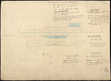
| Title: | St Bernard's Well - Section of mill leads at St Bernard's Well and Canonmills and formulae for the calculation of water velocity in ink and pencil on paper watermarked 1852. |
| Imprint: | 1852 |
| Pagination: | 1 map ; 56 x 76 cm. |
| Shelfmark: | Acc.10706 No.286 |
| Zoom Into Map: | Click on the map to view in greater detail. |
| Notes: | This map is from our Stevenson civil engineering plans collection. |