Project
The Scottish Water Mills Website provides a web-based resource displaying mill locations across Scotland. On these Project pages you will find a brief history of the Scottish Water Mills Project, a description of how the data were collected and processed, and how the web viewer itself was created.
This resource was created by Iara Nave Calton during a 6 month placement with the National Library of Scotland. It was devised and supported as part of a Collaborative Doctoral Partnership funded by the Arts and Humanities Research Council, which provided Iara with the opportunity to pause her PhD at University of Glasgow and undertake a work placement.
The project combines data from two sources, the GB1900 project and Historic Environment Scotland’s ‘Canmore’.
GB1900 Project
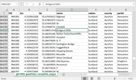
The GB1900 gazetteer project used crowdsourcing to transcribe all text strings from the Ordnance Survey 2nd edition 6 inch County Series maps. The result was over 2.5 million strings recorded across the maps for Scotland, Wales and England, including place names and features such as footpaths, kilns and churches. The resulting gazetteer of place names from GB1900 can be downloaded and queried as a spreadsheet or viewed on top of georeferenced maps.
It is possible to extract all records of mills and their associated features from the gazetteer, and 10,637 mill names (mills and associated mill features e.g. lades, dams) were thus extracted.
Canmore
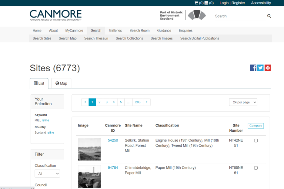
In November of 2018 we obtained a second set of data from the National Record of the Historic Environment (currently known as "Canmore") which includes records of Scotland’s archaeology, architecture, and industrial heritage. This data set contained 4705 ‘mill’ features and a further 6959 records with mill in their name (e.g. Millquarter Plantation, Shawsmill Bridge, Park Mill).
Demonstration viewer
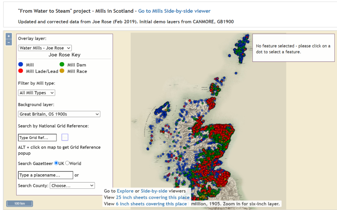
The GB1900 and Canmore datasets were combined and Joe Rose, a volunteer in Canada, did some initial work to classify the mills and to distinguish between mill buildings and their associated features. Chris Fleet of the National Library of Scotland then created a demonstration web-mapping viewer that allowed visualisation and basic querying of the dataset. At this stage, the potential utility of the project became clearer, as did the scale of the work ahead.
Processing the data
The next stage of the project was to process and check the data. The work needed to be done using Geographical Information System (GIS) software. ArcMap GIS was selected as Iara had experience with this software. This type of project could also be carried out using open source software such as QGIS.
The first step was to check that mills had not been missed and to identify duplicates. The GB1900 and Canmore data were extracted again and linked to the demonstration viewer’s dataset by performing various proximity queries in ArcMap. Trial and error was required to determine the appropriate distances for use in the proximity queries.
The queries were also used to link data for mills that appeared in both GB1900 and Canmore. The linking process was largely successful; however, some mills from GB1900 were assigned to the wrong Canmore record and had to be manually corrected.
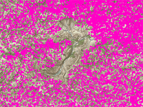
When the GB1900 gazetteer was displayed in the GIS, blank areas around Cromdale, Glen Muick, and Balmoral showed that the map text had not been transcribed for those areas. To fill in these gaps, data points were manually created from the 2nd edition Ordnance Survey map.
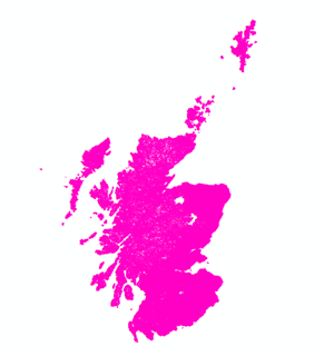
Data is missing from two white areas in the north-east of Scotland.
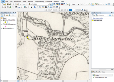
At the end of this process we had a dataset of 14,509 mill records.
Addition of mills on the 1st edition Ordnance Survey maps and categorising mills
The dataset was then expanded to include mills on the Ordnance Survey 1st edition 6 inch to the mile mapping and to categorise mills from all time periods. At the outset of the process, time was taken to become familiar with the Ordnance Survey map symbology and to discuss what information was to be recorded. The following standardised set of fields was used:
| Field | Description |
| IaraID | Unique number created by Iara in this project for each mill record. |
| OBJECTID | Unique reference number used by CANMORE / NMRS for their records. |
| Name | The name of the mill as written on the 2nd edition, 1st edition, or in Canmore. If none of these sources provided a name, an adjacent placename was adopted. Records without a name or a nearby placename were recorded as ‘Mill’. |
| AltNamProp | Alternative names that the mill was known by in addition to that given in the Name column. Can also include location information such as street name, town, river supplying water to the mill. In the case of associated features, the name of the associated mill was recorded. |
| Parish | The civil parish that the mill was in, based on parish boundaries in the 1950s. |
| County | The administrative county that this mill was in, based on county boundaries in the 1950s. |
| Map_1850s | Records if the mill was present at the time of the OS 1st edition mapping. Recorded as Yes or No where there was a high degree of certainty. ‘?’ was used when there was uncertainty. |
| Map1850s | As above but with one character Y or N values for simpler retrieval in the application |
| Clas1850s | Records the function of the mill and its power source, if known, at the time of the 1st edition mapping, following the Heritage Data controlled vocabulary. |
| 1850s_text | Free text description of mill feature from the OS 1st edition mapping. ‘?’ was used to record uncertainty. |
| Map_1900s | Records if the mill was present at the time of the OS 2nd edition mapping. Recorded as Yes or No where there was a high degree of certainty. ‘?’ was used when there was uncertainty. |
| Map1900s | As above but with one character Y or N values for simpler retrieval in the application. |
| Clas1900s | Records the function of the mill and its power source, if known, at the time of the 2nd edition mapping, following the Heritage Data controlled vocabulary. |
| 1900s_text | Free text description of mill feature from the OS 2nd edition mapping. |
| Associated | Records if other mill records are associated with this record. |
| MapPre1840 | Y or N to indicate if the mill pre-dated the OS mapping from the 1840s onwards or not. If mills were present in the CANMORE dataset, or from other sources, but not found on the map, this was usually N; if mills were present on OS maps, this was usually Y. |
| watermill | Y or N to indicate if the mill was a watermill. |
| notinCANM | Y or N to indicate if the mill record was not in the CANMORE / NMRS dataset. |
| URL | Link to the CANMORE / NMRS record, if the record is in CANMORE. |
Read about the next stages of the project in the following sections:

