Canal plans of Scotland, 18th-20th centuries
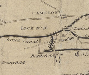
A small selection of maps and plans relating to canals in Scotland. The earliest of these relate to the Forth & Clyde Canal, actively planned from the 1760s. The Monkland Canal was constructed during the 1770s to bring coal from Old & New Monkland to Glasgow. The Caledonian Canal, along the Great Glen from Inverness to Fort William, was begun in 1804, partly opened in 1822, and completed in 1847. The Edinburgh and Glasgow Union Canal, connecting Edinburgh with the Forth & Clyde Canal at Port Downie, near Camelon, was opened in 1822.
Select the map you wish to view:
(ordered by canal name)
Caledonian Canal
- 1821 - Aaron ARROWSMITH - Caledonian Canal or Inland Navigation from the Eastern to the Western Sea
- 1850 - William Home LIZARS - Map or chart of the Caledonian Canal, or Inland Navigation from the Western to the Eastern Sea by Inverness and Fort William.
- 1851 - Dochgarrock Lock - Regulating Lock from outlet of Loch Dochfour to Dochgarroch
- 1880 - Panorama of the Caledonian Canal: Oban to Inverness.
- 1912 - Panoramic view of the Caledonian Canal
- 1913 - Eustace PORTER - Map or chart of the Caledonian Canal, or Inland Navigation from the Eastern to the Western Sea
- 1930 - Bonnie Scotland: relief panorama of the Caledonian Canal, the Great Glen and Glencoe.
- 1944 - HYDROGRAPHIC OFFICE - Caledonian Canal. (in Admiralty Charts of Scotland section)
Crinan Canal
Forth & Clyde Canal
- 1785 - Robert WHITWORTH; John LAURIE; John AINSLIE - A plan of the Great Canal from Forth to Clyde .
- 1805 - Section of intended canal
- 1807 - Plan of proposed canal, 1807. (copied 1819)
- 1814 - Robert STEVENSON - Sketch of country between Edin, & Glasgow showing canal
- 1815 - Printed plan, 1815.
- 1817 - Robert STEVENSON - Reduced Survey and Section of a line canal between Edinburgh and Glasgow ... (marked)
- 1817 - Robert STEVENSON - Reduced Survey and Section of a line of canal between Edinburgh and Glasgow ... (unmarked)
- 1846 - MACLURE & MACDONALD - Plan shewing the Forth & Clyde, Monkland, & Union Canals with the various railways, made & projected, that come into contact with them
- 1889 - David and Thomas STEVENSON - Section of canal at Grangemouth
- See also, County Maps of Stirlingshire and Dumbartonshire
Hamilton to Rutherglen Canal
Tay and Loch Earn Canal
Loch Spynie Canal
- 1888 - John MILLER - Loch Spynie Canal & proposed deepening of River Lossie
- 1888 - George GORDON Loch Spynie Canal- outfall from sluice to sea
Tweed Canal
Union Canal
- 1815 - Hugh BAIRD; Francis HALL - Reduced plan of the proposed Edinburgh & Glasgow Union Canal from lock no. 10 on the Forth & Clyde Canal navigation to the city of Edinburgh
- See also, County Maps of West Lothian and Midlothian
Scotland
Miscellaneous - not yet located
These plans are from our Stevenson Archive.
- 1833 - James GREEN - Ship Canal; sections
- 1833 - James GREEN - Ship Canal; sections
- 1833 - James GREEN - Ship Canal; sections
- Draw Bridge, Gates, Gearings, etc.
- Draw Bridge, Gates, Gearings, etc.
- Embankment, sluices, etc., of Canal Reservoir
- Section of canal
- Segments for gates, etc
- Draw Bridge, Gates, Gearings, etc.
- Draw Bridge, Gates, Gearings, etc.
- Draw Bridge, Gates, Gearings, etc.