Maps of the World, 16th-20th centuries
A small selection of world maps. We hope to expand this selection in the future.
Select the map you wish to view:
(listed chronologically)
- 15th century - Ranulph HIGDEN - [Map of the World]
- 1525 - PTOLEMY, 2nd cent - EUROPA, APHRICA, ASIA
- 1570 - Donato BERTELLI - Universale Descrittione di tutta La Terra conosciuta finqui
- 1584 - PTOLEMY, 2nd cent - UNIVERSALIS TABULA IUXTA PTOLEMAEUM
- 1665 - Willem and Joan BLAEU - Nova Et Accvratissima Totius Terrarvm Orbis Tabvla
- 1709 - Herman MOLL - A New and Correct Map of the World : laid down ac-cording to the newest discoveries...
- 1790 - Aaron ARROWSMITH - Chart of the world on Mercator's projection exhibiting all the new discoveries to the present time
- 1848 - Alexander Keith JOHNSTON - The Geological Structure of the Globe according to Ami Boue
- 1848 - Alexander Keith JOHNSTON - Outlines of Botantical Geography
- 1848 - Alexander Keith JOHNSTON - Zoological Geography. Geographical Division and Distribution of Birds over the World and Geographical Division and Distribution of Birds over Europe
- 1848 - Alexander Keith JOHNSTON - Zoological Geography. Geographical Division and Distribution of Carnivora
- 1848 - Alexander Keith JOHNSTON - Zoological Geography. Geographical Division and Distribution of Mammiferous Animals of the orders: Quadrumana, Marspialia, Edentata and Pachydermata
- 1848 - Alexander Keith JOHNSTON - Zoological Geography. Geographical Division and Distribution of Reptiles (Reptilia)
- 1848 - Alexander Keith JOHNSTON - Zoological Geography. Geographical Distribution of Rodentia and Geographical Distribution of Ruminantia
- 1862 - Archibald FULLARTON - The World in Hemispheres with comparative views of the heights of the mountains and basins of the principal rivers on the globe
- 1860 - Henry JAMES - Geometrical projection of two thirds of the sphere (Africa central)
- 1862 - Henry JAMES - Geometrical projection of two thirds of the sphere (Pacific Ocean Central)
- 1870 - George BARBER - The pharmaceutical or medico-botanical map of the world
- 1881 - John BARTHOLOMEW & Co. - Library chart of the world... (georeferenced layer)
- 1888 - CANADIAN PACIFIC RAILWAY COMPANY - Around the world: Canadian Pacific route
- 1921 - GREAT BRITAIN. WAR OFFICE - Cable map of the world
- 1920 - John George BARTHOLOMEW - World – bathy-orographical
- 1920 - John George BARTHOLOMEW - World – climate
- 1920 - John George BARTHOLOMEW - World – commercial development, occupations, means of traffic
- 1920 - John George BARTHOLOMEW - World – political
- 1920 - John George BARTHOLOMEW - World – population, races, religions, languages
- 1920 - John George BARTHOLOMEW - World – vegetation and ocean currents
- 1923 - DENOYER-GEPPERT CO. - Globe Gores entitled 12 inch Globe
- 1923 - HYDROGRAPHIC OFFICE - The World - Sailing Ship Routes
- 1923 - HYDROGRAPHIC OFFICE - Pacific, Atlantic and Indian Oceans : diagram of ocean currents
- 1925 - Navy league map of the British Empire.
- 1937 - W. & A.K. JOHNSTON LTD - W. & A.K. Johnston's "Effective" maps of the world. Land Utilization
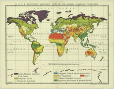
- 1937 - W. & A.K. JOHNSTON LTD - W. & A.K. Johnston's "Effective" maps of the world. Natural Vegetation
- 1937 - W. & A.K. Johnston Limited - W. & A.K. Johnston's "Effective" maps of the world. Climate
- 1945 - BRITISH OVERSEAS AIRWAYS CORPORATION - The air age map of the world. Centred on London
- 1951 - GREAT BRITAIN. WAR OFFICE - The world on Aitoff's equal-area projection.