Gall and Inglis graded road maps of Scotland, 1900s-1930s
Gall and Inglis graded road maps of Scotland graphic

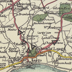
The Graded Road Maps series at half-inch to the mile (1:126,440) covered England and Wales, as well as southern Scotland, and this is why the sheet numbering below begins at Sheet 56. The series was intended for cyclists and motorists, with a unique colour coding of roads into four categories (superior; good; inferior; and rough) and with triangular symbols for dangerous (in bold) and steep hills. We also include on this page Gall & Inglis' Tourists Map of the Clyde, published in the 1920s and 1930s.

The Edinburgh-based firm of Gall & Inglis originated in a printing business set up by James Gall in 1810. His son, also called James, joined the firm in 1838 but resigned in 1847 to become a Church of Scotland minister. In 1847, Robert Inglis, soon to be his son in law, joined the firm, which survived through to the 1960s.

Graded road maps of Scotland, 1900s-1930s

These maps are held at the shelfmark: Map.s.121.

View sheets:
Sheet Number and Name   
Sheet 56 - Galloway [no cover]
Sheet 56 - Galloway and Ayrshire
Sheet 57 - Dumfries and Carlisle District
Sheet 59 - The Clyde [red print on cover]
Sheet 59 - The Clyde [brown print on cover]
Sheet 60 - Glasgow and Ayr
Sheet 61 - Edinburgh and District [dark cover]
Sheet 61 - Edinburgh and District [red print on cover]
Sheet 62 - The Borders [light cover]
Sheet 62 - The Borders [dark cover]
Sheet 69 - Oban and District
Sheet 70 - Central Perthshire [red cover]
Sheet 70 - Central Perthshire [no cover]
Sheet 70 - Central Perthshire [grey cover]
Sheet 71 - Fife, Forfar and East Perth [light cover]
Sheet 71 - Fife, Forfar and East Perth [green cover]
Sheet 71 - Fife, Forfar and East Perth [grey cover]
Sheet 74 - Inverness and Speyside
Sheet 75 - Aberdeen and Deeside [grey cover]
Sheet 75 - Aberdeen and Deeside [brown cover]

Gall & Inglis' Tourists Map of the Clyde.

This series has maps printed on both sides of each sheet (as indicated below). They are all held at the shelfmark: Map.s.121.

View sheets:
Sheet Number and Name    Date of Publication   
Gall & Inglis' Tourists Map of the Clyde - Front (including Firth of Clyde/Greenock)ca. 1925
Gall & Inglis' Tourists Map of the Clyde - Back (including Arran)ca. 1925
Gall & Inglis' Tourists Map of the Clyde - Front (including Firth of Clyde/Greenock)ca. 1935
Gall & Inglis' Tourists Map of the Clyde - Back (including Arran) ca. 1935
Gall & Inglis' Tourists Map of the Clyde - Front (including Firth of Clyde/Greenock)ca. 1938
Gall & Inglis' Tourists Map of the Clyde - Back (including Arran) ca. 1938
Gall & Inglis' Tourists Map of the Clyde - Front (including Firth of Clyde/Greenock)ca. 1938
Gall & Inglis' Tourists Map of the Clyde - Back (including Arran)ca. 1938
 

Copyright           Enquiries & Copies           Help