Mapmakers
Your search for Udny returned 101 records.
Ordered chronologically (undated items first).
| Field | Content | |
|---|---|---|
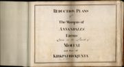
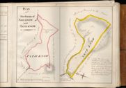
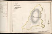
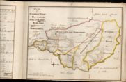
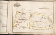
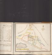
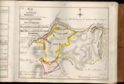
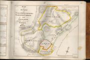
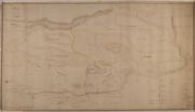
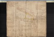
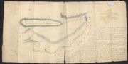
| Name: | Udny, Joseph (fl. ca 1770-1828) | |
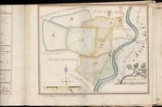
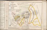
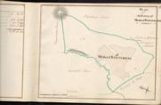
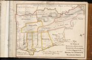
| Title: | Reduction Plans of The marquis of Annandales Farms Lying in the parishes of Moffat and part of KirkPatrick Juxta | |
| Zoom Into Map: | Click on the map to view in greater detail. | |
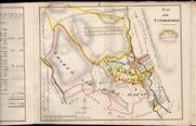
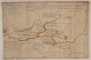
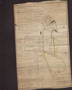
| Field | Content | |
|---|---|---|
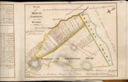
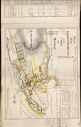
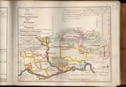
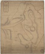
| Name: | Bell, William, fl. 1760-1813 (surveyor) Udny, Joseph, fl. ca 1770-1828 (draughtsman) | |
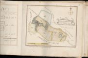
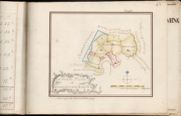
| Title: | Plan of Moffat Common Divided | |
| Zoom Into Map: | Click on the map to view in greater detail. | |
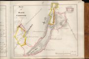
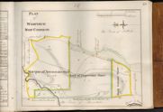
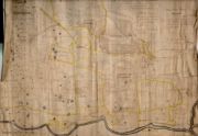
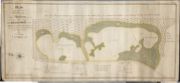
| Field | Content | |
|---|---|---|
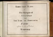
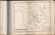
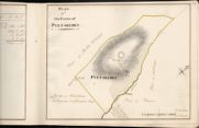
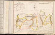
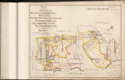
| Name: | Udny, Joseph (fl. ca 1770-1828) | |
| Title: | Reduction Plans of the Marquis of Annandale and Earl of Hopetouns Farms Lying in the Parish of Wamphray | |
| Zoom Into Map: | Click on the map to view in greater detail. | |
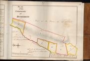
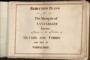
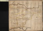
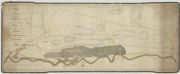
| Field | Content | |
|---|---|---|
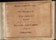
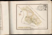
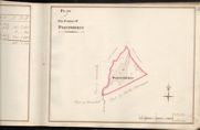
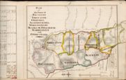
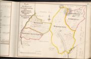
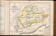
| Name: | Udny, Joseph (fl. ca 1770-1828) | |
| Title: | Reduction Plans of the Marquis of Annandales Farms Lying in the Parishes of Hutton and Corrie and Part of Sibbaldbie | |
| Zoom Into Map: | Click on the map to view in greater detail. | |
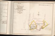
| Field | Content | |
|---|---|---|
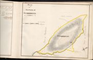
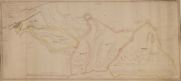
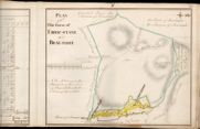
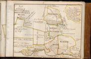
| Name: | Tait, James, fl. ca 1739-1797 (surveyor) Udny, Joseph, fl. ca 1770-1828 (draughtsman) | |
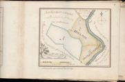
| Title: | Plan of the Farms of Akie-know and That-know | |
| Imprint: | 1759 | |
| Zoom Into Map: | Click on the map to view in greater detail. | |
| Field | Content | |
|---|---|---|
| Name: | Tait, James, fl. ca 1739-1797 Much subsequent surveying done in 1770s by Udny | |
| Title: | Plan of the 15 Merkland and Town of Moffat | |
| Imprint: | 1759 and 1770s | |
| Zoom Into Map: | Click on the map to view in greater detail. | |
| Field | Content | |
|---|---|---|
| Name: | Udny, Joseph, fl. ca 1770-1828 | |
| Title: | General Plan of Graitney Estate | |
| Imprint: | 1759 | |
| Zoom Into Map: | Click on the map to view in greater detail. | |
| Field | Content | |
|---|---|---|
| Name: | Tait, James, fl. ca 1739-1797 (surveyor) Udny, Joseph, fl. ca 1770-1828 (draughtsman) | |
| Title: | Boguehead and Hole | |
| Imprint: | 1759 | |
| Zoom Into Map: | Click on the map to view in greater detail. | |
| Field | Content | |
|---|---|---|
| Name: | Tait, James, fl. ca 1739-1797 (surveyor) Udny, Joseph, fl. ca 1770-1828 (draughtsman) | |
| Title: | Graitney Parks, Headless Cross and Graitney Green | |
| Imprint: | 1759 | |
| Zoom Into Map: | Click on the map to view in greater detail. | |
| Field | Content | |
|---|---|---|
| Name: | Tait, James, fl. ca 1739-1797 (surveyor) Udny, Joseph, fl. ca 1770-1828 (draughtsman) | |
| Title: | Hailstone Muir and Elliotstown | |
| Imprint: | 1759 | |
| Zoom Into Map: | Click on the map to view in greater detail. | |
| Field | Content | |
|---|---|---|
| Name: | Tait, James, fl. ca 1739-1797 (surveyor) Udny, Joseph, fl. ca 1770-1828 (draughtsman) | |
| Title: | Flosh-End | |
| Imprint: | 1759 | |
| Zoom Into Map: | Click on the map to view in greater detail. | |
| Field | Content | |
|---|---|---|
| Name: | Tait, James, fl. ca 1739-1797 (surveyor) Udny, Joseph, fl. ca 1770-1828 (draughtsman) | |
| Title: | Loanwath, Scurron &Bellaronn, Alison Banks and Highfoord | |
| Imprint: | 1759 | |
| Zoom Into Map: | Click on the map to view in greater detail. | |
| Field | Content | |
|---|---|---|
| Name: | Tait, James, fl. ca 1739-1797 (surveyor) Udny, Joseph, fl. ca 1770-1828 (draughtsman) | |
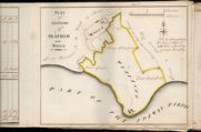
| Title: | Plan of the Farms of Seafield and Walls | |
| Imprint: | 1759 | |
| Zoom Into Map: | Click on the map to view in greater detail. | |
| Field | Content | |
|---|---|---|
| Name: | Tait, James, fl. ca 1739-1797 (surveyor) Udny, Joseph, fl. ca 1770-1828 (draughtsman) | |
| Title: | Croftheads | |
| Imprint: | 1759 | |
| Zoom Into Map: | Click on the map to view in greater detail. | |
| Field | Content | |
|---|---|---|
| Name: | Tait, James, fl. ca 1739-1797 (surveyor) Udny, Joseph, fl. ca 1770-1828 (draughtsman) | |
| Title: | Howes and Milfield | |
| Imprint: | 1759 | |
| Zoom Into Map: | Click on the map to view in greater detail. | |
| Field | Content | |
|---|---|---|
| Name: | Tait, James, fl. ca 1739-1797 (surveyor) Udny, Joseph, fl. ca 1770-1828 (draughtsman) | |
| Title: | Millby, Redgatehead and Hill Land | |
| Imprint: | 1759 | |
| Zoom Into Map: | Click on the map to view in greater detail. | |
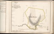
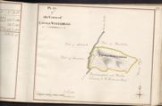
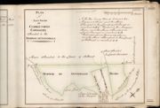
| Field | Content | |
|---|---|---|
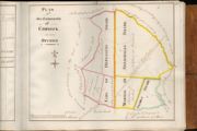
| Name: | Tait, James, fl. ca 1739-1797 (surveyor) Udny, Joseph, fl. ca 1770-1828 (draughtsman) | |
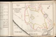
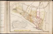
| Title: | Plan of Cummertrees Commonty | |
| Imprint: | 1759 | |
| Zoom Into Map: | Click on the map to view in greater detail. | |
| Field | Content | |
|---|---|---|
| Name: | Tait, James, fl. ca 1739-1797 (surveyor) Udny, Joseph, fl. ca 1770-1828 (draughtsman) | |
| Title: | Mains, Raw, Halltown and Dornock Wood | |
| Imprint: | 1759 | |
| Zoom Into Map: | Click on the map to view in greater detail. | |
| Field | Content | |
|---|---|---|
| Name: | Tait, James, fl. ca 1739-1797 (surveyor) Udny, Joseph, fl. ca 1770-1828 (draughtsman) | |
| Title: | Upper and Nether Woodheads | |
| Imprint: | 1759 | |
| Zoom Into Map: | Click on the map to view in greater detail. | |
| Field | Content | |
|---|---|---|
| Name: | Tait, James, fl. ca 1739-1797 (surveyor) Udny, Joseph, fl. ca 1770-1828 (draughtsman) | |
| Title: | Christy-Lands | |
| Imprint: | 1759 | |
| Zoom Into Map: | Click on the map to view in greater detail. | |
| Field | Content | |
|---|---|---|
| Name: | Tait, James, fl. ca 1739-1797 (surveyor) Udny, Joseph, fl. ca 1770-1828 (draughtsman) | |
| Title: | General Plan of Stabletown Barony | |
| Imprint: | 1759 | |
| Zoom Into Map: | Click on the map to view in greater detail. | |
| Field | Content | |
|---|---|---|
| Name: | Tait, James, fl. ca 1739-1797 (surveyor) Udny, Joseph, fl. ca 1770-1828 (draughtsman) | |
| Title: | Wicketthorn, Upper, Mid & Nether Ns, Kirkpatrick Town etc. | |
| Imprint: | 1759 | |
| Zoom Into Map: | Click on the map to view in greater detail. | |
| Field | Content | |
|---|---|---|
| Name: | Tait, James, fl. ca 1739-1797 (surveyor) Udny, Joseph, fl. ca 1770-1828 (draughtsman) | |
| Title: | Redhall & Calvertsholm | |
| Imprint: | 1759 | |
| Zoom Into Map: | Click on the map to view in greater detail. | |
| Field | Content | |
|---|---|---|
| Name: | Tait, James, fl. ca 1739-1797 (surveyor) Udny, Joseph, fl. ca 1770-1828 (draughtsman) | |
| Title: | Plan of Redhall Commonty on how divided | |
| Imprint: | 1759? | |
| Zoom Into Map: | Click on the map to view in greater detail. | |
| Field | Content | |
|---|---|---|
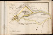
| Name: | Tait, James, fl. ca 1739-1797 (surveyor) Udny, Joseph, fl. ca 1770-1828 (draughtsman) | |
| Title: | Plan of the commonty of Kirkpatrick Flemming as now divided | |
| Imprint: | 1759? | |
| Zoom Into Map: | Click on the map to view in greater detail. | |
| Field | Content | |
|---|---|---|
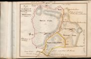
| Name: | Tait, John, ca. 1752-1782 (surveyor) Udny, Joseph, fl. ca 1770-1828 (draughtsman) | |
| Title: | Plan of the Farm of Craighouse | |
| Imprint: | 1760 | |
| Zoom Into Map: | Click on the map to view in greater detail. | |
| Field | Content | |
|---|---|---|
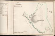
| Name: | Tait, John, ca. 1752-1782 (surveyor) Udny, Joseph, fl. ca 1770-1828 (draughtsman) | |
| Title: | Plan of the Farm of Corrie-hill | |
| Imprint: | 1760 | |
| Zoom Into Map: | Click on the map to view in greater detail. | |
| Field | Content | |
|---|---|---|
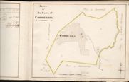
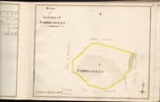
| Name: | Tait, John, ca. 1752-1782 (surveyor) Udny, Joseph, fl. ca 1770-1828 (draughtsman) | |
| Title: | Plan of the Farm of Corrie-halls | |
| Imprint: | 1760 | |
| Zoom Into Map: | Click on the map to view in greater detail. | |
| Field | Content | |
|---|---|---|
| Name: | Tait, John, ca. 1752-1782 (surveyor) Udny, Joseph, fl. ca 1770-1828 (draughtsman) | |
| Title: | Plan of Meikle Whiteriggs | |
| Imprint: | 1760 | |
| Zoom Into Map: | Click on the map to view in greater detail. | |
| Field | Content | |
|---|---|---|
| Name: | Tait, John, ca. 1752-1782 (surveyor) Udny, Joseph, fl. ca 1770-1828 (draughtsman) | |
| Title: | Plan of the Farm of Pyetshaws | |
| Imprint: | 1760 | |
| Zoom Into Map: | Click on the map to view in greater detail. | |
| Field | Content | |
|---|---|---|
| Name: | Tait, John, ca. 1752-1782 (surveyor) Udny, Joseph, fl. ca 1770-1828 (draughtsman) | |
| Title: | Plan of the Farm of Parsondykes | |
| Imprint: | 1760 | |
| Zoom Into Map: | Click on the map to view in greater detail. | |
| Field | Content | |
|---|---|---|
| Name: | Tait, John, ca. 1752-1782 (surveyor) Udny, Joseph, fl. ca 1770-1828 (draughtsman) | |
| Title: | Plan of the Farm of Stiddriggs | |
| Imprint: | 1760 | |
| Zoom Into Map: | Click on the map to view in greater detail. | |
| Field | Content | |
|---|---|---|
| Name: | Tait, John, ca. 1752-1782 (surveyor) Udny, Joseph, fl. ca 1770-1828 (draughtsman) | |
| Title: | Plan of the Farm of Birscaback | |
| Imprint: | 1760 | |
| Zoom Into Map: | Click on the map to view in greater detail. | |
| Field | Content | |
|---|---|---|
| Name: | Leslie, John (surveyor) Udny, Joseph, fl. ca 1770-1828 (draughtsman) | |
| Title: | Plan of the farms of Troutbeck, Corrie Mill, Corrie Mains, South part of Balstack and Kerfoot | |
| Imprint: | 1760 | |
| Zoom Into Map: | Click on the map to view in greater detail. | |
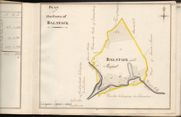
| Field | Content | |
|---|---|---|
| Name: | Tait, John, ca. 1752-1782 (surveyor) Udny, Joseph, fl. ca 1770-1828 (draughtsman) | |
| Title: | Plan of the Farm of Balstack | |
| Imprint: | 1760 | |
| Zoom Into Map: | Click on the map to view in greater detail. | |
| Field | Content | |
|---|---|---|
| Name: | Tait, John, ca. 1752-1782 (surveyor) Udny, Joseph, fl. ca 1770-1828 (draughtsman) | |
| Title: | Plan of the Farm of Corrie Mains | |
| Imprint: | 1760 | |
| Zoom Into Map: | Click on the map to view in greater detail. | |
| Field | Content | |
|---|---|---|
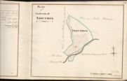
| Name: | Tait, John, ca. 1752-1782 (surveyor) Udny, Joseph, fl. ca 1770-1828 (draughtsman) | |
| Title: | Plan of the Farm Troutbeck | |
| Imprint: | 1760 | |
| Zoom Into Map: | Click on the map to view in greater detail. | |
| Field | Content | |
|---|---|---|
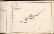
| Name: | Tait, John, ca. 1752-1782 (surveyor) Udny, Joseph, fl. ca 1770-1828 (draughtsman) | |
| Title: | Plan of the Farm of Corrie Mill | |
| Imprint: | 1760 | |
| Zoom Into Map: | Click on the map to view in greater detail. | |
| Field | Content | |
|---|---|---|
| Name: | Tait, John, ca. 1752-1782 (surveyor) Udny, Joseph, fl. ca 1770-1828 (draughtsman) | |
| Title: | Plan of the Farm of Wyneholm | |
| Imprint: | 1760 | |
| Zoom Into Map: | Click on the map to view in greater detail. | |
| Field | Content | |
|---|---|---|
| Name: | Tait, John, ca. 1752-1782 (surveyor) Udny, Joseph, fl. ca 1770-1828 (draughtsman) | |
| Title: | Plan of the Farm of Whiteriggs | |
| Imprint: | 1760 | |
| Zoom Into Map: | Click on the map to view in greater detail. | |
| Field | Content | |
|---|---|---|
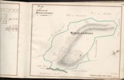
| Name: | Tait, John, ca. 1752-1782 (surveyor) Udny, Joseph, fl. ca 1770-1828 (draughtsman) | |
| Title: | Plan of the Farm of White-castles | |
| Imprint: | 1760 | |
| Zoom Into Map: | Click on the map to view in greater detail. | |
| Field | Content | |
|---|---|---|
| Name: | Tait, John, ca. 1752-1782 (surveyor) Udny, Joseph, fl. ca 1770-1828 (draughtsman) | |
| Title: | Plan of the Farm of Cowburn | |
| Imprint: | 1760 | |
| Zoom Into Map: | Click on the map to view in greater detail. | |
| Field | Content | |
|---|---|---|
| Name: | Richmond, James, 1760-1808 and Bell, William, fl. 1760-1813 (surveyors) Udny, Joseph, fl. ca 1770-1828 (draughtsman) | |
| Title: | Upper and Nether Stobohill | |
| Imprint: | 1760 | |
| Zoom Into Map: | Click on the map to view in greater detail. | |
| Field | Content | |
|---|---|---|
| Name: | Richmond, James, 1760-1808 and Bell, William, fl. 1760-1813 (surveyors) Udny, Joseph, fl. ca 1770-1828 (draughtsman) | |
| Title: | Cumpstown (and share of Sibbaldbie Commone) | |
| Imprint: | 1760 | |
| Zoom Into Map: | Click on the map to view in greater detail. | |
| Field | Content | |
|---|---|---|
| Name: | Richmond, James, 1760-1808 and Bell, William, fl. 1760-1813 (surveyors) Udny, Joseph, fl. ca 1770-1828 (draughtsman) | |
| Title: | Gillenbierigg (and share of Sibbaldbie Common) | |
| Imprint: | 1760 | |
| Zoom Into Map: | Click on the map to view in greater detail. | |
| Field | Content | |
|---|---|---|
| Name: | Udny, Joseph (fl. ca 1770-1828) | |
| Title: | Plan of the Farm of Gillenbierigg | |
| Imprint: | 1760 | |
| Zoom Into Map: | Click on the map to view in greater detail. | |
| Field | Content | |
|---|---|---|
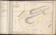
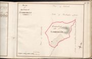
| Name: | Tait, John, ca. 1752-1782 (surveyor) Udny, Joseph, fl. ca 1770-1828 (draughtsman) | |
| Title: | Plan of the Farm of Lambhills | |
| Imprint: | 1760? | |
| Zoom Into Map: | Click on the map to view in greater detail. | |
| Field | Content | |
|---|---|---|
| Name: | Tait, James, fl. ca 1739-1797 (surveyor) Udny, Joseph, fl. ca 1770-1828 (draughtsman) | |
| Title: | Kinnel Head | |
| Imprint: | 1761 | |
| Zoom Into Map: | Click on the map to view in greater detail. | |
| Field | Content | |
|---|---|---|
| Name: | Shepherd, Alexander, ca. 1760-1789 (surveyor) Udny, Joseph, fl. ca 1770-1828 (draughtsman) | |
| Title: | Plan of Stidrigs & Banks, Plewlands, Park and Haig, Borelands, Inglestoun, and Barntimpen | |
| Imprint: | 1767 | |
| Zoom Into Map: | Click on the map to view in greater detail. | |
| Field | Content | |
|---|---|---|
| Name: | Richmond, James, 1760-1808 (surveyor) Udny, Joseph, fl. ca 1770-1828 (draughtsman) | |
| Title: | Plan of the Farms of Birsback, Stidriggs, Pyetshaws, Meiklewhitriggs, Corriehall, Corriehill, Craighouse and Hencastle | |
| Imprint: | 1767 | |
| Zoom Into Map: | Click on the map to view in greater detail. | |
| Field | Content | |
|---|---|---|
| Name: | Tait, James, fl. ca 1739-1797 (surveyor) Udny, Joseph, fl. ca 1770-1828 (draughtsman) | |
| Title: | Plan of Farms between Annan and Evan Water | |
| Imprint: | 1767 | |
| Zoom Into Map: | Click on the map to view in greater detail. | |
| Field | Content | |
|---|---|---|
| Name: | Tennoch, William, ca 1760-1782 (surveyor) Udny, Joseph, fl. ca 1770-1828 (draughtsman) | |
| Title: | Reduction Plan taken from Mr Tennochs large Plan of 1767 being the plan of Archbank and Clarefoot - the Farm of Carriferan and the Farm of Polmody | |
| Imprint: | 1767 | |
| Zoom Into Map: | Click on the map to view in greater detail. | |
| Field | Content | |
|---|---|---|
| Name: | Tait, James, fl. ca 1739-1797 (surveyor) Udny, Joseph, fl. ca 1770-1828 (draughtsman) | |
| Title: | Plan of the farm of Eriocstane and Braefoot | |
| Imprint: | 1767 and 1778 | |
| Zoom Into Map: | Click on the map to view in greater detail. | |
| Field | Content | |
|---|---|---|
| Name: | Tennoch, William, ca 1760-1782 (surveyor) Udny, Joseph, fl. ca 1770-1828 (draughtsman) | |
| Title: | Plan of the Farms of Rivox, Mossop, and Middlegill | |
| Imprint: | 1767? | |
| Zoom Into Map: | Click on the map to view in greater detail. | |
| Field | Content | |
|---|---|---|
| Name: | Tennoch, William, ca 1760-1782 (surveyor) Udny, Joseph, fl. ca 1770-1828 (draughtsman) | |
| Title: | Plan of Clarefoot and Archbank | |
| Imprint: | 1767? | |
| Zoom Into Map: | Click on the map to view in greater detail. | |
| Field | Content | |
|---|---|---|
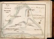
| Name: | Tennoch, William, ca 1760-1782 (surveyor) Udny, Joseph, fl. ca 1770-1828 (draughtsman) | |
| Title: | Plan of Palmoody | |
| Imprint: | 1767? | |
| Zoom Into Map: | Click on the map to view in greater detail. | |
| Field | Content | |
|---|---|---|
| Name: | Tennoch, William, ca 1760-1782 (surveyor) Udny, Joseph, fl. ca 1770-1828 (draughtsman) | |
| Title: | Plan of the Farm of Capplegill and Carriferan | |
| Imprint: | 1767? | |
| Zoom Into Map: | Click on the map to view in greater detail. | |
| Field | Content | |
|---|---|---|
| Name: | Richmond, James, 1760-1808 (surveyor) Udny, Joseph, fl. ca 1770-1828 (draughtsman) | |
| Title: | Farms of Dryfehead and Finigill | |
| Imprint: | 1767? | |
| Zoom Into Map: | Click on the map to view in greater detail. | |
| Field | Content | |
|---|---|---|
| Name: | Richmond, James, 1760-1808 (surveyor) Udny, Joseph, fl. ca 1770-1828 (draughtsman) | |
| Title: | Plan of the Farms of Mackmaw, Waterhead, & Dunscore, Closs and Winshiels | |
| Imprint: | 1767? | |
| Zoom Into Map: | Click on the map to view in greater detail. | |
| Field | Content | |
|---|---|---|
| Name: | Udny, Joseph (fl. ca 1770-1828) | |
| Title: | Plan of the Farms of Cumston, Gillenrierigg, and Hopeknows | |
| Imprint: | 1767? | |
| Zoom Into Map: | Click on the map to view in greater detail. | |
| Field | Content | |
|---|---|---|
| Name: | Richmond, James, 1760-1808 and Bell, William, fl. 1760-1813 (surveyors) Udny, Joseph, fl. ca 1770-1828 (draughtsman) | |
| Title: | Plan of the Farms of Cartertoun, Upper and Nether Stobohill | |
| Imprint: | 1767? | |
| Zoom Into Map: | Click on the map to view in greater detail. | |
| Field | Content | |
|---|---|---|
| Name: | Richmond, James, 1760-1808 and Bell, William, fl. 1760-1813 (surveyors) Udny, Joseph, fl. ca 1770-1828 (draughtsman) | |
| Title: | Plan of the Farms of Rockelflat & Kirkcroft, Hallhill, Nether Hutton, Liverknow, Carnwath, Gall, Millriggs, Millland, Nether Borland and Glebe | |
| Imprint: | 1767? | |
| Zoom Into Map: | Click on the map to view in greater detail. | |
| Field | Content | |
|---|---|---|
| Name: | Richmond, James, 1760-1808 (surveyor) Udny, Joseph, fl. ca 1770-1828 (draughtsman) | |
| Title: | Plan of the Farms of Cowan Clewgh and Lamshills, Whitcastles, Mirrinhall and Littlwhitriggs, Wyneholm | |
| Imprint: | 1767? | |
| Zoom Into Map: | Click on the map to view in greater detail. | |
| Field | Content | |
|---|---|---|
| Name: | Shepherd, Alexander, ca. 1760-1789 (surveyor) Udny, Joseph, fl. ca 1770-1828 (draughtsman) | |
| Title: | Plan of the Farms of Marchbank, Redrrae, Kirktoun, Bearholm, Miltons, and Murthat | |
| Imprint: | 1767? | |
| Zoom Into Map: | Click on the map to view in greater detail. | |
| Field | Content | |
|---|---|---|
| Name: | Tennoch, William, ca 1760-1782 (surveyor) Udny, Joseph, fl. ca 1770-1828 (draughtsman) | |
| Title: | Plan of the farms of Kinnelhall, Kinnelholm,Raeknows, Hazlebank,Lochwood, Bargainbuss, Roods, Auchindinning, Woodend & Mains | |
| Imprint: | 1767? | |
| Zoom Into Map: | Click on the map to view in greater detail. | |
| Field | Content | |
|---|---|---|
| Name: | Tennoch, William, ca 1760-1782 (surveyor) Udny, Joseph, fl. ca 1770-1828 (draughtsman) | |
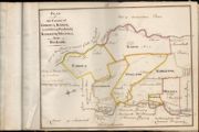
| Title: | Plan of the farms of Mollens, Raehill, and Crunziertoun | |
| Imprint: | 1767? | |
| Zoom Into Map: | Click on the map to view in greater detail. | |
| Field | Content | |
|---|---|---|
| Name: | Tennoch, William, ca 1760-1782 (surveyor) Udny, Joseph, fl. ca 1770-1828 (draughtsman) | |
| Title: | Plan of the Farms of Corsua, Karse, Lochbrow, Panlands,Kirkbank, Milhill, and Bankside | |
| Imprint: | 1767? | |
| Zoom Into Map: | Click on the map to view in greater detail. | |
| Field | Content | |
|---|---|---|
| Name: | Tait, John, ca. 1752-1782? (surveyor) Udny, Joseph, fl. ca 1770-1828 (draughtsman) | |
| Title: | Corsua & Moat | |
| Imprint: | 1767? | |
| Zoom Into Map: | Click on the map to view in greater detail. | |
| Field | Content | |
|---|---|---|
| Name: | Tait, James, fl. ca 1739-1797 (surveyor) Udny, Joseph, fl. ca 1770-1828 (draughtsman) | |
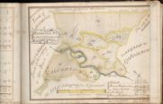
| Title: | Share of Graitney Common allocated to the marquis of Annandale | |
| Imprint: | 1770 | |
| Zoom Into Map: | Click on the map to view in greater detail. | |
| Field | Content | |
|---|---|---|
| Name: | Tait, James, fl. ca 1739-1797 (surveyor) Udny, Joseph, fl. ca 1770-1828 (draughtsman) | |
| Title: | Plan of that share of Cummertrees Commonty etc. | |
| Imprint: | 1770 | |
| Zoom Into Map: | Click on the map to view in greater detail. | |
| Field | Content | |
|---|---|---|
| Name: | Richmond, James, 1760-1808 (surveyor) Udny, Joseph, fl. ca 1770-1828 (draughtsman) | |
| Title: | Plan of the Farm Dormontrigg | |
| Imprint: | ca 1770 | |
| Zoom Into Map: | Click on the map to view in greater detail. | |
| Field | Content | |
|---|---|---|
| Name: | Tait, James, fl. ca 1739-1797 (surveyor) ? Udny, Joseph, fl. ca 1770-1828 (draughtsman) | |
| Title: | Plan of Bleise Commonty | |
| Imprint: | 1770s | |
| Zoom Into Map: | Click on the map to view in greater detail. | |
| Field | Content | |
|---|---|---|
| Name: | Tait, James, fl. ca 1739-1797 (surveyor) ? Udny, Joseph, fl. ca 1770-1828 (draughtsman) | |
| Title: | Plan of Wamphray Muir Common | |
| Imprint: | 1770s | |
| Zoom Into Map: | Click on the map to view in greater detail. | |
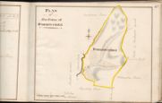
| Field | Content | |
|---|---|---|
| Name: | Tait, James, fl. ca 1739-1797 (surveyor) ? Udny, Joseph, fl. ca 1770-1828 (draughtsman) | |
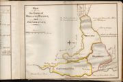
| Title: | Plan of the Commonty of Dundorran | |
| Imprint: | 1770s | |
| Zoom Into Map: | Click on the map to view in greater detail. | |
| Field | Content | |
|---|---|---|
| Name: | Udny, Joseph, fl. ca 1770-1828 | |
| Title: | Reduction plans of the Marquis of Annandales Farms Lying in the Parishes of Hutton and Corrie and part of Sibbalbie | |
| Imprint: | 1770s | |
| Zoom Into Map: | Click on the map to view in greater detail. | |
| Field | Content | |
|---|---|---|
| Name: | Bell, William, fl. 1760-1813 (surveyor) Udny, Joseph, fl. ca 1770-1828 (draughtsman) | |
| Title: | Plan of Cuthbertrigg | |
| Imprint: | 1772 | |
| Zoom Into Map: | Click on the map to view in greater detail. | |
| Field | Content | |
|---|---|---|
| Name: | Tait, James, fl. ca 1739-1797 (surveyor) Udny, Joseph, fl. ca 1770-1828 (draughtsman) | |
| Title: | The Plan of the farm of Kirkhill as posessed comprehending How-Gill-Cleughside, and Staffen-bigging with their shares of the Commonty of Bleise, Middle-rigg, Pleaknow, comprehending also the Mill, Mill-lands and Glebe of Wamphray | |
| Imprint: | 1773 | |
| Zoom Into Map: | Click on the map to view in greater detail. | |
| Field | Content | |
|---|---|---|
| Name: | Udny, Joseph, fl. ca 1770-1828 | |
| Title: | Plan of That Part of the Earl of Hopetouns Estate of Wamphray called the Inside of Wamphray etc. | |
| Imprint: | 1775 | |
| Zoom Into Map: | Click on the map to view in greater detail. | |
| Field | Content | |
|---|---|---|
| Name: | Tait, James, fl. ca 1739-1797 (surveyor) Udny, Joseph, fl. ca 1770-1828 (draughtsman) | |
| Title: | Plan of the under Commonty of Kirkpatrick Juxta | |
| Imprint: | 1775 | |
| Zoom Into Map: | Click on the map to view in greater detail. | |
| Field | Content | |
|---|---|---|
| Name: | Tait, James, fl. ca 1739-1797 (surveyor) ? Udny, Joseph, fl. ca 1770-1828 (draughtsman) | |
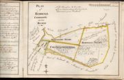
| Title: | Plan of the Commonty of Cammock as now divided | |
| Imprint: | 1776 | |
| Zoom Into Map: | Click on the map to view in greater detail. | |
| Field | Content | |
|---|---|---|
| Name: | Udny, Joseph, fl. ca 1770-1828 | |
| Title: | Plan of the farms of Fingland, Helbeckhill, Hazlebank, Cammock and Cackarank with their shares of Cammock and Bleise Commons | |
| Imprint: | 1776? | |
| Zoom Into Map: | Click on the map to view in greater detail. | |
| Field | Content | |
|---|---|---|
| Name: | Tait, James, fl. ca 1739-1797 (surveyor) Udny, Joseph, fl. ca 1770-1828 (draughtsman) | |
| Title: | Plan of the Farms of Leithanhall, Laverhay together with the estate of Poldean | |
| Imprint: | 1778 | |
| Zoom Into Map: | Click on the map to view in greater detail. | |
| Field | Content | |
|---|---|---|
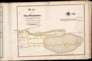
| Name: | Udny, Joseph (fl. ca 1770-1828) | |
| Title: | Plan of The Plantation on the Gallowhill | |
| Imprint: | 1778 | |
| Zoom Into Map: | Click on the map to view in greater detail. | |
| Field | Content | |
|---|---|---|
| Name: | Udny, Joseph (fl. ca 1770-1828) | |
| Title: | Plan of Upper Murthat, Miltons, Bearholm, Palaceknow, Marchbank and Redbrae shewing the severl pieces of ground pitted out for planting | |
| Imprint: | 1781 | |
| Zoom Into Map: | Click on the map to view in greater detail. | |
| Field | Content | |
|---|---|---|
| Name: | Udny, Joseph (fl. ca 1770-1828) | |
| Title: | Plan of part of the Farms of Raehill, Crunziertoun and Mollens | |
| Imprint: | 1781 | |
| Zoom Into Map: | Click on the map to view in greater detail. | |
| Field | Content | |
|---|---|---|
| Name: | Udny, Joseph (fl. ca 1770-1828) | |
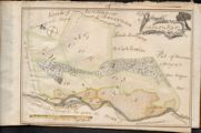
| Title: | Sketch of the farm of Raehills with adjacent farms showing the intended plantations | |
| Imprint: | 1782 | |
| Zoom Into Map: | Click on the map to view in greater detail. | |
| Field | Content | |
|---|---|---|
| Name: | Udny, Joseph (fl. ca 1770-1828) | |
| Title: | Plan of the Farms lying between the River of Annan and Kinnel Water | |
| Imprint: | 1786 | |
| Zoom Into Map: | Click on the map to view in greater detail. | |
| Field | Content | |
|---|---|---|
| Name: | Udny, Joseph (fl. ca 1770-1828) | |
| Title: | Plan of the parish of Johnstone Lying between the River of Annan and Kinnel Water | |
| Imprint: | 1786 | |
| Zoom Into Map: | Click on the map to view in greater detail. | |
| Field | Content | |
|---|---|---|
| Name: | Udny, Joseph (fl. ca 1770-1828) | |
| Title: | Rough Sketch of several farms of the Parish of Kirkpatrick Juxta | |
| Imprint: | 1787 | |
| Zoom Into Map: | Click on the map to view in greater detail. | |
| Field | Content | |
|---|---|---|
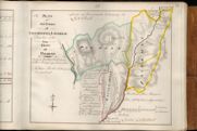
| Name: | Udny, Joseph (fl. ca 1770-1828) (Tait, James, fl. ca 1739-1797) | |
| Title: | Sketched Plan of the lands of Kirkpatrick Fleming with the share of common allocated to those lands in the division | |
| Imprint: | 1787 | |
| Zoom Into Map: | Click on the map to view in greater detail. | |
| Field | Content | |
|---|---|---|
| Name: | Udny, Joseph (fl. ca 1770-1828) | |
| Title: | Plan of Newbie | |
| Imprint: | 1788 | |
| Zoom Into Map: | Click on the map to view in greater detail. | |
| Field | Content | |
|---|---|---|
| Name: | Udny, Joseph (fl. ca 1770-1828) | |
| Title: | Plan of the Rainrig Common, lying in the Parish of Johnstone and shire of Dumfries | |
| Imprint: | 1791 | |
| Zoom Into Map: | Click on the map to view in greater detail. | |
| Field | Content | |
|---|---|---|
| Name: | Udny, Joseph (fl. ca 1770-1828) | |
| Title: | Plan of Moffat mill Lands &c | |
| Imprint: | 1792 | |
| Zoom Into Map: | Click on the map to view in greater detail. | |
| Field | Content | |
|---|---|---|
| Name: | Udny, Joseph (fl. ca 1770-1828 ; Riddell, Richard | |
| Title: | Plan of the Lands of Kinharvie lying in the parish of Newabbey and County of Galloway belonging to Robert Riddel…1793 | |
| Imprint: | 1793 | |
| Zoom Into Map: | Click on the map to view in greater detail. | |
| Field | Content | |
|---|---|---|
| Name: | Udny, Joseph (fl. ca 1770-1828) | |
| Title: | Plan of The Farms of Beastockrigg and Rigghead | |
| Imprint: | 1813 | |
| Zoom Into Map: | Click on the map to view in greater detail. | |
| Field | Content | |
|---|---|---|
| Name: | Udny, Joseph (fl. ca 1770-1828) | |
| Title: | Plan of the Farms of Kinnelhall and Kinnelknock | |
| Imprint: | 1813 | |
| Zoom Into Map: | Click on the map to view in greater detail. | |
| Field | Content | |
|---|---|---|
| Name: | Udny, Joseph (fl. ca 1770-1828) Lewars, John, 1769-1826 | |
| Title: | Copy of a plan made by Joseph Udny in 1792 of the commonty of Knockhill, with additions and explanations (Kirkmichael), 1814 | |
| Imprint: | 1814 | |
| Zoom Into Map: | Click on the map to view in greater detail. | |
| Field | Content | |
|---|---|---|
| Name: | Udny, Joseph (fl. ca 1770-1828) | |
| Title: | Plan of some lands exchanged between the Earl of Hopetoun and the Glebe Lands of the Parish of Kirkpatrick Juxta etc. | |
| Imprint: | 1815 | |
| Zoom Into Map: | Click on the map to view in greater detail. | |
| Field | Content | |
|---|---|---|
| Name: | Udny, Joseph (fl. ca 1770-1828) | |
| Title: | Plan of that part of the Farm of Kinnel-hall lying East of the High Road | |
| Imprint: | 1816 | |
| Zoom Into Map: | Click on the map to view in greater detail. | |
| Field | Content | |
|---|---|---|
| Name: | Udny, Joseph (fl. ca 1770-1828) | |
| Title: | Plan of the Lands of Cragie-Burn lyeing in the Parish of Moffat and County of Dumfries, the property of Colonel Charles Maitland of Maitlandfield | |
| Imprint: | 1816 | |
| Zoom Into Map: | Click on the map to view in greater detail. | |
| Field | Content | |
|---|---|---|
| Name: | Udny, Joseph (fl. ca 1770-1828) | |
| Title: | Plan of the Upper Crooks | |
| Imprint: | 1819/20 | |
| Zoom Into Map: | Click on the map to view in greater detail. | |