Estate Maps, 1750s-1900s

| Name: | Richmond, James, 1760-1808 and Bell, William, fl. 1760-1813 (surveyors) Udny, Joseph, fl. ca 1770-1828 (draughtsman) |
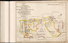
| Title: | Plan of the Farms of Rockelflat & Kirkcroft, Hallhill, Nether Hutton, Liverknow, Carnwath, Gall, Millriggs, Millland, Nether Borland and Glebe |
| Imprint: | 1767? |
| Notes: | View abstract relating to this map. Courtesy of Annandale Estates through the Dumfries Archival Mapping Project |
| Zoom Into Map: | Click on the map to view in greater detail. |