Mapmakers
Your search for Gordon, David returned 75 records.
Ordered chronologically (undated items first).
| Field | Content | |
|---|---|---|
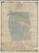
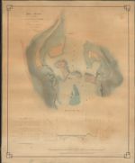
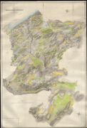
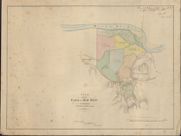
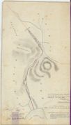
| Name: | Gordon, David, 1820-1893 | |
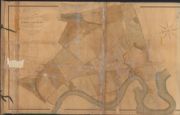
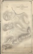
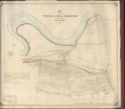
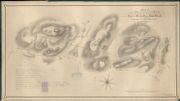
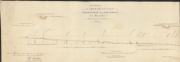
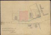
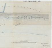
| Title: | Plan of the Kirkyard of Kirkhill 1885 | |
| Imprint: | 1786 | |
| Zoom Into Map: | Click on the map to view in greater detail. | |
| Field | Content | |
|---|---|---|
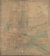
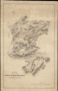
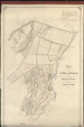
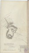
| Name: | Gordon, David, 1820-1893 | |
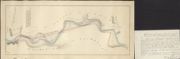
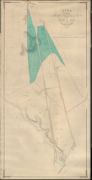
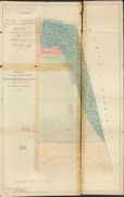
| Title: | Sketch of Beauly Village, together with the Orchard, etc. October, 1841. | |
| Imprint: | 1841 | |
| Zoom Into Map: | Click on the map to view in greater detail. | |
| Field | Content | |
|---|---|---|
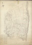
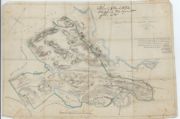
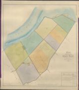
| Name: | Gordon, David, 1820-1893 | |
| Title: | Plan of the Lands of Kinneras and Druimnagarrachan, Cruive & Knockvuy Lying in the Parish of Kiltarlity | |
| Imprint: | 1841 | |
| Zoom Into Map: | Click on the map to view in greater detail. | |
| Field | Content | |
|---|---|---|
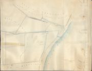
| Name: | Gordon, David, 1820-1893 | |
| Title: | Plan of the Lands of Teacnuick, Beauly-Carse, Bridgend, Teawig & Balblair, Situate in the Parish of Kilmorack, As Arranged and Subdivided from the Survey made in November 1842, by David Gordon Beauly, 1843 | |
| Imprint: | 1843 | |
| Zoom Into Map: | Click on the map to view in greater detail. | |
| Field | Content | |
|---|---|---|
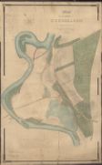
| Name: | Gordon, David, 1820-1893 | |
| Title: | Sketch of the Kirktown and Englishtown Lots | |
| Imprint: | 1844 | |
| Zoom Into Map: | Click on the map to view in greater detail. | |
| Field | Content | |
|---|---|---|
| Name: | Gordon, David, 1820-1893 | |
| Title: | Plan of the Lands of Fanblair and Ardblair, situated in the Parish of Kiltarlity | |
| Imprint: | 1846 | |
| Zoom Into Map: | Click on the map to view in greater detail. | |
| Field | Content | |
|---|---|---|
| Name: | Gordon, David, 1820-1893 | |
| Title: | Plan of the Farm of Dunballoch, situated in the parishes of Kiltarlity and Kirkhill, 1847 | |
| Imprint: | 1847 | |
| Zoom Into Map: | Click on the map to view in greater detail. | |
| Field | Content | |
|---|---|---|
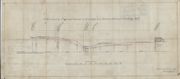
| Name: | Gordon, David, 1820-1893 | |
| Title: | Plan and Section of the site of a Proposed Bridge at the Lower Kilmorack Falls | |
| Imprint: | 1848 | |
| Zoom Into Map: | Click on the map to view in greater detail. | |
| Field | Content | |
|---|---|---|
| Name: | Gordon, David, 1820-1893 | |
| Title: | Plan and Section of a Proposed Road from the River Morar to Mallaig Pier, 1848 | |
| Imprint: | 1848 | |
| Zoom Into Map: | Click on the map to view in greater detail. | |
| Field | Content | |
|---|---|---|
| Name: | Gordon, David, 1820-1893 | |
| Title: | Plan of the Lands of Ardindrain, adjoining part of Glen Convinth, the property of the Right Hon Lord Lovat from Survey of David Gordon | |
| Imprint: | 1848 | |
| Zoom Into Map: | Click on the map to view in greater detail. | |
| Field | Content | |
|---|---|---|
| Name: | Gordon, David, 1820-1893 | |
| Title: | Plan of the Lands of Ardindrean and of the Farms of Convinth, Balintore and Dularich | |
| Imprint: | 1848-51 | |
| Zoom Into Map: | Click on the map to view in greater detail. | |
| Field | Content | |
|---|---|---|
| Name: | Gordon, David, 1820-1893 | |
| Title: | Plan of the Portion of the March betwixt Strathfarrar and Lochalsh which is disputed by the Proprietor of the Latter, 1850 | |
| Imprint: | 1850 | |
| Zoom Into Map: | Click on the map to view in greater detail. | |

| Field | Content | |
|---|---|---|
| Name: | Gordon, David, 1820-1893 | |
| Title: | Plan of Beauly Village, together with the Orchard, etc. Original dated October, 1841. | |
| Imprint: | 1850s | |
| Zoom Into Map: | Click on the map to view in greater detail. | |
| Field | Content | |
|---|---|---|
| Name: | Gordon, David, 1820-1893 | |
| Title: | Plan of the Barony of Strathfarrar reduced from the Survey of P May, 1758 | |
| Imprint: | 1852 | |
| Zoom Into Map: | Click on the map to view in greater detail. | |

| Field | Content | |
|---|---|---|
| Name: | Gordon, David, 1820-1893 | |
| Title: | Plan of the Barony of Strathfarrar reduced from the Survey of P May, 1758 | |
| Imprint: | 1852 | |
| Zoom Into Map: | Click on the map to view in greater detail. | |
| Field | Content | |
|---|---|---|
| Name: | Gordon, David, 1820-1893 | |
| Title: | Ordnance Sheets shewing Copy Plan of the Lands of Urchany and of the Hill Grouds of Farley etc situated in the Parish of Kilmorack | |
| Imprint: | 1852 | |
| Zoom Into Map: | Click on the map to view in greater detail. | |
| Field | Content | |
|---|---|---|
| Name: | Gordon, David, 1820-1893 | |
| Title: | Plan of the Lands of Urchany and of the Hll Grounds of Farley | |
| Imprint: | 1852 | |
| Zoom Into Map: | Click on the map to view in greater detail. | |

| Field | Content | |
|---|---|---|
| Name: | Gordon, David, 1820-1893 | |
| Title: | Plan of the Lands of Urchany and of the Hll Grounds of Farley | |
| Imprint: | 1852 | |
| Zoom Into Map: | Click on the map to view in greater detail. | |
| Field | Content | |
|---|---|---|
| Name: | Gordon, David, 1820-1893 | |
| Title: | Plan of the Lands of Ruifour, Teavarran and Cragganvallie, 1853, The Land Improved Then and Since being coloured Red, 1871 | |
| Imprint: | 1853 | |
| Zoom Into Map: | Click on the map to view in greater detail. | |
| Field | Content | |
|---|---|---|
| Name: | Gordon, David, 1820-1893 | |
| Title: | Plan of the Estate of Struy situated in the Parish of Kilmorack, the property of the Right Hon Lord Lovat, 1853 | |
| Imprint: | 1853 | |
| Zoom Into Map: | Click on the map to view in greater detail. | |
| Field | Content | |
|---|---|---|
| Name: | Gordon, David, 1820-1893 | |
| Title: | Plan of Parts of the Lands of Dunballoch. | |
| Imprint: | 1853 | |
| Zoom Into Map: | Click on the map to view in greater detail. | |
| Field | Content | |
|---|---|---|
| Name: | Gordon, David, 1820-1893 | |
| Title: | Sketch of that Piece of Ground on Bridgend which is Possessed by John Forsyth and his Assignees, 1854. | |
| Imprint: | 1854 | |
| Zoom Into Map: | Click on the map to view in greater detail. | |
| Field | Content | |
|---|---|---|
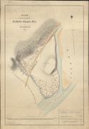
| Name: | Gordon, David, 1820-1893 | |
| Title: | Plan of the Proposed Catholic Chapel Feu at Glassburn, 1855 | |
| Imprint: | 1855 | |
| Zoom Into Map: | Click on the map to view in greater detail. | |
| Field | Content | |
|---|---|---|
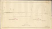
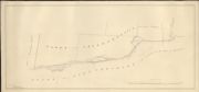
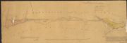
| Name: | Gordon, David, 1820-1893 | |
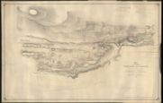
| Title: | Section across the Beauly Carse and River on the pencil line of Inverness-shire and Ross-shire Railway | |
| Imprint: | 1858 | |
| Zoom Into Map: | Click on the map to view in greater detail. | |
| Field | Content | |
|---|---|---|
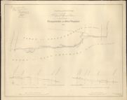
| Name: | Gordon, David, 1820-1893 | |
| Title: | Section from Beauly Pier along the Parliamentary Road etc on the plan of Groam to the point opposite Beaufort Castle. | |
| Imprint: | 1858 | |
| Zoom Into Map: | Click on the map to view in greater detail. | |
| Field | Content | |
|---|---|---|
| Name: | Gordon, David, 1820-1893 | |
| Title: | Plan of the farm of Inchberry, 1859 | |
| Imprint: | 1859 | |
| Zoom Into Map: | Click on the map to view in greater detail. | |
| Field | Content | |
|---|---|---|
| Name: | Gordon, David, 1820-1893 | |
| Title: | Plan of the Lands of Borlum, Glendoe Shellach Etc the property of the Right Hon Lord Lovat 1859 | |
| Imprint: | 1859 | |
| Zoom Into Map: | Click on the map to view in greater detail. | |
| Field | Content | |
|---|---|---|
| Name: | Gordon, David, 1820-1893 | |
| Title: | Plan of the Lands of Borlum, Glendoe, Shellach, etc the Property of the Right Hon Lord Lovat, 1859 | |
| Imprint: | 1859 | |
| Zoom Into Map: | Click on the map to view in greater detail. | |
| Field | Content | |
|---|---|---|
| Name: | Gordon, David, 1820-1893 | |
| Title: | Plan of the Oldtown of Aigas and of Two Adjacent Crofts, 1860. | |
| Imprint: | 1860 | |
| Zoom Into Map: | Click on the map to view in greater detail. | |
| Field | Content | |
|---|---|---|
| Name: | Gordon, David, 1820-1893 | |
| Title: | Plan of the Oldtown of Aigas and of Two Adjacent Crofts, 1860. | |
| Imprint: | 1860 | |
| Zoom Into Map: | Click on the map to view in greater detail. | |
| Field | Content | |
|---|---|---|
| Name: | Gordon, David, 1820-1893 | |
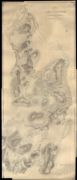
| Title: | Plan of the Hill Grounds of Wester Corriesulagach, part of Stratherrick, 1860 | |
| Imprint: | 1860 | |
| Zoom Into Map: | Click on the map to view in greater detail. | |
| Field | Content | |
|---|---|---|
| Name: | Gordon, David, 1820-1893 | |
| Title: | Farm of Bruiach and Adjacent Crofts Situated in Kiltarlity Parish, 1861. | |
| Imprint: | 1861 | |
| Zoom Into Map: | Click on the map to view in greater detail. | |
| Field | Content | |
|---|---|---|
| Name: | Gordon, David, 1820-1893 | |
| Title: | Plan and Sections of the Proposed March Burn between the Lands of Cragganvallie and Glen Urquhart, 1861. | |
| Imprint: | 1861 | |
| Zoom Into Map: | Click on the map to view in greater detail. | |
| Field | Content | |
|---|---|---|
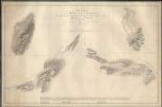
| Name: | Gordon, David, 1820-1893 | |
| Title: | [Sections of Embankment on Wester and mid-Crochiels, 1861] | |
| Imprint: | 1861 | |
| Zoom Into Map: | Click on the map to view in greater detail. | |
| Field | Content | |
|---|---|---|
| Name: | Gordon, David, 1820-1893 | |
| Title: | Plan of the Farm of Wester Lovat and Donaldston situated in the Parish of Kirkhill | |
| Imprint: | 1861 | |
| Zoom Into Map: | Click on the map to view in greater detail. | |
| Field | Content | |
|---|---|---|
| Name: | Gordon, David, 1820-1893 | |
| Title: | [Sketch and Sections of Propd Burn at Craggavallie, 1861] | |
| Imprint: | 1861 | |
| Zoom Into Map: | Click on the map to view in greater detail. | |
| Field | Content | |
|---|---|---|
| Name: | Gordon, David, 1820-1893 | |
| Title: | Plan of the Proposed March between Inchberry and Lentran, 1862 | |
| Imprint: | 1862 | |
| Zoom Into Map: | Click on the map to view in greater detail. | |
| Field | Content | |
|---|---|---|
| Name: | Gordon, David, 1820-1893 | |
| Title: | Plan of that part of the Lands of Stratherrick Belonging to the The Right Honourable Lord Lovat, which extends from Ballanrhu to Allt-Our inclusively | |
| Imprint: | 1862 | |
| Zoom Into Map: | Click on the map to view in greater detail. | |
| Field | Content | |
|---|---|---|
| Name: | Gordon, David, 1820-1893 | |
| Title: | Plan of the Western Portion of the Marches between the Properties of the Right Hon the Earl of Seafield and the Lord Lovat, being the whole Westward from Allt Caan a Keill as Settled in 1863 | |
| Imprint: | 1864 | |
| Zoom Into Map: | Click on the map to view in greater detail. | |
| Field | Content | |
|---|---|---|
| Name: | Gordon, David, 1820-1893 | |
| Title: | Plan of Lower Ardnagrask and Moor of Ord 1864-66 the Property of the Right Honourable Lord Lovat Surveyed 1864-6 | |
| Imprint: | 1864-6 | |
| Zoom Into Map: | Click on the map to view in greater detail. | |
| Field | Content | |
|---|---|---|
| Name: | Gordon, David, 1820-1893 | |
| Title: | Plan of Lower Ardnagrask and Moor of Ord 1864-66 the Property of the Right Honourable Lord Lovat Surveyed 1864-4 | |
| Imprint: | 1864-6 | |
| Zoom Into Map: | Click on the map to view in greater detail. | |
| Field | Content | |
|---|---|---|
| Name: | Gordon, David, 1820-1893 | |
| Title: | Plan of the Lands of Boblainy and Femenig 1858. and the Arable Lands of Clunevackie and Inshtaing together with Part of the Glen of Boblainy Plantation 1865. | |
| Imprint: | 1865 | |
| Zoom Into Map: | Click on the map to view in greater detail. | |
| Field | Content | |
|---|---|---|
| Name: | Gordon, David, 1820-1893 | |
| Title: | [Farm of Mid Main] | |
| Imprint: | 1865 | |
| Zoom Into Map: | Click on the map to view in greater detail. | |
| Field | Content | |
|---|---|---|
| Name: | Gordon, David, 1820-1893 | |
| Title: | Plan of the Marches between the Properties of the Right honourable Baron Lovat and James Murray Grant Esq, which have been settled in Terms of their Submission to Messrs Gordon and Mackay January 1865 | |
| Imprint: | 1865 | |
| Zoom Into Map: | Click on the map to view in greater detail. | |
| Field | Content | |
|---|---|---|
| Name: | Gordon, David, 1820-1893 | |
| Title: | Plan of the Lands of Clunes and the Hill Ground of Millefiach etc situated in the Parish of Kiltarlity | |
| Imprint: | 1866 | |
| Zoom Into Map: | Click on the map to view in greater detail. | |
| Field | Content | |
|---|---|---|
| Name: | Gordon, David, 1820-1893 | |
| Title: | [Ardnagrask & Rheindown March Burn, Map 1] | |
| Imprint: | 1867 | |
| Zoom Into Map: | Click on the map to view in greater detail. | |
| Field | Content | |
|---|---|---|
| Name: | Gordon, David, 1820-1893 | |
| Title: | Sections of Channel to be made for Ardnagrask and Rheindoun New March Burn, with reference to a plan, 1868. | |
| Imprint: | 1867 | |
| Zoom Into Map: | Click on the map to view in greater detail. | |
| Field | Content | |
|---|---|---|
| Name: | Gordon, David, 1820-1893 | |
| Title: | Sections of Channel to be made for Ardnagrask and Rheindoun New March Burn, with reference to a plan, 1868. | |
| Imprint: | 1867 | |
| Zoom Into Map: | Click on the map to view in greater detail. | |
| Field | Content | |
|---|---|---|
| Name: | Gordon, David, 1820-1893 | |
| Title: | Plan of the Farm of Balcraggan with Proposed Additions, 1867. | |
| Imprint: | 1867 | |
| Zoom Into Map: | Click on the map to view in greater detail. | |
| Field | Content | |
|---|---|---|
| Name: | Gordon, David, 1820-1893 | |
| Title: | Plan of the Lands of Tomich and Lettoch with part of Muir of Ord, 1867 | |
| Imprint: | 1867 | |
| Zoom Into Map: | Click on the map to view in greater detail. | |
| Field | Content | |
|---|---|---|
| Name: | Gordon, David, 1820-1893 | |
| Title: | [Bank of Scotland Site, etc 1871] | |
| Imprint: | 1870 | |
| Zoom Into Map: | Click on the map to view in greater detail. | |

| Field | Content | |
|---|---|---|
| Name: | Gordon, David, 1820-1893 | |
| Title: | Plan of the Lands of Dalcattaig and Portclair the Property of the Right Hon Lord Lovat, 1871 | |
| Imprint: | 1871 | |
| Zoom Into Map: | Click on the map to view in greater detail. | |
| Field | Content | |
|---|---|---|
| Name: | Gordon, David, 1820-1893 | |
| Title: | Sketch of the Shooting Ground to be let with Eilien Aigas House | |
| Imprint: | 1872 | |
| Zoom Into Map: | Click on the map to view in greater detail. | |
| Field | Content | |
|---|---|---|
| Name: | Gordon, David, 1820-1893 | |
| Title: | Plan of the Eastern Part of Muir of Ord Market Stance showing in Red the Building Plots, 1872 | |
| Imprint: | 1872 | |
| Zoom Into Map: | Click on the map to view in greater detail. | |
| Field | Content | |
|---|---|---|
| Name: | Gordon, David, 1820-1893 | |
| Title: | Section along the Proposed Course of Iron Pipe to be laid for Bruiach Threshing Mill | |
| Imprint: | 1874 | |
| Zoom Into Map: | Click on the map to view in greater detail. | |
| Field | Content | |
|---|---|---|
| Name: | Gordon, David, 1820-1893 | |
| Title: | [River Beauly Vessel, 1874] | |
| Imprint: | 1874 | |
| Zoom Into Map: | Click on the map to view in greater detail. | |
| Field | Content | |
|---|---|---|
| Name: | Gordon, David, 1820-1893 | |
| Title: | Plan of Part of the Lovat Property in the Parish of Kiltarlity which extends from Tomnacross to Femnock & Crerag inclusively | |
| Imprint: | 1874 | |
| Zoom Into Map: | Click on the map to view in greater detail. | |
| Field | Content | |
|---|---|---|
| Name: | Gordon, David, 1820-1893 | |
| Title: | [Abertarf Est] | |
| Imprint: | 1876 | |
| Zoom Into Map: | Click on the map to view in greater detail. | |
| Field | Content | |
|---|---|---|
| Name: | Gordon, David, 1820-1893 | |
| Title: | [Plan of Ground at North Morar Lodge, 1878] | |
| Imprint: | 1876 | |
| Zoom Into Map: | Click on the map to view in greater detail. | |
| Field | Content | |
|---|---|---|
| Name: | Gordon, David, 1820-1893 | |
| Title: | [Plan of Ground at North Morar Lodge, 1878] | |
| Imprint: | 1876 | |
| Zoom Into Map: | Click on the map to view in greater detail. | |
| Field | Content | |
|---|---|---|
| Name: | Gordon, David, 1820-1893 | |
| Title: | Sketch of Lot No. X, Easter Clunes, 1876 | |
| Imprint: | 1876 | |
| Zoom Into Map: | Click on the map to view in greater detail. | |
| Field | Content | |
|---|---|---|
| Name: | Gordon, David, 1820-1893 | |
| Title: | [Fanblair Shootings as let in, 1877] | |
| Imprint: | 1877 | |
| Zoom Into Map: | Click on the map to view in greater detail. | |
| Field | Content | |
|---|---|---|
| Name: | Gordon, David, 1820-1893 | |
| Title: | Plan of Part of the Croft Land of Dalcattaig | |
| Imprint: | 1877 | |
| Zoom Into Map: | Click on the map to view in greater detail. | |
| Field | Content | |
|---|---|---|
| Name: | Gordon, David, 1820-1893 | |
| Title: | [Plan of Beauly River extending from Beauly Village to Guisachan, 1877] | |
| Imprint: | 1877 | |
| Zoom Into Map: | Click on the map to view in greater detail. | |
| Field | Content | |
|---|---|---|
| Name: | Gordon, David, 1820-1893 | |
| Title: | Old Draft Plan of Culigran Arable with Propd Plantation added to it in 1863 | |
| Imprint: | 1877 | |
| Zoom Into Map: | Click on the map to view in greater detail. | |
| Field | Content | |
|---|---|---|
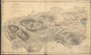
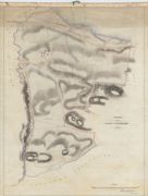
| Name: | Gordon, David, 1820-1893 | |
| Title: | Plan of that part of Stratherrick which forms the Shooting Range of Corriegarth 1878. W A Johnston Edinburgh. | |
| Imprint: | 1878 | |
| Zoom Into Map: | Click on the map to view in greater detail. | |
| Field | Content | |
|---|---|---|
| Name: | Gordon, David, 1820-1893 | |
| Title: | Plan of that part of Stratherrick which forms the Shooting Range of Corriegarth, 1878. | |
| Imprint: | 1878 | |
| Zoom Into Map: | Click on the map to view in greater detail. | |
| Field | Content | |
|---|---|---|
| Name: | Gordon, David, 1820-1893 | |
| Title: | Sletch copied from the plan signed by the Lord Lovat and the Chisholm 15th Sept 1842. | |
| Imprint: | 1881 | |
| Zoom Into Map: | Click on the map to view in greater detail. | |
| Field | Content | |
|---|---|---|
| Name: | Gordon, David, 1820-1893 | |
| Title: | Sletch copied from the plan signed by the Lord Lovat and the Chisholm 15th Sept. | |
| Imprint: | 1881 | |
| Zoom Into Map: | Click on the map to view in greater detail. | |
| Field | Content | |
|---|---|---|
| Name: | Gordon, David, 1820-1893 | |
| Title: | Plan of the Farm of Easter Lovat as Let to Mr John Rattray | |
| Imprint: | 1888 | |
| Zoom Into Map: | Click on the map to view in greater detail. | |
| Field | Content | |
|---|---|---|
| Name: | Gordon, David, 1820-1893 | |
| Title: | [Tomich Burn] | |
| Imprint: | 1889 | |
| Zoom Into Map: | Click on the map to view in greater detail. | |
| Field | Content | |
|---|---|---|
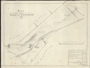
| Name: | Gordon, David, 1820-1893 | |
| Title: | Plan of the Farm of Teafrish | |
| Imprint: | 1890 | |
| Zoom Into Map: | Click on the map to view in greater detail. | |
| Field | Content | |
|---|---|---|
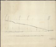
| Name: | Gordon, David, 1820-1893 | |
| Title: | Section of the Drains along the Kirkton Burn | |
| Imprint: | 1890 | |
| Zoom Into Map: | Click on the map to view in greater detail. | |
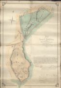
| Field | Content | |
|---|---|---|
| Name: | Gordon, David, 1820-1893 | |
| Title: | Plan of the Lands of Ardrennich and of Dalnamine Farm, situated in parish of Kiltarlity 1852 | |
| Imprint: | 1963 | |
| Zoom Into Map: | Click on the map to view in greater detail. | |