Estate Maps, 1750s-1900s

| Name: | Gordon, David, 1820-1893 |
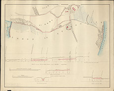
| Title: | Plan of Parts of the Lands of Dunballoch. |
| Imprint: | 1853 |
| Pagination: | 1 map: col.; 55 x 69 cm. |
| Shelfmark: | Lovat222-1 |
| Notes: | An unsigned, but in the style of David Gordon.. Contains rolled up within it a later map surveyed by David Gordon 5th August 1890, titled: Section along the Pencil Line marked ABC, on the Plan Scale 1:2382. (20 chains = 6.65" ). Courtesy of Lovat Highland Estates and the North of Scotland Archaeological Society. View Lovat Highland Estates mapping |
| Zoom Into Map: | Click on the map to view in greater detail. |