Estate Maps, 1750s-1960s
| Field | Content |
|---|---|
| Name: | Gordon, David (1820-1893) |
| Title: | Plan of the Lands of Urchany and of the Hill Grounds of Farley |
| Imprint: | 1852 |
| Pagination: | 1 manuscript map: col.; 84 x 170 cm. |
| Shelfmark: | Lovat264 |
| Notes: | Scale: 1:6,336 (60 chains = 7.5") Courtesy of Lovat Highland Estates and the North of Scotland Archaeological Society. |
| Zoom Into Map: | Click on the maps below to order images or view in greater detail. |
Map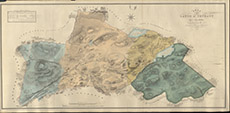
|
Reverse side
|
