Ordnance Survey, 1:25,000 maps of Great Britain (Regular series) - 1945-1973
Introduction
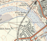
The 1:25,000 'Provisional edition' or 'First Series', was Ordnance Survey's first civilian map series at this medium scale, the forerunner of the modern Explorer and Outdoor Leisure maps. By 1956 it covered 80% of Great Britain, everywhere apart from the Scottish Highlands and Islands. The series is useful for showing rural and urban areas in much greater detail than the standard one-inch to the mile (1:63,360) maps. This website shows all our editions of 1:25,000 maps for each 10 kilometre square in Great Britain, as a well as a seamless georeferenced mosaic of the whole series.
See also:
- War Office, Great Britain 1:20,000, GSGS 2748, 1920s
- War Office, Great Britain 1:25,000, GSGS 3906, 1940-43
- Ordnance Survey, 1:25,000 Administrative Area Series, 1945-1968
- Ordnance Survey, 1:25,000 Outline Series, 1945-1965
In this section
- Content, Sources and Users
- Printing, sheet numbering and later history
Content

detail, with variant fonts for antiquities
One millimetre on the map is equal to 25 metres on the ground, and therefore a range of features that cannot be shown clearly at one-inch to the mile scale are included. Within settlements, the general character of buildings - whether terraces, semi-detached, or large detached houses, etc. - can be shown, and public buildings are distinguished by their darker shading. Within rural areas, the series is the smallest scale at which field boundaries can be shown with clarity, and consequently footpaths, tracks and bridleways can be easily followed. Different types of woodland (coniferous, deciduous, or mixed woodland) are indicated, and features of archaeological interest, including cairns, earthworks, historic routeways, and standing stones are shown. Roads and railways are depicted with less generalisation than at smaller scales, and contour lines of equal height are shown at close intervals of every 25 feet.
View a zoomable map legend of standard symbols and features.
Sources of information and compilation
The 1:25,000 maps reflect quite different sources of information from different dates, often on the same sheet, reflecting their terminology as a 'Provisional edition'. For more populated areas where the larger-scale National Grid survey had taken place, the latest, more detailed six-inch to the mile mapping could be used, photographically reducing detail down to 1:25,000. For other areas, the best available source mapping could be decades earlier, supplemented by less detailed map sources, including Second World War bomb-damage surveys, and military and road mapping in the 1940s. As work on the One-Inch Seventh Series progressed in the 1950s, this more comprehensive topographic revision could also be enlarged and used for certain features.
Users

with contours every 25 feet.
The 1:25,000 scale has always been attractive for military purposes. The Roy Military Survey map of Scotland is at a similar scale of 1:36,000, and the 1:20,000 scale was used in the First World War for artillery purposes on the Western Front and in selected areas of Great Britain (GSGS 2748). By early 1941, the whole of Great Britain had been mapped at the 1:25,000 scale (GSGS 3906) for military purposes, by photographically reducing the latest available six-inch to the mile maps, and with some minor updating. A military version of the 1:25,000 (GSGS 4627, or M.821) was also published from 1947-1960 for about half of the sheets, and used for military training and RAF target practice.
Officially, the main user communities of the civil 1:25,000 series were intended to be walkers, schools, geographers, and planners, but in practice, the volume of usage from all of these communities was quite limited. Print runs for sheets were low - usually in hundreds, rather than thousands, for a few years' stock. Whilst the planning requirement was in some respects a convenient excuse for the series, the maps were popular with the Land Utilisation Survey and as a base for thematic maps including soils, geology and administrative boundaries. By 1963-4, 22% of all sales were to schools, particularly for examination purposes. The series was valuable for outdoor recreation, but the 1:25,000 scale only really became popular with walkers when the sheet sizes increased with the later Pathfinder, Explorer, and Outdoor Leisure series.
 Next: Page 2 of 2