Pont maps | Pont texts | biographies | history | subjects | further reading
Pont Maps of Scotland, ca. 1583-1614 - Pont texts
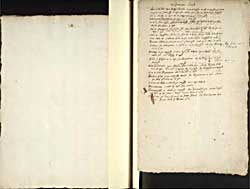
Januarie 1646
Pagination: 151v-152r
Transcription of text:
Januarie 1646
above Sterlin upon forth, Luckie on the southsyd 4 myl 1/2 myl fra the water
Touch is on that same syd 2 myl fra Sterlin, and 2 fra the water on the southsyd
nixt to Luckie 2 myl up is Cargennok on that same syd
firdir up is Buquhann 2 myl on that same syd
On that same syd Ardmanwell ferdir up a m. 1/2m fra the river and fra Buchann 3 myl
nixt is Arnpryour up that sam syd fra Ardmannal 3/4 myl and fra the river 1 myl
above it Arngibbon from the former 1 1/4m. fra the water 2 1/4myl
nixt above is Cardros hard on the water on the northsyd 3 myl
Bomore above the former on the same syd hard on the river 2 myl 1/2
Carden fra Arngibbon a myl 1/2m. on the south syd and fra Bomore it is 3 myl.
[up forth and to L Lomond]
Fintray on the south syd seaven myl long fra carden upon Ainrik and fra Sterlin 16. fra Kilsyth 8 myl
Kirk of Kippen is 2 myl fra Buquhann, and fra Forth 3/4 myl on the south syd
Kirk of Drimmin upon Ainrik north syd fra Carden 6 m. fra Kippon Kirk it is 8 myl. Drumikil is north fra it 1/2 myl. fra Buquhannan 2 myl.
it is betuix Buquhanan and Drumkil 2 myl
Bochron Kirk on the north syd of ainrik fra Buquhanan 7 myl above the kirk of Drimnin 6 myl
Kilmaronok Kirk on Ainrik the southsyd not a myl above it.
Buquhannan castel 17 myl fra Sterlin
Drumynhassil on the ainrik the orthsyd fra Drummikil 3m. above drymmin kirk 4 myl short, beneth bochron kirk 2 myl 1/2
Cragivarn the burn therof goeth to Ainrik fra Buquhannan it is 3 myl 1/2m. and fra the kirk of Bochron 5 myl.
Continued


![Next: 14 January 1646 Lennox Sterlinshyr Clydsdail Cuningham, [In Galloway and ther about]](../../img/next.gif)
