Pont maps | Pont texts | biographies | history | subjects | further reading
Pont Maps of Scotland, ca. 1583-1614 - Pont texts
for Cuningham and therabouts, Cuningham and therabout
Click on image to zoom into text


Scroll through text pages
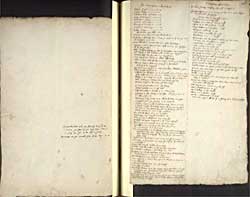
Pagination: 147v-148r
Transcription of text:
Dalmellintoun and the foot of loch Dun 1/2m. 1/2m the foot of the loch S W fra it, it hath ane yle in it and a hous
Kenmuir and the neerest part of the loch 12m.
for Cuningham and therabouts
Glascow Sempil 10m.
Glascow Paisley 6
Stinstoun kirk Eglintoun 3
Lairgs Kilburning C 5
Kilburning C Irwing 7
Saltcoats Kilburning 6
Peincors C Kilburning 8
Sempill C Kilburnie 8
Knok Lairgs 2 and betuix them Nodle burn
Skelmurlin burn and the place therof and Knok 1m.
fra Irwing to Skelmurly burn alongs the coast is 15m. the lenth of Cuningham on the sea
Ainok river fals in Garnok river 1m. above Eglintoun
Cunungham head is upon that river whilk is 2m. fra Eglintoun and 4 fra Irwing
Above Cuningham Head up the river is Leinshaw, ovir a pretty green hill south fra it cald Casteltoun hill, the hill on the north of it
Stuartoun kirk more up the river on the north syd 1/2 m.
on the south syd just aganis the kirk is Lochridge
Half a m. fra the kirk and river is Corsel, betuix them Cochelby
half a m. above the kirk on the south syd is Robertland
Hard by it is Swynstie
up the river on the north syd 1m. above Swynstie is Blacklaw a great hill the springs not far fra it
Southeast fra Blacklaw 1m. is Carnehill at the head of the river Anok whilk river cums out of the blakloch 1/2m above Carnhill
Blakloch is 3/4m. long 1/2m. broad Whytloch is 1m long 1/2m broad betuix them Carcarth river cums out of Whytloch
fornent Carnhil is Drumbuy hill due north
the mouth of Garnok is 1m. fra Irwing
And fra Garnok 3m is Kyl river
Caf river falleth in Garnok 3m above the sea
Eglintoun is fra Irwing 2 myl short and fra the sea 1m. and half a m.
Kilwinning is fra Irwing 2m. and fra Eglintoun 1m. Short
Cuningham head fra Irwing 4m. Eastward
Lugdoun water is hard by Eglintoun, north fra it it runneth in Garnok im. fra Kilwinning and 1/2 m. fra the sea, it hath a ston brig a m. fra Kilwinning and 1m fra Irwing and in the midway Garnoch her cours is up nordwest
Upon Garnok up the river ar as follow
Kilwinning on the north syd 2m. fra the sea
Above that 1m. is Mongrenan on the south syd
Woodsyd ovir aganis Mongrenan a m. on the north syd
Blair on the S or east syd 4m. m. fra Kilwinning
Achinhervy 2m. south fra the river 4m. fra Irwing
The tour west syd 4m. fra Irwing
The kirk of dory 5m. fra Irwing and 1/2m. above the joynings of Garnok and Caf rivers, and the river Ry runs in Garnok 1/4m. above kirk on the north syd. Ry runs fra the nord west with a great crook
Carsland 6m. fra Irwing 6 myl on the east syd of Garnok
Kilburning 1m. fra Garnok on the north syd besyd the loch of Kilburnin and a myl therfra
Irwing river runs fra Lowdon ?0 m. long
Saltcotts a toun and harbor 3m. fra Irwing N N west
fra Saltcotts is Stinstoun a myl east up the land
Kellylaw 1m. east fra Stinstoun, it is 4m. fra the kirk of Kilbyrny east fra it 1/2m. is a loch of 1m. long
fra Saltcots 1m. is the mouth of Stainlie burn
more north 1m. is Minfod burn, upon it Minfod 1/4m. fra the sea on the north syd
therfra 1m. is Gorak burn 6m. fra Lairges
1m. therfra Seamill burn
Poynt of Paincors 4m. fra Lairgs, and the seamilburn 1m. heir is a poynt runs nord nordwest in the sea a large myl upon the poynt therof standeth Payncros Castel
following the coast 2m. is Hunterstoun, and heir yew touch the sea which Payncors poynt took away in the way to Lairgs therfra the coast falleth straight nordeast to Largs
Cuningham and therabout
the river Irwing devyded Kyl and Cuningham
Irwing toun at the sea be north the river with a stone bridge a good haven for ships
Irwing river on both syds is thus
Craig 2m. up on the north syd
Dreghorn 2m. above that upon the S syd
Achens 2m. above the former S syd
Craigie wallace 4m. up furdir S syd
Ellersly 2m. furdir up S syd
Caprintoun 2m. furdir up S syd
Ricardtoun 2m. S syd
Kilmarnok a toun ovir aganis Ricardtoun the river betuix
The Dinn above Kilmarnok 1m. N syd
Crawfoord land 1m. furdir up N syd
Sloss hard by on that same syd
Rowallan 2m. up on the N syd 2m. fra the river
Dumisternok 2m. up on the sam syd
ovir aganis it Haning S syd 2m. fra the river
Kirk of Gaston 4m. above Dumisternok S syd
Bar hard by on the same syd
Sesnock hard by on that same syd
Gaston Castell 1m. above kirk on that syd also
Lowdun Castle ovir aganis Gastoun N syd and 1m. up the river
Newmils toun kirk castle a mylabove Gaston N syd
Bankhead 2m. up N syd
Braidlie 1m. up N syd
The hill Lowdown hil is at the springs of the river and joyneth to Clydsdail
Sesnok river falleth in Irwing river 8m. above the town of Irwing at the place called Sesnok
Above Sesnok 4m. Carnel on the W syd
Above it Brighthous 1/4m. W syd
nixt is Killoch 1m. up W syd
more up 1m. is Fowler N syd
more up is Achmannoch 2m. N syd
Sesnok river ryseth as far up as Irwing 4m. betuix the springs