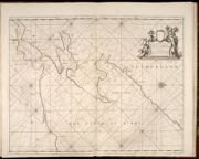
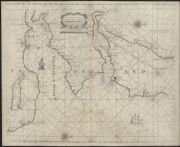
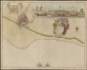
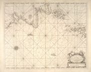
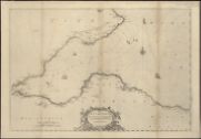
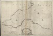
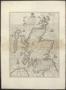
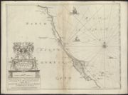
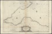
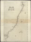
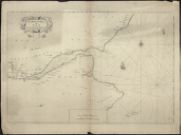
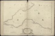
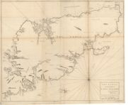
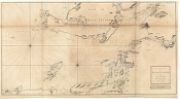
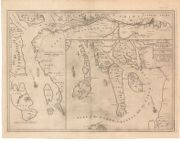
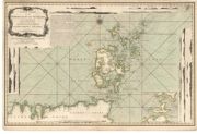
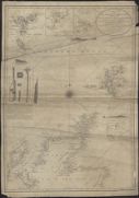
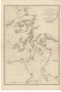
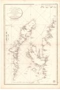
Coasts of Scotland on marine charts, 1580s-1900s
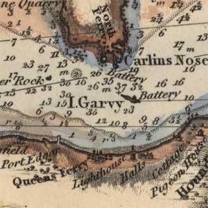
Nautical charts for mariners, focusing on marine hazards, harbours, coastal settlements, and islands. During the 19th century, the Hydrographic Office of the Admiralty surveyed all the coasts of Scotland in great detail, often updating charts regularly for busier ports and estuaries. For Admiralty charts view Admiralty Charts of Scotland, 1795-1963, and see also, German naval charts (1905-1945) for charts of Scottish and British waters by the Oberkommando der Kriegsmarine, Berlin.
See also Lighthouse plans and profiles and harbour plans by the Stevenson civil engineers.
View Coastal charts without thumbnail images.
289 coastal charts of Scotland.
Ordered chronologically (undated items first).
| Field | Content | |
|---|---|---|
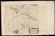
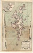
| Name: | Waghenaer, Lucas Janszoon, 1534 or 5-1606 | |
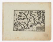
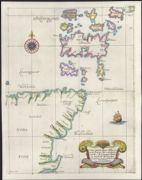
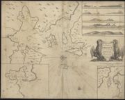
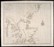
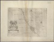
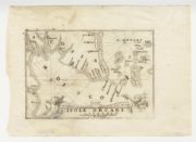
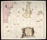
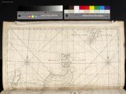
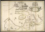
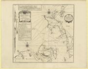
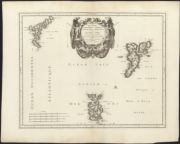
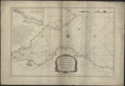
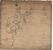
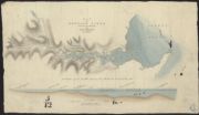
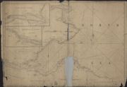
| Title: | Carte de la coste d'Ecosse depuis Barwick jusques à Cruden faite en 1559. | |
| Imprint: | Drawn 1559. | |
| Zoom Into Map: | Click on the map to view in greater detail. | |
| Field | Content | |
|---|---|---|
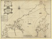
| Name: | Sideri, Georgio (Callapoda) | |
| Title: | [Portolan chart of Europe, drafted by Georgio Sideri / Calapoda] | |
| Imprint: | Drawn, 1560 | |
| Zoom Into Map: | Click on the map to view in greater detail. | |
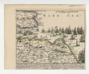
| Field | Content | |
|---|---|---|
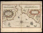
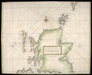
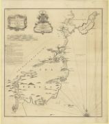
| Name: | Nicolay, Nicolas de, 1517-1583 | |
| Title: | Vraye & exacte description Hydrographique des costes maritimes d'Escosse & des Isles Orchades Hebrides avec partie d'Angleterre & d'Irlande servant a la navigation / Par N. de Nicolay D'auphinois Sieur d'Arfeville & de Belair … | |
| Imprint: | [Paris : Gilles Beys], 1583. | |
| Zoom Into Map: | Click on the map to view in greater detail. | |
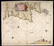
| Field | Content | |
|---|---|---|
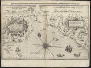
| Name: | Waghenaer, Lucas Janszoon, 1534 or 5-1606 | |
| Title: | Beschrijvinge van een deel vann Schottlandt van Bambourg tot Aberdein : daer Edenburg de princepaele Coepstat in is, So hem tlant daer 'bthoont, beneffens 2 eÿlende / door Lucas Ianss Wagenaer ; Ioannes a Doetecum Fecit. | |
| Imprint: | [Leyden : Plantin, 1583] | |
| Zoom Into Map: | Click on the map to view in greater detail. | |
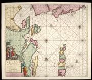
| Field | Content | |
|---|---|---|
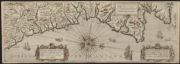
| Name: | Waghenaer, Lucas Janszoon, 1534 or 5-1606 | |
| Title: | Beschrijvinge van een deel vann Schottlandt van Bambourg tot Aberdein daer Edenburg de princaele Coepstat in is, So hem tlant daer vtboont beneffens zeÿlende. Orae maritimae Scotiae a Bamburgo ad Aberdinum, vera delineatio / Lucas Jansz Wagenaer ; Ioanne | |
| Imprint: | [Leyden : Plantin ca. 1589] | |
| Zoom Into Map: | Click on the map to view in greater detail. | |
| Field | Content | |
|---|---|---|
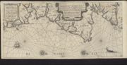
| Name: | Waghenaer, Lucas Janszoon, 1534 or 5-1606 | |
| Title: | Beschrijvinghe vande Noortcosten van Engelant ende Scotlant, ende ghelegentheit van dien, mitsgaders de monden vande rivieren, ende havenen, ende waer voren, men hem moet wachten = Description des costes Septentrionales d'Angleterre et Escosse... | |
| Imprint: | [Leyden : ghedruckt by Francois van Raphelengien voor Lucas Iansz Waghenaer 1592] | |
| Zoom Into Map: | Click on the map to view in greater detail. | |
| Field | Content | |
|---|---|---|
| Name: | Jansson, Jan, 1588-1664 | |
| Title: | Ware afbeeldinghe vande oostelycke zeecusten van Schotlandt. | |
| Imprint: | [Amsterdam : Jansson 1620]. | |
| Zoom Into Map: | Click on the map to view in greater detail. | |
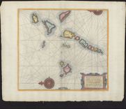
| Field | Content | |
|---|---|---|
| Name: | Blaeu, Willem Janszoon, 1571-1638 | |
| Title: | Pascaarte, verthoonende in wat ghestalte de Eylanden (Hebrides ghenaemt) achter de noordwesthoek van Schotlandt gheleghen zÿn = Carte marine de les Isles Hebrides Situez vers norouest arriere l'Escosse. | |
| Imprint: | [Amsterdam : Blaeu ca. 1623] | |
| Zoom Into Map: | Click on the map to view in greater detail. | |
| Field | Content | |
|---|---|---|
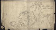
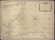
| Title: | Sea chart of the coasts from northern Scotland to Spitsbergen, including Norway | |
| Imprint: | ca.1635 | |
| Zoom Into Map: | Click on the map to view in greater detail. | |
| Field | Content | |
|---|---|---|
| Name: | Colom, Jacob Aertsz | |
| Title: | De Custen van Engelandt en Schotlandt tusschen Tinbij en de Eijlanden van Orcanesse. | |
| Imprint: | [Amsterdam : Colom 1641] | |
| Zoom Into Map: | Click on the map to view in greater detail. | |
| Field | Content | |
|---|---|---|
| Name: | Jacobsz, Theunis | |
| Title: | De custen van Schotland met de eylanden van Orcanesse, van 't eylandt Coket tot I. Sande / By Iacob Theunisz op het water, in de Lootsman. | |
| Imprint: | [Amsterdam : Jacobsz 1644]. | |
| Zoom Into Map: | Click on the map to view in greater detail. | |
| Field | Content | |
|---|---|---|
| Name: | Wright, Benjamin Visscher, Claes Jansz, 1586 or 1587-1652 | |
| Title: | Alata castra Scotiae Regia urbs et Metrolis Vulgi Edimburgum | |
| Imprint: | [ Amsterdam : Visscher, 1649 ] | |
| Zoom Into Map: | Click on the map to view in greater detail. | |
| Field | Content | |
|---|---|---|
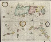
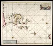
| Name: | Goos, Pieter | |
| Title: | Eylanden van Hitlandt ofte Schetlandt Fayer hill en Fulo; Eylanden van Hebrides gelegen achter de noord-west hoeck van Schotlant; Eylanden van Fero ofte Farre. | |
| Imprint: | [Amsterdam : P Goos ca. 1650] | |
| Zoom Into Map: | Click on the map to view in greater detail. | |
| Field | Content | |
|---|---|---|
| Name: | Blaeu, Willem Janszoon, 1571-1638 | |
| Title: | De Custen van Engelandt en Schotlandt tusschen Tinbij en Donde. | |
| Imprint: | [Amsterdam : Blaeu, ca. 1658] | |
| Zoom Into Map: | Click on the map to view in greater detail. | |
| Field | Content | |
|---|---|---|
| Name: | Blaeu, Willem Janszoon, 1571-1638 | |
| Title: |
De Custen van Schotlandt van Donde tot d'Eijlanden van Orcanesse. De kusten van Schotlandt van Donde tot Eijlanden Orcanesse. | |
| Imprint: | [Amsterdam : Blaeu, 1658] | |
| Zoom Into Map: | Click on the map to view in greater detail. | |
| Field | Content | |
|---|---|---|
| Name: | Blaeu, Willem Janszoon, 1571-1638 | |
| Title: |
Pascaarte, verthoonende in wat ghestalte de Eylanden (Hebrides ghenaemt) achter de noordwesthoek van Schotlandt gheleghen zÿn = Carte marine de les Isles Hebrides situez vers norouest arriere l'Escosse. Carte marine de les Isles Hebrides situez vers | |
| Imprint: | [Amsterdam : Blaeu, 1658] | |
| Zoom Into Map: | Click on the map to view in greater detail. | |
| Field | Content | |
|---|---|---|
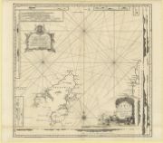
| Title: | Oversay - Chart of district | |
| Imprint: | n.d. | |
| Zoom Into Map: | Click on the map to view in greater detail. | |
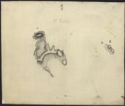
| Field | Content | |
|---|---|---|
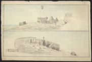
| Title: | St. Kilda - Plan of island | |
| Date: | 1660 | |
| Zoom Into Map: | Click on the map to view in greater detail. | |
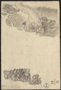
| Field | Content | |
|---|---|---|
| Title: | Portessie - Sketch of East Muck | |
| Date: | 1660 | |
| Zoom Into Map: | Click on the map to view in greater detail. | |
| Field | Content | |
|---|---|---|
| Title: | Whalsey - Boulders on bound Skerry | |
| Date: | 1660 | |
| Zoom Into Map: | Click on the map to view in greater detail. | |
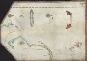
| Field | Content | |
|---|---|---|
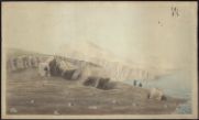
| Title: | Barra Head - Plan of Boulders at Barra Head (2 items). | |
| Date: | 1660 | |
| Zoom Into Map: | Click on the map to view in greater detail. | |
| Field | Content | |
|---|---|---|
| Title: | Barra Head - Plan of Boulders at Barra Head (2 items). | |
| Date: | 1660 | |
| Zoom Into Map: | Click on the map to view in greater detail. | |
| Field | Content | |
|---|---|---|
| Name: | Lucini, Antonio Francesco | |
| Title: | Carte particolare della costa di Scozia : che comincia con il C: di Cromare è Finis ce con I'Isole di Orcades. La longitudine Comincia da l'Isola di Picho d'Asores di Europa Carta XXXV / A.F. Lucini fece. | |
| Imprint: | [Fiorenze : G Gocchini 1661] | |
| Zoom Into Map: | Click on the map to view in greater detail. | |
| Field | Content | |
|---|---|---|
| Name: | Doncker, Hendrick | |
| Title: | De Custen van Schotlandt en de Eylanden van Orcanesse ; van 't eylandt Coket tot I. Sande / by Hendrick Doncker. | |
| Imprint: | [Amsterdam : Doncker ca. 1682] | |
| Zoom Into Map: | Click on the map to view in greater detail. | |
| Field | Content | |
|---|---|---|
| Name: | Keulen, Johannes van, 1654-1715 | |
| Title: | Paskaart vande noord cust van Schotland als mede de eylanden van Hitlandt en Fero. Naaukeuring opgestelt en van veel fouten verbetert ... / Iohannes van Keulen. | |
| Imprint: | [Amsterdam : J. van Keulen, 1682] | |
| Zoom Into Map: | Click on the map to view in greater detail. | |
| Field | Content | |
|---|---|---|
| Name: | Collins, Greenvile, fl. 1669-1698 | |
| Title: | The Chiefe Harbours in the Islands of Orkney. | |
| Imprint: | [London? : F. Collins?, 1688] | |
| Zoom Into Map: | Click on the map to view in greater detail. | |
| Field | Content | |
|---|---|---|
| Name: | Collins, Greenvile, fl. 1669-1698 | |
| Title: | The islands of Orkney | |
| Imprint: | 1688 | |
| Zoom Into Map: | Click on the map to view in greater detail. | |
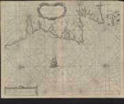
| Field | Content | |
|---|---|---|
| Name: | Collins, Greenvile, fl. 1669-1698 | |
| Title: | The cheife harbours in the islands of Orkney | |
| Imprint: | ?1689 | |
| Zoom Into Map: | Click on the map to view in greater detail. | |
| Field | Content | |
|---|---|---|
| Name: | Collins, Greenvile, fl. 1669-1698 | |
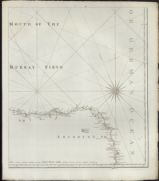
| Title: | Firth of Murray | |
| Imprint: | ?1689 | |
| Zoom Into Map: | Click on the map to view in greater detail. | |
| Field | Content | |
|---|---|---|
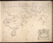
| Name: | Collins, Greenvile, fl. 1669-1698 | |
| Title: | Part of the maine island of Shetland | |
| Imprint: | ?1689 | |
| Zoom Into Map: | Click on the map to view in greater detail. | |
| Field | Content | |
|---|---|---|
| Name: | Collins, Greenvile, fl. 1669-1698 | |
| Title: | The south part of the isles of Shetland | |
| Imprint: | ca. 1689 | |
| Zoom Into Map: | Click on the map to view in greater detail. | |
| Field | Content | |
|---|---|---|
| Name: | Collins, Greenvile, fl. 1669-1698 Moll, Herman, d. 1732 | |
| Title: | The Firth of Murry / H. Moll, sculp. | |
| Imprint: | [London? : F. Collins?, 1689] | |
| Zoom Into Map: | Click on the map to view in greater detail. | |
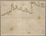
| Field | Content | |
|---|---|---|
| Name: | Thornton, John | |
| Title: | A chart of the east coast of Scotland / by John Thornton hydrographer, at the England, Scotland and Ireland in the Minories. | |
| Imprint: | [London] : John Thornton [ca. 1690] | |
| Zoom Into Map: | Click on the map to view in greater detail. | |
| Field | Content | |
|---|---|---|
| Name: | Collins, Greenvile, fl. 1669-1698 | |
| Title: | [Approaches to Leith] : To the right honourable Sr. Iames Fleming Lord Provost of ye city of Edenburgh, and ye rest of ye Hon. Councill of the s.n.y Burgh / this mapp is humbly dedicated by Capt. Greenvile Collins Hydrographer to the King. | |
| Imprint: | [London, 1693] | |
| Zoom Into Map: | Click on the map to view in greater detail. | |
| Field | Content | |
|---|---|---|
| Name: | Collins, Greenvile, fl. 1669-1698 | |
| Title: | The East Coast of Scotland with the Isles of Orkney and Shetland. | |
| Imprint: | [London? : F. Collins?, 1693?] | |
| Zoom Into Map: | Click on the map to view in greater detail. | |
| Field | Content | |
|---|---|---|
| Name: | Collins, Greenvile, fl. 1669-1698 | |
| Title: | Edinburgh Firth. | |
| Imprint: | [London? : F. Collins?, 1693?] | |
| Zoom Into Map: | Click on the map to view in greater detail. | |
| Field | Content | |
|---|---|---|
| Name: | Marr, John, fl. 1660-1720 Collins, Greenvile, fl. 1669-1698 | |
| Title: |
The Sea coast from Fiffnesse to Montros / was Survey'd by Mr. Mar, an injenious Marriner [sic] of Dundee. Sea coast from Fife Ness to Montrose. | |
| Imprint: | [London? : F. Collins?, 1693?] | |
| Zoom Into Map: | Click on the map to view in greater detail. | |
| Field | Content | |
|---|---|---|
| Name: | Collins, Greenvile, fl. 1669-1698 | |
| Title: | Leith / Ni Yeates fecit. | |
| Imprint: | [London? : F. Collins?, 1693?] | |
| Zoom Into Map: | Click on the map to view in greater detail. | |
| Field | Content | |
|---|---|---|
| Name: | Collins, Greenvile, fl. 1669-1698 Moll, Herman, d. 1732. | |
| Title: | The Islands of Orkney / H. Moll, sculp. | |
| Imprint: | [London? : F. Collins?, 1693?] | |
| Zoom Into Map: | Click on the map to view in greater detail. | |
| Field | Content | |
|---|---|---|
| Name: | Collins, Greenvile, fl. 1669-1698 Moll, Herman, d. 1732. | |
| Title: | Part of the Maine Island of Shetland / H. Moll, sculp. | |
| Imprint: | [London? : F. Collins?, 1693?] | |
| Zoom Into Map: | Click on the map to view in greater detail. | |
| Field | Content | |
|---|---|---|
| Name: | Collins, Greenvile, fl. 1669-1698 | |
| Title: | The South Part of the Isles of Shetland. | |
| Imprint: | [London? : F. Collins?, 1693?] | |
| Zoom Into Map: | Click on the map to view in greater detail. | |
| Field | Content | |
|---|---|---|
| Name: | Vooght, Claes Janszoon, d. 1696. Keulen, Johannes van, 1654-1715. | |
| Title: | Nieuwe paskaart van de Orcades Eylanden / door C.J. Vooght geometra. | |
| Imprint: | T'Amsterdam : Iohannes van Keulen, [1695] | |
| Zoom Into Map: | Click on the map to view in greater detail. | |
| Field | Content | |
|---|---|---|
| Name: | Marr, John | |
| Title: | Nieuwe en seer perfecte paskaart van Schotlandt van Berwyk tot Bokannais = A new and pertinent map of the eastern sea-coasts of Scotland ... from the cost of Berwik till Bokaness / by John Marr of Dundee. | |
| Imprint: | [Amsterdam : Doncker ca. 1696]. | |
| Zoom Into Map: | Click on the map to view in greater detail. | |
| Field | Content | |
|---|---|---|
| Name: | Anon | |
| Title: | A Chart Describing the Coast of Scotland from Berwick to Dungsby Head wth the Isles of Orkney Shetland & ye Western Islands. | |
| Imprint: | [S.l. : s.n., ca. 1700] | |
| Zoom Into Map: | Click on the map to view in greater detail. | |
| Field | Content | |
|---|---|---|
| Name: | Adair, John, ca. 1650-1722 | |
| Title: | A true and exact Hydrographical description of the Sea coast and Isles of Scotland made in Voyage round the same by that great and mighty James the 5th. [First] published at Paris by Nicholay D'aulphinois, 1583, and at Edinburgh, by John Adair | |
| Imprint: | [Edinburgh : s.n., 1703] | |
| Zoom Into Map: | Click on the map to view in greater detail. | |
| Field | Content | |
|---|---|---|
| Name: | Adair, John, ca. 1650-1722 | |
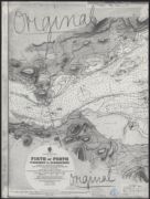
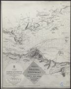
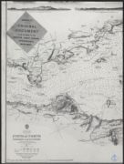
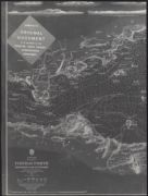
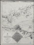
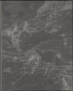
| Title: | The Frith of Forth from the Entry to the Queen's ferry, with all the Islands, Rocks, Sands, &c. | |
| Imprint: | [Edinburgh : s.n., 1703] | |
| Zoom Into Map: | Click on the map to view in greater detail. | |
| Field | Content | |
|---|---|---|
| Name: | Adair, John, ca. 1650-1722 | |
| Title: | Holy-Island, Fairn Islands with the many Rocks and Hazards that lye Scatter'd in that Sea, and the Coast from Sunderland point in England to St Abbs-head in Scotland, survey'd and navigated by J[oh]n Adair | |
| Imprint: | [Edinburgh : s.n., 1703] | |
| Zoom Into Map: | Click on the map to view in greater detail. | |
| Field | Content | |
|---|---|---|
| Name: | Adair, John, ca. 1650-1722 | |
| Title: | The Frith and River of Tay with all the Rocks, Sands, Shoals, &c., Survey'd by John Adair | |
| Imprint: | [Edinburgh : s.n., 1703] | |
| Zoom Into Map: | Click on the map to view in greater detail. | |
| Field | Content | |
|---|---|---|
| Name: | Adair, John, ca. 1650-1722 | |
| Title: | The Town and Water of Montross with the neighbouring Country & Coast from the Red-head to the North-water. Survey'd and Navigated by John Adair. | |
| Imprint: | [Edinburgh : s.n., 1703] | |
| Zoom Into Map: | Click on the map to view in greater detail. | |
| Field | Content | |
|---|---|---|
| Name: | Adair, John, ca. 1650-1722 | |
| Title: | The coast of Scotland from the Red-head to Aberdeen. Survey'd by John Adair. | |
| Imprint: | [Edinburgh : s.n., 1703] | |
| Zoom Into Map: | Click on the map to view in greater detail. | |
| Field | Content | |
|---|---|---|
| Name: | Adair, John, ca. 1650-1722 | |
| Title: | Holy-Island, Fairn-Islands ... and the Coast from Sunderland point ... to St. Abbs-head ... / surveyed and navigat'd by Jo. Adair. (Ja. Clark sculp.). | |
| Imprint: | [Edinburgh, 1703] | |
| Zoom Into Map: | Click on the map to view in greater detail. | |

| Field | Content | |
|---|---|---|
| Name: | Adair, John, ca. 1650-1722 | |
| Title: | A true and exact hydrographical description of the sea-coast and Isles of Scotland ... / published at Paris by Nicolay D'aulphinois ... 1583, and at Edinburgh by John Adair ... 1688. (James Moxon sculp.). | |
| Imprint: | [Edinburgh: Adair 1703] | |
| Zoom Into Map: | Click on the map to view in greater detail. | |
| Field | Content | |
|---|---|---|
| Name: | Adair, John, ca. 1650-1722 | |
| Title: | The coast of Scotland from the Red-head to Aberdeen / surveyed by John Adair. (Ja. Clark sculp.). | |
| Imprint: | [Edinburgh, 1703] | |
| Zoom Into Map: | Click on the map to view in greater detail. | |
| Field | Content | |
|---|---|---|
| Name: | Adair, John, ca. 1650-1722 | |
| Title: | The towne & water of Montross, with the neighbouring country & coast ... / surveyed & navigated be John Adair, 1693. (Ja. Clark sculp.). | |
| Imprint: | [Edinburgh, 1703] | |
| Zoom Into Map: | Click on the map to view in greater detail. | |
| Field | Content | |
|---|---|---|
| Name: | Adair, John, ca. 1650-1722 | |
| Title: | The Frith and River of Tay ... / survey'd by John Adair. (Ja. Clark sculp.). | |
| Imprint: | [Edinburgh, 1703] | |
| Zoom Into Map: | Click on the map to view in greater detail. | |
| Field | Content | |
|---|---|---|
| Name: | Adair, John, ca. 1650-1722 | |
| Title: | The Frith of Forth from the entry to the Queens ferry... / surveyed by John Adair. | |
| Imprint: | [Edinburgh, 1703] | |
| Zoom Into Map: | Click on the map to view in greater detail. | |
| Field | Content | |
|---|---|---|
| Name: | Adair, John, ca. 1650-1722 | |
| Title: | The Frith of Forth from the entry to the Queens ferry... / surveyed by John Adair. | |
| Imprint: | [Edinburgh, 1703] | |
| Zoom Into Map: | Click on the map to view in greater detail. | |
| Field | Content | |
|---|---|---|
| Name: | Nicolay, Nicolas de, 1517-1583 | |
| Title: | A true and exact hydrographical description of the sea-coast and Isles of Scotland ... / published at Paris by Nicolay D'aulphinois ... 1583, and at Edinburgh by John Adair ... 1688. (James Moxon sculp.). | |
| Imprint: | [Edinburgh: Adair 1703] | |
| Zoom Into Map: | Click on the map to view in greater detail. | |
| Field | Content | |
|---|---|---|
| Name: | Adair, John, ca. 1650-1722 | |
| Title: | Holy-Island, Fairn-Islands ... and the Coast from Sunderland point ... to St. Abbs-head ... / surveyed and navigat'd by Jo. Adair. (Ja. Clark sculp.). | |
| Imprint: | [Edinburgh, 1703] | |
| Zoom Into Map: | Click on the map to view in greater detail. | |
| Field | Content | |
|---|---|---|
| Name: | Adair, John, ca. 1650-1722 | |
| Title: | The Frith of Forth from the entry to the Queens ferry... / surveyed by John Adair. | |
| Imprint: | [Edinburgh, 1703] | |
| Zoom Into Map: | Click on the map to view in greater detail. | |
| Field | Content | |
|---|---|---|
| Name: | Adair, John, ca. 1650-1722 | |
| Title: | The coast of Scotland from the Red-head to Aberdeen / surveyed by John Adair. (Ja. Clark sculp.). | |
| Imprint: | [Edinburgh, 1703] | |
| Zoom Into Map: | Click on the map to view in greater detail. | |
| Field | Content | |
|---|---|---|
| Name: | Adair, John, ca. 1650-1722 | |
| Title: | The Frith and River of Tay with all the Rocks, Sands, Shoals, &c. | |
| Imprint: | [ca. 1703] | |
| Zoom Into Map: | Click on the map to view in greater detail. | |
| Field | Content | |
|---|---|---|
| Name: | Adair, John, ca. 1650-1722 | |
| Title: | The Frith of Forth from the entry to the Queens ferry, with all the Islands, Rocks, Sands | |
| Imprint: | [ca. 1703] | |
| Zoom Into Map: | Click on the map to view in greater detail. | |
| Field | Content | |
|---|---|---|
| Name: | Coronelli, Vincenzo | |
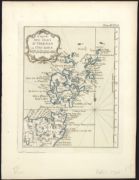
| Title: | Isole Orcadi. | |
| Imprint: | [Venice : Coronelli 1706] | |
| Zoom Into Map: | Click on the map to view in greater detail. | |
| Field | Content | |
|---|---|---|
| Name: | Schenk, Pieter | |
| Title: | Der Fransche vloot den 17 Maart 1708 uitgeloopen onder den Grave de Fourbin opp hebbende den gewaenden Prins von Wales, met een groote meenigte troepen uit Duinkerken naer Schotlant, om dat konigryk aen dien vorst to onderwerpen maer vertroit door den Eng | |
| Imprint: | Amsterdam : P Schenk 1712 | |
| Zoom Into Map: | Click on the map to view in greater detail. | |
| Field | Content | |
|---|---|---|
| Name: | Keulen, Johannes van, 1654-1715 | |
| Title: | Nieuwe Pascaert van de oost cust van Schotlandt beginnende van Barwyck tot aen de Orcades Ylanden ... / by Johannes van Ceuylen. | |
| Imprint: | [Amsterdam : Johannes van Keulen, ca. 1712] | |
| Zoom Into Map: | Click on the map to view in greater detail. | |
| Field | Content | |
|---|---|---|
| Name: | Keulen, Johannes van, 1654-1715 | |
| Title: | Pascaart van de noortcust van Yrland als meede de westcust van Schotland / by Johannes van Keulen. | |
| Imprint: | [Amsterdam : Johannes van Keulen, ca. 1712] | |
| Zoom Into Map: | Click on the map to view in greater detail. | |
| Field | Content | |
|---|---|---|
| Name: | Keulen, Johannes van, 1654-1715 | |
| Title: | Pascaert vande westkust van Schotlant, als mede een gedeelte van de Lewys Eylanden, van S. Patricius tot Nary, Nog t'I. Roda ofte Barre en t'I. S. Kilda met al Syn diepten en droochten, dus ver naeukeurigh op gestelt / t'Amsterdam, by Johannes van Keulen | |
| Imprint: | [Amsterdam : J. van Keulen, 1712] | |
| Zoom Into Map: | Click on the map to view in greater detail. | |
| Field | Content | |
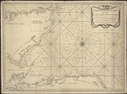
|---|---|---|
| Name: | J. Mount and T. Page | |
| Title: | A new chart of the sea coast of Scotland with the islands thereof. | |
| Imprint: | [London : Mount & Page, 1715] | |
| Zoom Into Map: | Click on the map to view in greater detail. | |
| Field | Content | |
|---|---|---|
| Name: | Keulen, Gerard van, 1678-1726 | |
| Title: |
De reede van 't Leith van Edenburgh = De rivier van Edenburgh ; Afteekening van Nieuwe en Oud Aberdeene aan de oostkust van Shotland. De rivier van Edenburgh. Afteekening van Nieuwe en Oud Aberdeene aan de oostkust van Shotland. | |
| Imprint: | [Amsterdam : G. van Keulen, 1727] | |
| Zoom Into Map: | Click on the map to view in greater detail. | |
| Field | Content | |
|---|---|---|
| Title: | A chart of the Coast of Scotland with all its islands : drawn according to the Globular Projection. | |
| Imprint: | [London : Knapton ... [et al.], 1728] | |
| Zoom Into Map: | Click on the map to view in greater detail. | |
| Field | Content | |
|---|---|---|
| Title: | A chart of the Coast of Scotland with all its islands : drawn according to the Globular Projection. | |
| Date: | 1728 | |
| Zoom Into Map: | Click on the map to view in greater detail. | |
| Field | Content | |
|---|---|---|
| Title: | To the Honorable Sr. Charles Wager, this Draught of Part of the Highlands of Scotland / is humblely Presented by... Mark Tiddeman. | |
| Date: | 1730 | |
| Zoom Into Map: | Click on the map to view in greater detail. | |
| Field | Content | |
|---|---|---|
| Name: | Mount & Page | |
| Title: | A New Chart of the sea coast of Scotland with the Islands thereof. | |
| Imprint: | [London : Mount & Page ca. 1730] | |
| Zoom Into Map: | Click on the map to view in greater detail. | |
| Field | Content | |
|---|---|---|
| Name: | Keulen, Gerard van, 1678-1726 | |
| Title: | Het Eyland Hitland met Zyn onderhoorige Eylanden : Wort by de Engelsche Shetland genaamt / by Gerard van Keulen. | |
| Imprint: | [Amsterdam : Johannes van Keulen, ca. 1730] | |
| Zoom Into Map: | Click on the map to view in greater detail. | |
| Field | Content | |
|---|---|---|
| Name: | Adair, John, ca. 1650-1722 Cooper, Richard, 1705-1764 | |
| Title: | The River and Frith [sic] of Forth ... / Richard Cooper sculpt. | |
| Imprint: | Edinburgh : Cooper, 1730. | |
| Zoom Into Map: | Click on the map to view in greater detail. | |
| Field | Content | |
|---|---|---|
| Name: | Tiddeman, Mark, fl. ca. 1730 | |
| Title: | To the Honorable Sr. Charles Wager, this Draught of Part of the Highlands of Scotland / is humblely Presented by... Mark Tiddeman. | |
| Imprint: | 1730. | |
| Zoom Into Map: | Click on the map to view in greater detail. | |
| Field | Content | |
|---|---|---|
| Name: | Adair, John, ca. 1650-1722 Cooper, Richard | |
| Title: | The River and Frith [sic] of Forth ... / Richard Cooper sculpt. | |
| Imprint: | Edinburgh : Cooper 1730. | |
| Zoom Into Map: | Click on the map to view in greater detail. | |
| Field | Content | |
|---|---|---|
| Name: | Adair, John, ca. 1650-1722 | |
| Title: | A new and exact map of the river Clyde / done by ... John Adair ... R. Cooper sculp. | |
| Imprint: | [Edinburgh], 1731. | |
| Zoom Into Map: | Click on the map to view in greater detail. | |
| Field | Content | |
|---|---|---|
| Name: | Adair, John, ca. 1650-1722 | |
| Title: | A new and exact map of the River Clyde done by the late Mr. John Adair / now publish'd for the good of the publick by Geo. Scott. | |
| Imprint: | [S.l.] : Scott, [1731] | |
| Zoom Into Map: | Click on the map to view in greater detail. | |
| Field | Content | |
|---|---|---|
| Name: | Marr, John, fl. 1660-1720 | |
| Title: | Nieuwe en seer perfecte paskaart van Schotlandt ... van Berwyk tot Bokannais = A new and pertinent map of the eastern sea-coasts of Scotland ... from the cost of Berwik till Bokaness / by John Marr of Dundee. | |
| Imprint: | [Amsterdam : G. van Keulen, ca. 1734]. | |
| Zoom Into Map: | Click on the map to view in greater detail. | |
| Field | Content | |
|---|---|---|
| Name: | Keulen, Gerard van, 1678-1726 | |
| Title: | Afteekening van de Noord Oost hoek van Schotland, Vertoonende The Firth of Murray, en daar in de Riviere Invernness, Cromertie, Tarbet of Tayne : t'vervolg van de Kust by Ord Head met de Letter 'A' geteenkent, vervolgt boven met de Letter 'A' tot de hoek | |
| Imprint: | [Amsterdam : Johannes van Keulen, ca. 1734] | |
| Zoom Into Map: | Click on the map to view in greater detail. | |
| Field | Content | |
|---|---|---|
| Name: | Keulen, Gerard van, 1678-1726 | |
| Title: | Nieuwe paskaart van de west kust van Schotlandt, de Lewys eylanden en de noord kust van Yrland : beginnende van C. Wrath of de Noordilykstc heck van Schotlandt tot in het St. Ioris Kanaal / to Amsterdam by Gerard van Keulen. | |
| Imprint: | [Amsterdam : J van Keulen 1734] | |
| Zoom Into Map: | Click on the map to view in greater detail. | |
| Field | Content | |
|---|---|---|
| Name: | Jaffray, John | |
| Title: | This draught of the town & sea coast about Peterhead …. R. Cooper fecit. 1739 | |
| Imprint: | 1739 | |
| Zoom Into Map: | Click on the map to view in greater detail. | |
| Field | Content | |
|---|---|---|
| Name: | Winter, Thomas (fl. 1742) | |
| Title: | A chart of the Solway Firth... according to an exact survey made anno 1742 | |
| Imprint: | Published by the Town of Dumfries, 1744 | |
| Zoom Into Map: | Click on the map to view in greater detail. | |
| Field | Content | |
|---|---|---|
| Name: | Winter, Thomas (fl. 1742) | |
| Title: | A chart of Solway Firth describing the banks & coasts of England and Scotland from St. Beeshead and the Ross of Kirkcudbright to the harbour of Carse in the river of Nith according to an exact survey made anno 1742 / Thomas Winter ; R. Cooper sculp. | |
| Imprint: | Dumfries : Town of Dumfries 1744. | |
| Zoom Into Map: | Click on the map to view in greater detail. | |

| Field | Content | |
|---|---|---|
| Name: | Ottens, R. (Reinier), 1698-1750. Ottens, J. (Josua), 1704-1765. | |
| Title: | Nieuwe paskaard van Hitland met de daar omleggende eylanden... | |
| Imprint: | [Amsterdam : R. & J. Ottens, ca. 1745]. | |
| Zoom Into Map: | Click on the map to view in greater detail. | |
| Field | Content | |
|---|---|---|
| Name: | W. & J. Mount & T. Page | |
| Title: | A new chart of the sea coast of Scotland with the islands thereof. | |
| Imprint: | London : W. & J. Mount & T. Page, [ca. 1748] | |
| Zoom Into Map: | Click on the map to view in greater detail. | |
| Field | Content | |
|---|---|---|
| Name: | MacKenzie, Murdoch (Senior), 1712-1797 | |
| Title: | Orkney Islands | |
| Imprint: | London: Printed for the Author,, in the year MDCCL. [1750] | |
| Zoom Into Map: | Click on the map to view in greater detail. | |
| Field | Content | |
|---|---|---|
| Name: | MacKenzie, Murdoch (Senior), 1712-1797 | |
| Title: | South isles of Orkney | |
| Imprint: | London: Printed for the Author,, in the year MDCCL. [1750] | |
| Zoom Into Map: | Click on the map to view in greater detail. | |
| Field | Content | |
|---|---|---|
| Name: | MacKenzie, Murdoch (Senior), 1712-1797 | |
| Title: | Pomona or main-land | |
| Imprint: | London: Printed for the Author,, in the year MDCCL. [1750] | |
| Zoom Into Map: | Click on the map to view in greater detail. | |
| Field | Content | |
|---|---|---|
| Name: | MacKenzie, Murdoch (Senior), 1712-1797 | |
| Title: | North east coast of Orkney | |
| Imprint: | London: Printed for the Author,, in the year MDCCL. [1750] | |
| Zoom Into Map: | Click on the map to view in greater detail. | |
| Field | Content | |
|---|---|---|
| Name: | MacKenzie, Murdoch (Senior), 1712-1797 | |
| Title: | North west coast of Orkney | |
| Imprint: | London: Printed for the Author,, in the year MDCCL. [1750] | |
| Zoom Into Map: | Click on the map to view in greater detail. | |
| Field | Content | |
|---|---|---|
| Name: | MacKenzie, Murdoch (Senior), 1712-1797 | |
| Title: | Lewis or north part of Long-Island | |
| Imprint: | London: Printed for the Author,, in the year MDCCL. [1750] | |
| Zoom Into Map: | Click on the map to view in greater detail. | |
| Field | Content | |
|---|---|---|
| Name: | MacKenzie, Murdoch (Senior), 1712-1797 | |
| Title: | North part of the Lewis | |
| Imprint: | London: Printed for the Author,, in the year MDCCL. [1750] | |
| Zoom Into Map: | Click on the map to view in greater detail. | |
| Field | Content | |
|---|---|---|
| Name: | MacKenzie, Murdoch (Senior), 1712-1797 | |
| Title: | South east coast of the Lewis | |
| Imprint: | London: Printed for the Author,, in the year MDCCL. [1750] | |
| Zoom Into Map: | Click on the map to view in greater detail. | |
| Field | Content | |
|---|---|---|
| Name: | Sanson, Nicolas, 1600-1667 | |
| Title: | Les Isles Orkadney, ou Orkney; Schetland, ou Hetland; et de Fero, ou Farre tirrées de divers memoires / par le Sr. Sanson. | |
| Imprint: | Paris : chez le S Robert [c1750?] | |
| Zoom Into Map: | Click on the map to view in greater detail. | |
| Field | Content | |
|---|---|---|
| Name: | Bellin, J. N. | |
| Title: | Carte de la mer d'Escosse contenant les isles et costes septentrionales et occidentales d'Escosse… | |
| Imprint: | [Paris : J. N. Bellin, 1753?] | |
| Zoom Into Map: | Click on the map to view in greater detail. | |
| Field | Content | |
|---|---|---|
| Name: | Palairet, Jean. | |
| Title: | 2e. Carte d'Ecosse 1755 / [by Jean Palairet]. | |
| Imprint: | [London : J Nourse & P Vaillant 1755] | |
| Zoom Into Map: | Click on the map to view in greater detail. | |
| Field | Content | |
|---|---|---|
| Name: | May, Peter, approximately 1724-1795 | |
| Title: | Aberdeen - Coast between Dee and Don | |
| Imprint: | 1756 | |
| Zoom Into Map: | Click on the map to view in greater detail. | |
| Field | Content | |
|---|---|---|
| Name: | Bellin, J. N. | |
| Title: | Carte du Golphe d'Edinburgh. | |
| Imprint: | [Paris : J. N. Bellin, 1757] | |
| Zoom Into Map: | Click on the map to view in greater detail. | |
| Field | Content | |
|---|---|---|
| Name: | Bellin, J. N. | |
| Title: | Carte des principaux ports des Isles Orcades… | |
| Imprint: | [Paris : J. N. Bellin, 1757] | |
| Zoom Into Map: | Click on the map to view in greater detail. | |
| Field | Content | |
|---|---|---|
| Name: | Watt, John | |
| Title: | The River of Clyde / entry to the River and Firth of Clyde [ca. 1760] | |
| Imprint: | 1760 | |
| Zoom Into Map: | Click on the map to view in greater detail. | |
| Field | Content | |
|---|---|---|
| Name: | Barry, James | |
| Title: | Chart of Lady Isle and the adjacent coast. Navigated and surveyed by James Barry. [Attached to] Plan of Lorn’s Hill part of the Estate of Mar. | |
| Imprint: | ca. 1760s? | |
| Zoom Into Map: | Click on the map to view in greater detail. | |
| Field | Content | |
|---|---|---|
| Name: | Bellin, J.N. | |
| Title: | Carte des Isles d'Orkney ou Orcades / [by J.N. Bellin] | |
| Imprint: | [S.l., 1764] | |
| Zoom Into Map: | Click on the map to view in greater detail. | |
| Field | Content | |
|---|---|---|
| Name: | Bellin, J.N. | |
| Title: | Carte des Isles de Hetland ou Schetland / [by J.N. Bellin] | |
| Imprint: | [S.l.] : MacMillan [1764] | |
| Zoom Into Map: | Click on the map to view in greater detail. | |
| Field | Content | |
|---|---|---|
| Name: | Aberdeen, William, fl. ca. 1742-1794 | |
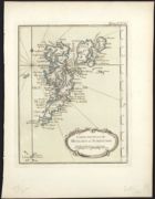
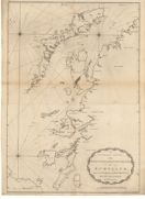
| Title: | A chart of the Orkney Islands. | |
| Imprint: | [1769] | |
| Zoom Into Map: | Click on the map to view in greater detail. | |
| Field | Content | |
|---|---|---|
| Name: | Mackenzie, Murdoch (Senior), 1712-1797 Terry, G. | |
| Title: | A general chart of the west coast and western islands of Scotland from Cantire to Cape Wrath and Butt of the Lewis. | |
| Imprint: | [London : Mackenzie], 1775. | |
| Zoom Into Map: | Click on the map to view in greater detail. | |
| Field | Content | |
|---|---|---|
| Name: | Mackenzie, Murdoch (Senior), 1712-1797 | |
| Title: | The north part of Sky island and the adjacent main of Scotland. | |
| Imprint: | [London : Mackenzie], 1775. | |
| Zoom Into Map: | Click on the map to view in greater detail. | |
| Field | Content | |
|---|---|---|
| Name: | Mackenzie, Murdoch (Senior), 1712-1797 | |
| Title: | The sound of Mull. | |
| Imprint: | [London : Mackenzie], 1775. | |
| Zoom Into Map: | Click on the map to view in greater detail. | |
| Field | Content | |
|---|---|---|
| Name: | Mackenzie, Murdoch (Senior), 1712-1797 | |
| Title: | The west side of the island Mull with the islands Tiri and Coll. | |
| Imprint: | [London : Mackenzie], 1775. | |
| Zoom Into Map: | Click on the map to view in greater detail. | |
| Field | Content | |
|---|---|---|
| Name: | MacKenzie, Murdoch (Senior), 1712-1797 | |
| Title: | The coast of Ireland, near Belfast Loch; with the opposite coast of Scotland: 1775. | |
| Imprint: | 1775 | |
| Zoom Into Map: | Click on the map to view in greater detail. | |
| Field | Content | |
|---|---|---|
| Name: | MacKenzie, Murdoch (Senior), 1712-1797 | |
| Title: | The north east coast of Ireland, from Larn to Rachlin Island; with part of Cantire in Scotland: 1775. | |
| Imprint: | 1775 | |
| Zoom Into Map: | Click on the map to view in greater detail. | |
| Field | Content | |
|---|---|---|
| Name: | Mackenzie, Murdoch (Senior), 1712-1797 | |
| Title: | The south part of Sky Island and the adjacent main of Scotland. | |
| Imprint: | [London : Mackenzie], 1776. | |
| Zoom Into Map: | Click on the map to view in greater detail. | |
| Field | Content | |
|---|---|---|
| Name: | Mackenzie, Murdoch (Senior), 1712-1797 | |
| Title: | The south part of Long Island from Bara Head to Benbecula I. | |
| Imprint: | [London : Mackenzie, 1776] | |
| Zoom Into Map: | Click on the map to view in greater detail. | |
| Field | Content | |
|---|---|---|
| Name: | Mackenzie, Murdoch (Senior), 1712-1797 | |
| Title: | The channel between Sky I and the Lewis. | |
| Imprint: | [London : Mackenzie, 1776] | |
| Zoom Into Map: | Click on the map to view in greater detail. | |
| Field | Content | |
|---|---|---|
| Name: | Mackenzie, Murdoch (Senior), 1712-1797 | |
| Title: | The Lewis or north part of Long Island. | |
| Imprint: | [London : Mackenzie, 1776] | |
| Zoom Into Map: | Click on the map to view in greater detail. | |
| Field | Content | |
|---|---|---|
| Name: | Mackenzie, Murdoch (Senior), 1712-1797 | |
| Title: | The west coast of Scotland from Ila to Mull. | |
| Imprint: | [London : Mackenzie, 1776] | |
| Zoom Into Map: | Click on the map to view in greater detail. | |
| Field | Content | |
|---|---|---|
| Name: | Keulen, Johannes van, 1654-1715 | |
| Title: | Nieuwe Caart van de Rivier van Glasgow in 't Groot. | |
| Imprint: | Amsterdam : van Keulen, ca. 1780. | |
| Zoom Into Map: | Click on the map to view in greater detail. | |
| Field | Content | |
|---|---|---|
| Name: | Bennett, J. Sayer, R. | |
| Title: | A new chart of the north coast of Scotland with… the Orkney Islands. | |
| Imprint: | London : R. Sayer and J. Bennett, 1781 | |
| Zoom Into Map: | Click on the map to view in greater detail. | |
| Field | Content | |
|---|---|---|
| Name: | Preston, Thomas, fl. 1743-1744 | |
| Title: | A new hydrographical survey of the islands of Shetland. | |
| Imprint: | London : R. Sayer and J. Bennett, 1781. | |
| Zoom Into Map: | Click on the map to view in greater detail. | |
| Field | Content | |
|---|---|---|
| Name: | Chandler, John | |
| Title: | A chart of the east coast of Great Britain, between Flamborough = head & Buchan = ness.1782.Inset:-A draught of the Frith of Forth. | |
| Imprint: | 1782 | |
| Zoom Into Map: | Click on the map to view in greater detail. | |
| Field | Content | |
|---|---|---|
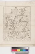
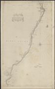
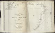
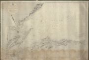
| Name: | Ainslie, John, 1745-1828 | |
| Title: | A general chart of the coast of Scotland from Berwick upon Tweed to Duncansbyhead in Caithness / Surveyd [sic] and engraved by John Ainslie. | |
| Imprint: | [Edinburgh: J Ainslie 1785] | |
| Zoom Into Map: | Click on the map to view in greater detail. | |
| Field | Content | |
|---|---|---|
| Name: | Ainslie, John, 1745-1828 | |
| Title: | A chart of part of Scotland containing the coasts of Kincardine Aberdeen and Banff Shires / from an actual survey by John Ainslie in 1784 and 1785. | |
| Imprint: | [Edinburgh: J Ainslie 1785] | |
| Zoom Into Map: | Click on the map to view in greater detail. | |
| Field | Content | |
|---|---|---|
| Name: | Ainslie, John, 1745-1828 | |
| Title: | A Chart of part of the coast of Scotland from Peterhead in Aberdeenshire to Findhorn in Elginshire shewing the opposite coast from Helmsdale to Duncansby Head in Caithness / from an actual survey by John Ainslie. | |
| Imprint: | [Edinburgh: J Ainslie 1785] | |
| Zoom Into Map: | Click on the map to view in greater detail. | |
| Field | Content | |
|---|---|---|
| Name: | Ainslie, John, 1745-1828 | |
| Title: | A chart of part of the North of Scotland, from Banff to Duncansby Head. | |
| Imprint: | [Edinburgh : J. Ainslie, 1785] | |
| Zoom Into Map: | Click on the map to view in greater detail. | |
| Field | Content | |
|---|---|---|
| Name: | Ainslie, John, 1745-1828 | |
| Title: | A chart of part of the South of Scotland, from Berwick upon Tweed to Skateraw Harbour in the County of Kincardine… | |
| Imprint: | [Edinburgh : J. Ainslie, 1785] | |
| Zoom Into Map: | Click on the map to view in greater detail. | |
| Field | Content | |
|---|---|---|
| Name: | Downie, Murdo | |
| Title: | A true and correct chart of the coast of Scotland from St Abb’s Head to the Red Head, up Edinburgh Firth to Aberlady Bay, and the Tay to Dundee: | |
| Imprint: | Aberdeen, July 1 1792. | |
| Zoom Into Map: | Click on the map to view in greater detail. | |
| Field | Content | |
|---|---|---|
| Name: | Downie, Murdo | |
| Title: | A general chart of the east coast of Scotland from Duncansby Head to the Staples. Insets:- Cromarty Harbour, Montrose Harbour, Aberdeen Harbour. | |
| Imprint: | Aberdeen, 1792 | |
| Zoom Into Map: | Click on the map to view in greater detail. | |
| Field | Content | |
|---|---|---|
| Name: | Downie, Murdo | |
| Title: | A chart of Edinburgh Firth from North Berwick to Limekilns. | |
| Imprint: | Aberdeen, 1792. | |
| Zoom Into Map: | Click on the map to view in greater detail. | |
| Field | Content | |
|---|---|---|
| Name: | Laurie & Whittle | |
| Title: | A new chart of the west coast of Scotland from the Point of Ardnamurchan to Cape Wrath: including the Western Isles of Lewis and Harris, North Uist, Benbecula South Uist, Barra, Sky, Rum etc. & London, Laurie & Whittle, 1794. | |
| Imprint: | 1794 | |
| Zoom Into Map: | Click on the map to view in greater detail. | |
| Field | Content | |
|---|---|---|
| Name: | Laurie & Whittle | |
| Title: | A new hydrographical survey of the east coast of Scotland, from Pentland Firth to Buchan Ness; including The Firth of Murray, called also the North Firth …. London, Laurie & Whittle, 1794. | |
| Imprint: | 1794 | |
| Zoom Into Map: | Click on the map to view in greater detail. | |
| Field | Content | |
|---|---|---|
| Name: | Laurie & Whittle | |
| Title: | A new hydrographical survey of the east coast of Scotland, from Buchan Ness to Fife Ness, including the Firth of Tay …… London, Laurie & Whittle, 1794. | |
| Imprint: | 1794 | |
| Zoom Into Map: | Click on the map to view in greater detail. | |
| Field | Content | |
|---|---|---|
| Name: | Hammond, John | |
| Title: | A new and accurate chart of the North or German Sea, with the Skager Rack and entrance of the Cattegat; London, Laurie & Whittle, 1794. | |
| Imprint: | 1794 | |
| Zoom Into Map: | Click on the map to view in greater detail. | |
| Field | Content | |
|---|---|---|
| Name: | Laurie & Whittle | |
| Title: | A new chart of the north coast of Scotland from Cape Wrath to Duncansby Head, with Pentland Firth, and the Orkney Islands, London, 1794. | |
| Imprint: | 1794 | |
| Zoom Into Map: | Click on the map to view in greater detail. | |
| Field | Content | |
|---|---|---|
| Name: | Preston, Thomas, fl. 1743-1744 | |
| Title: | A new hydrographical survey of the islands of Shetland … with many improvements and additions ….. Inset:- The Isles of Feroe. | |
| Imprint: | 1794 | |
| Zoom Into Map: | Click on the map to view in greater detail. | |
| Field | Content | |
|---|---|---|
| Name: | Laurie, Richard Holmes. | |
| Title: | A new hydrographical survey of the Firth of Forth, called also South Firth, or Edinburgh Firth …. London, Laurie & Whittle, 1794. | |
| Imprint: | 1794 | |
| Zoom Into Map: | Click on the map to view in greater detail. | |
| Field | Content | |
|---|---|---|
| Name: | Huddart, Joseph, 1740/1-1816 | |
| Title: | A new and original hydrographical survey of the North and St George’s Channel ……. London, 1794. | |
| Imprint: | 1794 | |
| Zoom Into Map: | Click on the map to view in greater detail. | |
| Field | Content | |
|---|---|---|
| Name: | Huddart, Joseph, 1740/1-1816 Laurie, Robert Whittle, James | |
| Title: | A new chart of the West coast of Scotland from the Mull of Galloway to Dunan Point in Sky. | |
| Imprint: | London : Laurie & Whittle, 1794 | |
| Zoom Into Map: | Click on the map to view in greater detail. | |
| Field | Content | |
|---|---|---|
| Name: | Huddart, Joseph, 1740/1-1816 Laurie, Robert Whittle, James | |
| Title: | A new chart of the West coast of Scotland from the point of Ardnamurchan to Cape Wrath. | |
| Imprint: | London : Laurie & Whittle, 1794. | |
| Zoom Into Map: | Click on the map to view in greater detail. | |
| Field | Content | |
|---|---|---|
| Name: | Eunson, George | |
| Title: | A chart of the islands of Orkney... with the coast of Scotland. | |
| Imprint: | S.l. : s.n., [1795] | |
| Zoom Into Map: | Click on the map to view in greater detail. | |
| Field | Content | |
|---|---|---|
| Name: | Donnelly, Ross | |
| Title: | A sketch of the Faro, Sketland & Orkney Isles with part of the coast of Scotland and the Lewis’s …… by Captain Ross Donnelly of H M Ship Pegasus …… London, R Laurie & J Whittle, 1797.Insets:- Brassa Sound, Thorshaven Harbour, Stromness Bay. | |
| Imprint: | 1797 | |
| Zoom Into Map: | Click on the map to view in greater detail. | |
| Field | Content | |
|---|---|---|
| Name: | Depot Generale de la Marine, Paris | |
| Title: | Carte particuliere de la cote occidentale d'Escosse, depuis la Pointe d'Ardnamurchan jusqu'au Mull de Galloway. | |
| Imprint: | [Paris] : Depot General de la Marine, 1804-5. | |
| Zoom Into Map: | Click on the map to view in greater detail. | |
| Field | Content | |
|---|---|---|
| Name: | Depot Generale de la Marine, Paris | |
| Title: | Carte particuliere de la cote occidentale d'Escosse, depuis le Cape Wrath jusqu'a la Pointe d'Ardnamurchan. | |
| Imprint: | [Paris] : Depot General de la Marine, 1804-5. | |
| Zoom Into Map: | Click on the map to view in greater detail. | |
| Field | Content | |
|---|---|---|
| Name: | Depot Generale de la Marine, Paris | |
| Title: | Carte particuliere de la cote orientale d'Ecosse, depuis St Abb's Head jusqu'a Duncansby Head. | |
| Imprint: | [Paris] : Depot General de la Marine, 1804-5. | |
| Zoom Into Map: | Click on the map to view in greater detail. | |
| Field | Content | |
|---|---|---|
| Name: | Heather, William | |
| Title: | A new and improved chart of the Hebrides. or Lewis Islands and adjacent coast of Scotland… | |
| Imprint: | London : W. Heather, 1804. | |
| Zoom Into Map: | Click on the map to view in greater detail. | |
| Field | Content | |
|---|---|---|
| Name: | Depot Generale de la Marine, Paris | |
| Title: | Carte des Isles Orcades. | |
| Imprint: | [Paris] : Depot General de la Marine, 1804-5. | |
| Zoom Into Map: | Click on the map to view in greater detail. | |
| Field | Content | |
|---|---|---|
| Name: | Depot Generale de la Marine, Paris | |
| Title: | Carte des Isles Shetland. | |
| Imprint: | [Paris] : Depot General de la Marine, 1804-5. | |
| Zoom Into Map: | Click on the map to view in greater detail. | |
| Field | Content | |
|---|---|---|
| Name: | Geographisches Institut zu Weimar. | |
| Title: | Die Orkney's oder die Orkadischen Inseln. | |
| Imprint: | Weimar : im Verlage des geograph Instituts 1806. | |
| Zoom Into Map: | Click on the map to view in greater detail. | |
| Field | Content | |
|---|---|---|
| Name: | Huddart, Joseph, 1740/1-1816 | |
| Title: | A new and original hydrographical survey of the North and St George’s Channels.London, Laurie & Whittle, 12 May 1808. | |
| Imprint: | 1808 | |
| Zoom Into Map: | Click on the map to view in greater detail. | |
| Field | Content | |
|---|---|---|
| Name: | Preston, Thomas, fl. 1743-1744 | |
| Title: | A new hydrographical survey of the Islands of Shetland / by ... Thomas Preston ... with sailing directions. | |
| Imprint: | London : Laurie & Whittle 1810. | |
| Zoom Into Map: | Click on the map to view in greater detail. | |
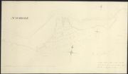
| Field | Content | |
|---|---|---|
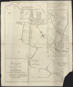
| Title: | Plan of the water or Frith of Dornoch. | |
| Imprint: | [S.l., 1814] | |
| Zoom Into Map: | Click on the map to view in greater detail. | |
| Field | Content | |
|---|---|---|
| Title: | Survey of the Frith [sic] of Forth, by George Thomas... in 1815 with MS notes in red on “arcs in which Messrs Milnes experimental lighthouse can be seen at a distance”. | |
| Date: | 1815 | |
| Zoom Into Map: | Click on the map to view in greater detail. | |

| Field | Content | |
|---|---|---|
| Name: | Thomson, George | |
| Title: | Forth, Firth of - Survey with soundings | |
| Imprint: | 1815 | |
| Zoom Into Map: | Click on the map to view in greater detail. | |
| Field | Content | |
|---|---|---|
| Name: | Thomson, George | |
| Title: | Forth, Firth of - Survey with soundings | |
| Imprint: | 1815 | |
| Zoom Into Map: | Click on the map to view in greater detail. | |
| Field | Content | |
|---|---|---|
| Name: | Thomas, George, fl. 1809-1846 Great Britain. Hydrographic Office | |
| Title: | Survey of the Frith [sic] of Forth, by George Thomas... in 1815 | |
| Imprint: | London : Hydrographic Office, surveyed 1815, published 1824. | |
| Zoom Into Map: | Click on the map to view in greater detail. | |
| Field | Content | |
|---|---|---|
| Name: | Stevenson, Robert, 1772-1850 Steedman, John | |
| Title: | Nautical survey of Firth of Tay | |
| Imprint: | 1816 | |
| Zoom Into Map: | Click on the map to view in greater detail. | |
| Field | Content | |
|---|---|---|
| Name: | Stevenson, Robert, 1772-1850 Steedman, John | |
| Title: | Nautical survey of Firth of Tay | |
| Imprint: | 1816 | |
| Zoom Into Map: | Click on the map to view in greater detail. | |
| Field | Content | |
|---|---|---|
| Name: | Stevenson, Robert, 1772-1850 Steedman, John | |
| Title: | Nautical survey of Firth of Tay | |
| Imprint: | 1816 | |
| Zoom Into Map: | Click on the map to view in greater detail. | |
| Field | Content | |
|---|---|---|
| Name: | Stevenson, Robert, 1772-1850 Steedman, John | |
| Title: | Nautical survey of Firth of Tay | |
| Imprint: | 1816 | |
| Zoom Into Map: | Click on the map to view in greater detail. | |
| Field | Content | |
|---|---|---|
| Name: | Stevenson, Robert, 1772-1850 Steedman, John | |
| Title: | Nautical survey of Firth of Tay | |
| Imprint: | 1816 | |
| Zoom Into Map: | Click on the map to view in greater detail. | |
| Field | Content | |
|---|---|---|
| Name: | Stevenson, Robert, 1772-1850 Steedman, John | |
| Title: | Nautical survey of Firth of Tay | |
| Imprint: | 1816 | |
| Zoom Into Map: | Click on the map to view in greater detail. | |
| Field | Content | |
|---|---|---|
| Name: | Stevenson, Robert, 1772-1850 Steedman, John | |
| Title: | Nautical survey of Firth of Tay | |
| Imprint: | 1816 | |
| Zoom Into Map: | Click on the map to view in greater detail. | |
| Field | Content | |
|---|---|---|
| Title: | Nautical Survey of the Firth of Tay | |
| Imprint: | 1816 | |
| Zoom Into Map: | Click on the map to view in greater detail. | |
| Field | Content | |
|---|---|---|
| Name: | Great Britain. Hydrographic Office. | |
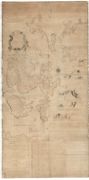
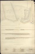
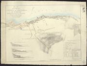
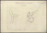
| Title: | Design for a harbour and village at Embo'. W. Gibb, Aberdeen, 1820. Endorsed: `Plans and Report. Proposed Harbour at Embo. Received by Mr Loch from Sir William Sutherland on the purchase of the estate by the Duke of Sutherland, 1859 (with separate booklet | |
| Date: | 1820 | |
| Zoom Into Map: | Click on the map to view in greater detail. | |
| Field | Content | |
|---|---|---|
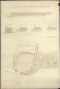
| Name: | Gibb, William | |
| Title: | Plan and sections of a proposed Pier and Harbour at Embo'. William Gibb, Aberdeen, 1820 | |
| Date: | 1820 | |
| Zoom Into Map: | Click on the map to view in greater detail. | |
| Field | Content | |
|---|---|---|
| Name: | Gibb, William | |
| Title: | Plan of the Bay and Part of the Coast on the Lands of Embo with the proposed Pier and Harbour. William Gibb, Aberdeen, 1821 | |
| Date: | 1821 | |
| Zoom Into Map: | Click on the map to view in greater detail. | |
| Field | Content | |
|---|---|---|
| Name: | Gibb, William | |
| Title: | Plan and sections of a proposed Pier and Harbour at Embo'. William Gibb, Aberdeen, 1821 | |
| Date: | 1821 | |
| Zoom Into Map: | Click on the map to view in greater detail. | |
| Field | Content | |
|---|---|---|
| Name: | Thomas, George, fl. 1809-1846 | |
| Title: | Survey of the Frith [sic] of Forth, by George Thomas... in 1815 | |
| Imprint: | London : Hydrographic Office, surveyed 1815, published 1824. | |
| Zoom Into Map: | Click on the map to view in greater detail. | |
| Field | Content | |
|---|---|---|
| Name: | Steedman, John | |
| Title: | Newport - Coast from Newport to Craighead with sections at Biggs, Seacraig & Eelcraig | |
| Imprint: | 1824-1825 | |
| Zoom Into Map: | Click on the map to view in greater detail. | |
| Field | Content | |
|---|---|---|
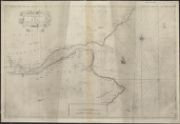
| Name: | Laurie, R.H. | |
| Title: | An hydrographic survey of the Firth of Forth, from St Abb’s Head and Fifeness to Queensferry, with the river thence to Stirling.London, R H Laurie, 1825.Inset:- The River Forth from Stirling to Queensferry. | |
| Imprint: | 1825 | |
| Zoom Into Map: | Click on the map to view in greater detail. | |
| Field | Content | |
|---|---|---|
| Name: | Stevenson, Robert (1772-1850) | |
| Title: | Survey of the Coast from Roan Island to Loch Eribol showing the position of Cape Wrath Light-house. Robert Stevenson, Civil Engineer, 1827. | |
| Imprint: | 1827 | |
| Zoom Into Map: | Click on the map to view in greater detail. | |
| Field | Content | |
|---|---|---|
| Name: | Peel, John. | |
| Title: | To the worshipful the mayor ... of Liverpool an entire new and correct chart ... of Liverpool & chester rivers with a continuation of the coast ... to holyhead ... [and] the harbour of Pile of Fowdry and the adjoining coast … | |
| Imprint: | Liverpool : T. Evans, 1829, [i.e. 1832] | |
| Zoom Into Map: | Click on the map to view in greater detail. | |
| Field | Content | |
|---|---|---|
| Name: | Stevenson, Robert, 1772-1850 | |
| Title: | Dornoch Firth - Map of Firth | |
| Imprint: | 1831 | |
| Zoom Into Map: | Click on the map to view in greater detail. | |
| Field | Content | |
|---|---|---|
| Title: | Plan of part of the river Nith and Solway Firth | |
| Imprint: | [S.l.], 1833. | |
| Zoom Into Map: | Click on the map to view in greater detail. | |
| Field | Content | |
|---|---|---|
| Name: | Stevenson, Robert, 1772-1850 | |
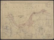
| Title: | Chart of the Zetland Islands, referred to in report on Post Office Packet Stations | |
| Imprint: | 1834 | |
| Zoom Into Map: | Click on the map to view in greater detail. | |
| Field | Content | |
|---|---|---|
| Title: | Cross section of Sea Bed - North Sea & English Channel. Watermark: 1834 | |
| Imprint: | 1834 | |
| Zoom Into Map: | Click on the map to view in greater detail. | |
| Field | Content | |
|---|---|---|
| Name: | Stevenson, Robert, 1772-1850 | |
| Title: | Chart of the Orkney Isles referred to in a report on the Post Office Packet Stations | |
| Imprint: | 1834 | |
| Zoom Into Map: | Click on the map to view in greater detail. | |
| Field | Content | |
|---|---|---|
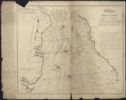
| Name: | Slater, Michael Otter, Henry C. | |
| Title: | Map of the East Coast of Scotland. Sheet XXII. Dornoch Frith by Commanders Slater and Otter, R. N. | |
| Imprint: | 1837 | |
| Zoom Into Map: | Click on the map to view in greater detail. | |
| Field | Content | |
|---|---|---|
| Name: | Jardine, James (1776-1858) | |
| Title: | Estuary of the River Oykell. Surveyor James Jardine, 1837. | |
| Imprint: | 1837 | |
| Zoom Into Map: | Click on the map to view in greater detail. | |
| Field | Content | |
|---|---|---|
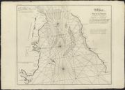
| Name: | Slater, Michael | |
| Title: | East Coast of Scotland. Sheet XXIII. Dornoch Frith by Commander Slater, R. N. | |
| Imprint: | Surveyed: 1837 | |
| Zoom Into Map: | Click on the map to view in greater detail. | |
| Field | Content | |
|---|---|---|
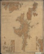
| Name: | Thomas, George, fl. 1809-1846 | |
| Title: | The Shetland Isles / surveyed by George Thomas ... 1833. (J. & C. Walker sculpt.). | |
| Imprint: | [London] : Admiralty 1838. | |
| Zoom Into Map: | Click on the map to view in greater detail. | |
| Field | Content | |
|---|---|---|
| Name: | Stevenson, David, 1815-1886 | |
| Title: | Chart of the Firth of Dornoch and the Kyle of Oykell of Sutherland in reference to the salmon fisheries, 1842. | |
| Imprint: | 1842 | |
| Zoom Into Map: | Click on the map to view in greater detail. | |
| Field | Content | |
|---|---|---|
| Name: | Stevenson, David, 1815-1886 | |
| Title: | Chart of the Firth of Dornoch and the Kyle of Oykell or Sutherland, in reference to the salmon fisheries.S. Leith’s Lithography.Edinburgh, 1842. | |
| Imprint: | 1842 | |
| Zoom Into Map: | Click on the map to view in greater detail. | |
| Field | Content | |
|---|---|---|
| Name: | Stevenson, David, 1815-1886 | |
| Title: | Chart of the Firth of Dornoch and the Kyle of Oykell or Sutherland in reference to the Salmon Fisheries'. David Stevenson, 1842 | |
| Date: | 1842 | |
| Zoom Into Map: | Click on the map to view in greater detail. | |
| Field | Content | |
|---|---|---|
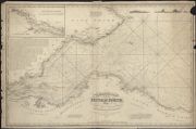
| Name: | Hobbs, J.S. | |
| Title: | A chart of the northern part of St George’s Channel and northern coasts of Ireland, & London, Charles Wilson late J W Norie & Wilson.1843.Insets:- Campbleton, The Maidens, Ardglass, Gola Islands, Lough Carlingford, Sligo Bay. | |
| Imprint: | 1843 | |
| Zoom Into Map: | Click on the map to view in greater detail. | |
| Field | Content | |
|---|---|---|
| Name: | Robinson, C. G., Commander | |
| Title: | Gourock - Plan of Gourock Bay | |
| Imprint: | 1844 | |
| Zoom Into Map: | Click on the map to view in greater detail. | |
| Field | Content | |
|---|---|---|
| Name: | Otter, Henry C. Slater, Michael | |
| Title: | Firth of Dornoch. Otter and Slater, 1845. | |
| Imprint: | 1845 | |
| Zoom Into Map: | Click on the map to view in greater detail. | |
| Field | Content | |
|---|---|---|
| Name: | Slater, Michael Otter, Henry C. | |
| Title: | Hydrographic Survey: Scotland. East Coast. Banff to the Ord of Caithness, Slater and Otter, 1845. | |
| Imprint: | 1845 | |
| Zoom Into Map: | Click on the map to view in greater detail. | |
| Field | Content | |
|---|---|---|
| Name: | Otter, Henry C. | |
| Title: | Hydrographic Survey: West Coast of Scotland. Handa Island to Rhu Stoir. Otter, 1846. | |
| Imprint: | 1846 | |
| Zoom Into Map: | Click on the map to view in greater detail. | |
| Field | Content | |
|---|---|---|
| Name: | Smith and Otter | |
| Title: | Hydrographic Survey: Loch Laxford. Smith and Otter, 1846. | |
| Imprint: | 1846 | |
| Zoom Into Map: | Click on the map to view in greater detail. | |
| Field | Content | |
|---|---|---|
| Name: | Robinson, C.G. Otter, Henry C. Bedford | |
| Title: | Hydrographic Survey: Scotland. West Coast. Robinsin, Otter and Bedford, etc. 1846-65. | |
| Imprint: | 1846-65 | |
| Zoom Into Map: | Click on the map to view in greater detail. | |
| Field | Content | |
|---|---|---|
| Name: | Otter, Henry C. | |
| Title: | West Coast of Scotland: Handa Island to Rhu Stoir by Commander H.C. Otter... 1846 | |
| Imprint: | Surveyed: 1846 | |
| Zoom Into Map: | Click on the map to view in greater detail. | |
| Field | Content | |
|---|---|---|
| Name: | Otter, Henry C. | |
| Title: | West Coast of Scotland. Sheet IV. Including Lochs Cairn Bahn, Glen Coul, and Glen Dhu by Commander H.C. Otter, 1846. | |
| Imprint: | Surveyed: 1846 | |
| Zoom Into Map: | Click on the map to view in greater detail. | |
| Field | Content | |
|---|---|---|
| Name: | Blachford, W. | |
| Title: | A chart of the north coast of Scotland including the Orkney and Shetland Islands. | |
| Imprint: | London : Blachford & Imray, 1846. | |
| Zoom Into Map: | Click on the map to view in greater detail. | |
| Field | Content | |
|---|---|---|
| Name: | Messrs Stevenson | |
| Title: | Survey of part of the coast of Sutherlandshire with Plan and sections of the Harbour and Connecting Road proposed…at Leck Robie…Messrs Stevenson, Civil Engineers, Edinburgh, 1847 | |
| Imprint: | 1847 | |
| Zoom Into Map: | Click on the map to view in greater detail. | |
| Field | Content | |
|---|---|---|
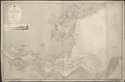
| Name: | Miller, John, 1805-1883 | |
| Title: | Queensferry - Queensferry Passage - Sheet 1 | |
| Imprint: | 1847 | |
| Zoom Into Map: | Click on the map to view in greater detail. | |
| Field | Content | |
|---|---|---|
| Name: | Miller, John, 1805-1883 | |
| Title: | Queensferry - Queensferry Passage - Sheet 2 | |
| Imprint: | 1847 | |
| Zoom Into Map: | Click on the map to view in greater detail. | |
| Field | Content | |
|---|---|---|
| Name: | Miller, John, 1805-1883 | |
| Title: | Queensferry - Queensferry Passage - Title page | |
| Imprint: | 1847 | |
| Zoom Into Map: | Click on the map to view in greater detail. | |
| Field | Content | |
|---|---|---|
| Name: | Jeffery, James Otter, Henry C. | |
| Title: | West Coast of Scotland. Sheet 1. Croc Huish to Karra Garrow, James Jeffrey, 1848. | |
| Imprint: | Surveyed: 1848 | |
| Zoom Into Map: | Click on the map to view in greater detail. | |
| Field | Content | |
|---|---|---|
| Name: | Great Britain. Hydrographic Office | |
| Title: | [Firth of Solway to Loch Ryan / surveyed by Captain Charles G. Robinson ... 1846.] | |
| Imprint: | [London : Admiralty ca. 1848?] | |
| Zoom Into Map: | Click on the map to view in greater detail. | |
| Field | Content | |
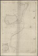
|---|---|---|
| Title: | Frith[s of For]th & Tay.St Abbs [Head to] Button-Ness. Published by [--]. Blachford & Imray | |
| Date: | 1850 | |
| Zoom Into Map: | Click on the map to view in greater detail. | |

| Field | Content | |
|---|---|---|
| Name: | Thomas, F.W., Lieut. | |
| Title: | Fisherrow to Queensferry | |
| Imprint: | 1850-4 | |
| Zoom Into Map: | Click on the map to view in greater detail. | |
| Field | Content | |
|---|---|---|
| Name: | Thomas, F.W., Lieut. | |
| Title: | Fisherrow to Queensferry | |
| Imprint: | 1850-4 | |
| Zoom Into Map: | Click on the map to view in greater detail. | |
| Field | Content | |
|---|---|---|
| Name: | Thomas, F.W., Lieut. | |
| Title: | Fisherrow to Queensferry | |
| Imprint: | 1850-4 | |
| Zoom Into Map: | Click on the map to view in greater detail. | |
| Field | Content | |
|---|---|---|
| Name: | Thomas, F.W., Lieut. | |
| Title: | Fisherrow to Queensferry | |
| Imprint: | 1850-4 | |
| Zoom Into Map: | Click on the map to view in greater detail. | |
| Field | Content | |
|---|---|---|
| Name: | Thomas, F.W., Lieut. | |
| Title: | Fisherrow to Queensferry | |
| Imprint: | 1850-4 | |
| Zoom Into Map: | Click on the map to view in greater detail. | |
| Field | Content | |
|---|---|---|
| Name: | Thomas, F.W., Lieut. | |
| Title: | Fisherrow to Queensferry | |
| Imprint: | 1850-4 | |
| Zoom Into Map: | Click on the map to view in greater detail. | |
| Field | Content | |
|---|---|---|
| Name: | Thomas, F.W., Lieut. | |
| Title: | Fisherrow to Queensferry | |
| Imprint: | 1850-4 | |
| Zoom Into Map: | Click on the map to view in greater detail. | |
| Field | Content | |
|---|---|---|
| Name: | Thomas, F.W., Lieut. | |
| Title: | Fisherrow to Queensferry | |
| Imprint: | 1850-4 | |
| Zoom Into Map: | Click on the map to view in greater detail. | |
| Field | Content | |
|---|---|---|
| Name: | Thomas, F.W., Lieut. | |
| Title: | Fisherrow to Queensferry | |
| Imprint: | 1850-4 | |
| Zoom Into Map: | Click on the map to view in greater detail. | |
| Field | Content | |
|---|---|---|
| Name: | Thomas, F.W., Lieut. | |
| Title: | Fisherrow to Queensferry | |
| Imprint: | 1850-4 | |
| Zoom Into Map: | Click on the map to view in greater detail. | |
| Field | Content | |
|---|---|---|
| Name: | Thomas, F.W., Lieut. | |
| Title: | Fisherrow to Queensferry | |
| Imprint: | 1850-4 | |
| Zoom Into Map: | Click on the map to view in greater detail. | |
| Field | Content | |
|---|---|---|
| Name: | Thomas, F.W., Lieut. | |
| Title: | Fisherrow to Queensferry | |
| Imprint: | 1850-4 | |
| Zoom Into Map: | Click on the map to view in greater detail. | |
| Field | Content | |
|---|---|---|
| Name: | Thomas, F.W., Lieut. | |
| Title: | Fisherrow to Queensferry | |
| Imprint: | 1850-4 | |
| Zoom Into Map: | Click on the map to view in greater detail. | |
| Field | Content | |
|---|---|---|
| Name: | Thomas, F.W., Lieut. | |
| Title: | Fisherrow to Queensferry | |
| Imprint: | 1850-4 | |
| Zoom Into Map: | Click on the map to view in greater detail. | |
| Field | Content | |
|---|---|---|
| Name: | Thomas, F.W., Lieut. | |
| Title: | Fisherrow to Queensferry | |
| Imprint: | 1850-4 | |
| Zoom Into Map: | Click on the map to view in greater detail. | |
| Field | Content | |
|---|---|---|
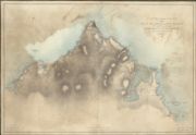
| Title: | Sketch of the Bay of Cromarty and Plan of the Proposed Harbour at Invergordon | |
| Imprint: | n.d. | |
| Zoom Into Map: | Click on the map to view in greater detail. | |
| Field | Content | |
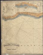
|---|---|---|
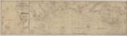
| Name: | Laurie, John (fl. 1757-1800) Whittle, James | |
| Title: | A New Hydrographical Survey of the East Coast of Scotland from Pentland Firth to Buchan Ness. | |
| Date: | 1850 | |
| Zoom Into Map: | Click on the map to view in greater detail. | |
| Field | Content | |
|---|---|---|
| Name: | Laurie, John (fl. 1757-1800) Whittle, James | |
| Title: | A New Hydrographical Survey of the East Coast of Scotland from Pentland Firth to Buchan Ness. | |
| Imprint: | n.d. | |
| Zoom Into Map: | Click on the map to view in greater detail. | |
| Field | Content | |
|---|---|---|
| Title: | Navidale (Hydrographic survey of the coast) | |
| Imprint: | n.d. | |
| Zoom Into Map: | Click on the map to view in greater detail. | |

| Field | Content | |
|---|---|---|
| Name: | Norie, J.W. | |
| Title: | New and improved chart of the Hebrides or Lewis Islands and Adjacent Coast of Scotland from the Mull of Cantire to Cape Wrath / Drawn from the latest surveys by J.W. Norie. | |
| Imprint: | London : JW Norie & Co 1816 [i.e. 1851] | |
| Zoom Into Map: | Click on the map to view in greater detail. | |
| Field | Content | |
|---|---|---|
| Name: | Hobbs, J.S. | |
| Title: | A chart of the Coast of England and Scotland, from Flamborough Head to Cape Wrath, including the Orkney Islands ... / by J. S. Hobbs. | |
| Imprint: | London : C Wilson 1851. | |
| Zoom Into Map: | Click on the map to view in greater detail. | |

| Field | Content | |
|---|---|---|
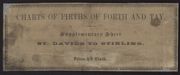
| Title: | Charts of the Forth and Tay - Supplementary Sheet - St. Davids to Stirling - Description and sailing directions | |
| Imprint: | 1856 | |
| Zoom Into Map: | Click on the map to view in greater detail. | |
| Field | Content | |
|---|---|---|
| Title: | Charts of the Forth and Tay - Supplementary Sheet - St. Davids to Stirling - Title | |
| Imprint: | 1856 | |
| Zoom Into Map: | Click on the map to view in greater detail. | |
| Field | Content | |
|---|---|---|
| Title: | Charts of the Forth and Tay - Supplementary Sheet - St. Davids to Stirling | |
| Imprint: | 1856 | |
| Zoom Into Map: | Click on the map to view in greater detail. | |
| Field | Content | |
|---|---|---|
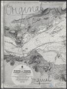
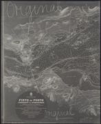
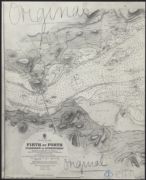
| Name: | W. & A.K. Johnston Limited | |
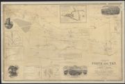
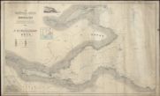
| Title: | The Nautical Guide to the Forth & Tay... / (engraved... by W. & A. K. Johnston). | |
| Imprint: | Edinburgh, 1863. | |
| Zoom Into Map: | Click on the map to view in greater detail. | |
| Field | Content | |
|---|---|---|
| Name: | Parks, Murray T. | |
| Title: | Chart of the River Mersey from Rock Lighthouse to Warrington Bridge... / [by] Murney T. Parks... [assisted by] Graham H. Hills. (Maclure, Macdonald & Macgregor Lithogrs.). | |
| Imprint: | [Liverpool] : J. Harrison for the Mersey Docks and Harbour Board, 1864. | |
| Zoom Into Map: | Click on the map to view in greater detail. | |
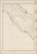
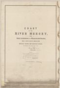
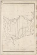
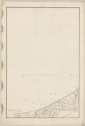
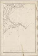
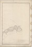
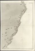
| Field | Content | |
|---|---|---|
| Name: | Depot Generale de la Marine, Paris | |
| Title: | Écosse: côte est de Bell Rock à Kinnaird Head, d'après les dernières cartes Anglaises. | |
| Imprint: | [Paris] : Dépôt des Cartes et Plans de la Marine 1867. | |
| Zoom Into Map: | Click on the map to view in greater detail. | |
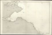
| Field | Content | |
|---|---|---|
| Name: | Depot Generale de la Marine, Paris | |
| Title: | Écosse: côte est de Longstone à Bell Rock d'après les dernières cartes Anglaises. | |
| Imprint: | [Paris] : Dépôt des Cartes et Plans de la Marine 1868. | |
| Zoom Into Map: | Click on the map to view in greater detail. | |
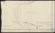
| Field | Content | |
|---|---|---|
| Title: | Nigg - Plan of Nigg Bay | |
| Imprint: | 1870 | |
| Zoom Into Map: | Click on the map to view in greater detail. | |
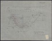
| Field | Content | |
|---|---|---|
| Name: | Stevenson, David, 1815-1886 Stevenson, Thomas, 1818-1887 | |
| Title: | Gourock - Bay and Soundings | |
| Imprint: | 1877 | |
| Zoom Into Map: | Click on the map to view in greater detail. | |
| Field | Content | |
|---|---|---|
| Title: | Hydrographic Survey: The British Isles. Copied from Admiralty Surveys, 1879. | |
| Imprint: | 1879 | |
| Zoom Into Map: | Click on the map to view in greater detail. | |
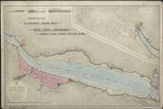
| Field | Content | |
|---|---|---|
| Title: | River Forth Conservancy. Admiralty chart showing proposed works, 1880. | |
| Imprint: | 1880 | |
| Zoom Into Map: | Click on the map to view in greater detail. | |
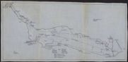
| Field | Content | |
|---|---|---|
| Title: | Plan of the Forth showing lights | |
| Imprint: | ca. 1880s-1920s? | |
| Zoom Into Map: | Click on the map to view in greater detail. | |
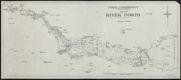
| Field | Content | |
|---|---|---|
| Title: | Plan of River Forth [with soundings] | |
| Imprint: | ca. 1880s-1920s? | |
| Zoom Into Map: | Click on the map to view in greater detail. | |
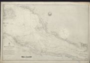
| Field | Content | |
|---|---|---|
| Name: | Ellis, J. H. | |
| Title: | Clyde, Firth of - Greenock to Dumbarton | |
| Imprint: | 1880 | |
| Zoom Into Map: | Click on the map to view in greater detail. | |
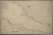
| Field | Content | |
|---|---|---|
| Name: | Ellis, J. H. | |
| Title: | Clyde, Firth of - Greenock to Dumbarton | |
| Imprint: | 1881 | |
| Zoom Into Map: | Click on the map to view in greater detail. | |
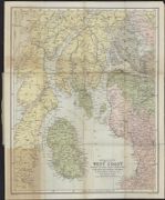
| Field | Content | |
|---|---|---|
| Name: | Archibald & Peck | |
| Title: | Archibald & Peck's map of the West Coast showing the royal route connections of Mr. David MacBrayne's steamers "Columba" "Iona" &c. | |
| Imprint: | Edinburgh, 1881 | |
| Zoom Into Map: | Click on the map to view in greater detail. | |
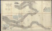
| Field | Content | |
|---|---|---|
| Name: | W. & A.K. Johnston Limited | |
| Title: | The Nautical Guide to the Forth & Tay... / (engraved... by W. & A.K. Johnston). | |
| Imprint: | Edinburgh, [1883] | |
| Zoom Into Map: | Click on the map to view in greater detail. | |
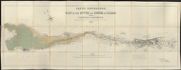
| Field | Content | |
|---|---|---|
| Name: | Kyle, Dennison and Frew | |
| Title: | Clyde navigation. : Map of the river and firth of Clyde from Carmyle to Gourock / compiled by Messrs. Kyle, Dennison and Frew ... from Ordnance and actual surveys. | |
| Imprint: | Glasgow : Engineer's Office 4th Aug. 1883. | |
| Zoom Into Map: | Click on the map to view in greater detail. | |
| Field | Content | |
|---|---|---|
| Name: | Biebull, Alan | |
| Title: | Clyde, Firth of - Tides | |
| Imprint: | 1886 | |
| Zoom Into Map: | Click on the map to view in greater detail. | |
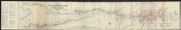
| Field | Content | |
|---|---|---|
| Name: | Deas, James | |
| Title: | Reid's new map of the river and Firth of Clyde, from Carmyle to Gourock / prepared from map supplied by Mr. James Deas. | |
| Date: | 1899 | |
| Zoom Into Map: | Click on the map to view in greater detail. | |
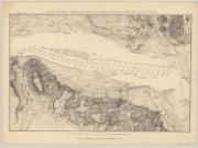
| Field | Content | |
|---|---|---|
| Name: | Malby and Sons. | |
| Title: | Position of the fleet at Spithead on the occasion of the funeral of Her Most Gracious Majesty Queen Victoria, 1st Feby. 1901. | |
| Imprint: | London : Admiralty, 1901. | |
| Zoom Into Map: | Click on the map to view in greater detail. | |
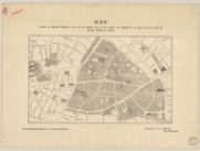
| Field | Content | |
|---|---|---|
| Name: | Malby and Sons. | |
| Title: | Position of the fleet at Spithead on the occasion of the funeral of Her Most Gracious Majesty Queen Victoria, 1st Feby. 1901. | |
| Imprint: | London : Admiralty, 1901. | |
| Zoom Into Map: | Click on the map to view in greater detail. | |
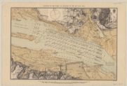
| Field | Content | |
|---|---|---|
| Name: | Malby and Sons. | |
| Title: | Position of the fleet at Spithead on the 28th June 1902. | |
| Imprint: | London : Admiralty, 1902. | |
| Zoom Into Map: | Click on the map to view in greater detail. | |
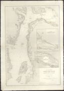
| Field | Content | |
|---|---|---|
| Name: | Renaud, J. | |
| Title: | Côte ouest d'É́cosse. 4412. Firth of Clyde et Rivière de la Clyde d'après les derniers levés anglais de 1880. / J. Renoud, ingénieur hydrographe. | |
| Imprint: | [Paris] : Service hydrographique de la Marine 1890 [ie. 1902]. | |
| Zoom Into Map: | Click on the map to view in greater detail. | |
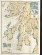
| Field | Content | |
|---|---|---|
| Title: | Ten fathom chart of the Firth of Clyde and Western Islands of Scotland, Ailsa Craig to Ardnamurchan. (Corrected to May 1904). | |
| Date: | 1904 | |
| Zoom Into Map: | Click on the map to view in greater detail. | |
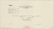
| Field | Content | |
|---|---|---|
| Title: | Maps to accompany the Scottish coast defence scheme - Skeleton Diagram of Command Communications - Tay Defences | |
| Imprint: | [London] : War Office, 1907-1909 | |
| Zoom Into Map: | Click on the map to view in greater detail. | |
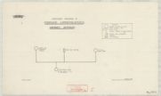
| Field | Content | |
|---|---|---|
| Title: | Maps to accompany the Scottish coast defence scheme - Skeleton Diagram of Command Communications - Aberdeen Defences | |
| Imprint: | [London] : War Office, 1907-1909 | |
| Zoom Into Map: | Click on the map to view in greater detail. | |

| Field | Content | |
|---|---|---|
| Title: | Maps to accompany the Scottish coast defence scheme - Skeleton Diagram of Command Communications - Forth Defences | |
| Imprint: | [London] : War Office, 1907-1909 | |
| Zoom Into Map: | Click on the map to view in greater detail. | |
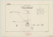
| Field | Content | |
|---|---|---|
| Title: | Maps to accompany the Scottish coast defence scheme - Skeleton Diagram of Command Communications - Clyde Defences | |
| Imprint: | [London] : War Office, 1907-1909 | |
| Zoom Into Map: | Click on the map to view in greater detail. | |
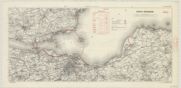
| Field | Content | |
|---|---|---|
| Title: | Maps to accompany the Scottish coast defence scheme - Forth Defences | |
| Imprint: | [London] : War Office, 1907-1909 | |
| Zoom Into Map: | Click on the map to view in greater detail. | |
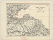
| Field | Content | |
|---|---|---|
| Title: | Maps to accompany the Scottish coast defence scheme - Forth Defences. Revised 1909 | |
| Imprint: | [London] : War Office, 1907-1909 | |
| Zoom Into Map: | Click on the map to view in greater detail. | |
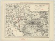
| Field | Content | |
|---|---|---|
| Title: | Maps to accompany the Scottish coast defence scheme - Clyde Defences. Revised 1909 | |
| Imprint: | [London] : War Office, 1907-1909 | |
| Zoom Into Map: | Click on the map to view in greater detail. | |
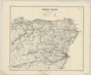
| Field | Content | |
|---|---|---|
| Title: | Maps to accompany the Scottish coast defence scheme - Aberdeen Defences. Revised 1909 | |
| Imprint: | [London] : War Office, 1907-1909 | |
| Zoom Into Map: | Click on the map to view in greater detail. | |
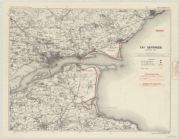
| Field | Content | |
|---|---|---|
| Title: | Maps to accompany the Scottish coast defence scheme - Tay Defences. Revised 1909 | |
| Imprint: | [London] : War Office, 1907-1909 | |
| Zoom Into Map: | Click on the map to view in greater detail. | |
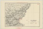
| Field | Content | |
|---|---|---|
| Title: | Maps to accompany the Scottish coast defence scheme - Tay Defences. Revised 1909 | |
| Imprint: | [London] : War Office, 1907-1909 | |
| Zoom Into Map: | Click on the map to view in greater detail. | |
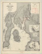
| Field | Content | |
|---|---|---|
| Title: | Maps to accompany the Scottish coast defence scheme - Clyde Defences. Revised 1909 | |
| Imprint: | [London] : War Office, 1907-1909 | |
| Zoom Into Map: | Click on the map to view in greater detail. | |
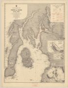
| Field | Content | |
|---|---|---|
| Name: | Great Britain. War Office. General Staff. Geographical Section. | |
| Title: | [Maps to accompany the Scottish coast defence scheme] | |
| Imprint: | [London] : War Office, 1907-1909. | |
| Zoom Into Map: | Click on the map to view in greater detail. | |
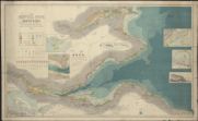
| Field | Content | |
|---|---|---|
| Name: | W. & A.K. Johnston Limited | |
| Title: | The Nautical Guide to the Forth & Tay... 1912. Corrected up to date. | |
| Imprint: | [Edinburgh : W & AK Johnston Ltd 1912] | |
| Zoom Into Map: | Click on the map to view in greater detail. | |
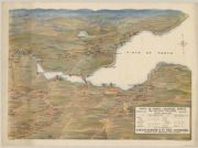
| Field | Content | |
|---|---|---|
| Title: | Firth of Forth-shipping ports and adjacent collieries. | |
| Imprint: | Glasgow : W.P. Laidlaw & Son, 1914. | |
| Zoom Into Map: | Click on the map to view in greater detail. | |
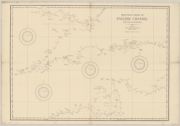
| Field | Content | |
|---|---|---|
| Title: | Practice chart of English Channel for use in schools. | |
| Imprint: | London : Imray, Laurie & Co, [1917] | |
| Zoom Into Map: | Click on the map to view in greater detail. | |
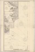
| Field | Content | |
|---|---|---|
| Name: | Imray, James Frederick. | |
| Title: | Chart showing the North and North West Coasts of Scotland] / compiled by James F. Imray. | |
| Imprint: | London : Imray, Laurie, Norie & Wilson, Ltd., 1917 | |
| Zoom Into Map: | Click on the map to view in greater detail. | |
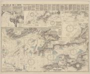
| Field | Content | |
|---|---|---|
| Name: | Close, Albert W. | |
| Title: | Close's fisherman's chart of the English Channel. Compiled from the latest government surveys. | |
| Imprint: | London, 1921. | |
| Zoom Into Map: | Click on the map to view in greater detail. | |
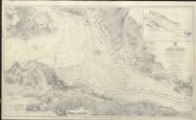
| Field | Content | |
|---|---|---|
| Title: | Clyde, Firth of - Gourock to Dumbarton | |
| Imprint: | 1932; revised 1935, 1936 | |
| Zoom Into Map: | Click on the map to view in greater detail. | |
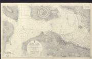
| Field | Content | |
|---|---|---|
| Name: | Great Britain. Hydrographic Office | |
| Title: | Clyde, Firth of - Dumbarton to Glasgow | |
| Imprint: | 1936 | |
| Zoom Into Map: | Click on the map to view in greater detail. | |
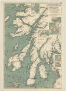
| Field | Content | |
|---|---|---|
| Name: | Stanford's Geographical Estabt. | |
| Title: | Stanford's general chart of the West Coast of Scotland from Mull of Kintyre to Ardnamurchan Point together with inset charts of Tobermory Harbour, Oban Harbour, East Loch Tarbert, Loch Crinan, Loch Gilp, Campbeltown Loch / prepared under the supervision | |
| Imprint: | London, 1938 | |
| Zoom Into Map: | Click on the map to view in greater detail. | |
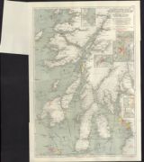
| Field | Content | |
|---|---|---|
| Name: | Stanford's Geographical Establishment | |
| Title: | Stanford's general chart of the West Coast of Scotland from Mull of Kintyre to Ardnamurchan Point, together with inset charts ... / prepared under the supervision of ... O.M. Watts, etc. | |
| Date: | 1947 | |
| Zoom Into Map: | Click on the map to view in greater detail. | |
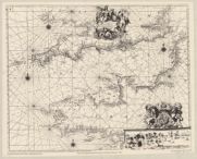
| Field | Content | |
|---|---|---|
| Name: | Collins, Greenvile, active 1669-1698. | |
| Title: | To the right honourable admirall Killegrew, this chart of the channell is ... / dedicated and presented by ... G. Collins. | |
| Imprint: | [London, 1964] | |
| Zoom Into Map: | Click on the map to view in greater detail. | |