Ordnance Survey large scale Scottish town plans, 1847-1895
Town Plan of Oban Surveyed: 1867-8 Scale: 1:500 17 map sheets
View individual sheets using a zoomable map or
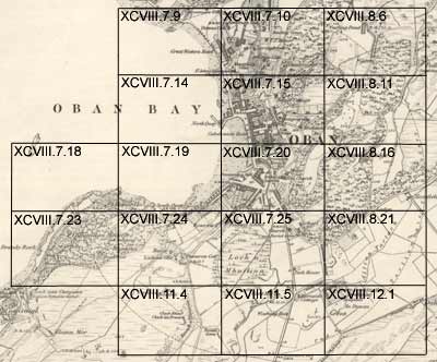
Click the graphic index below to view each sheet
You may also view this town plan as a georeferenced overlay on top of modern satellite imagery.