Estate Maps, 1750s-1900s
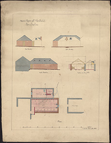
| Title: | Westfield (of Newholm). Mixed byre. Plan, elevation and section. |
| Pagination: | 1 map; 62 x 47 cm |
| Shelfmark: | MS.27735, a |
| Notes: | This map is from our Lockharts of Lee Estate mapping collection. |
| Zoom Into Map: | Click on the map to view in greater detail. |