Pont maps | Pont texts | biographies | history | subjects | further reading
Pont Maps of Scotland, ca. 1583-1614 - Pont texts
DIVERS DISTANCES and LENTHS of RIVERS
Click on image to zoom into text
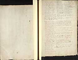


Scroll through text pages
Pagination: 138v-139r
Transcription of text:
DIVERS DISTANCES and LENTHS of RIVERS
This is Macfarlan - the MS has no heading here
[Riynnis
Machairs
Regalitie of Glenluz
The sherifdome of Wigtoun called ovir galloway]
Port Patrick-Wigtoun 21 m the long way by Glenlus
Port Patrick Glenlus 9
Wigtoun -Dumfreis 30
Wigtoun Ayre36
Wigtoun Glasco 56
Peblis -Edinburgh 16m
Karlinhops Edinburgh lOmyl
Selkirk Edinburgh 22 m
Selkirk Seatonn 22 m
Peeblis Lanrik 16 m
Peeblis Lithgow 18 myl
Biggar Drummailler 4 myl
Reedhead-Dundee 15.
Annand town in Annandail and Edinburgh 56, the way is up the hail river annand to the springs stil north then down Tweed fra the springs whill you fal in Lothian. the draucht of Tweed falling that lenth almost nordeast.
Wigtoun Dumfreis 30
The lenth of the river Annand 25 myl
The lenth of the river Esk in Lidisdale 18 myl
Sterlin Dumbartan 20 myl
Dumbartan and the ferry of Lochgher as you go to Rosneth 8 myle and 2 to Rosneth fra the ferry.
The hie way fra Edinburgh to Glasco is throw Falkirk
Innerara and the Tirbats in Cantyr 26
Mull of Cantyr and Ayr about 36 the course be sua E.N.E W.S.W a litle more to the south.
Loch Gilb makes a bow in the way from Innerara to Tarbatt castel and makes it 28, but the string wilbe 26 be the Marquis Argyls relation from whom I have thir.
Head of Loch Tay and Loch Dochar 9 myl. a litle river cums from Bin lwy a great month upon the north head of Loch Lomond) and makes the spring of Dochar, thir hill yeilds water to Loch Lomond, and to the west sea at Dunstaffage and to Loch Tay.
Braid Albayn taketh up all the lands north fra Loch Tay to the March of Rennach sum 6 myl west to Argyl, sum 12 myl south to the rivers that fall in Tay beneth the Loch, and litle grownd to the east of the Loch.
Dunstaffage Innerara 20 myl as I remember, with a bow about going be the end of Lochaw.
Balwhidder stands upon the water of --- it hath ane paroch church cald Baquhidder. thir river fals out of the hill cald --- ,out of whilk the river Earne ryseth, whilk earne falleth in Loch Earne, the said kirk is tua myl fra the Loch Erne, it is southwest fra the loch, the said river runs southwest throw Balwhidder (the lenth of the cowntrey 9 myll) throw Strahyr under Balquheddir and fals in Loch Low being 4 myl long and 1 myl broad, it is 4 myl fra the head of the loch to the head of the river, the loch of Earne is in the paroch of Bawhiddir. After it cums out of the loch a myl lower it falls in the water of Teth, on the east syd at the kirk of Kilmahug. it is 12 myl fra Kilmahug to Stirlin doun Teth al the way. Teth fals in Forth 1 myl above the brig of Stirlin, betuix Kincarne and Kilmahug about 24 myl.
Glenample stands upon the head of Loch erne, it is of the paroche of Baquhiddir. Loch erne is 6 myl long.
The lenth of Glenprossin is 14 myl to the fal of prossin in the south water to the springs.
The lenth of Carratie is 9 myl
The lenth of Southesk fra the head of the water to Cortachie 16 myl. it is between the head of Southesk and Castalltoun in braymarr 15 myl.
Between prossin head and the head of Yla is not 2 myl. ther is between the twa rivers a small river cald Lintrethin, it hath a loch of the same name, about 2 myl in circuit being more rownd.
Ila runs streyght to the brig of Ruffen, whilk is of stone upon Yla a myl above it. it is fra Ruffen to the head of Yla 20 myl.
Shie and Ardle cum from the hils between Angus and Mar. Shie to the east, whilk after the ? lenth of 12 myl be many crooks fals in Ardle. Ardle looseth the name after the meeting and Shie also and ar cald Ericht and fal in Yla at Coupirgranng four myl beneth Ruthven. Between Ruthven and Kinclevin 9 myl. Between Kinclevin and St. Jhonstoun 6 myl, fra St. Jhonstoun to Dunkeld 10 myl, fra Dunkeld to Ballach is 20 myl.
The lenth of the Water of Dochar and Glendochar 16 myl,it cums out of Loch dochar
Logy river runs in the head of Lochtay at the kirk of Killyn whilk kirk stands between thir tua rivers wha run very neer the kirk both, it cums from northwest and cums hard by the westsyd of Findlarig. it is 1/4 myl between Findlarig and Killin. Loch Tay is 12 myl long.
Glenample at the head of Loch Erne, the neerest cutt of land betuix Loch Erne and Lochtay is 7 myl.Betuix Loch Erne and the brig of Erne 18 myl, viz. fra the foot of the loch.
Betuix the foot of the Loch Erin and St Jhonstoun - 16 myl
Betuix Cowper of Angus and St Jhonstoun 12 myl
Betuix Couper and Dunkel 10 myl, Coupar and Kellymoor 8 myl Cowper and Forfar 14 myl, Coupar and Dundie 10 myl.
Glasgo Kirkintillo 6 myl
Glasgo Hamiltoun 8
Dumbartan and the end of the firth of Clyd over aganis the cloch stane is 11
Glasgo Parthick 2 myl. Hamiltoun Lanrick - 8 myl.
Kirkintillo Parthick 8 myl
Kalvyn river is 12 myl long, the one spring cums from Sterlinshyr about Kilsyth the uthir nordwest therfra sum 8 myls then run five myle or they joyn
Sterlin Faulkirk 7 myl betuix.