Estate Maps, 1750s-1900s

| Name: | Wells, James (fl. ca 1756-1791) |
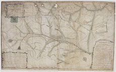
| Title: | Plan of Wanlockhead |
| Imprint: | 1756 |
| Pagination: | 1 manuscript map : col. ; 71 x 117 cm. |
| Shelfmark: | RHP37555 |
| Notes: | Courtesy of the Dumfries Archival Mapping Project - view further details View georeferenced map. |
| Zoom Into Map: | Click on the map to view in greater detail. |