Estate Maps, 1750s-1900s
| Name: | Mason, John, jnr |
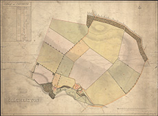
| Title: | Plan of Gilchriston, measured in 1824. |
| Imprint: | 1824 |
| Pagination: | 1 map; 54 x 73 cm |
| Shelfmark: | MS.17874, 25 |
| Notes: | We are very grateful to the Fletchers of Saltoun for permission to display this map on our website. Saltoun Estate mapping home page. |
| Zoom Into Map: | Click on the map to view in greater detail. |