Queensberry Estate Plans, 1854
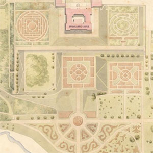
A set of six volumes of detailed estate maps of Queensberry belonging to The Duke of Buccleuch and Queensberry. The estate maps were all surveyed by McCallum and Dundas, Civil Engineers, Edinburgh, in 1854. The maps were scanned by the Dumfries Archival Mapping Project. The original maps are held privately.
View each volume of estate plans:
- First Division, lying in the parishes of Closeburn, Dryfesdale, Hutton and Corrie, Kirkmichael, Lochmaben, Morton, and Crawford - the property of The Duke of Buccleuch and Queensberry (incomplete)
- Second Division, lying in the parishes of Dornock, Hoddam, Keir, Middlebie, and Tynron - the property of The Duke of Buccleuch and Queensberry (incomplete)
- Third Division, lying in the parishes of Durisdeer, Morton, Penpont, Sanquhar, and Crawford - the property of The Duke of Buccleuch and Queensberry (complete)
- Fourth Division, lying in the parishes of Kirkmahoe, Kirkpatrick-Juxta, Moffat, and Morton - the property of The Duke of Buccleuch and Queensberry (incomplete)
- Fifth Division, lying in the parish of Penpont - the property of The Duke of Buccleuch and Queensberry (complete)
- Sixth Division, lying in the parishes of Kirkconnel, Sanquhar, and Crawfordjohn - the property of The Duke of Buccleuch and Queensberry (complete)