Town Plans / Views, 1580s-1940s
| Field | Content |
|---|---|
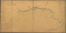
| Title: | Kirkcaldy - Harbour and chart of coast from Dysart to the Vows Rock |
| Pagination: | 1 map : col.; 584 x 1160 mm. |
| Shelfmark: | MS.5854, No.33 |
| Zoom Into Map: | Click on the map to view in greater detail. |
| Notes: | This map is from our Stevenson civil engineering plans collection. |