Town Plans / Views, 1580s-1940s
| Field | Content |
|---|---|
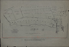
| Title: | Ground plan of the city of Edinburgh's property on the north side of the town intended to be feu'd out for building upon. |
| Imprint: | [Edinburgh, 1940] |
| Pagination: | 1 map ; 48 x 69 cm |
| Shelfmark: | Signet.s.100 |
| Zoom Into Map: | Click on the map to view in greater detail. |
| Notes: | We are very grateful to the WS Society for their permission to display this map online. View Signet Library collection maps of Scotland held at NLS. |