Town Plans / Views, 1580s-1940s
| Field | Content |
|---|---|
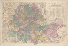
| Title: | A map of the County of London shewing the boundary of the jurisdiction of the London County Council, etc. |
| Imprint: | London : E. Stanford, 1892. |
| Pagination: | 1 map ; 611 x 957 mm. |
| Shelfmark: | Map.l.36.5 |
| Zoom Into Map: | Click on the map to view in greater detail. |
| Notes: | Scale 1:31,680 [List of] City, Parishes, Districts, &c. |