Town Plans / Views, 1580s-1940s
| Field | Content |
|---|---|
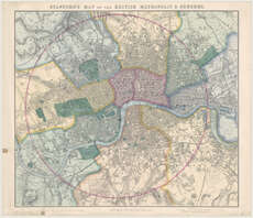
| Title: | Stanford's map of the British metropolis & suburbs. |
| Imprint: | London, 1860. |
| Pagination: | 1 map ; 633 x 723 mm. |
| Shelfmark: | Map.l.34.34 |
| Zoom Into Map: | Click on the map to view in greater detail. |
| Notes: | Scale 1:21,120 |