Estate Maps, 1750s-1900s
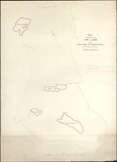
| Title: | Plan of the Lands of Dolay, Craggy, Tecraig and Saval-beg situated in the Parishes of Lairg and Rogart (Enlargement of Acc.10225/Map 130) |
| Imprint: | n.d. |
| Pagination: | 1 map ; 99 x 90 cm |
| Shelfmark: | Acc.10225/131 |
| Notes: | We are very grateful to Sutherland Estates for permission to display this map on our website. Sutherland Estate mapping home page. |
| Zoom Into Map: | Click on the map to view in greater detail. |