Estate Maps, 1750s-1900s
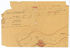
| Title: | Plan of Benarty Hill, in the parish of Ballingry, showing proposed resevoirs and pipelines, 19th cent. |
| Imprint: | 19th century |
| Pagination: | 1 map; 29 x 41 cm |
| Shelfmark: | MS.13444 |
| Zoom Into Map: | Click on the map to view in greater detail. |