Estate Maps, 1750s-1900s
| Name: | Forrester, W. |
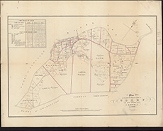
| Title: | Plan of part of the lands of Torry as now divided into lots April, 1842 / W. Forrester lithog. |
| Imprint: | [Edinburgh, 1842] |
| Pagination: | 1 map ; 388 x 577 mm |
| Shelfmark: | EMS.s.600 |
| Zoom Into Map: | Click on the map to view in greater detail. |