Estate Maps, 1750s-1900s
| Name: | Bell, Andrew. |
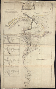
| Title: | A Plan of the River Findhorn from the Sluy Pool downward to the rivers mouth at low water together with the coast and lands adjacent ... / ([by Peter May] A. Bell sc). |
| Imprint: | [S.l., [1765] |
| Pagination: | 1 map ; 710 x 392 mm |
| Shelfmark: | EMS.s.338 |
| Zoom Into Map: | Click on the map to view in greater detail. |